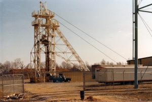
Category:Photograph

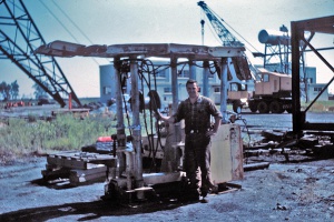
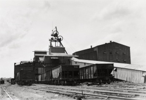
Caption: Old Ben 21
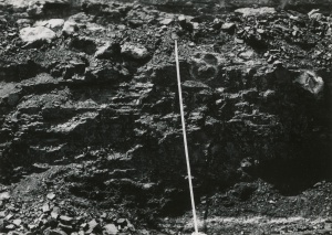
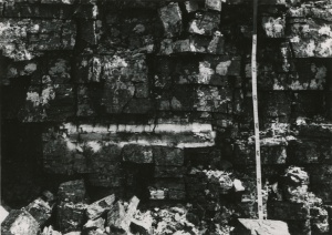
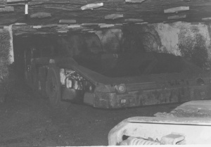
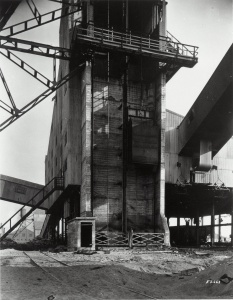
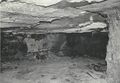
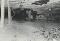
Rheinstahl-Wanheim 4 leg chocks
Credit: Illinois State Geological Survey
Date: 1960's

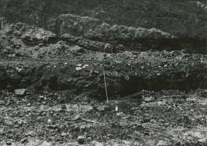
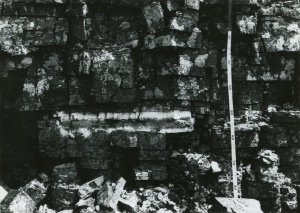
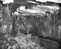
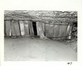
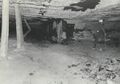
Caption: Old Ben 21
Rheinstahl-Wanheim 6 leg Chocks
Face 3
Credit: Illinois State Geological Survey
Date: 1964
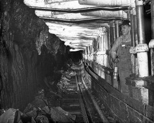
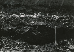
Caption: Old Ben 21
Rheinstahl-Wanheim 6 leg Chocks
Face 3
Credit: Illinois State Geological Survey
Date: 1964
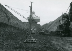
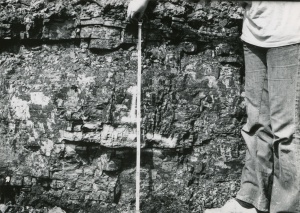
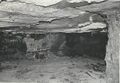
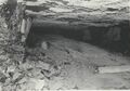
Caption: Old Ben 21
Gullick Chocks
Face 6
Credit: Illinois State Geological Survey
Date: 1969 Jun-1970 Apr
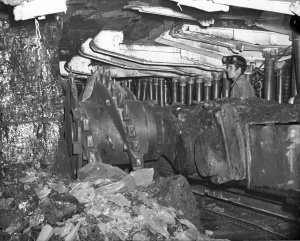
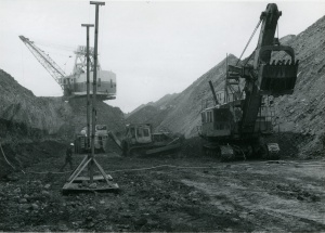
Caption: Old Ben 21
Gullick Chocks
Face 6(3rd-5th N Panel off 1 E.S. Mains)
Credit: Illinois State Geological Survey
Date: 1969 Jun-1970 Apr

Caption: Old Ben 21
Gullick Chocks
Face 6 (3rd-5th N Panel off 1 E.S. Mains)
Credit: Illinois State Geological Survey
Date: 1969 Jun-1970 Apr

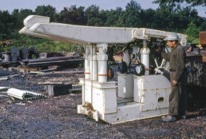
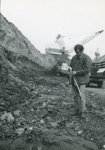
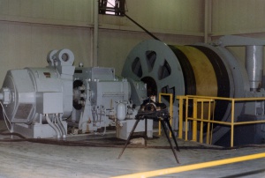
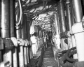
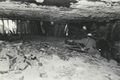
Caption: Old Ben 21
Joy-Gullick 600 ton Chocks
Face 6
Credit: Illinois State Geological Survey
Date: 1969 Jun-1970 Apr
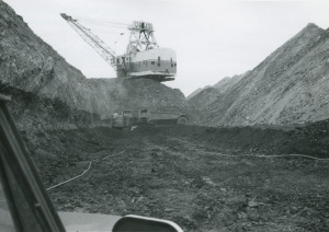
Caption: Old Ben 21
Joy-Gullick 600 ton Chocks
Face 6
Credit: Illinois State Geological Survey
Date: 1969 Jun-1970 Apr
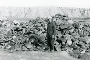
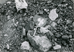
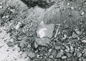
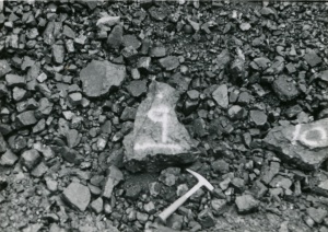
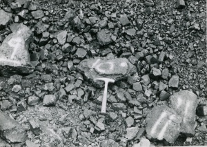
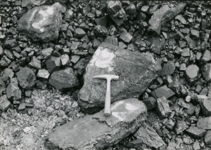
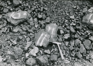
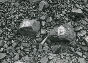
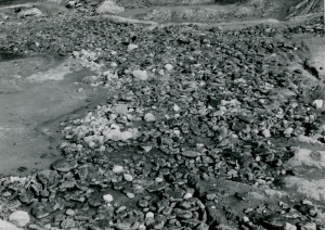
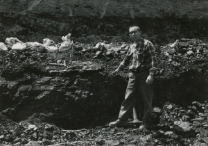
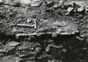
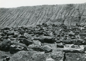
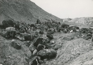
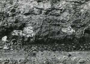
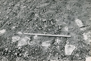
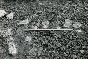
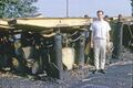
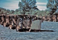
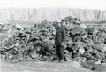
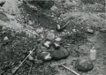
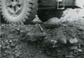
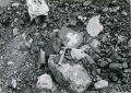
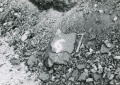
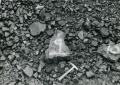
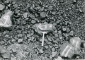
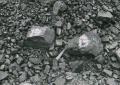
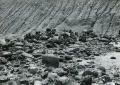
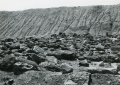
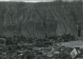
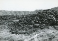
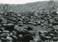
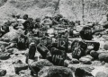
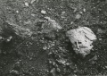
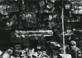
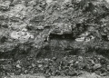
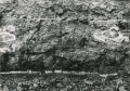
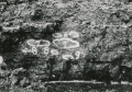
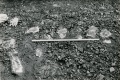
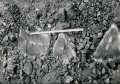
Caption: Coalballs in Pit 14
Credit: Phillips Coal Ball Collection
Date: 05/06/1972

Caption: Coalballs in Pit 14
Credit: Phillips Coal Ball Collection
Date: 05/06/1972
Caption: Coalballs in Pit 14
Credit: Phillips Coal Ball Collection
Date: 05/06/1972
Caption: Coalballs in Pit 14
Credit: Phillips Coal Ball Collection
Date: 05/06/1972
Caption: Coalballs in Pit 14
Credit: Phillips Coal Ball Collection
Date: 05/06/1972
Caption: Coalballs in Pit 14
Credit: Phillips Coal Ball Collection
Date: 05/06/1972
Caption: Coalballs in Pit 14
Credit: Phillips Coal Ball Collection
Date: 05/06/1972
Caption: Coalballs in Pit 14
Credit: Phillips Coal Ball Collection
Date: 05/06/1972
Caption: Coalballs in Pit 14
Credit: Phillips Coal Ball Collection
Date: 05/06/1972
Caption: Coalballs in Pit 14
Credit: Phillips Coal Ball Collection
Date: 05/06/1972
Caption: Coalballs in Pit 14
Credit: Phillips Coal Ball Collection
Date: 05/06/1972
Caption: Coalballs in Pit 14
Credit: Phillips Coal Ball Collection
Date: 05/06/1972
Caption: Coalballs in Pit 14
Credit: Phillips Coal Ball Collection
Date: 05/06/1972
Caption: Coalballs in Pit 14
Credit: Phillips Coal Ball Collection
Date: 05/06/1972
Caption: Coalballs in Pit 14
Credit: Phillips Coal Ball Collection
Date: 05/06/1972
Caption: Coalballs in Pit 14
Credit: Phillips Coal Ball Collection
Date: 05/06/1972
Caption: Coalballs in Pit 14
Credit: Phillips Coal Ball Collection
Date: 05/06/1972
Caption: Coalballs in Pit 14
Credit: Phillips Coal Ball Collection
Date: 05/06/1972
Caption: Coalballs in Pit 14
Credit: Phillips Coal Ball Collection
Date: 05/06/1972
Caption: Coalballs in Pit 14
Credit: Phillips Coal Ball Collection
Date: 05/06/1972
Caption: Coalballs in Pit 14
Credit: Phillips Coal Ball Collection
Date: 05/06/1972
Caption: Coalballs in Pit 14
Credit: Phillips Coal Ball Collection
Date: 05/06/1972
Caption: Coalballs in Pit 14
Credit: Phillips Coal Ball Collection
Date: 05/06/1972
Caption: Coalballs in Pit 14
Credit: Phillips Coal Ball Collection
Date: 05/06/1972
Caption: Coalballs in Pit 14
Credit: Phillips Coal Ball Collection
Date: 05/06/1972
Caption: Coalballs in Pit 14
Credit: Phillips Coal Ball Collection
Date: 05/06/1972
Caption: Coalballs in Pit 14
Credit: Phillips Coal Ball Collection
Date: 05/06/1972
Caption: Coalballs in Pit 14
Credit: Phillips Coal Ball Collection
Date: 05/06/1972
Caption: Coalballs in Pit 14
Credit: Phillips Coal Ball Collection
Date: 05/06/1972
Caption: Coalballs in Pit 14
Credit: Phillips Coal Ball Collection
Date: 05/06/1972
Caption: Coalballs in Pit 14
Credit: Phillips Coal Ball Collection
Date: 05/06/1972
Caption: Coalballs in Pit 14
Credit: Phillips Coal Ball Collection
Date: 05/06/1972
Caption: Coalballs in Pit 14
Credit: Phillips Coal Ball Collection
Date: 05/06/1972
Caption: Coalballs in Pit 14
Credit: Phillips Coal Ball Collection
Date: 05/06/1972
Caption: Coalballs in Pit 14
Credit: Phillips Coal Ball Collection
Date: 05/06/1972
Caption: Coalballs in Pit 14
Credit: Phillips Coal Ball Collection
Date: 05/06/1972

Caption: Coalballs in Pit 14
Credit: Phillips Coal Ball Collection
Date: 05/06/1972
Caption: Coalballs in Pit 14
Credit: Phillips Coal Ball Collection
Date: 05/06/1972
Caption: Coalballs in Pit 14
Credit: Phillips Coal Ball Collection
Date: 05/06/1972
Caption: Coalballs in Pit 14
Credit: Phillips Coal Ball Collection
Date: 05/06/1972
Caption: Coalballs in Pit 14
Credit: Phillips Coal Ball Collection
Date: 05/06/1972
Caption: Coalballs in Pit 14
Credit: Phillips Coal Ball Collection
Date: 05/06/1972
Caption: Coalballs in Pit 14
Credit: Phillips Coal Ball Collection
Date: 05/06/1972
Caption: Coalballs in Pit 14
Credit: Phillips Coal Ball Collection
Date: 05/06/1972
Caption: Coalballs in Pit 14
Credit: Phillips Coal Ball Collection
Date: 05/06/1972
Caption: Coalballs in Pit 14
Credit: Phillips Coal Ball Collection
Date: 05/06/1972
Caption: Coalballs in Pit 14
Credit: Phillips Coal Ball Collection
Date: 05/06/1972
Caption: Coalballs in Pit 14
Credit: Phillips Coal Ball Collection
Date: 05/06/1972
Caption: Coalballs in Pit 14
Credit: Phillips Coal Ball Collection
Date: 05/06/1972
Caption: Coalballs in Pit 14
Credit: Phillips Coal Ball Collection
Date: 05/06/1972
Caption: Coalballs in Pit 14
Credit: Phillips Coal Ball Collection
Date: 05/06/1972
Caption: Coalballs in Pit 14
Credit: Phillips Coal Ball Collection
Date: 05/06/1972
Caption: Coalballs in Pit 14
Credit: Phillips Coal Ball Collection
Date: 05/06/1972
Caption: Coalballs in Pit 14
Credit: Phillips Coal Ball Collection
Date: 05/06/1972
Caption: Coalballs in Pit 14
Credit: Phillips Coal Ball Collection
Date: 05/06/1972
Caption: Coalballs in Pit 14
Credit: Phillips Coal Ball Collection
Date: 05/06/1972
Caption: Coalballs in Pit 14
Credit: Phillips Coal Ball Collection
Date: 05/06/1972
Caption: Coalballs in Pit 14
Credit: Phillips Coal Ball Collection
Date: 05/06/1972
Caption: Coalballs in Pit 14
Credit: Phillips Coal Ball Collection
Date: 05/06/1972
Caption: Coalballs in Pit 14
Credit: Phillips Coal Ball Collection
Date: 05/06/1972
Caption: Coalballs in Pit 14
Credit: Phillips Coal Ball Collection
Date: 05/06/1972
Caption: Coalballs in Pit 14
Credit: Phillips Coal Ball Collection
Date: 05/06/1972
Caption: Coalballs in Pit 14
Credit: Phillips Coal Ball Collection
Date: 05/06/1972
Caption: Coalballs in Pit 14
Credit: Phillips Coal Ball Collection
Date: 05/06/1972
Caption: Coalballs in Pit 14
Credit: Phillips Coal Ball Collection
Date: 05/06/1972
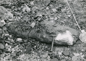
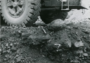
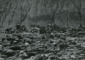
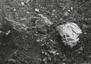
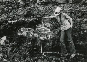
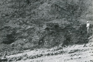
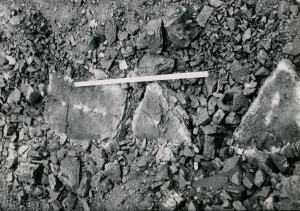
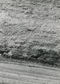
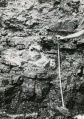
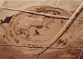
Caption: In situ coalballs and main coalball zone did not have a dark shale immediately over coal.
Credit: Phillips Coal Ball Collection
Date: 05/06/1972
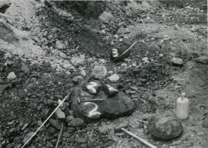
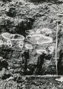
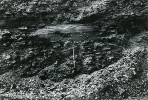
Caption: Coalballs in situ 50-75cm below top of Summum (No.4) coal in main coalball Zone, Northern Illinois Mine, South Wilmington.
Credit: Phillips Coal Ball Collection
Date: 05/06/1972
Caption: Coalballs in situ 50-75cm below top of Summum (No.4) coal in main coalball Zone, Northern Illinois Mine, South Wilmington.
Credit: Phillips Coal Ball Collection
Date: 05/06/1972
Caption: Coalballs in situ 50-75cm below top of Summum (No.4) coal in main coalball Zone, Northern Illinois Mine, South Wilmington.
Credit: Phillips Coal Ball Collection
Date: 05/06/1972
Caption: Coalballs in situ 50-75cm below top of Summum (No.4) coal in main coalball Zone, Northern Illinois Mine, South Wilmington.
Credit: Phillips Coal Ball Collection
Date: 05/06/1972
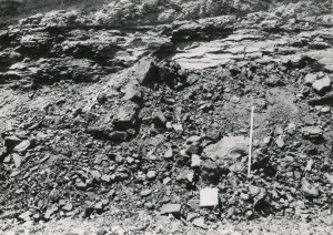
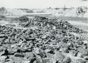
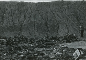
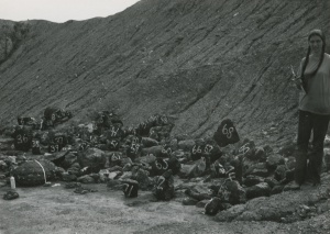
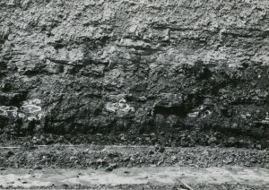
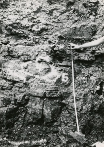
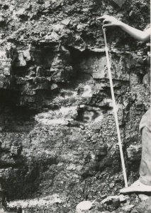
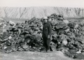
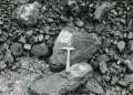
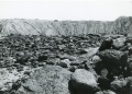
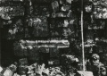
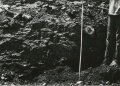
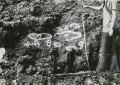
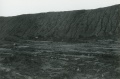
Caption: Main Coalballs zone in Pit 14
Credit: Phillips Coal Ball Collection
Date: 05/06/1972
Caption: Main Coalballs zone in Pit 14
Credit: Phillips Coal Ball Collection
Date: 05/06/1972
Caption: Main Coalballs zone in Pit 14
Credit: Phillips Coal Ball Collection
Date: 05/06/1972
Caption: Main Coalballs zone in Pit 14
Credit: Phillips Coal Ball Collection
Date: 05/06/1972
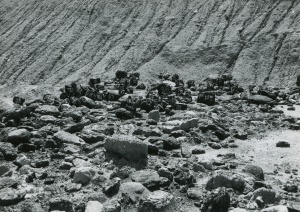
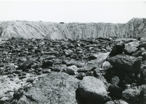
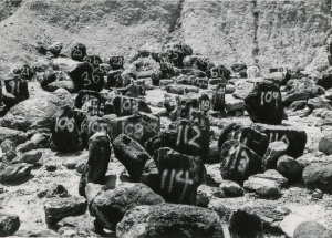
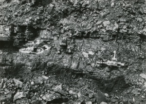
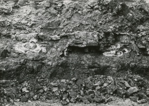
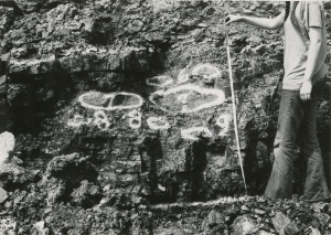
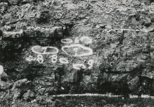
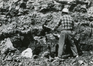
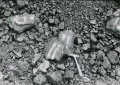
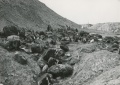
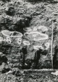
Caption: Coalballs in place at top of Summum coal in main coalball zone of pit 14
Credit: Phillips Coal Ball Collection
Date: 05/06/1972
Caption: Coalballs in place at top of Summum coal in main coalball zone of pit 14
Credit: Phillips Coal Ball Collection
Date: 05/06/1972
Caption: Coalballs in place at top of Summum coal in main coalball zone of pit 14
Credit: Phillips Coal Ball Collection
Date: 05/06/1972
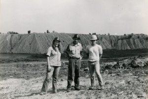
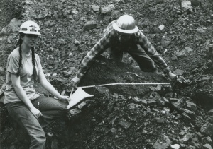
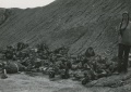
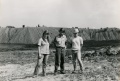
Caption: Joan Courvoisier, Melbourne McKee, & Kenneth Cope in Pit 14
Credit: Phillips Coal Ball Collection
Date: 09/18/1972
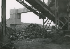
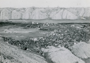
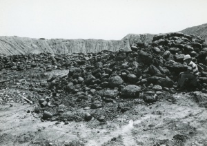
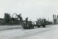
Caption: Stockpile in Pit 11 (coalballs from Pit 14)
Credit: Phillips Coal Ball Collection
Date: 09/18/1972
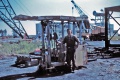
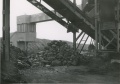
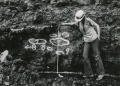
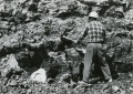
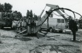
Caption: Coal Cutter
Credit: Phillips Coal Ball Collection
Date: 05/06/1972

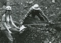
Caption: Coal Cutter - High pressure water
Credit: Phillips Coal Ball Collection
Date: 05/06/1972
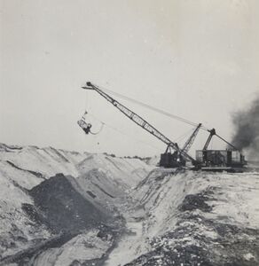
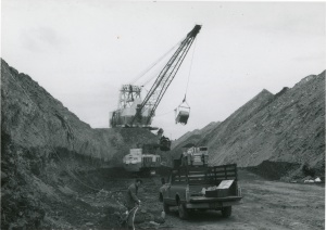
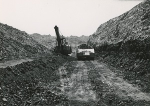
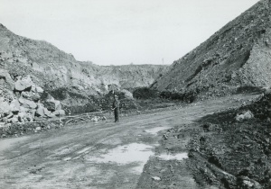
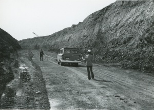
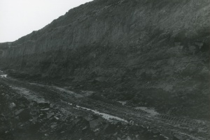
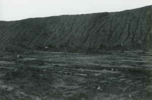
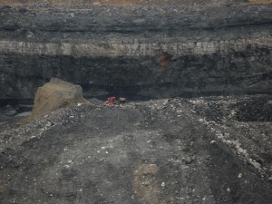
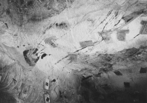
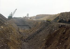
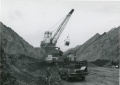
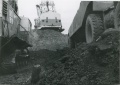
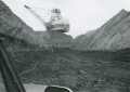
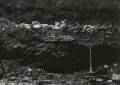
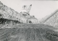
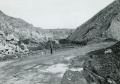
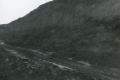
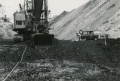
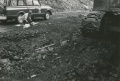
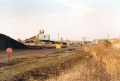
Caption: Surface mine pit, NE 30-T6N-R3E, dragline. Photographer G. Cady
Credit: Illinois State Geological Survey
Date: 6-25-1941
Library No.: 2316 (M-1513)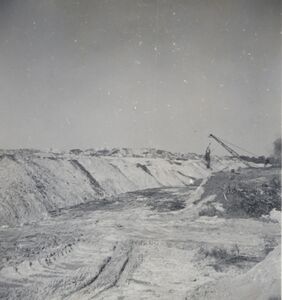
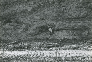
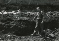
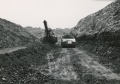
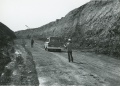
Caption: Surface mine, dragline in distance. Photographer: G. Cady
Credit: Illinois State Geological Survey
Date: 6-25-1941
Library No.: 2317 (M-1514)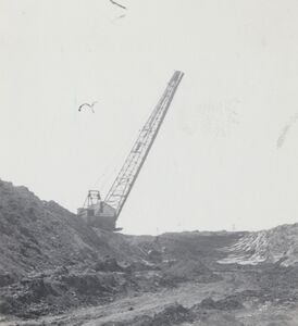
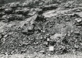
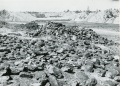
Caption: Surface mine, dragline. Photographer: G. Cady
Credit: Illinois State Geological Survey
Date: circa 1941
Library No.: 2462 (M-1659)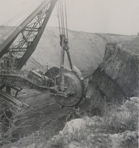
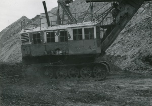
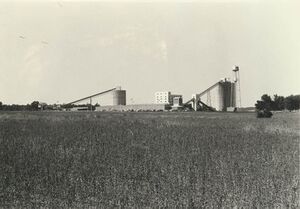
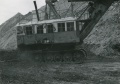
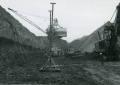
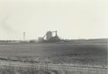
Caption: Excavating head of first Illinois bucketwheel excavator designed by Frank F. Kolbe of United Electric Coal Company. This was an economical method of moving a great volume of soil and shale and depositing it far enough away to prevent the spoil pile from sliding back into the pit. This wheel excavator could deposit to a spoil pile 400 ft away. Bucyrus built the upper portion onto a Marion dragline chassis. The machine weighed about 1,000 tons and had an output of 1,000 cubic yards of material per hour. This volume is about 5 times the rate of the Marion dragline model it replaced.
Credit: Illinois State Geological Survey
Date: 1949
Library No.: 2765 (M-1963)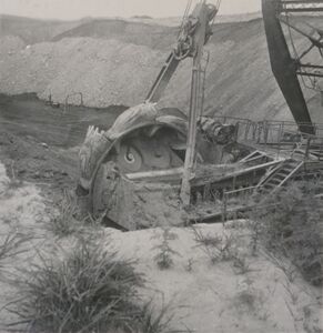
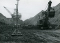
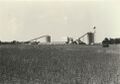
Caption: Excavating head of bucketwheel excavator. Photographer: G. Cady This is the first bucketwheel excavator, designed by Frank F. Kolbe of United Electric Coal Company. This was an economical method of moving a great volume of soil and shale and depositing it far enough away to prevent the spoil pile from sliding back into the pit. This wheel excavator could deposit to a spoil pile 400 ft away. Bucyrus built the upper portion onto a Marion dragline chassis. The machine weighed about 1,000 tons and had an output of 1,000 cubic yards of material per hour. This volume is about 5 times the rate of the Marion dragline model it replaced.
Credit: Illinois State Geological Survey
Date: 1949
Library No.: 2766 (M-1964)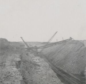
Caption: Conveyor portion of bucketwheel excavator. Photographer: G. Cady This is the first bucketwheel excavator in Illinois, designed by Frank F. Kolbe of United Electric Coal Company. This was an economical method of moving a great volume of soil and shale and depositing it far enough away to prevent the spoil pile from sliding back into the pit. This wheel excavator could deposit to a spoil pile 400 ft away. Bucyrus built the upper portion onto a Marion dragline chassis. The machine weighed about 1,000 tons and had an output of 1,000 cubic yards of material per hour. This volume is about 5 times the rate of the Marion dragline model it replaced.
Credit: Illinois State Geological Survey
Date: 1949
Library No.: 2767 (M-1965)
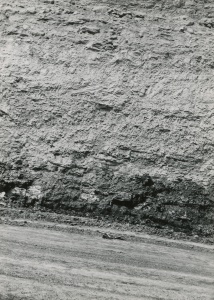
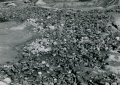
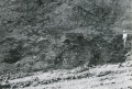
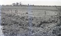
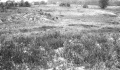
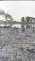
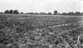
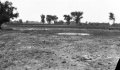
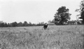
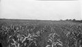
Caption: Drowned-out area of corn near Nokomis where the 8 foot coal bed is worked at a depth of about 625 feet.
Credit: Illinois State Geological Survey
Date: Pre-1914
Library No.: M-1000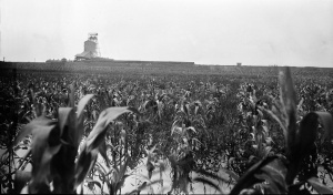
Caption: Drowned-out area of corn near Nokomis where the 8 foot coal bed is worked at a depth of about 625 feet.
Credit: Illinois State Geological Survey
Date: Pre-1914
Library No.: M-1001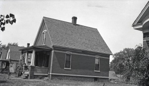
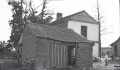
Caption: Houses in northwest Springfield for which claims were paid by a mining company for damages caused by mining coal 5 feet 9 inches thick at a depth of about 200 feet.
Credit: Illinois State Geological Survey
Date: Pre-1914
Publication: Fig. 44 Cooperative Bulletin 17 – Subsidence in Illinois
Library No.: M-1003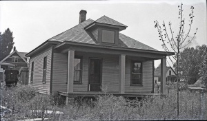
Caption: Houses in northwest Springfield for which claims were paid by a mining company for damages caused by mining coal 5 feet 9 inches thick at a depth of about 200 feet.
Credit: Illinois State Geological Survey
Date: Pre-1914
Library No.: M-1005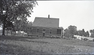
Caption: Houses in northwest Springfield for which claims were paid by a mining company for damages caused by mining coal 5 feet 9 inches thick at a depth of about 200 feet. See M-1004
Credit: Illinois State Geological Survey
Library No.: M-1006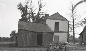
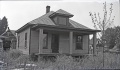
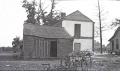
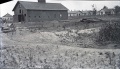
Caption: Brick house near Danville abandoned on account of danger by room-and-pillar mining of a 6-foot coal at a depth of about 200 feet.
Credit: Illinois State Geological Survey
Date: Pre-1914
Publication: Fig. 42 Cooperative Bulletin 17 – Subsidence in Illinois
Library No.: M-1007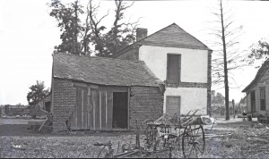
Caption: Brick house near Danville abandoned on account of danger by room-and-pillar mining of a 6-foot coal at a depth of about 200 feet.
Credit: Illinois State Geological Survey
Date: Pre-1914
Library No.: M-1008
Caption: Brick house near Danville abandoned on account of danger by room-and-pillar mining of a 6-foot coal at a depth of about 200 feet.
Credit: Illinois State Geological Survey
Date: Pre-1914
Library No.: M-1009
Caption: Brick house near Danville abandoned on account of danger by room-and-pillar mining of a 6-foot coal at a depth of about 200 feet.
Credit: Illinois State Geological Survey
Date: Pre-1914
Library No.: M-1010
Caption: Brick house near Danville abandoned on account of danger by room-and-pillar mining of a 6-foot coal at a depth of about 200 feet.
Credit: Illinois State Geological Survey
Date: Pre-1914
Library No.: M-1011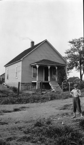
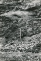
Caption: Plaster and foundation cracked.
Credit: Illinois State Geological Survey
Date: Pre-1914
Library No.: M-1003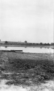
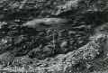
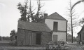
Caption: Hippert (HIPPARD?) mine on Freeburg road, freshly filled mine, water entering through cave
Credit: Illinois State Geological Survey
Library No.: M-1035
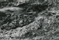
Caption: Gartside Mine, Murphysboro, sink in low land, pillar pulling
Credit: Illinois State Geological Survey
Library No.: M-1036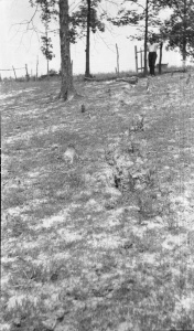
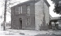
Caption: Superior Coal Mine No.2 Gillespie
Credit: Illinois State Geological Survey
Library No.: M-1042
Caption: Subsidence fill, L and M track SE of Staunton--Consolidated No 6 mine
Credit: Illinois State Geological Survey
Library No.: M-1044
Caption: Subsidence fill, L and M track SE of Staunton--Consolidated No 6 mine
Credit: Illinois State Geological Survey
Library No.: M-1045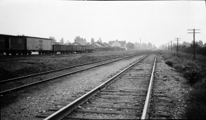
Caption: IL Central looking North from Madison shaft Divernon--sag in tracks and fill on rightt tracks
Credit: Illinois State Geological Survey
Library No.: M-1047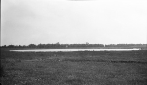
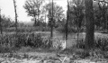
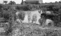
Caption: Pond North of Witt
Credit: Illinois State Geological Survey
Library No.: M-809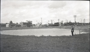
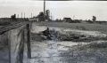
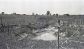
Caption: Pond caused by subsidence at Westville, Vermilion County, where 6 feet of coal was removed by room-and-pillar mining at a depth of 210 feet. Levels at surface show maximum depth of sag to by 4.7 feet.
Credit: Illinois State Geological Survey
Date: Pre-1914
Publication: Fig. 30 Cooperative Bulletin 17 – Subsidence in Illinois
Library No.: M-813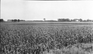
Caption: Open space south of Danville about 200 feet square in cornfield, indicating that area is not tilled because water stands over the sage in the spring.
Credit: Illinois State Geological Survey
Date: pre-1914
Publication: Fig. 31 Cooperative Bulletin 17 – Subsidence in Illinois
Library No.: M-821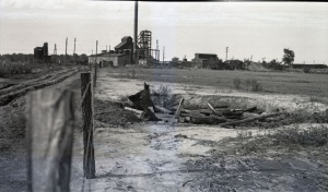
Caption: Pit hole filled with rubbish at the Electric mine near Danville
Credit: Illinois State Geological Survey
Date: Pre-1914
Publication: Fig. 35 Cooperative Bulletin 17 – Subsidence in Illinois
Library No.: M-822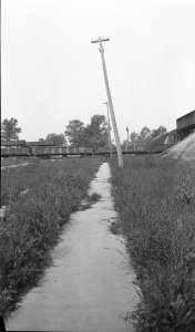
Caption: Broken sidewalk and telephone poles tipped toward a sag over Franklin Count Mine where and 8 foot coal is being removed at a depth of 450 feet.
Credit: Illinois State Geological Survey
Date: Pre-1914
Publication: Fig. 26 Cooperative Bulletin 17 – Subsidence in Illinois
Library No.: M-825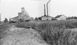
Caption: Swamp in a typical sag in Randolph County where a 6 foot coal is being mined at depth of 150 feet. The rooms are on 50 foot centers; pillars 18 feet.
Credit: Illinois State Geological Survey
Date: Pre-1914
Publication: Fig. 27 Cooperative Bulletin 17 – Subsidence in Illinois
Library No.: M-826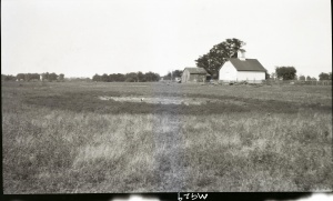
Caption: Subsidence Kelly No 5 Mine
(Mine Index:3740)
Credit: Illinois State Geological Survey
Date: Pre-1914
Library No.: M-929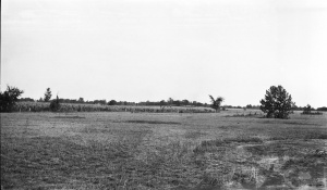
Credit: Illinois State Geological Survey
Library No.: M-932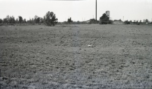
Caption: South of shaft, 3 feet deep
Credit: Illinois State Geological Survey
Library No.: M-933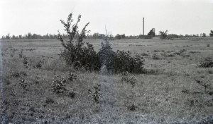
Caption: Kellyville No. 3 Near Electric mine Danville District. 8 foot diameter, 3 feet deep.
Credit: Illinois State Geological Survey
Library No.: M-934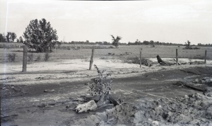
Caption: Ash filled road washed away.
Credit: Illinois State Geological Survey
Library No.: M-938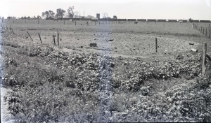
Credit: Illinois State Geological Survey
Caption: Break in curb and pavement in Decatur over the Manufacturers & Consumers Coal Co. Mine.
Credit: Illinois State Geological Survey
Date: Pre-1914
Library No.: M-947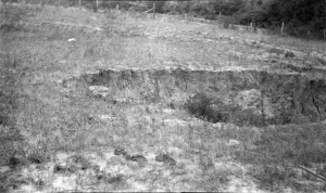
Caption: Caves on hillside
Credit: Illinois State Geological Survey
Library No.: M-952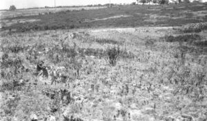
Caption: Subsidence along railroad tracks.
Credit: Illinois State Geological Survey
Library No.: M-959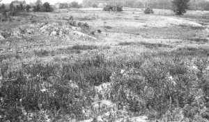
Caption: Subsidence in hilly area--mound (left foreground) over pillar.
Credit: Illinois State Geological Survey
Library No.: M-960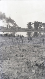
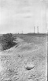
Caption: Mine Pond, 200 feet diameter 3 feet deep
Credit: Illinois State Geological Survey
Library No.: M-961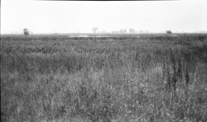
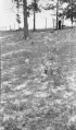
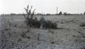
Caption: Sag foreground and background high grass over pillar
Credit: Illinois State Geological Survey
Library No.: M-962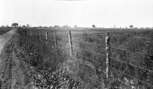
Caption: Sag--quarter mile long--fence shows sag of about 2 feet
Credit: Illinois State Geological Survey
Library No.: M-963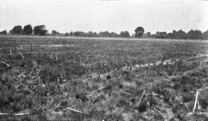
Caption: North-West of shaft, 800 feet across by 3 feet deep with some water
Credit: Illinois State Geological Survey
Library No.: M-965
Caption: Subsidence over two rooms east of Security shaft east of the ICRR south of Du Quoin
Credit: Illinois State Geological Survey
Library No.: M-966
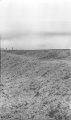
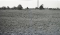
Caption: Typical sag
Credit: Illinois State Geological Survey
Library No.: M-967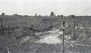
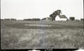
Caption: Surface breaks extending over a room in a mine near Harrisburg where the coal is 7 feet thick and 80 feet deep. The rooms are 24 feet wide and have 24 foot pillars
Credit: Illinois State Geological Survey
Date: Pre-1914
Publication: Fig. 13 Cooperative Bulletin 17 – Subsidence in Illinois
Library No.: M-968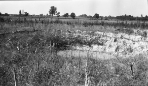
Caption: Breaks in field south of O'Gara No. 7
Credit: Illinois State Geological Survey
Library No.: M-969
Caption: Sag near Gartside Mine Murphysboro. Rig in sag.
Credit: Illinois State Geological Survey
Library No.: M-979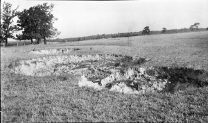
Caption: Surface breaks in a field near Carterville, 300 yards SW of Hafer Washed Coal Co. The shaft is 120 feet deep and a 7 foot bed of coal is being mined. The roof is slate and the overburden is clay; no quicksand has been noted. The breaks are about 20 feet in diameter and from a few feet to as much as 20 feet deep.
Credit: Illinois State Geological Survey
Date: Pre-1914
Publication: Fig. 12 Cooperative Bulletin 17 – Subsidence in Illinois
Library No.: M-991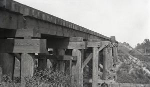
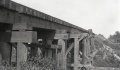
Caption: Repaired railroad trestle in Franklin County. One end subsided 18 inches more than the other, the total having been reported is about 4 feet.
Credit: Illinois State Geological Survey
Date: Pre-1914
Publication: Fig. 40 Cooperative Bulletin 17 – Subsidence in Illinois
Library No.: M-992![<b>Caption:</b> Barn of mining company lowered 4 feet at one end [right side]. It has been partially restored.<br><b>Credit:</b> Illinois State Geological Survey<br><b>Date:</b> Pre-1914<br><b>Library No.:</b> M-993](/images/thumb/f/fb/M-993_Old_Ben_8_mine_W_Frankfort_rt_end_4ft_lower.jpg/300px-M-993_Old_Ben_8_mine_W_Frankfort_rt_end_4ft_lower.jpg)
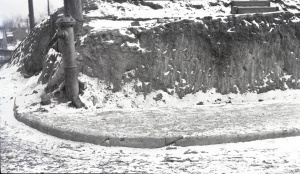
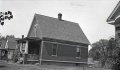
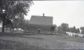
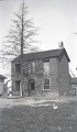
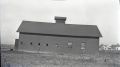
Caption: Barn of mining company lowered 4 feet at one end [right side]. It has been partially restored.
Credit: Illinois State Geological Survey
Date: Pre-1914
Library No.: M-993![<b>Caption:</b> Barn of mining company lowered 4 feet at one end [right side]. It has been partially restored.<br><b>Credit:</b> Illinois State Geological Survey<br><b>Date:</b> Pre-1914<br><b>Publication:</b> Fig. 47 Cooperative Bulletin 17 – Subsidence in Illinois<br><b>Library No.:</b> M-994](/images/thumb/a/ae/M-994_Old_Ben_8_mine_W_Frankfort_Coop_17_Fig_47_rt_end_4ft_lower.jpg/300px-M-994_Old_Ben_8_mine_W_Frankfort_Coop_17_Fig_47_rt_end_4ft_lower.jpg)
Caption: Barn of mining company lowered 4 feet at one end [right side]. It has been partially restored.
Credit: Illinois State Geological Survey
Date: Pre-1914
Publication: Fig. 47 Cooperative Bulletin 17 – Subsidence in Illinois
Library No.: M-994
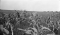
Caption: Drowned-out area of corn near Nokomis where the 8 foot coal bed is worked at a depth of about 625 feet.
Credit: Illinois State Geological Survey
Date: Pre-1914
Library No.: M-995
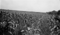
Caption: Drowned-out area of corn near Nokomis where the 8 foot coal bed is worked at a depth of about 625 feet.
Credit: Illinois State Geological Survey
Date: Pre-1914
Library No.: M-996
Caption: Drowned-out area of corn near Nokomis where the 8 foot coal bed is worked at a depth of about 625 feet.
Credit: Illinois State Geological Survey
Date: Pre-1914
Library No.: M-997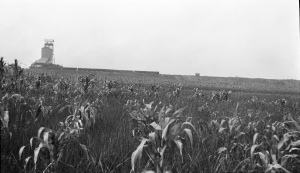
Caption: Drowned-out area of corn near Nokomis where the 8 foot coal bed is worked at a depth of about 625 feet.
Credit: Illinois State Geological Survey
Date: Pre-1914
Library No.: M-998
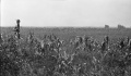
Caption: Drowned-out area of corn near Nokomis where the 8 foot coal bed is worked at a depth of about 625 feet.
Credit: Illinois State Geological Survey
Date: Pre-1914
Publication: Fig. 32 Cooperative Bulletin 17 – Subsidence in Illinois
Library No.: M-999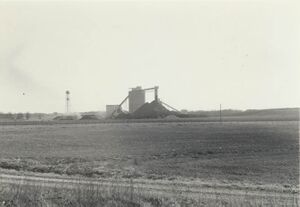
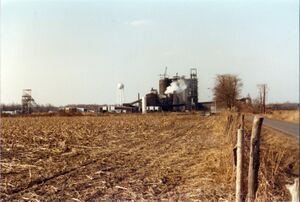
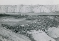
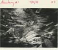
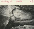
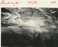
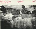
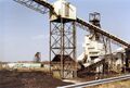
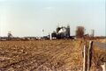
Caption: View looking southward at preparation plant of Monterey Coal Company's Mine No. 1
Date: 1979
Caption: Monterey #1, Macoupin Co. 1979
Date: 1979
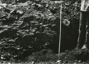
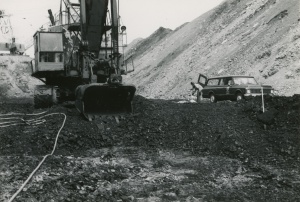
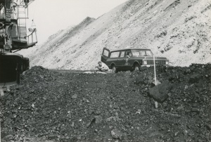
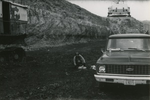
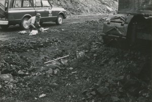
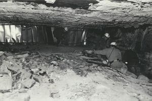
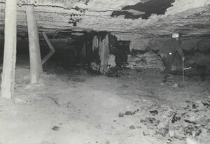
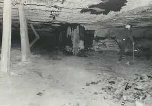
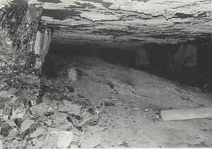
Caption: Floor heaving: 7' vertical opening was closed to only a few feet. Wooden posts which were set when the squeeze first started broke.
Date: 07/11/1972
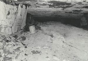
Caption: Floor heaving: 7' vertical opening was closed to only a few feet.
Date: 07/11/1972
Caption: As the floor heaves particularly near the center of the rooms, irregular cracks start to develop thus dividing the floor into separate plates thereby allowing differential movement of these plates.
Date: 07/11/1972
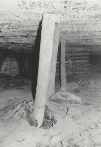
Caption: Floor heaving: 7' vertical opening was closed to only a few feet. Wooden posts which were set when the squeeze first started broke or were pused into the underclay whiched heaved and broke around them.
Date: 07/11/1972
Caption: The heaving puts unusual stresses on the coal pillars which leads to their ultimate failure.
Date: 07/11/1972
Caption: The heaving puts unusual stresses on the coal pillars which leads to their ultimate failure.
Date: 07/11/1972
Date: 07/11/1972
Date: 07/11/1972
Library No.: Mn act macoupin 14
Date: 07/11/1972
Date: 07/11/1972
Date: 07/11/1972
Date: 07/11/1972
Date: 07/11/1972
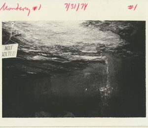
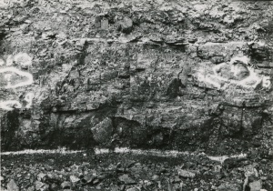
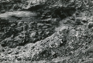
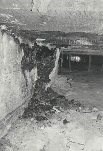
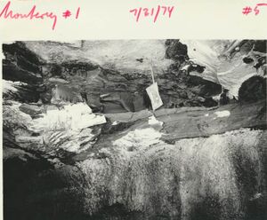
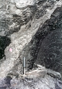
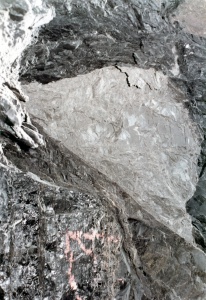
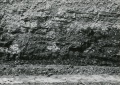
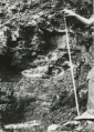
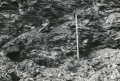
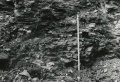
Caption: Anna Shale, slip and bedding.
Date: 07/31/1974
Caption: Anna Shale, slip and bedding.
Date: 07/31/1974
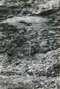
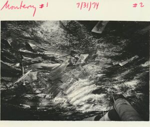
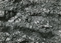
Caption: Roof fall, where Energy Shale above coal (many plants in shale) above Energy Shale very thin Anna Shale and "pot" of Brereton Limestone.
Date: 07/31/1974
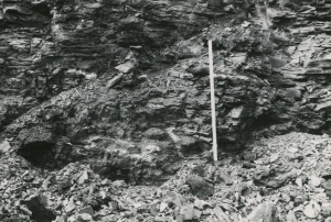
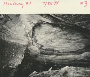
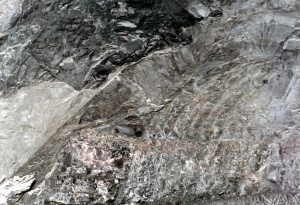
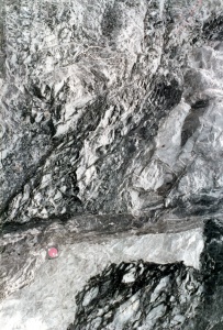
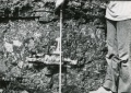
Caption: "Crossbedding of coal laminae in gray shale, fall along slip"
Date: 07/31/1974
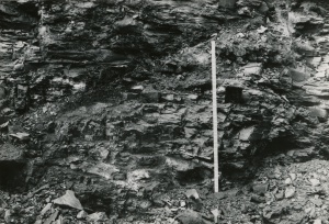
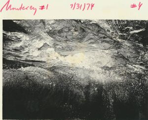
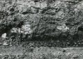
Caption: Energy Shale pinching out towards the south, rather thin (2 ft) Anna Shale above and thin Brereton Limestone; fall along slip.
Date: 07/31/1974
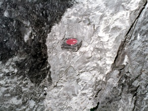
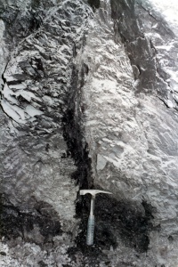
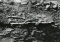
Caption: Septarian concretions in gray silty mudstone above the Herrin Coal
Date: 07/29/1984

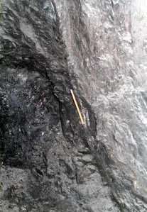
Caption: Pyritic concretion at coal-shale boundary.
Date: 07/29/1984

Caption: One of many flat-lying fossil logs in the immediate roof.
Date: 07/29/1984
Caption: Fossil tree stump, or "kettlebottom" in immediate roof.
Date: 07/29/1984
Caption: "Kettlebottom", Monterey No. 1 Mine, in Energy Shale.
Date: 07/29/1984
Caption: Herrin Coal at the S Coal surface mine near Elkville, IL. Herrin coal at the base of the highwall ‘splits’ or separates apart both to the right and left from a central intact portion, with Energy shale intercalated between the upper and lower coal benches. Coal splits that are found close to penecontemporaneous river channels, such as this example near the Walshville paleochannel, are likely formed by erosion at the channel margins that creates peat flaps that float, followed by sediment deposition infilling below the flaps, and on top.
Date: November 19, 2009

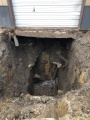
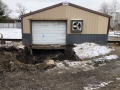
Caption: The covering of the old shaft (abandoned 1902) has failed, resulting in subsidence below the shed entrance. Photo courtesy of David Kimmerle, P. E., Division of Abandoned Mined Land Reclamation
Credit: Illinois Department of Natural Resources - Office of Mines and Minerals
Date: 3-2020

Caption: The covering of the old shaft (abandoned 1902) has failed, resulting in subsidence below the shed entrance. Photo courtesy of David Kimmerle, P. E., Division of Abandoned Mined Land Reclamation
Credit: Illinois Department of Natural Resources - Office of Mines and Minerals
Date: 3-2020
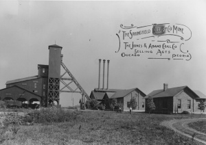
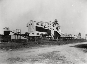
Caption: Springfield Colliery Company, Sangamon County. The A-frame structure in the center of the photography is the headframe, supporting cables from the engine house on the right. The shaft is below the tower. The structure on the left is the tipple, or loading platform, and the sorting shed is above the tipple.
Credit: Illinois State Geological Survey
Date: Circa 1910
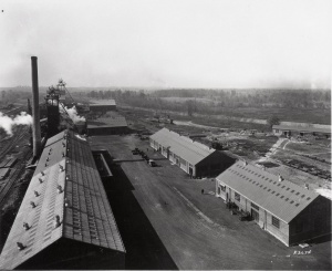
Caption: Preparation plant and surface buildings at Old Ben No. 24. Man shaft in background. Photo by John Nelson, March 1981.
Credit: Illinois State Geological Survey
Date: March 1981

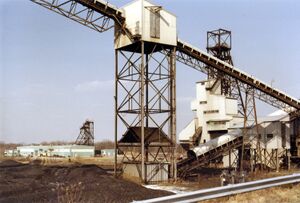
Caption: Preparation Plant at old portal of Orient No. 4 Mine, looking north. Photo by John Nelson
Credit: Illinois State Geological Survey
Date: 03/24/1981
Publication: Mine Notes
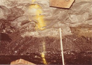
Caption: Oil seep in Piasa Limestone roof, travel-way of 6th North off 2nd SE Mains, about 2300' inby.
Credit: Illinois State Geological Survey
Date: 07/10/1974
Publication: Mine Notes
Caption: Oil seep in Piasa Limestone roof, travel-way of 6th North off 2nd SE Mains, about 2300' inby.
Date: 07/10/1974
Publication: Mine Notes
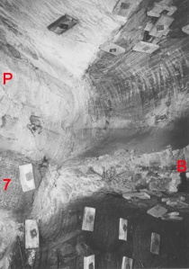
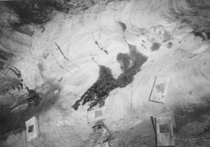
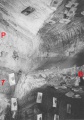
Caption: Normal fault with about 80 feet displacement. Left side down (P) Piasa Limestone (7) No. 7 coal (B) Brereton Limestone on footwall. Located about 2500' into 6th North travel-way off 2nd SE Mains.
Credit: Illinois State Geological Survey
Date: 07/10/1974
Publication: Mine Notes
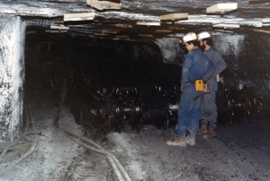
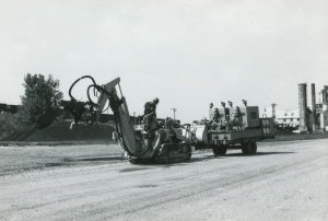
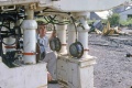
Caption: Curt Lewman (left) and Steve Danner with continuous mining machine. Photo by John Nelson
Credit: Illinois State Geological Survey
Date: 03/24/1981
Publication: Mine Notes
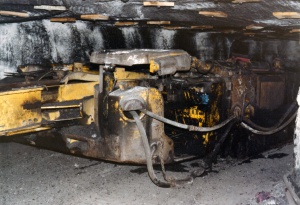
Caption: Operator's control position for continuous miner.
Credit: Illinois State Geological Survey
Date: 03/24/1981
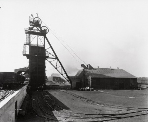
Caption: Headframe at No. 3 Portal, Orient No. 4
Credit: Illinois State Geological Survey
Date: 03/24/1981
Publication: Mine Notes
Caption: Hoisting room, Portal No. 3
Credit: Illinois State Geological Survey
Date: 03/24/1981
Publication: Mine Notes

Caption: Lamp room, No. 3 Portal
Credit: Illinois State Geological Survey
Date: 03/24/1981
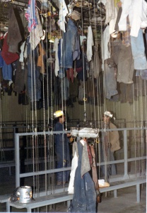
Caption: Change Room, No. 3 Portal
Credit: Illinois State Geological Survey
Date: 03/24/1981
Publication: Mine Notes
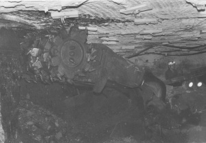
Caption: Continuous miner in action in the 8th Panel West
Credit: Illinois State Geological Survey
Date: 03/24/1981
Caption: Shuttle car in action
Credit: Illinois State Geological Survey
Date: 03/24/1981
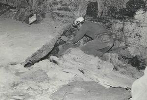
Caption: Series of Photos by Eugene Robertson, showing fault zone in 8th Main East near 1st Main North, Orient No. 4 Mine. This view shows dragged and brecciated rock along normal fault. Tape measure rests on light gray Energy Shale on downthrown block;black Anna Shale overlies Energy shale to the left. Fault plane about 6 inches to right (west) of tape; Herrin coal to the right of fault.
Credit: Illinois State Geological Survey
Date: 06/21/1984
Publication: Mine Notes
Caption: Series of Photos by Eugene Robertson, showing fault zone in 8th Main East near 1st Main North, Orient No. 4 Mine.
A more complete view of the fault zone, same sight.
Credit: Illinois State Geological Survey
Date: 06/21/1984
Publication: Mine Notes
Caption: Series of Photos by Eugene Robertson, showing fault zone in 8th Main East near 1st Main North, Orient No. 4 Mine.
View above and to right of last (Mn 45 028.jpg). Note variation in width of fault zone; a lenticular slice of relatively unfractured Energy Shale between two grouge-filled planes.
Credit: Illinois State Geological Survey
Date: 06/21/1984
Publication: Mine Notes
Caption: Series of Photos by Eugene Robertson, showing fault zone in 8th Main East near 1st Main North, Orient No. 4 Mine.
Another slice of Energy Shale along fault zone.
Credit: Illinois State Geological Survey
Date: 06/21/1984
Publication: Mine Notes

Caption: Series of Photos by Eugene Robertson, showing fault zone in 8th Main East near 1st Main North, Orient No. 4 Mine.
View of fault on north rib of same entry. Energy and Anna Shale on right, downthrown block dragged to nearly vertical position; coal and shale left of fault are dragged and heavily sheared.
Credit: Illinois State Geological Survey
Date: 06/21/1984
Publication: Mine Notes
Caption: Series of Photos by Eugene Robertson, showing fault zone in 8th Main East near 1st Main North, Orient No. 4 Mine.
North rib, view from farther back. Top is to right
Credit: Illinois State Geological Survey
Date: 06/21/1984
Publication: Mine Notes
Caption: Series of Photos by Eugene Robertson, showing fault zone in 8th Main East near 1st Main North, Orient No. 4 Mine.
Another view; gouge along fault plane.
Credit: Illinois State Geological Survey
Date: 06/21/1984
Publication: Mine Notes
Caption: Series of Photos by Eugene Robertson, showing fault zone in 8th Main East near 1st Main North, Orient No. 4 Mine.
Same place,Mn 45 033.jpg, rock dust cleared off for a better view.
Credit: Illinois State Geological Survey
Date: 06/21/1984
Publication: Mine Notes
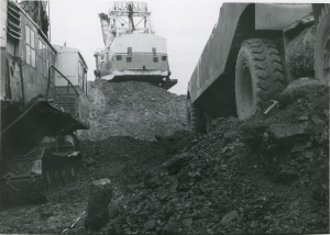
Caption: Jader Fuel Co. mine, looking south. Springfield Coal on floor of pit below dragline dips north, toward camera. On bench at west (right), Briar Hill Coal is being loaded. Herrin Coal is being uncovered farther to the west, out of the picture.
Date: 08/27/1986

Caption: Surface works of Inland Steel Co. Mine No. 1, Jefferson County; as viewed from southeast. Photo by John Nelson, March 1981
Credit: Illinois State Geological Survey
Date: March 1981
Caption: View of Inland Steel's tipple from the south
Date: 1981
Caption: Sinking of Inland Steel's coal hoist shaft.
Date: June 30, 1966
Caption: Sinking of Inland Steel's man and material shaft.
Date: June 26, 1966
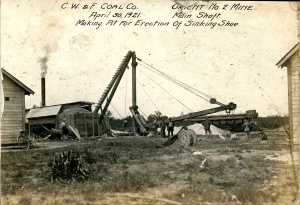
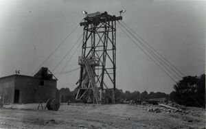
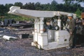
Caption: Orient No. 2 Mine Main Shaft, Making Pit for Erection of Sinking Shoe
Credit: Ledvina Collection
Date: April 30, 1921
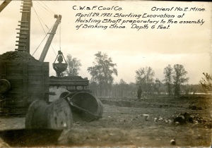
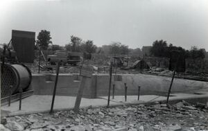
Caption: Orient No. 2 Mine. Starting Excavation at Hoisting Shaft preparatory to the assembly of Sinking Shoe. Depth 6 feet.
Credit: Ledvina Collection
Date: April 29, 1921
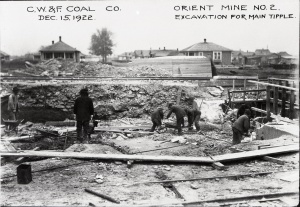
Caption: Orient Mine No. 2. Excavation for Main Tipple
Credit: Ledvina Collection
Date: December 15, 1922
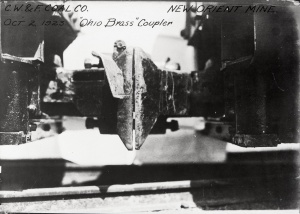
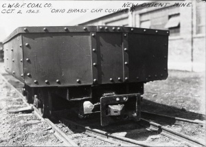
Caption: New Orient Mine. "Ohio Brass" Coupler
Credit: Ledvina Collection
Date: October 2, 1923
Caption: New Orient Mine. "Ohio Brass" coupler
Credit: Ledvina Collection
Date: October 2, 1923
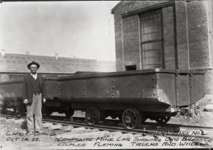
Caption: Orient Mine No. 2. Composite mine car showing Ohio Brass Co. coupler. Fleming Trucks and Wheels.
Credit: Ledvina Collection
Date: October 14, 1922
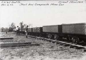
Caption: Orient Mine No. 2. Steel and composite mine car.
Credit: Ledvina Collection
Date: November 3, 1922
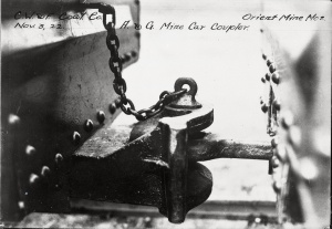
Caption: Orient Mine No. 2. A. & G. mine car coupler
Credit: Ledvina Collection
Date: November 3, 1922
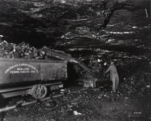
Caption: Joy Loading Machine
Credit: Ledvina Collection
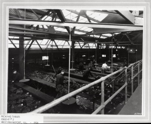
Caption: Picking Tables
Credit: Ledvina Collection
Date: 1935
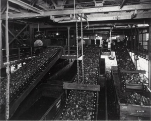
Caption: Prep Plant
Credit: Ledvina Collection
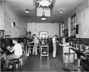
Caption: Orient 2, Lab
Credit: Ledvina Collection
Credit: Ledvina Collection
Credit: Ledvina Collection
Credit: Ledvina Collection
Caption: Small hoist house
Credit: Ledvina Collection
Credit: Ledvina Collection


![<b>Caption:</b> Barn of mining company lowered 4 feet at one end [right side]. It has been partially restored.<br><b>Credit:</b> Illinois State Geological Survey<br><b>Date:</b> Pre-1914<br><b>Library No.:</b> M-993](/wiki/File:M-993_Old_Ben_8_mine_W_Frankfort_rt_end_4ft_lower.jpg)
![<b>Caption:</b> Barn of mining company lowered 4 feet at one end [right side]. It has been partially restored.<br><b>Credit:</b> Illinois State Geological Survey<br><b>Date:</b> Pre-1914<br><b>Publication:</b> Fig. 47 Cooperative Bulletin 17 – Subsidence in Illinois<br><b>Library No.:</b> M-994](/wiki/File:M-994_Old_Ben_8_mine_W_Frankfort_Coop_17_Fig_47_rt_end_4ft_lower.jpg)


Media in category "Photograph"
The following 200 files are in this category, out of 219 total.
(previous page) (next page)
 1960s Old Ben 21 Rheinstahl-Wanheim 4 leg chocks MI 863.jpg 3,000 × 1,997; 209 KB
 1964 Rheinstahl-Wanheim 6 leg Chocks Old Ben 21 used Face 3 2.jpg 2,530 × 1,776; 515 KB
 1964 Rheinstahl-Wanheim 6 leg Chocks Old Ben 21 used Face 3.jpg 2,530 × 1,686; 545 KB
 1969 Jun-1970 Apr Old Ben 21 Face 6 Gullick Chocks 1.jpg 2,863 × 2,291; 575 KB
 1969 Jun-1970 Apr Old Ben 21 Face 6 Gullick Chocks 2.jpg 3,000 × 2,414; 511 KB
 1969 Jun-1970 Apr Old Ben 21 Face 6 Gullick Chocks 3.jpg 3,000 × 2,411; 471 KB
 1969 Jun-1970 Apr Old Ben 21 Joy-Gullick 600 ton Chocks used on Face 6 4.jpg 3,000 × 2,005; 220 KB
 1969 Jun-1970 Apr Old Ben 21 Joy-Gullick 600 ton Chocks used on Face 6.jpg 3,000 × 2,027; 248 KB
 Cb001.jpg 2,242 × 1,512; 1.01 MB
 Cb002 01.jpg 1,965 × 1,404; 793 KB
 Cb002 02.jpg 2,178 × 1,525; 677 KB
 Cb002 03.jpg 2,159 × 1,540; 1.24 MB
 Cb002 04.jpg 2,169 × 1,541; 987 KB
 Cb003 01.jpg 2,176 × 1,526; 812 KB
 Cb003 02.jpg 2,178 × 1,541; 700 KB
 Cb003 03.jpg 2,164 × 1,512; 905 KB
 Cb003 04.jpg 2,177 × 1,550; 810 KB
 Cb004 01.jpg 2,159 × 1,525; 771 KB
 Cb004 02.jpg 1,526 × 2,176; 858 KB
 Cb004 03.jpg 2,165 × 1,550; 812 KB
 Cb004 04.jpg 2,167 × 1,530; 780 KB
 Cb005 01.jpg 2,169 × 1,530; 1.07 MB
 Cb005 02.jpg 2,157 × 1,530; 1.04 MB
 Cb005 03.jpg 2,170 × 1,537; 817 KB
 Cb005 04.jpg 2,157 × 1,534; 1.06 MB
 Cb006 01.jpg 2,147 × 1,534; 977 KB
 Cb006 02.jpg 2,174 × 1,537; 906 KB
 Cb006 03.jpg 2,160 × 1,538; 938 KB
 Cb007 01.jpg 2,174 × 1,513; 984 KB
 Cb007 02.jpg 2,165 × 1,530; 1.11 MB
 Cb008 01.jpg 2,222 × 1,577; 1.04 MB
 Cb008 02.jpg 2,223 × 1,570; 1.24 MB
 Cb008 04.jpg 2,233 × 1,578; 947 KB
 Cb008 3.jpg 2,231 × 1,564; 885 KB
 Cb009 01.jpg 2,212 × 1,568; 1.06 MB
 Cb009 02.jpg 2,226 × 1,575; 1.38 MB
 Cb009 03.jpg 2,240 × 1,562; 1.16 MB
 Cb009 4.jpg 2,209 × 1,554; 1.06 MB
 Cb010 01.jpg 2,242 × 1,598; 1.15 MB
 Cb010 02.jpg 2,222 × 1,581; 1.08 MB
 Cb010 03.jpg 2,229 × 1,574; 1.44 MB
 Cb010 04.jpg 2,234 × 1,590; 1.39 MB
 Cb011 01.jpg 2,218 × 1,562; 908 KB
 Cb011 02.jpg 2,222 × 1,568; 939 KB
 Cb011 03.jpg 2,233 × 1,594; 1.3 MB
 Cb011 04.jpg 2,230 × 1,597; 1.11 MB
 Cb012 01.jpg 2,228 × 1,581; 856 KB
 Cb012 02.jpg 2,234 × 1,581; 1.04 MB
 Cb012 03.jpg 2,227 × 1,593; 1.17 MB
 Cb013 01.jpg 2,215 × 1,572; 1.17 MB
 Cb013 02.jpg 1,577 × 2,214; 1.28 MB
 Cb013 03.jpg 2,231 × 1,578; 815 KB
 Cb014 01.jpg 2,226 × 1,582; 900 KB
 Cb014 02.jpg 2,223 × 1,556; 1.04 MB
 Cb014 03.jpg 2,225 × 1,594; 1.17 MB
 Cb014 04.jpg 2,214 × 1,554; 1.03 MB
 Cb015 01.jpg 2,234 × 1,580; 1.49 MB
 Cb015 02.jpg 2,231 × 1,585; 1.46 MB
 Cb015 03.jpg 2,225 × 1,580; 1.17 MB
 Cb015 04.jpg 2,226 × 1,587; 1.14 MB
 Cb016 01.jpg 1,574 × 2,232; 1.27 MB
 Cb016 02.jpg 2,223 × 1,586; 1.31 MB
 Cb016 03.jpg 2,239 × 1,569; 1.28 MB
 Cb017 01.jpg 2,223 × 1,586; 1 MB
 Cb017 02.jpg 2,232 × 1,586; 1.08 MB
 Cb017 03.jpg 2,228 × 1,558; 1.29 MB
 Cb017 04.jpg 2,210 × 1,584; 1.16 MB
 Cb018 01.jpg 1,585 × 2,228; 1.12 MB
 Cb018 02.jpg 1,590 × 2,234; 917 KB
 Cb019 01.jpg 2,228 × 1,587; 1.32 MB
 Cb020 01.jpg 2,299 × 1,540; 634 KB
 Cb020 02.jpg 2,298 × 1,545; 1.11 MB
 Cb020 03.jpg 2,306 × 1,547; 1.11 MB
 Cb020 04.jpg 2,277 × 1,546; 1.14 MB
 Cb021 01.jpg 2,264 × 1,546; 1.08 MB
 Cb021 02.jpg 1,548 × 2,294; 1.23 MB
 Cb021 03.jpg 2,296 × 1,546; 1.07 MB
 Cb021 04.jpg 2,286 × 1,553; 1.18 MB
 Cb022 01.jpg 2,289 × 1,544; 931 KB
 Cb022 02.jpg 2,293 × 1,542; 1.04 MB
 Cb022 03.jpg 2,294 × 1,528; 750 KB
 Cb022 04.jpg 2,299 × 1,548; 844 KB
 Cb023 01.jpg 2,278 × 1,539; 1.47 MB
 Cb023 02.jpg 2,305 × 1,538; 1.37 MB
 Cb023 03.jpg 2,179 × 1,534; 1.14 MB
 Cb023 04.jpg 2,283 × 1,539; 923 KB
 Cb024 01.jpg 2,300 × 1,514; 749 KB
 Cb024 02.jpg 2,289 × 1,540; 691 KB
 Cb024 03.jpg 2,286 × 1,482; 915 KB
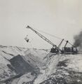 Image 2316.jpg 807 × 830; 185 KB
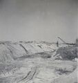 Image 2317.jpg 808 × 859; 190 KB
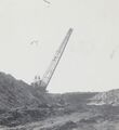 Image 2462.jpg 810 × 886; 155 KB
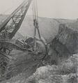 Image 2765.jpg 837 × 893; 227 KB
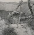 Image 2766.jpg 831 × 856; 217 KB
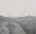 Image 2767.jpg 836 × 807; 166 KB
 M-1000 Peabody 10 Nokomis sag corn field MI 194 8ft coal at 625ft.jpg 4,357 × 2,570; 1.32 MB
 M-1001 Peabody 10 Nokomis sag corn field MI 194 8ft coal at 625ft.jpg 4,381 × 2,567; 1.59 MB
 M-1003 NW Springfield IL Lincoln Park Coal Coop 17 Fig 44 5.75ft coal 200ft deep.jpg 2,500 × 1,456; 461 KB
 M-1004 NW Springfield IL Lincoln Park Coal see M-1003 and 1006.jpg 2,500 × 1,467; 637 KB
 M-1005 NW Springfield IL Lincoln Park Coal.jpg 2,500 × 1,467; 534 KB
 M-1006 NW Springfield IL Lincoln Park Coal see M-1004.jpg 2,500 × 1,481; 742 KB
 M-1007 Kelly No 5 Danville District Coop 17 Fig 42 6ft coal 200ft deep.jpg 2,500 × 1,484; 431 KB
 M-1008 Kelly No 5 Danville 6ft coal 200ft deep-ps.jpg 2,500 × 1,480; 545 KB
 M-1009 Kelly No 5 Danville District 6ft coal 200ft deep.jpg 2,500 × 1,461; 500 KB
 M-1010 Kelly No 5 Danville District 6ft coal 200ft deep.jpg 2,500 × 1,478; 573 KB
 M-1011 Kelly No 5 Danville District 6ft coal 200ft deep.jpg 1,454 × 2,500; 438 KB
 M-1033 Taylor Springs Peabody no 15 Plaster and foundation cracked.jpg 2,509 × 4,327; 1.21 MB
 M-1035 11 Hippert mine on Freeburg rd freshly filled mine water entering through cave.jpg 2,582 × 4,319; 1.09 MB
 M-1036 Gartside Mine Murphysboro sink low land pillar pulling.jpg 4,376 × 2,561; 1.39 MB
 M-1042 Superior Coal Mine no 2 Gillespie.jpg 2,568 × 4,378; 1.29 MB
 M-1044 sub fill L and M track SE of Staunton Consolidated no 6 mine.jpg 2,572 × 4,350; 1.09 MB
 M-1045 sub fill LandM track SE of Staunton Consolidated no 6 mine.jpg 2,584 × 4,338; 1.32 MB
 M-809 Pond N of Witt Peabody 14.jpg 4,375 × 2,550; 1.04 MB
 M-821 Coop 17 Fig 31 Dering Coal Co Danville District.jpg 4,388 × 2,577; 1.22 MB
 M-822 Copp 17 Fig 35 Pit s of Electric Mine Danville District see M-934.jpg 2,500 × 1,469; 579 KB
 M-825 Coop 17 fig 26 broken sidewalk tilted pole Old Ben 8 - 8ft coal at 450ft.jpg 2,544 × 4,340; 1.07 MB
 M-826 Coop 17 fig 27.jpg 2,500 × 1,471; 463 KB
 M-929 Subsidence Kelly No 5 Mine.jpg 4,408 × 2,666; 1.18 MB
 M-932 Kellyville No 3 near Electric mine Danville District.jpg 4,388 × 2,555; 1.38 MB
 M-933 Kellyville No 3 S of shalft 3ft deep Electric mine Danville District.jpg 2,500 × 1,477; 802 KB
 M-934 Kellyville No 3 near Electric mine Danville District 8ft dia 3ft deep.jpg 2,500 × 1,464; 719 KB
 M-939 Kellyville No 3 near Electric mine Danville District.jpg 2,500 × 1,465; 731 KB
 M-947 break in curb and pavement Decatur over M C CC.jpg 2,500 × 1,446; 545 KB
 M-952 Madison CC Dewaine IL caves on hill side.jpg 4,348 × 2,580; 1.1 MB
 M-959 Taylor No 1 Carterville Subsidence along RR tracks 1.jpg 4,344 × 2,547; 1.13 MB
 M-960 Taylor No 1 Carterville sub in hilly area-mound left foreground over pillar.jpg 2,500 × 1,467; 481 KB
 M-961 Carterville A mine Pond 200 ft dia 3ft deep.jpg 1,443 × 2,500; 508 KB
 M-962 Sunfield mine Duquoin sag foreground and background high grass over pillar.jpg 4,376 × 2,586; 1.36 MB
 M-963 Majestic Mine-Duquoin sag quarter mile long fence shows sag of about 2ft.jpg 4,366 × 2,554; 1.28 MB
 M-965 Paradise Mine E of Duquoin NW of shaft 800ft across 3ft deep some wtr.jpg 4,344 × 2,539; 1.21 MB
 M-966 sink over two rooms E of Security shaft E of ICRR S of Duquoin.jpg 4,365 × 2,570; 1.48 MB
 M-967 Sunfield Mine typical Duquoin sag.jpg 4,355 × 2,541; 1.3 MB
 M-968 OGara CC no 7 Coop 17 Fig 13 7ft coal 80ft deep.jpg 2,500 × 1,457; 622 KB
 M-969 Breaks in field S of OGara Co No 7 Harrisburg.jpg 4,376 × 2,548; 1.39 MB
 M-979 Sag near Gartside Mine Murphysboro rig in sag.jpg 4,373 × 2,553; 973 KB
 M-991 Coop 17 fig 12.jpg 2,500 × 1,471; 575 KB
 M-992 Coop 17 Fig 40 trestle 1.5ft submine.jpg 2,500 × 1,460; 366 KB
 M-993 Old Ben 8 mine W Frankfort rt end 4ft lower.jpg 2,500 × 1,440; 509 KB
 M-994 Old Ben 8 mine W Frankfort Coop 17 Fig 47 rt end 4ft lower.jpg 2,500 × 1,397; 379 KB
 M-995 Peabody 10 Nokomis sag corn field MI 194 8ft coal at 625ft.jpg 4,365 × 2,537; 1.09 MB
 M-996 Peabody 10 Nokomis sag corn field MI 194 8ft coal at 625ft.jpg 4,385 × 2,553; 1.19 MB
 M-997 Peabody 10 Nokomis sag corn field MI 194 8ft coal at 625ft.jpg 4,373 × 2,547; 1.21 MB
 M-998 Peabody 10 Nokomis sag corn field MI 194 8ft coal at 625ft.jpg 4,391 × 2,536; 1.54 MB
 M-999 Peabody 10 Nokomis Coop 17 fig 32 sag corn field MI 194 8ft coal at 625ft.jpg 4,370 × 2,536; 1.14 MB
 M0886 minenotes 01.jpg 667 × 461; 48 KB
 M0886 minenotes 02.jpg 967 × 675; 118 KB
 M0886 minenotes 03.jpg 668 × 462; 68 KB
 M0886 minenotes 04.jpg 668 × 466; 73 KB
 M0886 minenotes 05.jpg 667 × 458; 69 KB
 M0886 minenotes 06.jpg 459 × 670; 61 KB
 M0886 minenotes 07.jpg 457 × 667; 77 KB
 M0886 minenotes 08.jpg 460 × 665; 86 KB
 M0886 minenotes 09.jpg 667 × 460; 78 KB
 M0886 minenotes 10 a.jpg 3,008 × 2,412; 535 KB
 M0886 minenotes 10 b.jpg 666 × 462; 79 KB
 M0886 minenotes 10.jpg 671 × 447; 72 KB
 M0886 minenotes 11.jpg 667 × 458; 63 KB
 M0886 minenotes 12 a.jpg 660 × 461; 63 KB
 M0886 minenotes 12.jpg 665 × 466; 77 KB
 M0886 minenotes 13.jpg 697 × 603; 66 KB
 M0886 minenotes 14.jpg 681 × 579; 94 KB
 M0886 minenotes 15.jpg 664 × 566; 88 KB
 M0886 minenotes 16.jpg 680 × 553; 98 KB
 M0886 minenotes 17.jpg 675 × 559; 95 KB
 M0886 minenotes 18.jpg 740 × 523; 97 KB
 M0886 minenotes 19.jpg 747 × 528; 74 KB
 M0886 minenotes 19b.jpg 3,001 × 2,065; 554 KB
 M0886 minenotes 20 b.jpg 2,986 × 2,064; 486 KB
 M0886 minenotes 20.jpg 736 × 523; 78 KB
 M1037 photo.jpg 2,816 × 2,112; 2.65 MB
 M2707 shaft down.jpg 2,543 × 3,390; 1.72 MB
 M2707 shaft.jpg 3,390 × 2,543; 1.92 MB
 Ml 876.jpg 3,880 × 2,738; 561 KB
 Mn 03a 053.jpg 1,498 × 1,012; 1.01 MB
 Mn 45 015.jpg 2,430 × 1,649; 1.2 MB
 Mn 45 016.jpg 2,646 × 1,849; 838 KB
 Mn 45 017.jpg 2,628 × 1,843; 783 KB
 Mn 45 018.jpg 1,672 × 2,383; 776 KB
 Mn 45 019.jpg 2,466 × 1,664; 1.53 MB
 Mn 45 020.jpg 2,426 × 1,659; 1.57 MB
 Mn 45 021.jpg 2,475 × 1,662; 1.36 MB
 Mn 45 022.jpg 2,441 × 1,644; 1.31 MB
 Mn 45 023.jpg 2,435 × 1,639; 1.4 MB
 Mn 45 024.jpg 1,632 × 2,355; 1.56 MB
 Mn 45 025.jpg 2,646 × 1,834; 713 KB
 Mn 45 026.jpg 2,628 × 1,834; 568 KB
 Mn 45 027.jpg 2,308 × 1,739; 1.29 MB
 Mn 45 028.jpg 1,662 × 2,372; 1.49 MB
 Mn 45 029.jpg 2,372 × 1,623; 1.42 MB
 Mn 45 030.jpg 1,662 × 2,417; 1.31 MB
 Mn 45 031.jpg 1,661 × 2,429; 1.46 MB
 Mn 45 032.jpg 1,622 × 2,396; 1.56 MB
 Mn 45 033.jpg 1,639 × 2,457; 1.28 MB
 Mn 45 034.jpg 1,661 × 2,401; 1.37 MB
 Mn act gallatin 01.jpg 2,956 × 2,056; 528 KB
 Mn act jackson 01.jpg 3,012 × 2,034; 1.7 MB
 Mn act jackson 02.jpg 3,016 × 2,028; 1.99 MB