0139: Difference between revisions
Jack Brown (talk | contribs) No edit summary |
No edit summary |
||
| Line 1: | Line 1: | ||
{{Sidebar Info Query}} | {{Sidebar Info Query}} | ||
{{Header | {{Header | ||
|checked=1st Entry | |||
|unlocated=No | |unlocated=No | ||
|shown_on_map=Yes | |shown_on_map=Yes | ||
| Line 13: | Line 14: | ||
|quad2=Rend Lake Dam | |quad2=Rend Lake Dam | ||
|quad3=Thompsonville | |quad3=Thompsonville | ||
|city1=Benton | |||
|year-start=1915 | |year-start=1915 | ||
|year-end=1924 | |year-end=June 1924 | ||
|Latitude=37.9938560171228 | |Latitude=37.9938560171228 | ||
|Longitude=-88.8766411523642 | |Longitude=-88.8766411523642 | ||
| Line 57: | Line 59: | ||
|Date=1915-1916 | |Date=1915-1916 | ||
|Production=51,115 | |Production=51,115 | ||
|Sum=No | |||
}} | }} | ||
{{Production | {{Production | ||
| Line 63: | Line 66: | ||
|Date=1916-1924 | |Date=1916-1924 | ||
|Production=4,016,768 | |Production=4,016,768 | ||
|Sum=No | |||
| | |||
}} | }} | ||
{{Production | {{Production | ||
|Production=4,016,768 | |Production=4,016,768 | ||
|Sum=Yes | |||
}} | }} | ||
===Production Notes=== | ===Production Notes=== | ||
| Line 89: | Line 91: | ||
{{Annotated bibliography | {{Annotated bibliography | ||
|bibliography=Directory of Illinois Coal Mines (Franklin County) - Mine names, mine index, ownership, years of operation. | |bibliography=Directory of Illinois Coal Mines (Franklin County) - Mine names, mine index, ownership, years of operation. | ||
}} | }} | ||
{{Annotated bibliography | {{Annotated bibliography | ||
| Line 105: | Line 104: | ||
{{Query-image}} | {{Query-image}} | ||
===Photographs=== | |||
{{Photo Query}} | |||
==Additional Notes== | |||
{{Editwithform}} | |||
{{Editwithform}} | {{Editwithform}} | ||
Revision as of 15:15, April 1, 2022
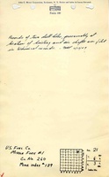
Mine Index Number: 0139
| Company Name: | United States Fuel Company | ||
|---|---|---|---|
| Mine Name: | Middle Fork Mine | ||
| Start Date: | 1915 | End Date: | June 1924 |
| Type of Mine: | Underground | ||
| Total acres shown: | 838 | ||
| Acres after map date: | General Area of mining acres shown: | ||
Shaft, Slope, Drift or Tipple Location(s)
| Type | County | Township-Range | Section | Part Section |
|---|
| Main shaft (12'x17') | Franklin | 6S 3E | 21 | NE NE NE |
| Air shaft (12'x15') | Franklin | 6S 3E | 21 | NW NE NE |
Geology
| Thickness (ft) | |||||
|---|---|---|---|---|---|
| Seam | Depth (ft) | Min | Max | Ave | Mining Method |
| Herrin | 602-609 | 5.0 | 11.5 | 6.0-7.67 | RPP |
Geological Problems Reported
The roof in the northern part of the mine was light gray shale (white top) and came down readily. “Several feet” of top coal had to be left to support this roof. Other areas had 6 inches to 6 feet of black shale as roof, which drew in some places, or limestone roof. The mine manager noted that the roof in east-west entries held, while the roof in north-south entries fell in a very short time. The coal rolled considerably in the eastern and southern parts of the mine, making it difficult to maintain easy grades on the haulage roads. The roadbeds had many hills and valleys. Rolls and slips were present in the seam, but not of sufficient density to have a detrimental affect on mining. Pyrite lenses and calcite veinlets were also present in the coal. The underclay was 4 to 5 feet thick and heaved when wet.
Production
| Company | Mine Name | Date | Production (tons) |
| Middle Fork Mining Company | Middle Fork | 1915-1916 | 51,115 |
| United States Fuel Company | Middle Fork | 1916-1924 | 4,016,768 |
| Total Production: 4,016,768 | |||
Production Notes
Coal Report production (if available)
Sources of Data
| Source Map | Map Date | Original Scale | Digitized Scale | Map Type |
| Microfilm, document 351418 | 7-3-1924 | 1:3600 | 1:7696 | Final |
Annotated Bibliography (Data source - brief description of information)
| Coal Reports - Production, ownership, years of operation, shaft sizes, depth, thickness. |
| Directory of Illinois Coal Mines (Franklin County) - Mine names, mine index, ownership, years of operation. |
| Mine notes (Franklin County) - Mine type, shaft locations, seam, depth, thickness, geologic problems. |
| Microfilm map, document 351418, reel 03136, frame 53 - Shaft locations, mine outline, mining method. |
Mine Notes
Mine Images

Photographs
Additional Notes