0924: Difference between revisions
No edit summary |
No edit summary |
||
| Line 1: | Line 1: | ||
{{Sidebar Info Query}} | {{Sidebar Info Query}} | ||
{{Header | {{Header | ||
|checked= | |checked=Checked OK | ||
|unlocated=No | |unlocated=No | ||
|shown_on_map=Yes | |shown_on_map=Yes | ||
| Line 9: | Line 9: | ||
|mine_type=Surface | |mine_type=Surface | ||
|mined-out-area=16 | |mined-out-area=16 | ||
|indicated=No | |||
|county1=Vermilion | |county1=Vermilion | ||
|quad1=Danville SE | |quad1=Danville SE | ||
Latest revision as of 11:41, September 2, 2022
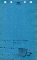
Mine Index Number: 0924
| Company Name: | Two Rivers Coal Company | ||
|---|---|---|---|
| Mine Name: | Two Rivers Mine | ||
| Start Date: | 1952 | End Date: | 1963 |
| Type of Mine: | Surface | ||
| Total acres shown: | 16 | ||
| Acres after map date: | General Area of mining acres shown: | ||
Shaft, Slope, Drift or Tipple Location(s)
| Type | County | Township-Range | Section | Part Section |
|---|
| Tipple | Vermilion | 19N 11W | 17 | SE NE NE |
| Pits | Vermilion | 19N 11W | 17 | E ½ NE, W ½ NW |
Geology
| Thickness (ft) | |||||
|---|---|---|---|---|---|
| Seam | Depth (ft) | Min | Max | Ave | Mining Method |
| Danville | 35 | 6.0 | Surface |
Geological Problems Reported
Production
| Company | Mine Name | Date | Production (tons) |
| Two Rivers Coal Company | Two Rivers | 1952-1963 Idle 1962 | 196,870 |
| Total Production: 196,870 | |||
Production Notes
Coal Report production (if available)
Sources of Data
| Source Map | Map Date | Original Scale | Digitized Scale | Map Type |
| Microfilm, document 352998 | 12-22-1955 | 1:2400 | 1:3972 | Final The map stated “Final” although the survey date would indicate it showed the extent of the mine only 3 years after opening. The source map was very faint and difficult to read. An original copy of the microfilm map was found at the Vermilion County Clerk’s office, and no later date was noted on the more legible copy. The mined area shown on the accompanying map is the approximate size expected for the production reported. This suggests that the mine outline is complete. |
Annotated Bibliography (Data source - brief description of information)
| Coal Reports - Production, ownership, years of operation, mining method. |
| Directory of Illinois Coal Mines (Vermilion County) - Mine names, mine index, ownership, years of operation. |
| Mine notes (Vermilion County) - Tipple location, depth, thickness. |
| Microfilm map, document 352998, reel 03141, frame 143 - Mine location, mine outline, mining method. |
Mine Notes
Mine Images

Photographs