3707: Difference between revisions
No edit summary |
No edit summary |
||
| (One intermediate revision by the same user not shown) | |||
| Line 15: | Line 15: | ||
|quad2=Danville SW | |quad2=Danville SW | ||
|year-start=1955 | |year-start=1955 | ||
|year-end=1965 | |year-end=February 1965 | ||
|Latitude=40. | |Latitude=40.08626873 | ||
|Longitude=-87. | |Longitude=-87.59743451 | ||
|Zoom=12 | |Zoom=12 | ||
}} | }} | ||
Latest revision as of 11:29, September 28, 2022
Mine Index Number: 3707
| Company Name: | United Electric Coal Company | ||
|---|---|---|---|
| Mine Name: | Mary Moore No. 25 Mine | ||
| Start Date: | 1955 | End Date: | February 1965 |
| Type of Mine: | Surface | ||
| Total acres shown: | 350 | ||
| Acres after map date: | General Area of mining acres shown: | ||
|
Mined through several small underground mines, including mine index 3722 (Smith Hollow Mine), 3723 (Stewart Mine), 3724 (Bates Mine), 3718 (Red Top Mine), and 6522 (Georgetown Mine). | |||
Shaft, Slope, Drift or Tipple Location(s)
| Type | County | Township-Range | Section | Part Section |
|---|
| Tipple | Vermilion | 19N 11W | 27 | SE NW NW |
Geology
| Thickness (ft) | |||||
|---|---|---|---|---|---|
| Seam | Depth (ft) | Min | Max | Ave | Mining Method |
| Danville Ceased operations in the Danville Coal in September 1960; moved pit east into Herrin Coal in November 1960 | 45-60 | 5.0-5.83 | Surface |
| Herrin Ceased operations in the Danville Coal in September 1960; moved pit east into Herrin Coal in November 1960 | 4.5 | Surface |
Geological Problems Reported
Production
| Company | Mine Name | Date | Production (tons) |
| United Electric Coal Company | Mary Moore No. 25 | 1955-1965 | 2,677,828 |
| Total Production: 2,677,828 | |||
Production Notes
Coal Report production (if available)
Sources of Data
| Source Map | Map Date | Original Scale | Digitized Scale | Map Type |
| Company, 1-29-13 | 2-28-1965 | 1:19200 | 1:19200 | Final |
| USGS topographic map | 1978 | 1:24000 | 1:24000 | Secondary source |
Annotated Bibliography (Data source - brief description of information)
| Coal Reports - Production, ownership, years of operation. |
| Directory of Illinois Coal Mines (Vermilion County) - Mine names, mine index, ownership, years of operation. |
| Mine notes (Vermilion County) - Mine type, mine location, seam, depth, thickness. |
| Company map, Coal Section files (1-29-13) - Mine outline, mining method. |
| USGS topographic map, 1966, Photorevised 1978 - Mine outline. |
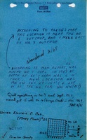
Mine Notes
Mine Images

Photographs