0428: Difference between revisions
No edit summary |
No edit summary |
||
| (3 intermediate revisions by 2 users not shown) | |||
| Line 9: | Line 9: | ||
|mine_type=Underground | |mine_type=Underground | ||
|mined-out-area=3,154 | |mined-out-area=3,154 | ||
|indicated=No | |||
|county1=Franklin | |county1=Franklin | ||
|county2=Williamson | |county2=Williamson | ||
| Line 20: | Line 21: | ||
|Latitude=37.8748780760216 | |Latitude=37.8748780760216 | ||
|Longitude=-88.9635439138373 | |Longitude=-88.9635439138373 | ||
|Zoom=13 | |||
}} | }} | ||
==Shaft, Slope, Drift or Tipple Location(s)== | ==Shaft, Slope, Drift or Tipple Location(s)== | ||
| Line 90: | Line 92: | ||
}} | }} | ||
{{Annotated bibliography | {{Annotated bibliography | ||
|bibliography= | |bibliography=Directory of Illinois Coal Mines (Franklin County) - Mine names, mine index, ownership, years of operation. | ||
}} | }} | ||
{{Annotated bibliography | {{Annotated bibliography | ||
|bibliography= | |bibliography=Mine notes (Franklin County) - Mine type, shaft location, seam, depth, geologic problems. | ||
}} | }} | ||
{{Annotated bibliography | {{Annotated bibliography | ||
| Line 99: | Line 101: | ||
}} | }} | ||
{{Annotated bibliography | {{Annotated bibliography | ||
|bibliography= | |bibliography=Company map, ISGS map library, 4102 i5.1-6 - Shaft locations, geologic problems. | ||
}} | }} | ||
==Mine Notes== | ==Mine Notes== | ||
Latest revision as of 12:20, September 30, 2022
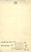
Mine Index Number: 0428
| Company Name: | Old Ben Coal Corporation | ||
|---|---|---|---|
| Mine Name: | Old Ben No. 15 Mine | ||
| Start Date: | 1919 | End Date: | January 1954 |
| Type of Mine: | Underground | ||
| Total acres shown: | 3,154 | ||
| Acres after map date: | General Area of mining acres shown: | ||
Shaft, Slope, Drift or Tipple Location(s)
| Type | County | Township-Range | Section | Part Section |
|---|
| Main shaft | Franklin | 7S 2E | 35 | 740 FNL, 445 FWL |
| Air shaft | Franklin | 7S 2E | 35 | SE NW SW |
| Air shaft | Williamson | 8S 2E | 4 | SE SE SE |
Geology
| Thickness (ft) | |||||
|---|---|---|---|---|---|
| Seam | Depth (ft) | Min | Max | Ave | Mining Method |
| Herrin | 419 | 8.0-8.83 | RPP,HERsome HER |
Geological Problems Reported
Gas may have been a problem at this mine; an explosion killed one man. Top coal was left to protect the shale roof and recovered on retreat. Pillars were sometimes drawn on retreat also. Some steep grades were present due to swags in the seam. Only a few pyrite facings were found, along with a “noticeable” amount of calcite facings. The company map showed numerous northwest-southeast trending faults in the southern part of the mine. These faults had throws ranging from 2 to 8 feet.
Production
| Company | Mine Name | Date | Production (tons) |
| Old Ben Coal Corporation | Old Ben No. 15 | 1919-1954 Idle 1925 | 20,917,351 |
| Total Production: 20,917,351 | |||
Production Notes
Coal Report production (if available)
Sources of Data
| Source Map | Map Date | Original Scale | Digitized Scale | Map Type |
| Microfilm, document 351435 | 6-30-1954 | 1:4800 | 1:9931 | Final |
Annotated Bibliography (Data source - brief description of information)
| Coal Reports - Production, ownership, years of operation, thickness, geologic problems. |
| Directory of Illinois Coal Mines (Franklin County) - Mine names, mine index, ownership, years of operation. |
| Mine notes (Franklin County) - Mine type, shaft location, seam, depth, geologic problems. |
| Microfilm map, document 351435, reel 03136, frames 103 and 104 - Shaft locations, mine outline, mining method. |
| Company map, ISGS map library, 4102 i5.1-6 - Shaft locations, geologic problems. |
Mine Notes
Mine Images
![[[:Old Ben No. 15|Old Ben No. 15]]](https://wikiimage.isgs.illinois.edu/ilmines/franklin/thumbnails/m0428mrg_th.jpg)
Photographs