0796: Difference between revisions
Alan.Myers (talk | contribs) No edit summary |
No edit summary |
||
| (5 intermediate revisions by one other user not shown) | |||
| Line 1: | Line 1: | ||
{{Sidebar Info Query}} | {{Sidebar Info Query}} | ||
{{Header | {{Header | ||
|checked=Checked OK | |||
|unlocated=No | |unlocated=No | ||
|shown_on_map=Yes | |shown_on_map=Yes | ||
|reason_nsm=The mined area shown on the accompanying map is the approximate size expected for the reported production. This suggests that the mine outline is complete. | |||
|Mine-index=0796 | |Mine-index=0796 | ||
|Coal_co=Midway Coal Company | |Coal_co=Midway Coal Company | ||
|Mine Name Header=Midway Mine | |Mine Name Header=Midway Mine | ||
|mine_type=Underground | |mine_type=Underground | ||
|mined-out-area= | |mined-out-area=17 | ||
|indicated=No | |||
|county1=St. Clair | |county1=St. Clair | ||
|quad1=Freeburg | |quad1=Freeburg | ||
|year-start=1934 | |year-start=1934 | ||
|year-end=1951 | |year-end=March 1951 | ||
|Latitude=38.4663488310001 | |Latitude=38.4663488310001 | ||
|Longitude=-89.942560823 | |Longitude=-89.942560823 | ||
| Line 33: | Line 36: | ||
}} | }} | ||
{{Shaft locations | {{Shaft locations | ||
|shaft_type= | |shaft_type=Air shaft | ||
|County=St. Clair | |County=St. Clair | ||
|Town-Range=1S 8W | |Town-Range=1S 8W | ||
| Line 58: | Line 61: | ||
|Date=1934-1942 | |Date=1934-1942 | ||
|Production=72,808 | |Production=72,808 | ||
|Sum=No | |||
}} | }} | ||
{{Production | {{Production | ||
| Line 64: | Line 68: | ||
|Date=1951-1951 {{#info: Idle 1943-1950|note}} | |Date=1951-1951 {{#info: Idle 1943-1950|note}} | ||
|Production=150 | |Production=150 | ||
|Sum=No | |||
| | |||
}} | }} | ||
{{Production | {{Production | ||
|Production=72,958 | |Production=72,958 | ||
|Sum=Yes | |||
}} | }} | ||
===Production Notes=== | ===Production Notes=== | ||
| Line 99: | Line 102: | ||
}} | }} | ||
{{Annotated bibliography | {{Annotated bibliography | ||
|bibliography= | |bibliography=Mine notes (St. Clair County) - Shaft location, seam, depth, thickness. | ||
}} | }} | ||
{{Annotated bibliography | {{Annotated bibliography | ||
|bibliography= | |bibliography=Microfilm map, document 351134, reel 03134, frames 270, 271 - Shaft locations, mine outline (eastern), mining method. | ||
}} | }} | ||
{{Annotated bibliography | {{Annotated bibliography | ||
|bibliography=Mine | |bibliography=ISGS map library, 4103.S31 i5.1-59, map of Midwest Highwall No. 2 Mine (mine index 4274) - Mine outline (western). | ||
}} | }} | ||
==Mine Notes== | ==Mine Notes== | ||
| Line 116: | Line 116: | ||
{{Query-image}} | {{Query-image}} | ||
===Photographs=== | |||
{{Photo Query}} | |||
{{Editwithform}} | |||
{{Editwithform}} | {{Editwithform}} | ||
Latest revision as of 10:16, October 1, 2022
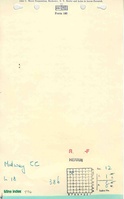
Mine Index Number: 0796
| Company Name: | Midway Coal Company | ||
|---|---|---|---|
| Mine Name: | Midway Mine | ||
| Start Date: | 1934 | End Date: | March 1951 |
| Type of Mine: | Underground | ||
| Total acres shown: | 17 | ||
| Acres after map date: | General Area of mining acres shown: | ||
|
The mined area shown on the accompanying map is the approximate size expected for the reported production. This suggests that the mine outline is complete. | |||
Shaft, Slope, Drift or Tipple Location(s)
| Type | County | Township-Range | Section | Part Section |
|---|
| Main shaft | St. Clair | 1S 8W | 12 | NE NW NW |
| Air shaft | St. Clair | 1S 8W | 12 | NE NW NW |
| Air shaft | St. Clair | 1S 8W | 12 | NE NW NW |
Geology
| Thickness (ft) | |||||
|---|---|---|---|---|---|
| Seam | Depth (ft) | Min | Max | Ave | Mining Method |
| Herrin | 63-75, 85 at air shaft | 6.0-7.0 | MRP |
Geological Problems Reported
Production
| Company | Mine Name | Date | Production (tons) |
| Midway Coal Company | Midway | 1934-1942 | 72,808 |
| Midway Coal Company | Midway | 1951-1951 Idle 1943-1950 | 150 |
| Total Production: 72,958 | |||
Production Notes
Coal Report production (if available)
Sources of Data
| Source Map | Map Date | Original Scale | Digitized Scale | Map Type |
| Microfilm, document 351134 | 9-15-1937 | 1:1200 | 1:2234 | Not final |
| ISGS map library, 4103.S31 i5.1-59 | 6-1-1970 | 1:2400 | 1:2400 | Secondary source |
Annotated Bibliography (Data source - brief description of information)
| Coal Reports - Production, ownership, years of operation. |
| Directory of Illinois Coal Mines (St. Clair County) - Mine names, mine index, ownership, years of operation. |
| Mine notes (St. Clair County) - Shaft location, seam, depth, thickness. |
| Microfilm map, document 351134, reel 03134, frames 270, 271 - Shaft locations, mine outline (eastern), mining method. |
| ISGS map library, 4103.S31 i5.1-59, map of Midwest Highwall No. 2 Mine (mine index 4274) - Mine outline (western). |
Mine Notes
Mine Images


Photographs