Mine Index Number: 0796
| Company Name:
|
Midway Coal Company
|
| Mine Name:
|
Midway Mine
|
| Start Date:
|
1934
|
End Date:
|
March 1951
|
| Type of Mine:
|
Underground
|
| Total acres shown:
|
17
|
| Acres after map date:
|
|
General Area of mining acres shown:
|
|
|
The mined area shown on the accompanying map is the approximate size expected for the reported production. This suggests that the mine outline is complete.
|
Shaft, Slope, Drift or Tipple Location(s)
| Type
|
County
|
Township-Range
|
Section
|
Part Section
|
| Main shaft
|
St. Clair
|
1S 8W
|
12
|
NE NW NW
|
| Air shaft
|
St. Clair
|
1S 8W
|
12
|
NE NW NW
|
| Air shaft
|
St. Clair
|
1S 8W
|
12
|
NE NW NW
|
Geology
| Herrin
|
63-75, 85 at air shaft
|
|
|
6.0-7.0
|
MRP
|
Geological Problems Reported
Production
| Company
|
Mine Name
|
Date
|
Production (tons)
|
Production Notes
Coal Report production (if available)
Sources of Data
| Microfilm, document 351134
|
9-15-1937
|
1:1200
|
1:2234
|
Not final
|
| ISGS map library, 4103.S31 i5.1-59
|
6-1-1970
|
1:2400
|
1:2400
|
Secondary source
|
Annotated Bibliography (Data source - brief description of information)
| Coal Reports - Production, ownership, years of operation.
|
| Directory of Illinois Coal Mines (St. Clair County) - Mine names, mine index, ownership, years of operation.
|
| Mine notes (St. Clair County) - Shaft location, seam, depth, thickness.
|
| Microfilm map, document 351134, reel 03134, frames 270, 271 - Shaft locations, mine outline (eastern), mining method.
|
| ISGS map library, 4103.S31 i5.1-59, map of Midwest Highwall No. 2 Mine (mine index 4274) - Mine outline (western).
|
Mine Notes
Mine Images
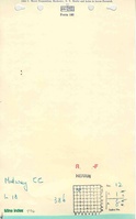
Microfilm: 351134
Map Date: 9-15-1937
Coal Co.: Midway Coal Company
Mine Name: Midway Mine
Full Res Download
ISGS map library: 4103.S31 i5.1-59
Map Date: 6-1-1970
Coal Co.: Peabody Coal Company
Mine Name: Midwest Highwall No. 2 Mine
Full Res Download
Photographs