0790: Difference between revisions
No edit summary |
No edit summary |
||
| (5 intermediate revisions by 3 users not shown) | |||
| Line 1: | Line 1: | ||
{{Sidebar Info Query}} | {{Sidebar Info Query}} | ||
{{Header | {{Header | ||
|checked=Checked OK | |||
|unlocated=No | |unlocated=No | ||
|shown_on_map=Yes | |shown_on_map=Yes | ||
| Line 8: | Line 9: | ||
|mine_type=Underground | |mine_type=Underground | ||
|mined-out-area=613 | |mined-out-area=613 | ||
|indicated=No | |||
|county1=St. Clair | |county1=St. Clair | ||
|quad1=Freeburg | |quad1=Freeburg | ||
| Line 14: | Line 16: | ||
|Latitude=38.482728014 | |Latitude=38.482728014 | ||
|Longitude=-89.950005456 | |Longitude=-89.950005456 | ||
|Zoom=13 | |||
}} | }} | ||
==Shaft, Slope, Drift or Tipple Location(s)== | ==Shaft, Slope, Drift or Tipple Location(s)== | ||
| Line 52: | Line 55: | ||
|Date=1883-1886 | |Date=1883-1886 | ||
|Production=76,282 | |Production=76,282 | ||
|Sum=No | |||
}} | }} | ||
{{Production | {{Production | ||
| Line 58: | Line 62: | ||
|Date=1886-1896 | |Date=1886-1896 | ||
|Production=613,636 | |Production=613,636 | ||
|Sum=No | |||
}} | }} | ||
{{Production | {{Production | ||
| Line 64: | Line 69: | ||
|Date=1896-1897 | |Date=1896-1897 | ||
|Production=24,785 | |Production=24,785 | ||
|Sum=No | |||
}} | }} | ||
{{Production | {{Production | ||
| Line 70: | Line 76: | ||
|Date=1897-1904 | |Date=1897-1904 | ||
|Production=192,012 | |Production=192,012 | ||
|Sum=No | |||
}} | }} | ||
{{Production | {{Production | ||
| Line 77: | Line 84: | ||
|Date=1904-1909 | |Date=1904-1909 | ||
|Production=104,267 | |Production=104,267 | ||
|Sum=No | |||
}} | }} | ||
{{Production | {{Production | ||
| Line 83: | Line 91: | ||
|Date=1909-1910 | |Date=1909-1910 | ||
|Production=12,150 | |Production=12,150 | ||
|Sum=No | |||
}} | }} | ||
{{Production | {{Production | ||
| Line 89: | Line 98: | ||
|Date=1910-1950 | |Date=1910-1950 | ||
|Production=2,806,455 | |Production=2,806,455 | ||
|Sum=No | |||
| | |||
}} | }} | ||
{{Production | {{Production | ||
|Production=3,829,587 | |Production=3,829,587 | ||
|Sum=Yes | |||
}} | }} | ||
===Production Notes=== | ===Production Notes=== | ||
| Line 131: | Line 139: | ||
{{Photo Query}} | {{Photo Query}} | ||
{{Editwithform}} | {{Editwithform}} | ||
{{Editwithform}} | {{Editwithform}} | ||
Latest revision as of 14:09, October 5, 2022
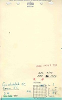
Mine Index Number: 0790
| Company Name: | Groom Coal Company | ||
|---|---|---|---|
| Mine Name: | Richland Mine | ||
| Start Date: | 1883 | End Date: | December 1950 |
| Type of Mine: | Underground | ||
| Total acres shown: | 613 | ||
| Acres after map date: | General Area of mining acres shown: | ||
Shaft, Slope, Drift or Tipple Location(s)
| Type | County | Township-Range | Section | Part Section |
|---|
| Main shaft | St. Clair | 1S 8W | 2 | NW NE NE |
| Air shaft | St. Clair | 1S 8W | 2 | NW NE NE |
Geology
| Thickness (ft) | |||||
|---|---|---|---|---|---|
| Seam | Depth (ft) | Min | Max | Ave | Mining Method |
| Herrin | 100 | 11.5 | 6.5-7.0 | MRP |
Geological Problems Reported
Production
| Company | Mine Name | Date | Production (tons) |
| Dutch Hollow Coal Company | Richland | 1883-1886 | 76,282 |
| Consolidated Coal Company of St. Louis | Richland | 1886-1896 | 613,636 |
| Richard Schramm | Richland | 1896-1897 | 24,785 |
| Consolidated Coal Company | Richland | 1897-1904 | 192,012 |
| Herman Pfuhl , lessee | Richland | 1904-1909 | 104,267 |
| Richland Coal Company | Richland | 1909-1910 | 12,150 |
| Groom Coal Company | Richland | 1910-1950 | 2,806,455 |
| Total Production: 3,829,587 | |||
Production Notes
Coal Report production (if available)
Sources of Data
| Source Map | Map Date | Original Scale | Digitized Scale | Map Type |
| Microfilm, document 351116 | 12-22-1954 | 1:2400 | 1:4303 | Final |
Annotated Bibliography (Data source - brief description of information)
| Coal Reports - Production, ownership, years of operation, thickness. |
| Directory of Illinois Coal Mines (St. Clair County) - Mine names, mine index, ownership, years of operation. |
| Mine notes (St. Clair County) - Mine type, shaft location, seam, depth, thickness. |
| Microfilm map, document 351116, reel 03134, frames 244, 245 - Slope and shaft locations, mine outline, mining method. |
Mine Notes
Mine Images

Photographs