2922: Difference between revisions
No edit summary |
No edit summary |
||
| Line 1: | Line 1: | ||
{{Sidebar Info Query}} | {{Sidebar Info Query}} | ||
{{Header | {{Header | ||
|checked= | |checked=Checked OK | ||
|unlocated=No | |unlocated=No | ||
|shown_on_map=Yes | |shown_on_map=Yes | ||
| Line 11: | Line 11: | ||
|county1=Macoupin | |county1=Macoupin | ||
|quad1=Hettick | |quad1=Hettick | ||
|city1=Chesterfield | |||
|year-start=1878 | |year-start=1878 | ||
|year-end=1909 | |year-end=1909 | ||
| Line 109: | Line 110: | ||
{{Annotated bibliography header}} | {{Annotated bibliography header}} | ||
{{Annotated bibliography | {{Annotated bibliography | ||
|bibliography=Coal Reports - Production, ownership, years of operation, depth, thickness, mining method. | |bibliography=Coal Reports - Production, ownership, years of operation, mine type, depth, thickness, mining method. | ||
}} | }} | ||
{{Annotated bibliography | {{Annotated bibliography | ||
| Line 115: | Line 116: | ||
}} | }} | ||
{{Annotated bibliography | {{Annotated bibliography | ||
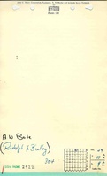
|bibliography=Mine notes (Macoupin County) - | |bibliography=Mine notes (Macoupin County) - Drift location, seam. | ||
}} | }} | ||
==Mine Notes== | ==Mine Notes== | ||
Revision as of 09:39, April 17, 2023
Mine Index Number: 2922
| Company Name: | W. H. H. Bode | ||
|---|---|---|---|
| Mine Name: | Bode Mine | ||
| Start Date: | 1878 | End Date: | 1909 |
| Type of Mine: | Underground | ||
| Total acres shown: | |||
| Acres after map date: | General Area of mining acres shown: | ||
Shaft, Slope, Drift or Tipple Location(s)
| Type | County | Township-Range | Section | Part Section |
|---|
| Main drift | Macoupin | 10N 9W | 29 | NW NW NE |
Geology
| Thickness (ft) | |||||
|---|---|---|---|---|---|
| Seam | Depth (ft) | Min | Max | Ave | Mining Method |
| Herrin | 60 | 5.0-6.0 | RP |
Geological Problems Reported
Production
| Company | Mine Name | Date | Production (tons) |
| Thomas Beilby | Beilby | 1878-1879 | 150 |
| Rudolph and Beilby | Beilby | 1881-1883 | 1,826 |
| Beilby and Company | Beilby | 1883-1885 | 4,200 |
| Beilby and Rudolph | Beilby and Rudolph | 1885-1886 | 2,000 |
| Beilby and Company | Beilby | 1886-1890 | 9,144 |
| August Bode | Bode slope | 1894-1895 Idle 1891-1893 | 500 |
| W. H. A. Bodi | Bodi | 1897-1905 Idle 1896 | 8,965 |
| W. H. H. Bode | Bode shaft | 1908-1909 Idle 1906-1907 | 250 |
| Total Production: 27,035 | |||
Production Notes
Coal Report production (if available)
Sources of Data
| Source Map | Map Date | Original Scale | Digitized Scale | Map Type |
Annotated Bibliography (Data source - brief description of information)
| Coal Reports - Production, ownership, years of operation, mine type, depth, thickness, mining method. |
| Directory of Illinois Coal Mines (Macoupin County) - Mine names, mine index, ownership, years of operation. |
| Mine notes (Macoupin County) - Drift location, seam. |
Mine Notes
Mine Images

Photographs