0067: Difference between revisions
Alan.Myers (talk | contribs) No edit summary |
No edit summary |
||
| Line 21: | Line 21: | ||
|Latitude=39.507067 | |Latitude=39.507067 | ||
|Longitude=-89.763327 | |Longitude=-89.763327 | ||
|Zoom= | |Zoom=13 | ||
}} | }} | ||
==Shaft, Slope, Drift or Tipple Location(s)== | ==Shaft, Slope, Drift or Tipple Location(s)== | ||
| Line 166: | Line 166: | ||
}} | }} | ||
{{Source Map | {{Source Map | ||
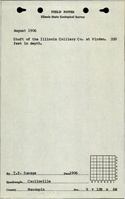
|Source Map= | |Source Map=State archive, IL_1131_03 | ||
|Map Date=7-1-1923 | |Map Date=7-1-1923 | ||
|Original Scale=1:2400 | |Original Scale=1:2400 | ||
|Digitized Scale=1: | |Digitized Scale=1:2400 | ||
|Map Type=Secondary source | |Map Type=Secondary source | ||
}} | }} | ||
| Line 186: | Line 186: | ||
}} | }} | ||
{{Annotated bibliography | {{Annotated bibliography | ||
|bibliography= | |bibliography=State archive, IL_1131_03, map of Royal Colliery Mine (mine index [[0185]]) - Partial mine outline (southwest part of mine). | ||
}} | }} | ||
==Mine Notes== | ==Mine Notes== | ||
Revision as of 11:04, October 19, 2023
Mine Index Number: 0067
| Company Name: | Virden Mining Company | ||
|---|---|---|---|
| Mine Name: | Virden Mine | ||
| Start Date: | 1892 | End Date: | July 1960 |
| Type of Mine: | Underground | ||
| Total acres shown: | 1,866 | ||
| Acres after map date: | 6 | General Area of mining acres shown: | |
Shaft, Slope, Drift or Tipple Location(s)
| Type | County | Township-Range | Section | Part Section |
|---|
| Main shaft | Macoupin | 12N 6W | 9 | NE NW NE |
| Air shaft | Macoupin | 12N 6W | 4 | SE SW SE |
| “New” air shaft | Macoupin | 12N 6W | 3 | SE SW NE |
Geology
| Thickness (ft) | |||||
|---|---|---|---|---|---|
| Seam | Depth (ft) | Min | Max | Ave | Mining Method |
| Herrin | 320-330 | 4.0 | 8.0 | 6.0-7.0 | RPP |
Geological Problems Reported
Top coal (15 to 18 inches) was left to support the roof because of the clod between the coal and the limestone caprock. The northern part of the mine had a sandstone roof, which resulted in some wet areas. Rolls were present on the western side of the mine, which curtailed development in that direction. Pyrite bands and lenses were present throughout the seam and the mine. The floor heaved in some areas.
Production
| Company | Mine Name | Date | Production (tons) |
| Chicago-Virden Coal Company | Chicago-Virden No. 1 | 1892-1904 | 2,796,067 |
| Illinois Collieries Company | Illinois Collieries No. 1 | 1904-1909 Idle 1909 | 1,141,110 |
| Glenridge Coal Company | Glenridge No. 1 | 1909-1913 | 664,732 |
| Montour Coal Company | Montour No. 402 | 1913-1918 Idle 1916 | 646,361 |
| Pittsburg Coal Company | Pitsburg No. 402 | 1918-1920 | 384,787 |
| Illinois Coal and Coke Corporation | Illinois Coal and Coke No. 3 | 1920-1923 | 861,467 |
| Illinois Coal Corporation | Empire No. 3 | 1923-1932 Idle 1926-1931 | 569,768 |
| Virden Coal Company | Virden | 1932-1937 | 309,008 |
| Lincoln Liquidating Company | Lincoln Liquidating | 1937-1939 | 129,606 |
| Virden Mining Company | Virden | 1939-1959 | 2,879,381 |
| Virden Mining Company | Virden | 1959-1959 | 28,833 Production after map date |
| Total Production: 10,411,120 | |||
Production Notes
Coal Report production (if available)
Sources of Data
| Source Map | Map Date | Original Scale | Digitized Scale | Map Type |
| Microfilm, document 352558 | 4-1959 | 1:2400 | 1:4966 | Not final |
| Microfilm, document 352541 | 2-28-1938 | 1:2400 | 1:4138 | Not final |
| State archive, IL_1131_03 | 7-1-1923 | 1:2400 | 1:2400 | Secondary source |
Annotated Bibliography (Data source - brief description of information)
| Coal Reports - Production, ownership, years of operation, depth. |
| Mine notes (Macoupin County) - Mine type, shaft location, seam, depth, thickness, geologic problems. |
| Microfilm map, document 352558, reel 03139, frames 307-314 - Shaft locations, mine outline, mining method. |
| Microfilm map, document 352541, reel 03139, frames 272-274 - Partial mine outline (west side). |
| State archive, IL_1131_03, map of Royal Colliery Mine (mine index 0185) - Partial mine outline (southwest part of mine). |
Mine Notes
Mine Images
![[[:Royal No. 1|Royal No. 1]]](https://go.illinois.edu/ILMImages/macoupin/thumbnails/m0185_IL_1131_03_th.jpg)
![[[:Lincoln Liquidating|Lincoln Liquidating]]](https://go.illinois.edu/ILMImages/macoupin/thumbnails/m0067b_th.jpg)
![[[:Virden|Virden]]](https://go.illinois.edu/ILMImages/macoupin/thumbnails/m0067_th.jpg)

Photographs