3719: Difference between revisions
No edit summary |
No edit summary |
||
| Line 4: | Line 4: | ||
|unlocated=No | |unlocated=No | ||
|shown_on_map=Yes | |shown_on_map=Yes | ||
|reason_nsm=This includes area for Grape Creek No. 3 Mine (mine index [[3750]]) since the boundary between the mines could not be distinguished. The Grape Creek mines (No.s 1 through 5, mine index numbers [[3756]], [[3755]], [[3750]], [[3745]] and [[3719]]) reported production at various times under only one or two mines. The total area shown for these Grape Creek mines is in line with the production of all the Grape Creek mines. | |||
|Mine-index=3719 | |Mine-index=3719 | ||
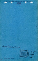
|Coal_co=Coaster and Jacobs | |Coal_co=Coaster and Jacobs | ||
| Line 9: | Line 10: | ||
|mine_type=Underground | |mine_type=Underground | ||
|mined-out-area=289 | |mined-out-area=289 | ||
| | |indicated=No | ||
|county1=Vermilion | |county1=Vermilion | ||
|quad1=Danville SE | |quad1=Danville SE | ||
Revision as of 15:43, September 7, 2022
Mine Index Number: 3719
| Company Name: | Coaster and Jacobs | ||
|---|---|---|---|
| Mine Name: | Grape Creek No. 5 Mine | ||
| Start Date: | 1884 | End Date: | 1894 |
| Type of Mine: | Underground | ||
| Total acres shown: | 289 | ||
| Acres after map date: | General Area of mining acres shown: | ||
|
This includes area for Grape Creek No. 3 Mine (mine index 3750) since the boundary between the mines could not be distinguished. The Grape Creek mines (No.s 1 through 5, mine index numbers 3756, 3755, 3750, 3745 and 3719) reported production at various times under only one or two mines. The total area shown for these Grape Creek mines is in line with the production of all the Grape Creek mines. | |||
Shaft, Slope, Drift or Tipple Location(s)
| Type | County | Township-Range | Section | Part Section |
|---|
| Main shaft | Vermilion | 19N 11W | 28 | SW NW SE Connected underground to Grape Creek No. 3 Mine; no specific air or escape shaft was noted for either mine and it is assumed that their underground connection satisfied legal requirements of the time. |
Geology
| Thickness (ft) | |||||
|---|---|---|---|---|---|
| Seam | Depth (ft) | Min | Max | Ave | Mining Method |
| Herrin | 125-127 | 6.25-6.58 | RP |
Geological Problems Reported
An explosion of fire-damp accumulated from a fault killed one man in 1884. The accumulation was not typical, but occurred after the fans had been shut down after the Saturday shift was over, and no other accidents occurred after changing the ventilation procedure (leaving fans running).
Production
| Company | Mine Name | Date | Production (tons) |
| Grape Creek Coal and Coke Company | Grape Creek No. 5 | 1884-1892 | 504,579 |
| Dickinson and Frazier | Grape Creek No. 5 | 1892-1893 | 55,718 |
| Coaster and Jacobs | Grape Creek No. 5 | 1893-1894 | 15,192 |
| Grape Creek Coal and Coke Company | Grape Creek No. 5 | 1894-1894 | none |
| Total Production: 575,489 | |||
Production Notes
Coal Report production (if available)
Sources of Data
| Source Map | Map Date | Original Scale | Digitized Scale | Map Type |
| ISGS map library, 4103.V4 i5.1-92 | 8-1913 | 1:8050 | 1:8050 | Secondary source |
| ISGS map library, 4103.V4 i5.1-107 | 1941 | 1:3400 | 1:3400 | Secondary source |
Annotated Bibliography (Data source - brief description of information)
| Coal Reports - Production, ownership, years of operation, seam, depth, thickness, mining method, geologic problems. |
| Directory of Illinois Coal Mines (Vermilion County) - Mine names, mine index, ownership, years of operation. |
| Mine notes (Vermilion County) - Mine type, shaft location. |
| ISGS map library, 4103.V4 i5.1-92, map of Danville Belt Coal Company - Mine outline, mine type. |
| ISGS map library, 4103.V4 i5.1-107, map of Danville Belt Coal Company - Mine outline and unmined blocks within the mine. |
Mine Notes
Mine Images


Photographs