Mine Index Number: 3756
| Company Name:
|
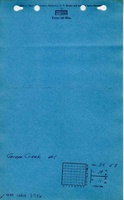
Grape Creek Coal and Coke Company
|
| Mine Name:
|
Grape Creek No. 1 Mine
|
| Start Date:
|
Unknown
|
End Date:
|
1885
|
| Type of Mine:
|
Underground
|
| Total acres shown:
|
39
|
| Acres after map date:
|
|
General Area of mining acres shown:
|
|
|
The Grape Creek mines (No.s 1 through 5, mine index numbers 3756, 3755, 3750, 3745 and 3719) reported production at various times under only one or two mine names. The total area shown for these Grape Creek mines is in line with the production of all the Grape Creek mines.
|
Shaft, Slope, Drift or Tipple Location(s)
| Type
|
County
|
Township-Range
|
Section
|
Part Section
|
| Main drift
|
Vermilion
|
19N 11W
|
34
|
SW SW NW
|
| Drift
|
Vermilion
|
19N 11W
|
33
|
SE NE NE
|
Geology
| Herrin
|
14-60
|
|
|
6.0-6.67
|
RP, HERThe 1885 Coal Report stated that Grape Creek Nos. 1, 2 & 4 were pulling pillars and not likely to last much longer.
|
Geological Problems Reported
Production
| Company
|
Mine Name
|
Date
|
Production (tons)
|
|
|
|
|
|
| Total Production: 620,617
|
Production Notes
Coal Report production (if available)
Sources of Data
| ISGS map library, 4103.V4 i5.1-92
|
8-1913
|
1:7956
|
1:7956
|
Secondary source
|
| ISGS map library, 4103.V4 i5.1-107
|
undated
|
1:3636
|
1:3636
|
Secondary source
|
Annotated Bibliography (Data source - brief description of information)
| Coal Reports - Production, ownership, years of operation, depth, thickness, mining method.
|
| Directory of Illinois Coal Mines (Vermilion County) - Mine names, mine index, ownership, years of operation.
|
| Mine notes (Vermilion County) - Mine type, drift location, seam.
|
| ISGS map library, 4103.V4 i5.1-92, map of Danville Belt Coal Company - Mine outline, mine type.
|
| ISGS map library, 4103.V4 i5.1-107, map of Danville Belt Coal Company - Mine outline, drift location.
|
Mine Notes
Mine Images
 These files may not be true to scale and are not georgistered. These files may not be true to scale and are not georgistered.
|
Map Type:
|
ISGS map library
|
| Map ID:
|
4103 v4 i5 1-92
|
| Company:
|
Danville Belt Coal Company
|
| Mine Name:
|
|
| Caption:
|
|
| Map Date:
|
08-1913
|
| Map Status:
|
Secondary
|
| Image Credit:
|
|
| Note:
|
|
| More Info:
|
4103 v4 i5 1-92.jpg
|
| Full Res Download:These files are true to scale and most are georegistered for gis software. These files may be a very large (>1GB) download!
|
https://wikiimage.isgs.illinois.edu/ilmines/vermilion/4103 v4 i5 1-92.zip
|
 These files may not be true to scale and are not georgistered. These files may not be true to scale and are not georgistered.
|
Map Type:
|
ISGS map library
|
| Map ID:
|
4103 v4 i5 1-107
|
| Company:
|
|
| Mine Name:
|
|
| Caption:
|
|
| Map Date:
|
Undated
|
| Map Status:
|
Secondary
|
| Image Credit:
|
|
| Note:
|
ISGS map library, 4103.V4 i5.1-107, is a composite map of 16 pieces combined into one map of Danville Belt Coal Company
|
| More Info:
|
4103 v4 i5 1-107.jpg
|
| Full Res Download:These files are true to scale and most are georegistered for gis software. These files may be a very large (>1GB) download!
|
https://wikiimage.isgs.illinois.edu/ilmines/vermilion/4103 v4 i5 1-107.zip
|
Photographs