6787: Difference between revisions
No edit summary |
No edit summary |
||
| Line 1: | Line 1: | ||
{{Sidebar Info Query}} | {{Sidebar Info Query}} | ||
{{Header | {{Header | ||
|checked= | |checked=Checked OK | ||
|unlocated=No | |unlocated=No | ||
|shown_on_map=Yes | |shown_on_map=Yes | ||
| Line 10: | Line 10: | ||
|mined-out-area=2 | |mined-out-area=2 | ||
|after_map=18 | |after_map=18 | ||
|indicated=No | |||
|county1=Vermilion | |county1=Vermilion | ||
|quad1=Danville SW | |quad1=Danville SW | ||
Revision as of 10:42, September 22, 2022
Mine Index Number: 6787
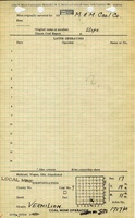
| Company Name: | M. and M. Coal Company | ||
|---|---|---|---|
| Mine Name: | M. and M. Mine | ||
| Start Date: | 1925 | End Date: | 1934 |
| Type of Mine: | Underground | ||
| Total acres shown: | 2 | ||
| Acres after map date: | 18 | General Area of mining acres shown: | |
Shaft, Slope, Drift or Tipple Location(s)
| Type | County | Township-Range | Section | Part Section |
|---|
| Slope | Vermilion | 19N 11W | 17 | SW SE SW |
| Air shaft | Vermilion | 19N 11W | 17 | SW SE SW |
Geology
| Thickness (ft) | |||||
|---|---|---|---|---|---|
| Seam | Depth (ft) | Min | Max | Ave | Mining Method |
| Danville | MRP |
Geological Problems Reported
Production
| Company | Mine Name | Date | Production (tons) |
| Meeker and Martin Coal Company | Meeker and Martin | 1925-1926 | 9,167 |
| Meeker and Martin Coal Company | Meeker and Martin | 1926-1927 | 12,333 Production after map date |
| Martin and Meeker Coal Company | Martin and Meeker | 1928-1929 | 24,000 Production after map date |
| Meeker and Martin Coal Company | Meeker and Martin | 1930-1930 | 11,000 Production after map date |
| Everett Meeker | Meeker | 1931-1932 | 18,400 Production after map date |
| M. and M. Coal Company | M. and M. | 1933-1934 | 11,800 Production after map date |
| Total Production: 86,700 | |||
Production Notes
Coal Report production (if available)
Sources of Data
| Source Map | Map Date | Original Scale | Digitized Scale | Map Type |
| Company, 10-7-3 | 9-30-1926 | 1:1200 | 1:1200 | Not final |
Annotated Bibliography (Data source - brief description of information)
| Coal Reports - Production, ownership, years of operation. |
| Directory of Illinois Coal Mines (Vermilion County) - Mine names, mine index, ownership, years of operation. |
| Company map, courtesy Vermilion County Recorder’s Office, traced, Coal Section files 10-7-3 - Mine outline, slope and shaft locations, mining method. |
Mine Notes
Mine Images

Photographs