Mine Index Number: 6787
| Company Name:
|
M. and M. Coal Company
|
| Mine Name:
|
M. and M. Mine
|
| Start Date:
|
1925
|
End Date:
|
1934
|
| Type of Mine:
|
Underground
|
| Total acres shown:
|
2
|
| Acres after map date:
|
18
|
General Area of mining acres shown:
|
|
|
|
Shaft, Slope, Drift or Tipple Location(s)
| Type
|
County
|
Township-Range
|
Section
|
Part Section
|
| Main slope
|
Vermilion
|
19N 11W
|
17
|
SW SE SW
|
| Air shaft
|
Vermilion
|
19N 11W
|
17
|
SW SE SW
|
Geology
Geological Problems Reported
Production
| Company
|
Mine Name
|
Date
|
Production (tons)
|
Production Notes
Coal Report production (if available)
Sources of Data
| Company, 10-7-3
|
9-30-1926
|
1:1200
|
1:1200
|
Not final
|
Annotated Bibliography (Data source - brief description of information)
| Coal Reports - Production, ownership, years of operation.
|
| Directory of Illinois Coal Mines (Vermilion County) - Mine names, mine index, ownership, years of operation.
|
| Company map, courtesy Vermilion County Recorder’s Office, traced, Coal Section files 10-7-3 - Mine outline, slope and shaft locations, mining method.
|
Mine Notes
Mine Images
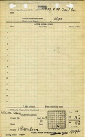
Company: 10-7-3
Map Date: 9-30-1926
Coal Co.: M. and M. Coal Company
Mine Name: M. and M. Mine
Full Res Download
Photographs