3499: Difference between revisions
No edit summary |
No edit summary |
||
| Line 1: | Line 1: | ||
{{Sidebar Info Query}} | {{Sidebar Info Query}} | ||
{{Header | {{Header | ||
|checked= | |checked=Checked OK | ||
|unlocated=No | |unlocated=No | ||
|shown_on_map=Yes | |shown_on_map=Yes | ||
|reason_nsm=Connected underground to Knecht Mine (mine index [[3502]]) and Oakland Mine (mine index [[3500]]). | |||
|Mine-index=3499 | |Mine-index=3499 | ||
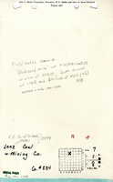
|Coal_co=Consolidated Coal Company of St. Louis | |Coal_co=Consolidated Coal Company of St. Louis | ||
|Mine Name Header=Lenz Mine | |Mine Name Header=Lenz Mine | ||
|mine_type=Underground | |mine_type=Underground | ||
|mined-out-area=20 | |mined-out-area=20 | ||
|indicated=No | |||
|county1=St. Clair | |county1=St. Clair | ||
|quad1=French Village | |quad1=French Village | ||
Revision as of 11:15, September 23, 2022
Mine Index Number: 3499
| Company Name: | Consolidated Coal Company of St. Louis | ||
|---|---|---|---|
| Mine Name: | Lenz Mine | ||
| Start Date: | 1883 | End Date: | 1887 |
| Type of Mine: | Underground | ||
| Total acres shown: | 20 | ||
| Acres after map date: | General Area of mining acres shown: | ||
|
Connected underground to Knecht Mine (mine index 3502) and Oakland Mine (mine index 3500). | |||
Shaft, Slope, Drift or Tipple Location(s)
| Type | County | Township-Range | Section | Part Section |
|---|
| Main shaft | St. Clair | 1N 8W | 7 | SE NE NW |
Geology
| Thickness (ft) | |||||
|---|---|---|---|---|---|
| Seam | Depth (ft) | Min | Max | Ave | Mining Method |
| Herrin | 125-140 | 6.0-7.0 | MRP |
Geological Problems Reported
Production
| Company | Mine Name | Date | Production (tons) |
| St. Clair Co-operative Mining and Supply Company | Lenz | 1883-1884 | 3,020 Idle. Ownership and production prior to 1884 are not known. The Coal Report of 1883 indicates 19 acres were mined. (The tonnage reported above represents about 1 acre.) |
| Consolidated Coal Company of St. Louis | Lenz | 1886-1887 Idle July 1884 to June 1885. | 3,956 |
| Total Production: 6,976 | |||
Production Notes
Coal Report production (if available)
Sources of Data
| Source Map | Map Date | Original Scale | Digitized Scale | Map Type |
| ISGS map library 4103.S31 i5.1-49 | 1903 | 1:2400 | 1:4966 | Secondary source |
| Microfilm, document 350974 | 4-4-1913 | 1:2400 | 1:2232 | Secondary source |
Annotated Bibliography (Data source - brief description of information)
| Coal Reports - Production, ownership, years of operation. |
| Directory of Illinois Coal Mines (St. Clair County) - Mine names, mine index, ownership, years of operation. |
| Mine notes (St. Clair County) - Thickness, depth, seam, mine type, shaft location. |
| ISGS map library, 4103.S31 i5.1-49, map of Kncecht Mine (mine index 3502) - Shaft location, mine outline (northern), mining method. |
| Microfilm map, document 350974, reel 03134, frames 34 and 35, map of Oakland Mine (mine index 3500) - Mine outline (southern). |
Mine Notes
Mine Images


Photographs