Mine Index Number: 3499
| Company Name:
|
Consolidated Coal Company of St. Louis
|
| Mine Name:
|
Lenz Mine
|
| Start Date:
|
1883
|
End Date:
|
1887
|
| Type of Mine:
|
Underground
|
| Total acres shown:
|
20
|
| Acres after map date:
|
|
General Area of mining acres shown:
|
|
|
Connected underground to Knecht Mine (mine index 3502) and Oakland Mine (mine index 3500).
|
Shaft, Slope, Drift or Tipple Location(s)
| Type
|
County
|
Township-Range
|
Section
|
Part Section
|
| Main shaft
|
St. Clair
|
1N 8W
|
7
|
SE NE NW
|
Geology
| Herrin
|
125-140
|
|
|
6.0-7.0
|
MRP
|
Geological Problems Reported
Production
| Company
|
Mine Name
|
Date
|
Production (tons)
|
Production Notes
Coal Report production (if available)
Sources of Data
| ISGS map library 4103.S31 i5.1-49
|
1903
|
1:2400
|
1:4966
|
Secondary source
|
| Microfilm, document 350974
|
4-4-1913
|
1:2400
|
1:2232
|
Secondary source
|
Annotated Bibliography (Data source - brief description of information)
| Coal Reports - Production, ownership, years of operation.
|
| Directory of Illinois Coal Mines (St. Clair County) - Mine names, mine index, ownership, years of operation.
|
| Mine notes (St. Clair County) - Thickness, depth, seam, mine type, shaft location.
|
| ISGS map library, 4103.S31 i5.1-49, map of Kncecht Mine (mine index 3502) - Shaft location, mine outline (northern), mining method.
|
| Microfilm map, document 350974, reel 03134, frames 34 and 35, map of Oakland Mine (mine index 3500) - Mine outline (southern).
|
Mine Notes
Mine Images
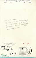
Microfilm: 350974
Map Date: 4-4-1913
Coal Co.: Southern Coal and Mining Company
Mine Name: Oakland Mine
Full Res Download
Company: 4103.S31 i5.1-49
Map Date: 3-21-1903
Coal Co.: Consolidated Coal Company of St. Louis
Mine Name: Knecht Mine
Full Res Download
Photographs