3562: Difference between revisions
No edit summary |
No edit summary |
||
| Line 8: | Line 8: | ||
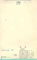
|Mine Name Header=Orchard Mine | |Mine Name Header=Orchard Mine | ||
|mine_type=Underground | |mine_type=Underground | ||
|mined-out-area=None | |mined-out-area=None | ||
|indicated= | |after_map=1 | ||
|indicated=Yes | |||
|county1=St. Clair | |county1=St. Clair | ||
|quad1=Freeburg | |quad1=Freeburg | ||
Latest revision as of 19:38, October 1, 2022
Mine Index Number: 3562
| Company Name: | Orchard Coal Company | ||
|---|---|---|---|
| Mine Name: | Orchard Mine | ||
| Start Date: | 1936 | End Date: | 1937 |
| Type of Mine: | Underground | ||
| Total acres shown: | None | ||
| Production Indicated Acres: | 1 | General Area of mining acres shown: | |
Shaft, Slope, Drift or Tipple Location(s)
| Type | County | Township-Range | Section | Part Section |
|---|
| Main shaft | St. Clair | 1S 7W | 7 | SE SE NW |
Geology
| Thickness (ft) | |||||
|---|---|---|---|---|---|
| Seam | Depth (ft) | Min | Max | Ave | Mining Method |
| Herrin | 200 | 7.0 |
Geological Problems Reported
Production
| Company | Mine Name | Date | Production (tons) |
| Wilson Coal Company | Wilson | 1936-1936 | 7,601 |
| Orchard Mine | Orchard | 1937-1937 | 360 |
| Total Production: 7,961 | |||
Production Notes
Coal Report production (if available)
Sources of Data
| Source Map | Map Date | Original Scale | Digitized Scale | Map Type |
| Mined-Out Area 27 | 1950 | 1:62500 | 1:62500 | Secondary source |
Annotated Bibliography (Data source - brief description of information)
| Coal Reports - Production, ownership, years of operation, seam, thickness, depth. |
| Directory of Illinois Coal Mines (St. Clair County) - Mine names, mine index, ownership, years of operation. |
| Mine notes (St. Clair County) - Mine type, shaft location, seam, depth, thickness. |
| ISGS compilation map, Mined-Out Area 27 - Shaft location. |
Mine Notes
Mine Images

Photographs