Mine Index Number: 3562
| Company Name:
|
Orchard Coal Company
|
| Mine Name:
|
Orchard Mine
|
| Start Date:
|
1936
|
End Date:
|
1937
|
| Type of Mine:
|
Underground
|
| Total acres shown:
|
None
|
| Production Indicated Acres:
|
1
|
General Area of mining acres shown:
|
|
|
|
Shaft, Slope, Drift or Tipple Location(s)
| Type
|
County
|
Township-Range
|
Section
|
Part Section
|
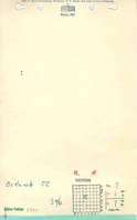
| Main shaft
|
St. Clair
|
1S 7W
|
7
|
SE SE NW
|
Geology
Geological Problems Reported
Production
| Company
|
Mine Name
|
Date
|
Production (tons)
|
Production Notes
Coal Report production (if available)
Sources of Data
| Mined-Out Area 27
|
1950
|
1:62500
|
1:62500
|
Secondary source
|
Annotated Bibliography (Data source - brief description of information)
| Coal Reports - Production, ownership, years of operation, seam, thickness, depth.
|
| Directory of Illinois Coal Mines (St. Clair County) - Mine names, mine index, ownership, years of operation.
|
| Mine notes (St. Clair County) - Mine type, shaft location, seam, depth, thickness.
|
| ISGS compilation map, Mined-Out Area 27 - Shaft location.
|
Mine Notes
Mine Images
ISGS mined-out area map: Area 27
Map Date: 1950
Coal Co.: Orchard
Mine Name: Orchard Mine
Photographs