Mine Index Number: 0697
| Company Name:
|
Peabody Coal Company
|
| Mine Name:
|
Will Scarlet Mine
|
| Start Date:
|
1953
|
End Date:
|
December 1987
|
| Type of Mine:
|
Surface
|
| Total acres shown:
|
4,474 This area includes many other pits elsewhere in Saline and Williamson Counties.
|
| Acres after map date:
|
|
General Area of mining acres shown:
|
|
|
|
Shaft, Slope, Drift or Tipple Location(s)
| Type
|
County
|
Township-Range
|
Section
|
Part Section
|
| Tipple
|
Williamson
|
10S 4E
|
24
|
SE NE NW
|
Geology
| Dekoven
|
25-35
|
|
|
3.17-3.46
|
Surface
|
| Houchin Creek
|
|
|
|
2.0
|
Surface
|
Geological Problems Reported
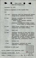
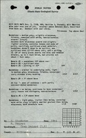
A large igneous dike was reported in the mine. This dike was 15 feet wide. About 10 feet southwest of the main dike, a smaller dike cut through the Davis Coal. Another smaller (2 to 3 feet wide) dike was present about 500-600 feet southwest of the main dike. These dikes were near a 100-foot wide graben. The overburden was mainly sandstone and shale, which was fractured in some locations. This made the highwall difficult to maintain and dangerous to work near. Calcite was present in the coal as fracture fillings. Pyrite was present in lenses and fracture fillings. Some of the seams had high sulfur and ash content, despite high Btu values, and were not mined at all locations.
Production
| Company
|
Mine Name
|
Date
|
Production (tons)
|
Production Notes
Coal Report production (if available)
Sources of Data
| Company, Coal Section files
|
1-1-1989
|
1:12000
|
1:12000
|
Final
|
| Microfilm, document 353298
|
7-16-1959
|
1:12000
|
1:24000
|
Not final
|
| USGS topographic map
|
PR 1990
|
1:24000
|
1:24000
|
Secondary source
|
Annotated Bibliography (Data source - brief description of information)
| Coal Reports - Production, ownership, years of operation, seams, depth, thickness, mining method.
|
| Directory of Illinois Coal Mines (Williamson County) - Mine names, mine index, ownership, years of operation
|
| Mine notes (Williamson County) - Mine type, mine location, seam, geologic problems.
|
| Microfilm map, document 353298, reel 03142, frame 257 - Mine location, mine outline (T10S-R4E-13,14,15).
|
| Company map, Coal Section files - Mine outline, mining method.
|
| USGS topographic map, Carrier Mills 7.5-minute Quadrangle, 1961, photorevised 1990 - Mine outline.
|
Mine Notes
Mine Images
![[[:Will Scarlet|Will Scarlet]]](https://wikiimage.isgs.illinois.edu/ilmines/williamson/thumbnails/m0697b_th.jpg) These files may not be true to scale and are not georgistered. These files may not be true to scale and are not georgistered.
|
Map Type:
|
Company
|
| Map ID:
|
6-407 & 6-191
|
| Company:
|
Peabody Coal Company
|
| Mine Name:
|
Will Scarlet
|
| Caption:
|
|
| Map Date:
|
01-01-1989
|
| Map Status:
|
Final
|
| Image Credit:
|
|
| Note:
|
|
| More Info:
|
M0697b
|
| Full Res Download:These files are true to scale and most are georegistered for gis software. These files may be a very large (>1GB) download!
|
https://wikiimage.isgs.illinois.edu/ilmines/williamson/m0697b.zip
|
![[[:Will Scarlet|Will Scarlet]]](https://wikiimage.isgs.illinois.edu/ilmines/williamson/thumbnails/m0697_th.jpg) These files may not be true to scale and are not georgistered. These files may not be true to scale and are not georgistered.
|
Map Type:
|
Microfilm
|
| Map ID:
|
353298 3142 257
|
| Company:
|
Peabody Coal Company
|
| Mine Name:
|
Will Scarlet
|
| Caption:
|
|
| Map Date:
|
07-16-1959
|
| Map Status:
|
Not Final
|
| Image Credit:
|
|
| Note:
|
|
| More Info:
|
M0697
|
| Full Res Download:These files are true to scale and most are georegistered for gis software. These files may be a very large (>1GB) download!
|
https://wikiimage.isgs.illinois.edu/ilmines/williamson/m0697.zip
|
Photographs