0798: Difference between revisions
Alan.Myers (talk | contribs) No edit summary |
No edit summary |
||
| Line 143: | Line 143: | ||
{{Source map header}} | {{Source map header}} | ||
{{Source Map | {{Source Map | ||
|Source Map= | |Source Map=State archive, IL_2575_01 | ||
|Map Date=6-1-1918 | |Map Date=6-1-1918 | ||
|Original Scale=1:2400 | |Original Scale=1:2400 | ||
|Digitized Scale=1: | |Digitized Scale=1:2400 | ||
|Map Type=Final | |Map Type=Final | ||
}} | }} | ||
{{Source Map | {{Source Map | ||
|Source Map= | |Source Map=State archive, IL_2576_01 | ||
|Map Date=6- | |Map Date=6-18-1929 | ||
|Original Scale=1: | |Original Scale=1:2400 | ||
|Digitized Scale=1: | |Digitized Scale=1:2400 | ||
|Map Type=Final | |Map Type=Final | ||
}} | }} | ||
| Line 170: | Line 170: | ||
}} | }} | ||
{{Annotated bibliography | {{Annotated bibliography | ||
|bibliography= | |bibliography=State archive, IL_2575_01 (Herrin coal) - Shaft locations, mine outline, mining method, seam. | ||
}} | }} | ||
{{Annotated bibliography | {{Annotated bibliography | ||
|bibliography= | |bibliography=State archive, IL_2576_01 (Springfield coal) - Mine outline, mining method, seam, geologic problems. | ||
}} | }} | ||
==Mine Notes== | ==Mine Notes== | ||
Latest revision as of 15:27, May 8, 2024
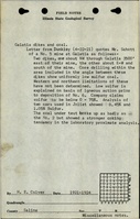
Mine Index Number: 0798
| Company Name: | Big Creek Coals, Inc. | ||
|---|---|---|---|
| Mine Name: | Big Creek No. 5 Mine | ||
| Start Date: | 1902 | End Date: | June 1923 |
| Type of Mine: | Underground | ||
| Total acres shown: | 126 (67 in the Herrin Coal, 59 in the Springfield Coal) | ||
| Acres after map date: | General Area of mining acres shown: | ||
Shaft, Slope, Drift or Tipple Location(s)
| Type | County | Township-Range | Section | Part Section |
|---|
| Main shaft (Herrin) | Saline | 8S 5E | 11 | SW NW SE |
| Air shaft (Herrin) | Saline | 8S 5E | 11 | SW NW SE |
Geology
| Thickness (ft) | |||||
|---|---|---|---|---|---|
| Seam | Depth (ft) | Min | Max | Ave | Mining Method |
| Herrin (1902-1916) | 340-367 | 5.5 | 6.5 | 5.5-5.83 | RPB |
| Springfield (1917-1923) | 485.5 | 2.0 | 7.5 | 6.0 | RPB |
Geological Problems Reported
Two dikes were reported, 3500 feet east of the mine, trending northwest, and the other south of the mine, trending east-west. The Herrin Coal had some gas. The Springfield Coal was very “dirty”, and sandstone lenses rolled into the seam. Pyrite was present as thin lenses. The roof was good, mostly of limestone, but the shale beneath the limestone fell where it was thin.
Production
| Company | Mine Name | Date | Production (tons) |
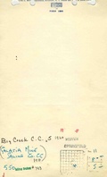
| Galatia Coal Company | Galatia | 1902-1911Idle 1904 | 154,914 |
| St. Louis Coal and Coke Company | Galatia No. 1 | 1911-1912 | 20,000 |
| Galatia and Saline Coal Company | Galatia No. 1 | 1912-1913 | 14,000 |
| Galatia Coal Company | Galatia | 1913-1914 | 21,950 |
| Brown and Jones Coal Company | Galatia | 1914-1915 | 4,893 |
| Durham Coal Company | Durham | 1915-1917 | 66,870 |
| Saline County Coal Company | Saline County No. 5 | 1917-1918 | 56,918 |
| Galatia Colliery Company | Galatia No. 5 | 1918-1919 | 30,794 |
| Big Creek Coals, Inc. | Big Creek No. 5 | 1919-1923Production was not reported in 1922; the mine was idle or production was less than 10,000 tons | 210,356 |
| Peabody Coal Company | Peabody No. 45 | 1923-1923 | none reportedPeabody Coal Company was listed as the successor to Saline County Coal Company on the map, but no production was reported under this name. |
| Total Production: 580,695 | |||
Production Notes
Coal Report production (if available)
Sources of Data
| Source Map | Map Date | Original Scale | Digitized Scale | Map Type |
| State archive, IL_2575_01 | 6-1-1918 | 1:2400 | 1:2400 | Final |
| State archive, IL_2576_01 | 6-18-1929 | 1:2400 | 1:2400 | Final |
Annotated Bibliography (Data source - brief description of information)
| Coal Reports - Production, ownership, years of operation. |
| Directory of Illinois Coal Mines (Saline County) - Mine names, mine index, ownership, years of operation. |
| Mine notes (Saline County) - Mine type, shaft location, seam, depth, thickness, geologic problems. |
| ISGS Field notes (Saline County) - Geologic problems. |
| State archive, IL_2575_01 (Herrin coal) - Shaft locations, mine outline, mining method, seam. |
| State archive, IL_2576_01 (Springfield coal) - Mine outline, mining method, seam, geologic problems. |
Mine Notes
Mine Images
![[[:Peabody No. 45|Peabody No. 45]]](https://go.illinois.edu/ILMImages/saline/thumbnails/m0798_IL_2576_01_th.jpg)
![[[:Saline County No. 5|Saline County No. 5]]](https://go.illinois.edu/ILMImages/saline/thumbnails/m_0798_IL_2575_01_th.jpg)
Photographs