0872: Difference between revisions
No edit summary |
Alan.Myers (talk | contribs) No edit summary |
||
| (One intermediate revision by the same user not shown) | |||
| Line 10: | Line 10: | ||
|mined-out-area=6,367 | |mined-out-area=6,367 | ||
|county1=Randolph | |county1=Randolph | ||
|county2=Perry | |||
|quad1=Steeleville | |quad1=Steeleville | ||
|quad4=Welge | |quad4=Welge | ||
| Line 16: | Line 17: | ||
|year-start=1936 | |year-start=1936 | ||
|year-end=May 1983 | |year-end=May 1983 | ||
|Latitude= | |Latitude=38.053048 | ||
|Longitude= | |Longitude=-89.621230 | ||
|Zoom=15 | |Zoom=15 | ||
}} | }} | ||
Latest revision as of 11:37, April 11, 2022
Mine Index Number: 0872
| Company Name: | Southwestern Illinois Coal Corporation | ||
|---|---|---|---|
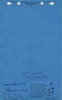
| Mine Name: | Streamline Mine | ||
| Start Date: | 1936 | End Date: | May 1983 |
| Type of Mine: | Surface | ||
| Total acres shown: | 6,367 | ||
| Acres after map date: | General Area of mining acres shown: | ||
Shaft, Slope, Drift or Tipple Location(s)
| Type | County | Township-Range | Section | Part Section |
|---|
| Pit | Randolph | 6S 5W | 23, 24 |
| Pit | Randolph | 6S 5W | 25, 36 |
| Pit | Randolph | 6S 5W | 15 |
Geology
| Thickness (ft) | |||||
|---|---|---|---|---|---|
| Seam | Depth (ft) | Min | Max | Ave | Mining Method |
| Herrin | 38-83 | 5.5-6.0 | Surface |
| Springfield | 87-135 | 3.0-5.0 | Surface |
Geological Problems Reported
Thin shale bands were seen in the coal. Pyrite was present as thin lenses. In NE NW 14-T6S-R5W, the interval between the Herrin and Springfield Coals was 15 to 20 feet and consisted of 4 to 6 feet of shale and underclay and 8 to 10 feet of limestone.
Production
| Company | Mine Name | Date | Production (tons) |
| Southwestern Illinois Coal Corporation | Streamline | 1936-1983 | 53,450,027 |
| Total Production: 53,450,027 | |||
Production Notes
Coal Report production (if available)
Sources of Data
| Source Map | Map Date | Original Scale | Digitized Scale | Map Type |
| USGS digital orthophoto map | 2004 | 1:6000 | 1:6000 | Secondary source |
Annotated Bibliography (Data source - brief description of information)
| Coal Reports - Production, ownership, years of operation, seam, depth, thickness. |
| Directory of Illinois Coal Mines (Randolph County) - Mine names, mine index, ownership, years of operation. |
| Mine notes (Randolph County) - Mine type, mine location, seam, depth, thickness. |
| ISGS field notes (G. H. Cady and G. Wilson, 1-5-1944) - Geologic problems. |
| USGS digital orthophoto map, Willisville Quadrangle, 2004 - Mine outline. |
| Company map, Coal Section files, 1-32-25 - Verify pit identification. |
| Company map, Coal Section files, 6-252 L - Verify pit identification. |
| Company map, ISGS map library, 4103.P42 i5.1-62 - Verify pit identification. |
Mine Notes
Mine Images


Photographs