Category:Gallatin-County: Difference between revisions
Alan.Myers (talk | contribs) (Created page with "{{County-Page}}") |
Alan.Myers (talk | contribs) No edit summary Tag: Reverted |
||
| Line 1: | Line 1: | ||
==Map and Directory PDF Download== | |||
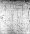
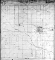
This county map displays coal mines and/or underground industrial mineral mines. If coal mining has occurred in this county, a directory of additional information about these coal mines is included with the map. Buffer regions for industrial mineral mines were incorporated into this map due to limited information regarding these mines. The size of the buffer region is dependent on the uncertainty or inaccuracy of the mine location. For more information regarding industrial mineral mines please contact the ISGS Industrial Minerals Section. The county maps also display quadrangle boundaries for which the ISGS has completed studies. Scale 1:100,000. PDF file.</br> | |||
{| class="wikitable" style="background-color:#ffffff;" | |||
|- | |||
| <html><a href="https://wikiimage.isgs.illinois.edu/ilmines/webfiles/mines-series/mines-maps/pdf-files/mines-map-gallatin-herrincoal.pdf"><img style="max-width: 250px; max-height: 250px;" src="https://wikiimage.isgs.illinois.edu/ilmines/webfiles/mines-series/mines-maps/images/mines-gallatin-herrincoal.gif"></a></html> | |||
| <html><a href="https://wikiimage.isgs.illinois.edu/ilmines/webfiles/mines-series/mines-maps/pdf-files/mines-map-gallatin-springfieldcoal.pdf"><img style="max-width: 250px; max-height: 250px;" src="https://wikiimage.isgs.illinois.edu/ilmines/webfiles/mines-series/mines-maps/images/mines-gallatin-springfieldcoal.gif"></a></html> | |||
|- | |||
! [https://wikiimage.isgs.illinois.edu/ilmines/webfiles/mines-series/mines-maps/pdf-files/mines-map-gallatin-herrincoal.pdf Herrin Coal Mine Map] | |||
![https://wikiimage.isgs.illinois.edu/ilmines/webfiles/mines-series/mines-directories/pdf-files/mines-directory-bond.pdf Springfield Coal Mine Map] | |||
|} | |||
{| class="wikitable" style="background-color:#ffffff;" | |||
|- | |||
| <html><a href="https://wikiimage.isgs.illinois.edu/ilmines/webfiles/mines-series/mines-maps/pdf-files/mines-map-gallatin-othercoals.pdf"><img style="max-width: 250px; max-height: 250px;" src="https://wikiimage.isgs.illinois.edu/ilmines/webfiles/mines-series/mines-maps/images/mines-bond.gif"></a></html> | |||
| <html><a href="https://wikiimage.isgs.illinois.edu/ilmines/webfiles/mines-series/mines-directories/pdf-files/mines-directory-gallatin.pdf"><img style="max-width: 250px; max-height: 250px;" src="https://wikiimage.isgs.illinois.edu/ilmines/webfiles/mines-series/mines-directories/images/mines-dir.gif"></a></html> | |||
|- | |||
! [https://wikiimage.isgs.illinois.edu/ilmines/webfiles/mines-series/mines-maps/pdf-files/mines-map-gallatin-othercoals.pdf Other Coals Mine Map] | |||
![https://wikiimage.isgs.illinois.edu/ilmines/webfiles/mines-series/mines-directories/pdf-files/mines-directory-gallatin.pdf Gallatin County Mine Directory] | |||
|} | |||
{{County-Page}} | {{County-Page}} | ||
Revision as of 15:22, January 18, 2023
Map and Directory PDF Download
This county map displays coal mines and/or underground industrial mineral mines. If coal mining has occurred in this county, a directory of additional information about these coal mines is included with the map. Buffer regions for industrial mineral mines were incorporated into this map due to limited information regarding these mines. The size of the buffer region is dependent on the uncertainty or inaccuracy of the mine location. For more information regarding industrial mineral mines please contact the ISGS Industrial Minerals Section. The county maps also display quadrangle boundaries for which the ISGS has completed studies. Scale 1:100,000. PDF file.

|

|
| Herrin Coal Mine Map | Springfield Coal Mine Map |
|---|

|

|
| Other Coals Mine Map | Gallatin County Mine Directory |
|---|
County Coal Data
Mines that Appear in Gallatin-County
- 9998 & 9999 = Unknown dates
Unlocated Mines in Gallatin-County
Mine that have known coal production but no known location
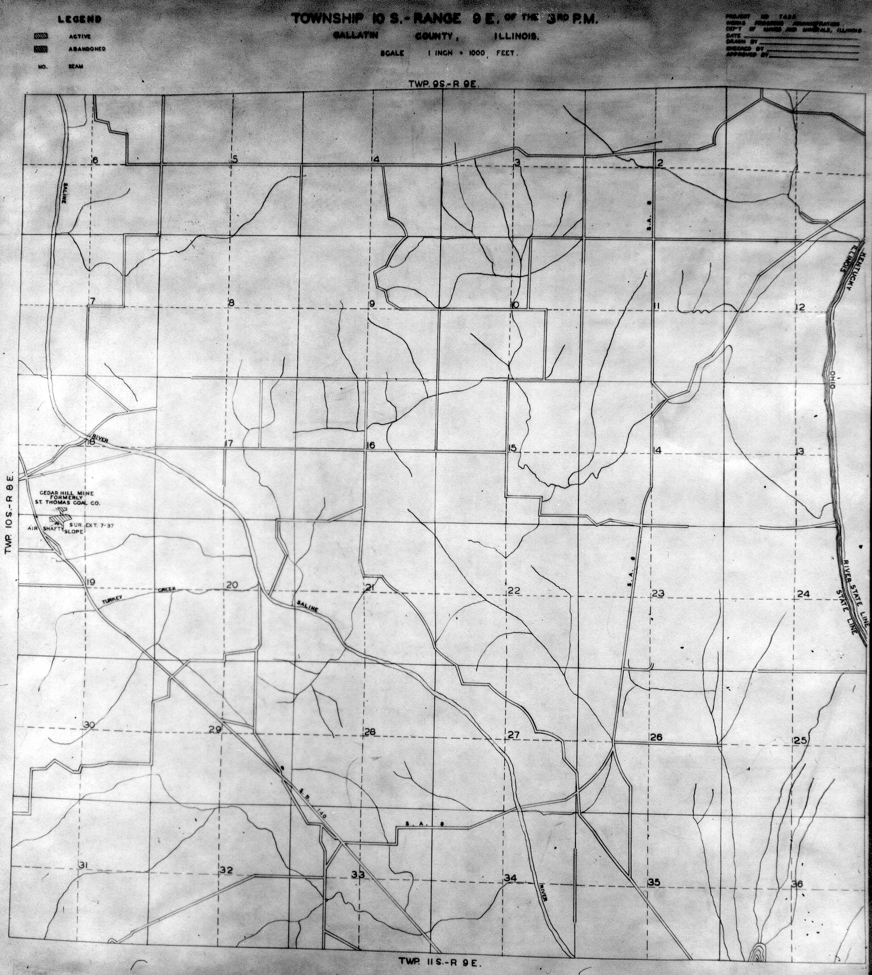
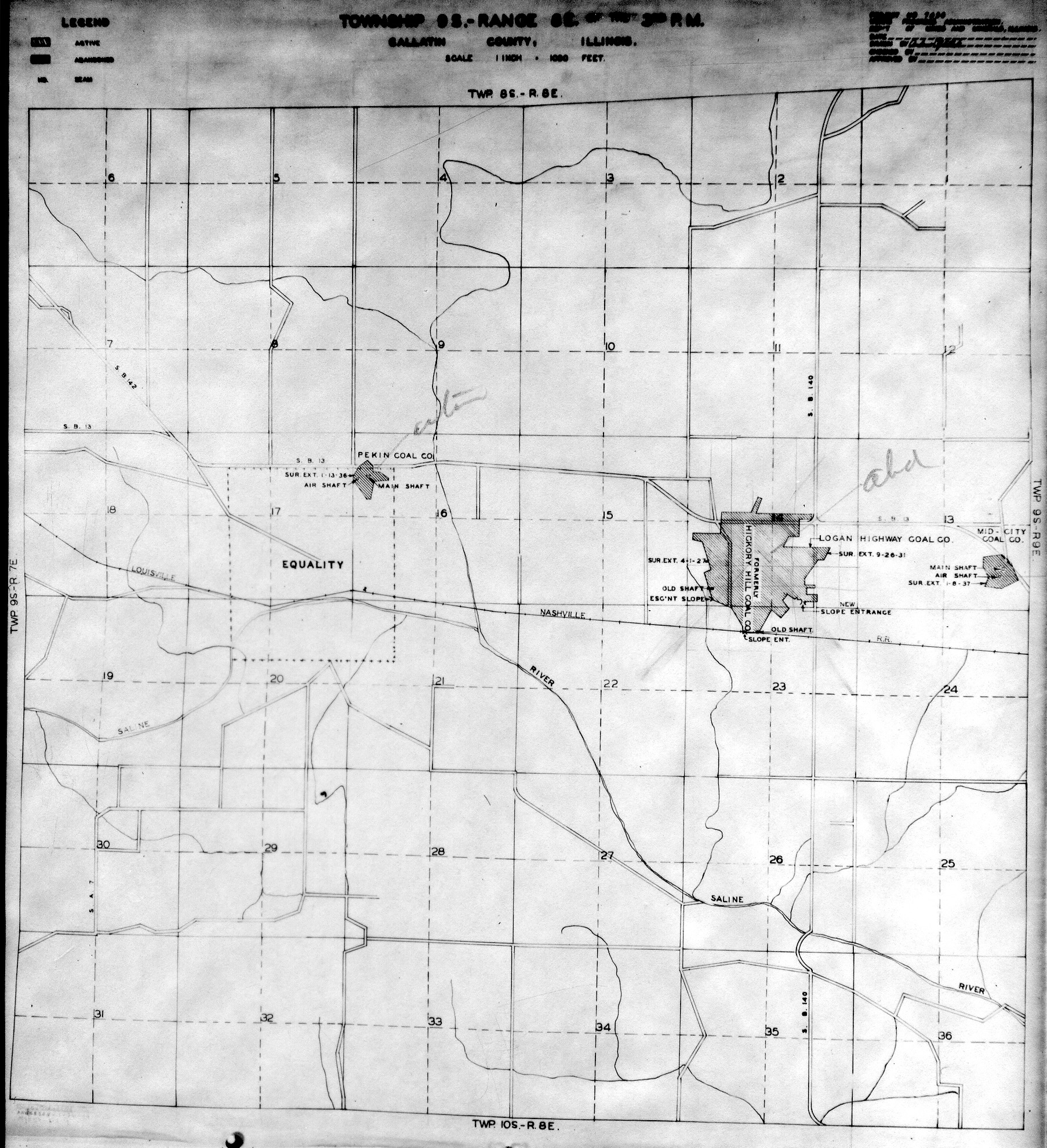
Historical Mined Out Area Maps
WPA
These maps were constructed as part of the nationwide Works Projects Administration (WPA), generally between 1934 and 1937 with some later updates or revisions,
Disclaimer
Maps for some locations might have multiple versions/seams, please inspected these areas closely for differences.
Notes and corrections were made by ISGS staff.
These maps are reproductions from microfilm, they may be of poor quality with text difficult to read.


Federal Land Bank of St. Louis, Preliminary Reports on Subsidence Investigations
Federal Land Bank of St. Louis, Preliminary Reports on Subsidence Investigations (refered by Coal Section Staff as "Quade Maps")
Mining engineers working for the Federal Land Bank of St. Louis mapped areas of subsidence due to coal mining in the early 1930s. These reports often include county maps of mine properties with mined-out areas including shaft locations, as well as subsidence areas.
Disclaimer
Maps for some locations might have multiple versions/seams, please inspected these areas closely for differences.
These maps are accompanied by a report, please download and inspect this document.
Notes and corrections were made by ISGS staff.
There are no Quade Maps for this county
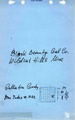
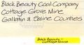
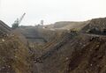
Photographs

Pages in category "Gallatin-County"
The following 142 pages are in this category, out of 142 total.
0
2
4
Media in category "Gallatin-County"
The following 7 files are in this category, out of 7 total.
 M0995 minenotes.pdf 752 × 1,177, 23 pages; 4.21 MB
 M1004 minenotes.pdf 750 × 1,250, 17 pages; 3.39 MB
 M1022 minenotes.pdf 737 × 1,175, 20 pages; 4.3 MB
 M1044 minenotes.pdf 560 × 302, 11 pages; 4.43 MB
 Mn act gallatin 01.jpg 2,956 × 2,056; 528 KB
 WPA GALLATIN 10S9E.jpg 1,785 × 1,996; 1.37 MB
 WPA GALLATIN 9S8E.jpg 1,806 × 1,981; 1.22 MB