Mine Index Number: 0041
| Company Name:
|
Niantic Carbon Coal Company
|
| Mine Name:
|
Niantic Mine
|
| Start Date:
|
1883
|
End Date:
|
1924
|
| Type of Mine:
|
Underground
|
| Total acres shown:
|
340
|
| Acres after map date:
|
40
|
General Area of mining acres shown:
|
|
|
|
Shaft, Slope, Drift or Tipple Location(s)
| Type
|
County
|
Township-Range
|
Section
|
Part Section
|
| Main shaft
|
Macon
|
16N 1W
|
12
|
SW SW NW
|
| Air shaft
|
Macon
|
16N 1W
|
12
|
SW SW NW
|
Geology
| Springfield
|
365-370
|
|
6.0
|
4.5-5.5
|
RPB,LWsome LW (1918-1922)
|
Geological Problems Reported
Some gas problems were noted in 1884, but increased ventilation remedied the situation. The roof was 3 to 5 inches of black and blue-gray shale, overlain by 2 to 18 inches of limestone cap rock, with 40 feet of gray shale above the limestone. Horsebacks ranged from common to abundant and some were quite large. This increased the cost of mining so that the mine was sometimes not economically competitive. Clay veins were present in the coal, and the upper part of the seam contained small pyrite streaks and many pyrite concretions. The floor clay was 4.5 feet thick and heaved badly when wet.
Production
| Company
|
Mine Name
|
Date
|
Production (tons)
|
|
|
|
|
|
| Total Production: 1,484,137
|
Production Notes
Coal Report production (if available)
Sources of Data
| WPA, T16N-R1W
|
8-14-1918
|
1:12000
|
1:12000
|
Secondary source
|
| Microfilm, document 352326 The microfilm map was only used to match up with WPA. The microfilm was of very poor quality and almost impossible to read.
|
8-14-1918
|
1:2400
|
1:414
|
Not final
|
Annotated Bibliography (Data source - brief description of information)
| Coal Reports - Production, ownership, years of operation.
|
| Directory of Illinois Coal Mines (Macon County) - Mine names, mine index, ownership, years of operation.
|
| ENR Document 85/01 - Mining method.
|
| Mine notes (Macon County) - Mine type, shaft location, seam, depth, thickness.
|
| WPA map, T16N-R1W - Mine outline.
|
| Microfilm map, document 352326, reel 03138, frame 432 - Shaft locations, mining method.
|
Mine Notes
Mine Images
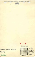
Microfilm: 352326
Map Date: 8-14-1918
Coal Co.: Niantic Carbon Coal Company
Mine Name: Niantic Mine
Full Res Download
WPA: T16N-R1W
Map Date: 8-14-1918
Coal Co.: Niantic Carbon Coal Company
Mine Name: Niantic
Full Res Download
Photographs