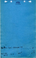
Mine Index Number: 0084
| Company Name:
|
Southern Coal, Coke and Mining Company
|
| Mine Name:
|
Southern Mine No. 9
|
| Start Date:
|
1899
|
End Date:
|
March 1938
|
| Type of Mine:
|
Underground
|
| Total acres shown:
|
1,291
|
| Acres after map date:
|
|
General Area of mining acres shown:
|
|
|
|
Shaft, Slope, Drift or Tipple Location(s)
| Type
|
County
|
Township-Range
|
Section
|
Part Section
|
| Main shaft (9'x18')
|
Clinton
|
1N 5W
|
17
|
50 FNL, 200 FWL SW
|
| Air shaft (6'x9')
|
Clinton
|
1N 5W
|
17
|
NW NW SW
|
Geology
| Herrin
|
319-326
|
6.5
|
9.0
|
7.5-8.3
|
MRP
|
Geological Problems Reported
The mine is crossed by a number of faults trending WNW-ESE in which the offset is about the thickness of the seam, upthrown on the south side. Limestone forms the immediate roof over most of the mine, black shale is the roof over the remainder. Black shale is very poor roof and must be heavily timbered. Sometimes coal is left with the black slate as a good clean parting occurs there. The floor clay heaves very badly when wet or if pillars are robbed. The source map shows areas of squeeze in the north central part of the mine, some rooms labeled “caved” in the north part of the mine, and several offsets in the mining pattern (throughout the mine) due to faults.
Production
| Company
|
Mine Name
|
Date
|
Production (tons)
|
|
|
|
|
|
| Total Production: 9,899,982
|
Production Notes
Coal Report production (if available)
Sources of Data
| Microfilm, document 351119
|
4-24-1939
|
1:2400
|
1:4303
|
Final
|
Annotated Bibliography (Data source - brief description of information)
| Coal Reports - Production, ownership, years of operation, seam, depth, thickness, geologic problems.
|
| Directory of Illinois Coal Mines (Clinton County) - Mine names, mine index, ownership, years of operation.
|
| Mine notes (Clinton County) - Mine type, shaft locations, seam, depth, thickness, geologic problems.
|
| Microfilm map, document 351119, reel 03134, frames 248-251 - Shaft locations, mine outline, mining method, geologic problems.
|
| Company map, state archive, IL_53_03 (same as microfilm) - Shaft locations, mine outline, mining method.
|
Mine Notes
Mine Images
Photographs
![[[:New Baden|New Baden]]](https://wikiimage.isgs.illinois.edu/ilmines/clinton/thumbnails/m0084_il_53_03_th.jpg)