Mine Index Number: 0149
| Company Name:
|
Crear-Clinch Coal Company
|
| Mine Name:
|
McClintock Mine
|
| Start Date:
|
1907
|
End Date:
|
March 1927
|
| Type of Mine:
|
Underground
|
| Total acres shown:
|
711
|
| Acres after map date:
|
|
General Area of mining acres shown:
|
|
|
|
Shaft, Slope, Drift or Tipple Location(s)
| Type
|
County
|
Township-Range
|
Section
|
Part Section
|
| Main shaft (9 x 14 ft)
|
Williamson
|
8S 3E
|
19
|
NE SW NE
|
| Air shaft
|
Williamson
|
8S 3E
|
19
|
NE SW NE
|
Geology
| Herrin
|
261
|
7.5
|
9.0
|
8.17
|
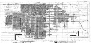
RPP, HERStippling that marks pillar extraction appears over most of the mine.
|
Geological Problems Reported
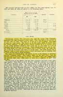
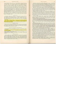
A 1924 gas explosion killed 33 men. The source map shows a fault in the northeastern part of the mine. Many unmined areas may indicate faulting or other geologic problems. The roof was a soft gray shale that required timbering. Top coal was left to support the roof, but it was soft and often fell. Numerous “charcoal” (fusain) lenses were present throughout the coal, as well as pyrite stringers and lenses. Slips were also present throughout the coal. The source map shows two areas where squeezes apparently limited mining, both in the center of the southernmost portion of the mine (SE SE 19-T8S-R3E).
Production
| Company
|
Mine Name
|
Date
|
Production (tons)
|
|
|
|
|
|
| Total Production: 4,929,679
|
Production Notes
Coal Report production (if available)
Sources of Data
| Microfilm, document 353213
|
6-1-1927
|
1:2400
|
1:4800
|
Final
|
Annotated Bibliography (Data source - brief description of information)
| Coal Reports - Production, ownership, years of operation, geologic problems.
|
| Directory of Illinois Coal Mines (Williamson County) - Mine names, mine index, ownership, years of operation.
|
| Mine notes (Williamson County) - Mine type, shaft location, seam, depth, thickness, geologic problems.
|
| Microfilm map, document 353213, reel 03142, frames 132 & 133 - Shaft locations, mine outline, mining method, geologic problems.
|
Mine Notes
Mine Images
Microfilm: 353213
Map Date: 6-1-1927
Coal Co.: Crear-Clinch Coal Company
Mine Name: McClintock Mine
Full Res Download
Photographs


