Mine Index Number: 2904
| Company Name:
|
F. and M. Coal Company
|
| Mine Name:
|
F. and M. Mine
|
| Start Date:
|
1934
|
End Date:
|
1943
|
| Type of Mine:
|
Underground
|
| Total acres shown:
|
10
|
| Production Indicated Acres:
|
4
|
General Area of mining acres shown:
|
|
|
|
Shaft, Slope, Drift or Tipple Location(s)
| Type
|
County
|
Township-Range
|
Section
|
Part Section
|
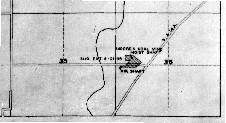
| Main shaft
|
Macoupin
|
7N 9W
|
36
|
SE SW NW
|
| Escape/air shaft
|
Macoupin
|
7N 9W
|
36
|
NW NW SW
|
Geology
| Herrin
|
120
|
4.5
|
6.5
|
5.0
|
RPB
|
Geological Problems Reported
Production
| Company
|
Mine Name
|
Date
|
Production (tons)
|
| Fred Hausman Hausman operated the escape shaft and Moore operated the main shaft of the same mine.
|
Hausman
|
1934-1936
|
2,292
|
|
|
| Roscoe Moore Hausman operated the escape shaft and Moore operated the main shaft of the same mine.
|
Moore
|
1935-1942
|
17,449
|
|
|
Production Notes
Coal Report production (if available)
Sources of Data
| WPA, T7N-R9W
|
6-21-1938
|
1:12000
|
1:57556
|
Secondary source
|
| Mine notes
|
6-7-1937
|
1:62500
|
1:62500
|
Secondary source
|
| ISGS field notes (G. H. Cady)
|
8-6-1938
|
1:62500
|
1:62500
|
Secondary source
|
Annotated Bibliography (Data source - brief description of information)
| Coal Reports - Production, ownership, years of operation.
|
| Directory of Illinois Coal Mines (Macoupin County) - Mine names, mine index, ownership, years of operation, mining method.
|
| WPA map, T7N-R9W - Mine outline, shaft locations.
|
| Mine notes (Macoupin County) - Mine type, shaft location, seam, depth, thickness.
|
| ISGS field notes (Macoupin County) - Mine location, seam.
|
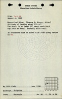
Mine Notes
Mine Images
 These files may not be true to scale and are not georgistered. These files may not be true to scale and are not georgistered.
|
Map Type:
|
WPA
|
| Map ID:
|
7N 9W
|
| Company:
|
|
| Mine Name:
|
|
| Caption:
|
|
| Map Date:
|
1938
|
| Map Status:
|
Secondary
|
| Image Credit:
|
|
| Note:
|
|
| More Info:
|
M2904 wpa
|
| Full Res Download:These files are true to scale and most are georegistered for gis software. These files may be a very large (>1GB) download!
|
https://wikiimage.isgs.illinois.edu/ilmines/macoupin/m2904 wpa.zip
|
 These files may not be true to scale and are not georgistered. These files may not be true to scale and are not georgistered.
|
Map Type:
|
USGS topographic
|
| Map ID:
|
USGS topographic Coal Section files
|
| Company:
|
|
| Mine Name:
|
|
| Caption:
|
|
| Map Date:
|
1928
|
| Map Status:
|
Secondary
|
| Image Credit:
|
|
| Note:
|
Notes made by unknown coal section staff on the Brighton Quadrangle 1928 edition.
|
| More Info:
|
Brighton topo 1928
|
| Full Res Download:These files are true to scale and most are georegistered for gis software. These files may be a very large (>1GB) download!
|
https://go.illinois.edu/ILMImages/macoupin/brighton topo 1928.zip
|
Photographs