Mine Index Number: 3194
| Company Name:
|
Lee Coal Company
|
| Mine Name:
|
Lee No. 2 Auger Mine
|
| Start Date:
|
1968
|
End Date:
|
December 31, 1968
|
| Type of Mine:
|
Surface/Underground
|
| Total acres shown:
|
2
|
| Acres after map date:
|
|
General Area of mining acres shown:
|
|
|
This mine is in the midst of a pit surface mined by Western Brick Company (mine index 3790) (mine location and source map title block support location).
|
Shaft, Slope, Drift or Tipple Location(s)
| Type
|
County
|
Township-Range
|
Section
|
Part Section
|
| Mine
|
Vermilion
|
19N 12W
|
14
|
NE NW NE
|
Geology
Geological Problems Reported
Production
| Company
|
Mine Name
|
Date
|
Production (tons)
|
Production Notes
Coal Report production (if available)
Sources of Data
| ISGS map library, 4103.V4 i5.1-119
|
1-31-1969
|
1:480
|
1:660
|
Final
|
Annotated Bibliography (Data source - brief description of information)
| Coal Reports - Production, ownership, years of operation.
|
| Directory of Illinois Coal Mines (Vermilion County) - Mine names, mine index, ownership, years of operation.
|
| Mine notes (Vermilion County) - Mine type, seam, depth, thickness.
|
| ISGS map library, 4103.V4 i5.1-119 - Mine location, mine outline, mining method.
|
Mine Notes
Mine Images
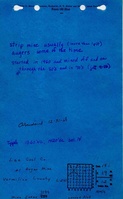
Map library: 4103.V4 i5.1-119
Map Date: 1-31-1969
Coal Co.: Lee Coal Company
Mine Name: Lee No. 2 Mine
Full Res Download
Photographs