Mine Index Number: 3565
| Company Name:
|
Paramount Coal and Coke Company
|
| Mine Name:
|
Randle Mine
|
| Start Date:
|
1889
|
End Date:
|
1942
|
| Type of Mine:
|
Underground
|
| Total acres shown:
|
239
|
| Acres after map date:
|
3
|
General Area of mining acres shown:
|
|
|
|
Shaft, Slope, Drift or Tipple Location(s)
| Type
|
County
|
Township-Range
|
Section
|
Part Section
|
| Main shaft (6' x 12')
|
St. Clair
|
1S 7W
|
19
|
SW NW NE
|
| Air shaft
|
St. Clair
|
1S 7W
|
19
|
SE NW NE
|
Geology
| Herrin
|
143-150
|
|
|
6.0-7.5
|
MRP
|
Geological Problems Reported
The source map shows an area caved in the eastern part of the mine.
Production
| Company
|
Mine Name
|
Date
|
Production (tons)
|
|
|
|
|
|
| Total Production: 1,620,934
|
Production Notes
Coal Report production (if available)
Sources of Data
| Microfilm, document 351087
|
11-7-1938
|
1:1200
|
1:2317
|
Not final
|
Annotated Bibliography (Data source - brief description of information)
| Coal Reports - Production, ownership, years of operation.
|
| Directory of Illinois Coal Mines (St. Clair County) - Mine names, mine index, ownership, years of operation.
|
| Mine notes (St. Clair County) - Mine type, shaft location and size, seam, depth, thickness.
|
| Microfilm map, document 351087, reel 03134, frame 197, 198 - Shaft locations, mine outline, mining method, geologic problems.
|
Mine Notes
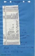
Mine Images
Microfilm: 351087
Map Date: 11-7-1938
Coal Co.: Freeburg Coal Company
Mine Name: Randle Mine
Full Res Download
Photographs