Mine Index Number: 3667
| Company Name:
|
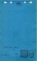
Scarce Brothers
|
| Mine Name:
|
Scarce No. 1 Mine
|
| Start Date:
|
1934
|
End Date:
|
1937
|
| Type of Mine:
|
Underground
|
| Total acres shown:
|
10 The source map includes many areas of old workings that are shown under this mine index that were previously mined, perhaps by the unknown mines shown at the back of this report.
|
| Production Indicated Acres:
|
Less than 1
|
General Area of mining acres shown:
|
|
|
|
Shaft, Slope, Drift or Tipple Location(s)
| Type
|
County
|
Township-Range
|
Section
|
Part Section
|
| Main shaft
|
Vermilion
|
18N 11W
|
3
|
NW SE NW
|
| Air shaft
|
Vermilion
|
18N 11W
|
3
|
NE SE NW This air shaft is shared with Talbert & Anderson (mine index 3654).
|
Geology
Geological Problems Reported
Production
| Company
|
Mine Name
|
Date
|
Production (tons)
|
Production Notes
Coal Report production (if available)
Sources of Data
| Microfilm, document 352968
|
4-2-1937
|
1:2400
|
1:1986
|
Final
|
Annotated Bibliography (Data source - brief description of information)
| Coal Reports - Production, ownership, years of operation, mining method.
|
| Directory of Illinois Coal Mines (Vermilion County) - Mine names, mine index, ownership, years of operation.
|
| Mine notes (Vermilion County) - Mine type, shaft location.
|
| Microfilm map, document 352968, reel 03141, frame 111 - Shaft locations, mine outline, mining method.
|
Mine Notes
Mine Images
Microfilm: 352968
Map Date: 4-2-1937
Coal Co.: Scarce Brothers
Mine Name: Scarce No. 1 Mine
Full Res Download
Photographs