Mine Index Number: 3705
| Company Name:
|
Tilton Mining Company
|
| Mine Name:
|
Tilton No. 1 Mine
|
| Start Date:
|
1923
|
End Date:
|
October 1941
|
| Type of Mine:
|
Underground
|
| Total acres shown:
|
108
|
| Acres after map date:
|
12
|
General Area of mining acres shown:
|
|
|
This area is smaller than expected from production; the expected size is about 220 acres (minimum 180 acres). A general area of mining has been added to the map to indicate the expected size. The mine map may be incomplete. The east part of the mine was active at the time of the last survey, and this may be the location of the acres mined after the map date. The old workings near the southeast part of the mine are probably from prior to 1931.
|
Shaft, Slope, Drift or Tipple Location(s)
| Type
|
County
|
Township-Range
|
Section
|
Part Section
|
| Main slope
|
Vermilion
|
19N 11W
|
19
|
NE SW NW
|
| Air shaft
|
Vermilion
|
19N 11W
|
19
|
NE SW NW
|
Geology
Geological Problems Reported
Production
| Company
|
Mine Name
|
Date
|
Production (tons)
|
|
|
|
|
|
| Total Production: 651,938
|
Production Notes
Coal Report production (if available)
Sources of Data
| Company, 4103.V4 i5.1-56
|
5-25-1940
|
1:1200
|
1:1200
|
Not final
|
Annotated Bibliography (Data source - brief description of information)
| Coal Reports - Production, ownership, years of operation, thickness.
|
| Directory of Illinois Coal Mines (Vermilion County) - Mine names, mine index, ownership, years of operation.
|
| Mine notes (Vermilion County) - Mine type, slope location, seam, depth, thickness.
|
| Company map, ISGS map library, 4103.V4 i5.1-56 - Slope & shaft locations, mine outline, mining method, old workings location of Chicago and Carbon Mine (mine index 7113).
|
Mine Notes
Mine Images
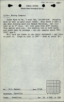
Map library: 4103.V4 i5.1-56
Map Date: 5-25-1940
Coal Co.: Tilton Mining Company
Mine Name: Tilton No. 1 Mine
Image Credit: Illinois State Geological Survey
Full Res Download
Photographs