Mine Index Number: 3712
| Company Name:
|
Contract Coal Company
|
| Mine Name:
|
Contract No. 3 Mine
|
| Start Date:
|
1924
|
End Date:
|
1930
|
| Type of Mine:
|
Underground and Surface
|
| Total acres shown:
|
15
|
| Acres after map date:
|
|
General Area of mining acres shown:
|
|
|
|
Shaft, Slope, Drift or Tipple Location(s)
| Type
|
County
|
Township-Range
|
Section
|
Part Section
|
| Main slope
|
Vermilion
|
19N 11W
|
21
|
SW SE NE This is the same slope listed for Delaware No. 2 (mine index 3711), used later for access to Contract No. 3 Mine’s enlargement of that underground mine.
|
Geology
Geological Problems Reported
Production
| Company
|
Mine Name
|
Date
|
Production (tons)
|
Production Notes
Coal Report production (if available)
Sources of Data
| Microfilm, document 352876
|
8-18-1929
|
1:2400
|
1:4965
|
Not final
|
| ISGS map library, 4103.V4 i5.1-50
|
8-18-1929
|
1:2400
|
1:2400
|
Not final
|
Annotated Bibliography (Data source - brief description of information)
| Coal Reports - Production, ownership, years of operation.
|
| Directory of Illinois Coal Mines (Vermilion County) - Mine names, mine index, ownership, years of operation.
|
| Mine notes (Vermilion County) - Mine type, mine location, seam, thickness, mining method.
|
| Microfilm map, document 352876, reel 03140, frame 506 - Slope location, mine outline, mining method.
|
| ISGS map library, 4103.V4 i5.1-50 - Mine outlines, slope location, mining method.
|
Mine Notes
Mine Images
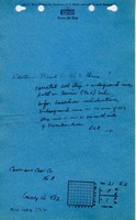
Microfilm: 352876
Map Date: 8-18-1929
Coal Co.: Contract Coal Company
Mine Name: Contract No. 3 Mine
Full Res Download
Map library: 4103.V4 i5.1-50
Map Date: 8-18-1929
Coal Co.: Contract Coal Company
Mine Name: Contract No. 3 Mine
Full Res Download
Photographs