Mine Index Number: 3744
| Company Name:
|
I. R. Brown
|
| Mine Name:
|
Brown Mine
|
| Start Date:
|
1929
|
End Date:
|
1934
|
| Type of Mine:
|
Underground
|
| Total acres shown:
|
Less than 1
|
| Production Indicated Acres:
|
1
|
General Area of mining acres shown:
|
|
|
This mine was later partially surface mined by Bunting Mine (mine index 3754).
|
Shaft, Slope, Drift or Tipple Location(s)
| Type
|
County
|
Township-Range
|
Section
|
Part Section
|
| Main drift
|
Vermilion
|
19N 11W
|
33
|
NW NE SW
|
Geology
Geological Problems Reported
Production
| Company
|
Mine Name
|
Date
|
Production (tons)
|
Production Notes
Coal Report production (if available)
Sources of Data
| ISGS mine notes
|
Undated
|
(text only)
|
1:24000 Point plotted onto 1:24,000 USGS topographic map and digitized.
|
Undated
|
| ISGS map library, 4103.V4 i5.1-107
|
Undated
|
1:3636
|
1:3636
|
Secondary source
|
Annotated Bibliography (Data source - brief description of information)
| Coal Reports - Production, ownership, years of operation.
|
| Directory of Illinois Coal Mines (Vermilion County) - Mine names, mine index, ownership, years of operation.
|
| Mine notes (Vermilion County) - Mine type, drift location.
|
| ISGS map library, 4103.V4 i5.1-107, map of Danville Belt Coal Company - Mine outline, drift location.
|
Mine Notes
Mine Images
 These files may not be true to scale and are not georgistered. These files may not be true to scale and are not georgistered.
|
Map Type:
|
ISGS map library
|
| Map ID:
|
4103 v4 i5 1-107
|
| Company:
|
|
| Mine Name:
|
|
| Caption:
|
|
| Map Date:
|
Undated
|
| Map Status:
|
Secondary
|
| Image Credit:
|
|
| Note:
|
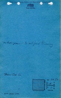
ISGS map library, 4103.V4 i5.1-107, is a composite map of 16 pieces combined into one map of Danville Belt Coal Company
|
| More Info:
|
4103 v4 i5 1-107.jpg
|
| Full Res Download:These files are true to scale and most are georegistered for gis software. These files may be a very large (>1GB) download!
|
https://wikiimage.isgs.illinois.edu/ilmines/vermilion/4103 v4 i5 1-107.zip
|
Photographs