Mine Index Number: 3849
| Company Name:
|
Henry Brothers Coal Company
|
| Mine Name:
|
Riverbank Mine
|
| Start Date:
|
1933
|
End Date:
|
1947
|
| Type of Mine:
|
Underground
|
| Total acres shown:
|
11
|
| Acres after map date:
|
Less than 1
|
General Area of mining acres shown:
|
|
|
The area shown is too large for the production by about 5 acres. The area shown may include another Larson mine (see the unlocated mines at the back of this report).
|
Shaft, Slope, Drift or Tipple Location(s)
| Type
|
County
|
Township-Range
|
Section
|
Part Section
|
| Main slope Report from state inspector McKenna indicated that the new escapement had been made the main haulage, and coal is hoisted out of that slope instead of the old drift entrance.
|
Vermilion
|
19N 12W
|
21
|
NW NW NW
|
| Drift
|
Vermilion
|
19N 12W
|
20
|
NW NE NE
|
| Air shaft ("new")
|
Vermilion
|
19N 12W
|
21
|
NW NW NW
|
| Air shaft ("old")
|
Vermilion
|
19N 12W
|
20
|
NW NE NE
|
| Slope
|
Vermilion
|
19N 12W
|
21
|
NW NW NW
|
| Air drift
|
Vermilion
|
19N 12W
|
21
|
NW NW NW
|
Geology
Geological Problems Reported
Production
| Company
|
Mine Name
|
Date
|
Production (tons)
|
| Riverbank Coal Company Operated by Larson Coal Company until March 1936, then bought by Riverbank Coal Company, c/o D. L. Moon. Changed management in 1937 to Thomas Bridgewater. Walter Martin operated this mine from January to March 1939, idle March through April, then operated by Charles Elliott, and still later in 1939 operated by Earl Enos. In 1940, management changed to Eric Magnusum. Operated under the name of Riverbank Coal Company through all these changes.
|
Riverbank
|
1936-1943
|
5,033
|
|
|
Production Notes
Coal Report production (if available)
Sources of Data
| Microfilm, document 352869
|
2-2-1945
|
1:720
|
1:1142
|
Not final
|
| Microfilm, document 352961
|
11-5-1938
|
1:480
|
1:828
|
Not final
|
Annotated Bibliography (Data source - brief description of information)
| Coal Reports - Production, ownership, years of operation.
|
| Directory of Illinois Coal Mines (Vermilion County) - Mine names, mine index, ownership, years of operation.
|
| Mine notes (Vermilion County) - Mine type, mine location, seam, depth, thickness.
|
| Microfilm map, document 352869, reel 03140, frame 497 - Mine openings, mine outline, mining method.
|
| Microfilm map, document 352961, reel 03141, frame 104 - Old air shaft, drift location, old workings, mine outline (western).
|
Mine Notes
Mine Images
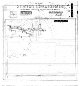
Microfilm: 352869
Map Date: 2-2-1945
Coal Co.: Sharon Coal Company
Mine Name: Riverbank Mine
Full Res Download
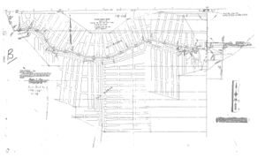
Microfilm: 352961
Map Date: 11-5-1938
Coal Co.: Riverbank Coal Company
Mine Name: Riverbank Mine
Full Res Download
Photographs


