Mine Index Number: 3850
| Company Name:
|
Dixon-Block Coal Company
|
| Mine Name:
|
Dixon-Block No. 2 Mine
|
| Start Date:
|
1944
|
End Date:
|
March 1946
|
| Type of Mine:
|
Surface
|
| Total acres shown:
|
16
|
| Acres after map date:
|
|
General Area of mining acres shown:
|
|
|
|
Shaft, Slope, Drift or Tipple Location(s)
| Type
|
County
|
Township-Range
|
Section
|
Part Section
|
| Tipple
|
Vermilion
|
19N 12W
|
30
|
|
Geology
Geological Problems Reported
Production
| Company
|
Mine Name
|
Date
|
Production (tons)
|
Production Notes
Coal Report production (if available)
Sources of Data
| USGS topographic map
|
PR 1978
|
1;24000
|
1:24000
|
Secondary source
|
| Coal Section composite map
|
Undated
|
1:62500
|
1:62500
|
Secondary source
|
Annotated Bibliography (Data source - brief description of information)
| Coal Reports - Production, ownership, years of operation.
|
| Directory of Illinois Coal Mines (Vermilion County) - Mine names, mine index, ownership, years of operation.
|
| Mine notes (Vermilion County) - Mine type, slope & tipple locations, seam, depth, thickness.
|
| USGS topographic map, 1966, Photorevised 1978 - Mine outline, mining method.
|
| Coal Section composite map, Danville Coal thickness (1-24-31-i) - Mine outline, mining method.
|
Mine Notes
Mine Images
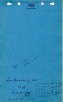
Coal Section files: 1-24-31-i
Map Date: Undated
Coal Co.: Dixon-Block Coal Company
Mine Name: Dixon-Block No. 2 Mine
Photographs