Mine Index Number: 4142
| Company Name:
|
Hill Coal Company
|
| Mine Name:
|
Hill Mine
|
| Start Date:
|
1917
|
End Date:
|
1937
|
| Type of Mine:
|
Underground
|
| Total acres shown:
|
9
|
| Acres after map date:
|
|
General Area of mining acres shown:
|
|
|
Not Shown On Map. This mine is not shown on the accompanying map because of later surface mining by the Delta Mine (mine index 0702).
|
Shaft, Slope, Drift or Tipple Location(s)
| Type
|
County
|
Township-Range
|
Section
|
Part Section
|
| Main slope The main slope is used as an air/escapment for Hill No. 2 (mine index 4143).
|
Williamson
|
9S 4E
|
34
|
SE SE SE
|
| Air shaft
|
Williamson
|
9S 4E
|
34
|
NE SE SE
|
Geology
| Springfield
|
30
|
|
|
4.17-4.25
|
MRP
|
Geological Problems Reported
Production
| Company
|
Mine Name
|
Date
|
Production (tons)
|
| W. N. Hill
|
Hill
|
1917-1923 Production not reported in 1922 for mines producing less than 10,000 tons
|
2,300
|
|
|
Production Notes
Coal Report production (if available)
Sources of Data
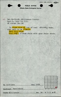
| Company, 4103.W52 i5.1-69
|
5-22-1940
|
1:1200
|
1:1200
|
Final
|
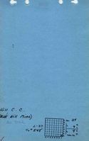
| Microfilm, document 353158
|
9-12-1937
|
1:1200
|
1:1406
|
Final
|
Annotated Bibliography (Data source - brief description of information)
| Coal Reports - Production, ownership, years of operation.
|
| Directory of Illinois Coal Mines (Williamson County) - Mine names, mine index, ownership, years of operation.
|
| Mine notes (Williamson County) - Mine type, shaft location, seam, depth, thickness.
|
| Company map, ISGS map library, 4103.W52 i5.1-69 - Slope and shaft location, mine outline.
|
| Microfilm map, document 353158, reel 04142, frame 45, map of Hill Mine No. 2 - Slope and shaft locations, mine outline, mining method.
|
Mine Notes
Mine Images
 These files may not be true to scale and are not georgistered. These files may not be true to scale and are not georgistered.
|
Map Type:
|
Company
|
| Map ID:
|
4103.w52 i5.1-69
|
| Company:
|
Hill Coal Company
|
| Mine Name:
|
|
| Caption:
|
|
| Map Date:
|
05-22-1940
|
| Map Status:
|
Final
|
| Image Credit:
|
|
| Note:
|
|
| More Info:
|
M4143
|
| Full Res Download:These files are true to scale and most are georegistered for gis software. These files may be a very large (>1GB) download!
|
https://go.illinois.edu/ILMImages/williamson/m4143.zip
|
![[[:Hill|Hill]]](https://go.illinois.edu/ILMImages/williamson/thumbnails/m4142_IL_1499_01_th.jpg) These files may not be true to scale and are not georgistered. These files may not be true to scale and are not georgistered.
|
Map Type:
|
State Archive
|
| Map ID:
|
IL_1499_01
|
| Company:
|
Hill Coal Company
|
| Mine Name:
|
Hill
|
| Caption:
|
|
| Map Date:
|
09-12-1937
|
| Map Status:
|
Final
|
| Image Credit:
|
|
| Note:
|
|
| More Info:
|
M4142 IL 1499 01
|
| Full Res Download:These files are true to scale and most are georegistered for gis software. These files may be a very large (>1GB) download!
|
https://go.illinois.edu/ILMImages/williamson/m4142 IL 1499 01.zip
|
Photographs