Mine Index Number: 4536
| Company Name:
|
Roberts Coal Company
|
| Mine Name:
|
Roberts No. 2 Mine
|
| Start Date:
|
1938
|
End Date:
|
March 1, 1941
|
| Type of Mine:
|
Underground
|
| Total acres shown:
|
1
|
| Acres after map date:
|
|
General Area of mining acres shown:
|
|
|
|
Shaft, Slope, Drift or Tipple Location(s)
| Type
|
County
|
Township-Range
|
Section
|
Part Section
|
| Slope
|
Vermilion
|
19N 12W
|
13
|
SE NW NE
|
Geology
| Danville
|
20-70
|
|
|
5.25-6.0
|
RP
|
Geological Problems Reported
Production
| Company
|
Mine Name
|
Date
|
Production (tons)
|
Production Notes
Coal Report production (if available)
Sources of Data
| Microfilm, document 352946
|
3-6-1943
|
1:600
|
1:1366
|
Secondary source
|
Annotated Bibliography (Data source - brief description of information)
| Coal Reports - Production, ownership, years of operation.
|
| Directory of Illinois Coal Mines (Vermilion County) - Mine names, mine index, ownership, years of operation.
|
| Mine notes (Vermilion County) - Mine type, slope location, seam, depth, thickness.
|
| Microfilm map, document 352946, reel 03141, frame 88, map of Swan Mine (mine index 3802) - Slope location, mine outline, mining method.
|
Mine Notes
Mine Images
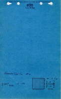
Microfilm: 352946
Map Date: 3-6-1943
Coal Co.: Swan Coal Company
Mine Name: Swan Mine
Full Res Download
Photographs