Mine Index Number: 7880
| Company Name:
|
Louis Lueking
|
| Mine Name:
|
Lueking No. 3 Mine
|
| Start Date:
|
1889
|
End Date:
|
1908
|
| Type of Mine:
|
Underground
|
| Total acres shown:
|
|
| Production Indicated Acres:
|
5
|
General Area of mining acres shown:
|
18
|
|
|
Shaft, Slope, Drift or Tipple Location(s)
| Type
|
County
|
Township-Range
|
Section
|
Part Section
|
| Main shaft
|
Macoupin
|
7N 9W
|
35
|
SW SE NE
|
| Escape shaft
|
Macoupin
|
7N 9W
|
35
|
SW SE NE
|
Geology
| Herrin
|
60-85
|
|
6.0
|
3.75-5.5
|
RP
|
Geological Problems Reported
Production
| Company
|
Mine Name
|
Date
|
Production (tons)
|
Production Notes
Coal Report production (if available)
Sources of Data
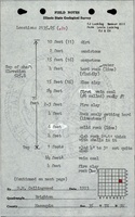
| ISGS field notes (D. M. Collingwood)
|
1923
|
(text only)
|
1:24000 Point plotted onto 1:24,000 USGS topographic map and digitized.
|
Secondary source
|
| Plat Book of Macoupin County
|
1893
|
1:31680
|
1:31680
|
Secondary source
|
Annotated Bibliography (Data source - brief description of information)
| Coal Reports - Production, ownership, years of operation, mine type, depth, thickness, mining method.
|
| ISGS field notes (Macoupin County) - Mine type, shaft locations, seam, depth, thickness.
|
| Plat Book of Macoupin Co., Illinois, 1893-94, Chicago?: The American Atlas Co., 79p. - Shaft location.
|
Mine Notes
Mine Images
 These files may not be true to scale and are not georgistered. These files may not be true to scale and are not georgistered.
|
Map Type:
|
Plat book of Macoupin County
|
| Map ID:
|
|
| Company:
|
|
| Mine Name:
|
|
| Caption:
|
|
| Map Date:
|
1893-1894
|
| Map Status:
|
Secondary
|
| Image Credit:
|
|
| Note:
|
|
| More Info:
|
M7880 1893-1894 plat
|
| Full Res Download:These files are true to scale and most are georegistered for gis software. These files may be a very large (>1GB) download!
|
https://go.illinois.edu/ILMImages/macoupin/m7880 1893-1894 plat.zip
|
Photographs