Category:Henry-County
County Coal Data
Mines that Appear in Henry-County
- 9998 & 9999 = Unknown dates
Unlocated Mines in Henry-County
Mine that have known coal production but no known location
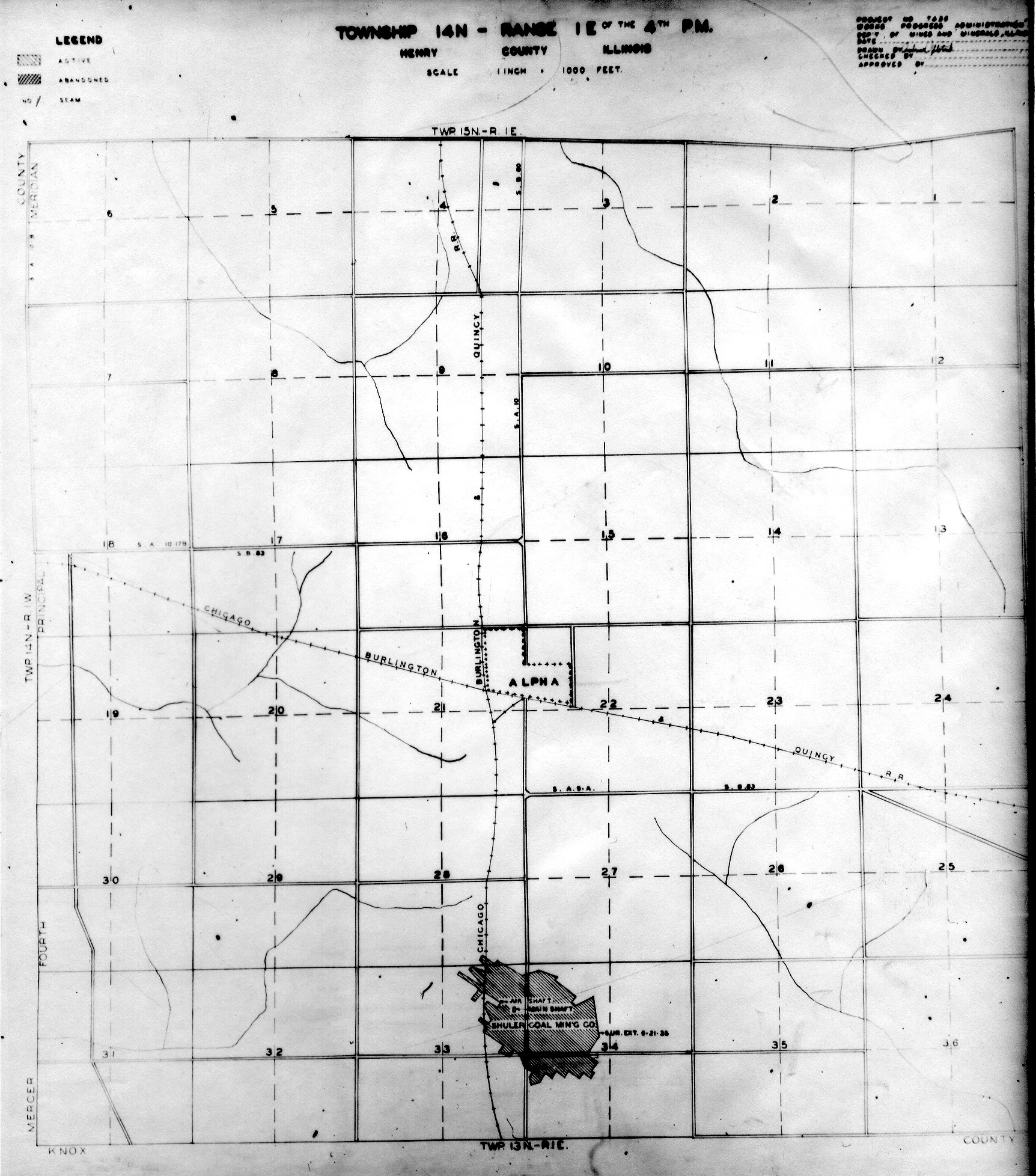
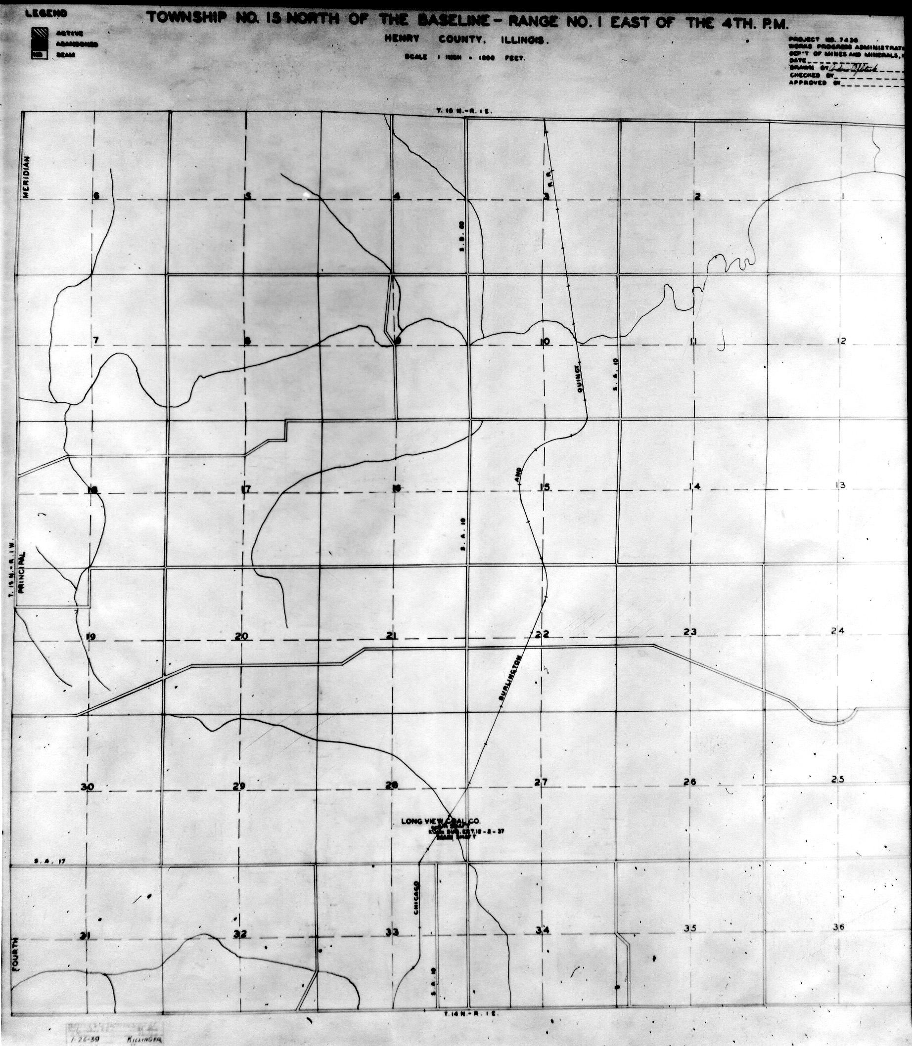
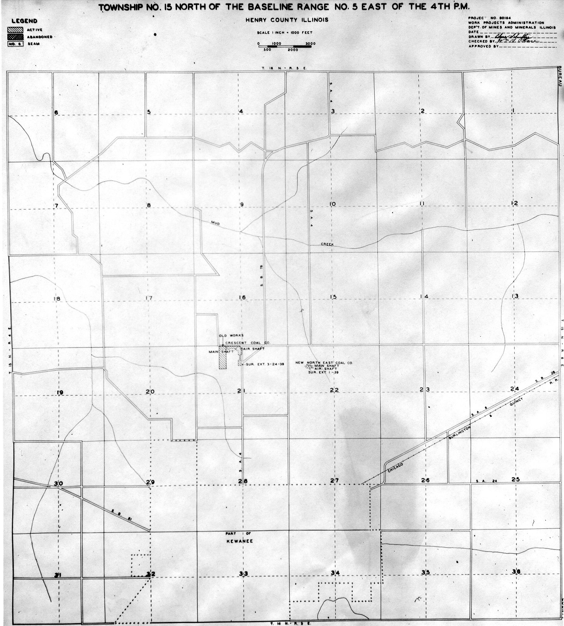
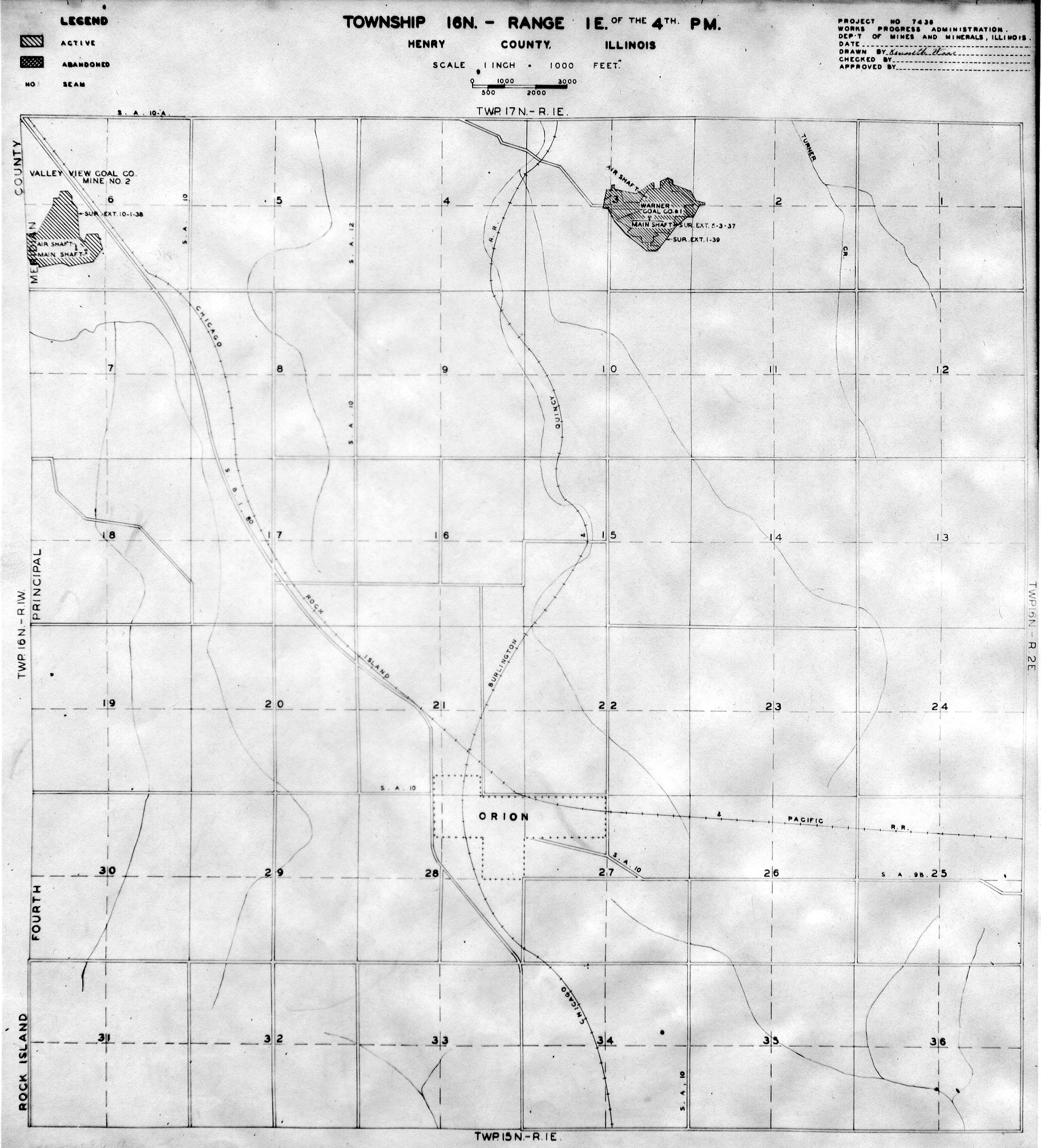
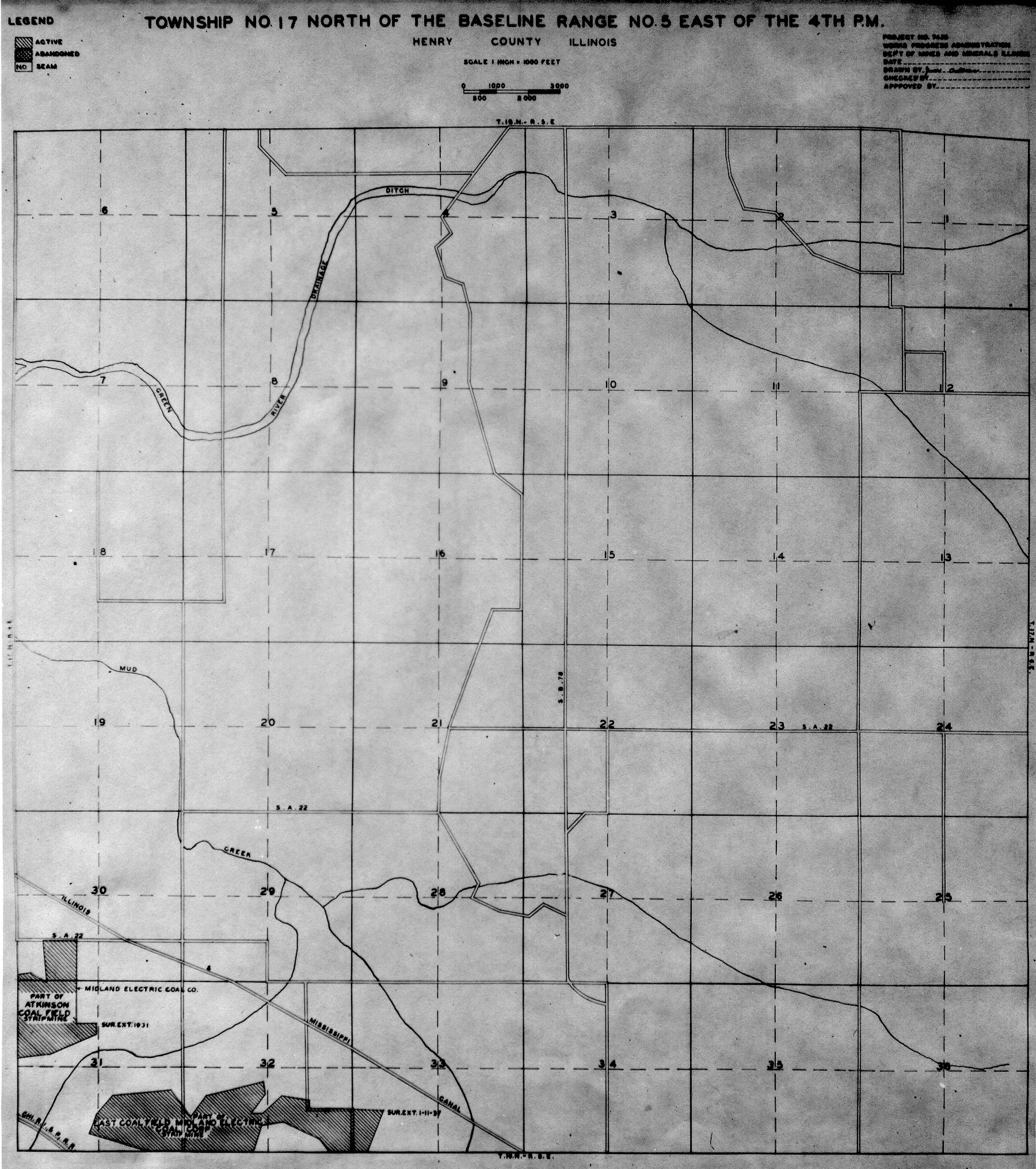
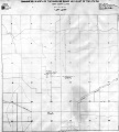
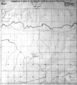
Historical Mined Out Area Maps
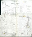
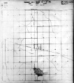
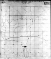
WPA
These maps were constructed as part of the nationwide Works Projects Administration (WPA), generally between 1934 and 1937 with some later updates or revisions,
Disclaimer
Maps for some locations might have multiple versions/seams, please inspected these areas closely for differences.
Notes and corrections were made by ISGS staff.
These maps are reproductions from microfilm, they may be of poor quality with text difficult to read.


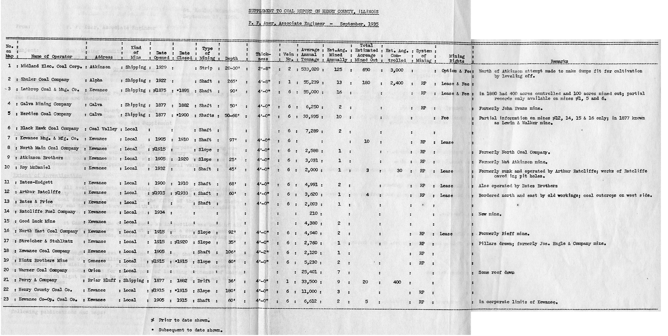
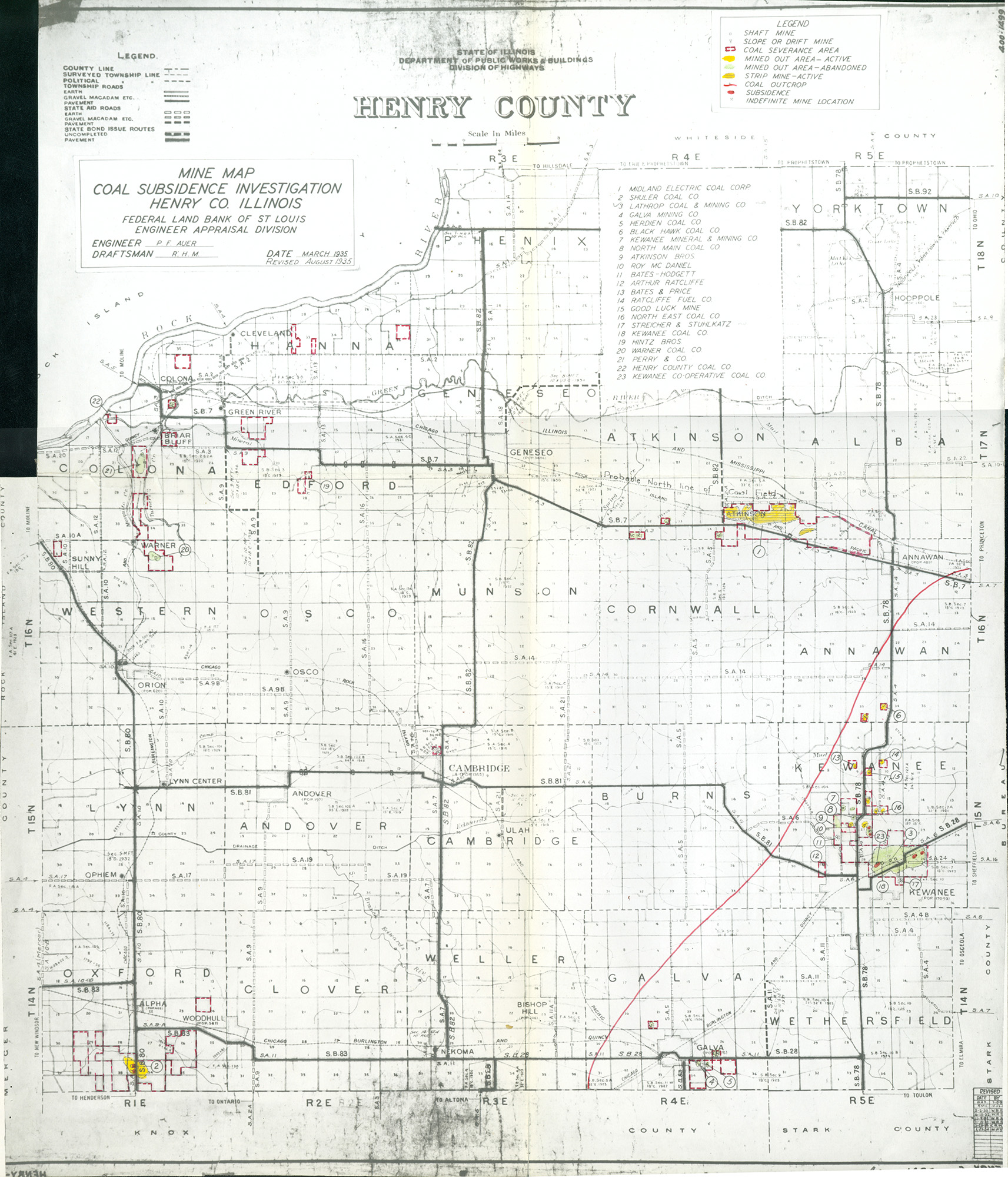
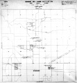
Federal Land Bank of St. Louis, Preliminary Reports on Subsidence Investigations
Federal Land Bank of St. Louis, Preliminary Reports on Subsidence Investigations (refered by Coal Section Staff as "Quade Maps")
Mining engineers working for the Federal Land Bank of St. Louis mapped areas of subsidence due to coal mining in the early 1930s. These reports often include county maps of mine properties with mined-out areas including shaft locations, as well as subsidence areas.
Disclaimer
Maps for some locations might have multiple versions/seams, please inspected these areas closely for differences.
These maps are accompanied by a report, please download and inspect this document.
Notes and corrections were made by ISGS staff.


Photographs
Pages in category "Henry-County"
The following 159 pages are in this category, out of 159 total.
1
2
5
7
Media in category "Henry-County"
The following 12 files are in this category, out of 12 total.
 QUADE HENRY TABLE.jpg 2,200 × 1,109; 826 KB
 QUADE HENRY.jpg 1,713 × 2,000; 1,012 KB
 WPA HENRY 14N1E.jpg 1,724 × 1,956; 1 MB
 WPA HENRY 15N1E.jpg 1,844 × 2,116; 1.16 MB
 WPA HENRY 15N5E NO 1.jpg 2,012 × 2,176; 524 KB
 WPA HENRY 15N5E NO 2.jpg 1,852 × 2,056; 1.13 MB
 WPA HENRY 16N1E.jpg 1,824 × 2,012; 1.17 MB
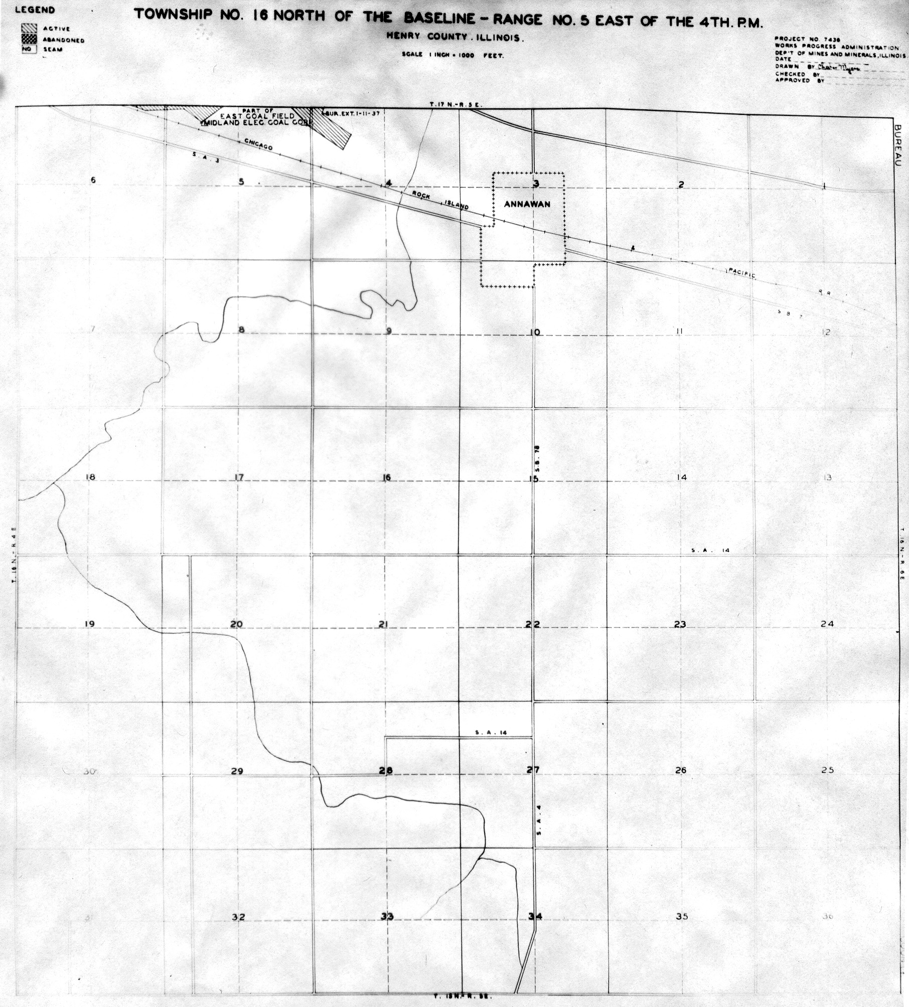
 WPA HENRY 16N5E.jpg 1,812 × 2,008; 995 KB
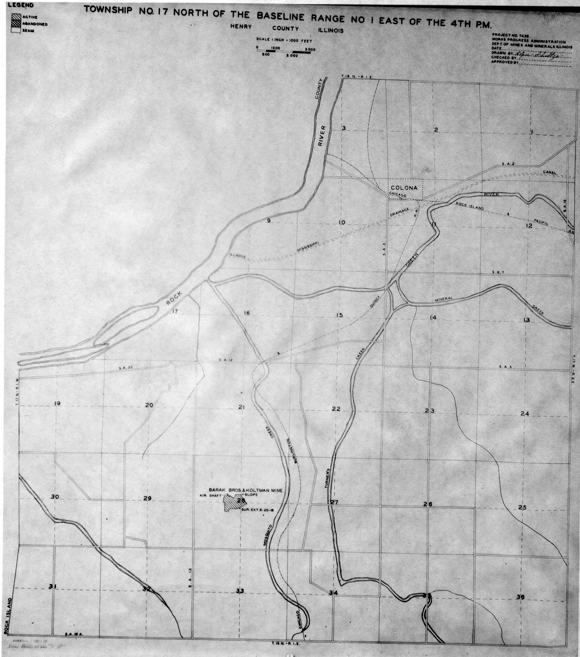
 WPA HENRY 17N1E.jpg 1,900 × 2,152; 1.5 MB
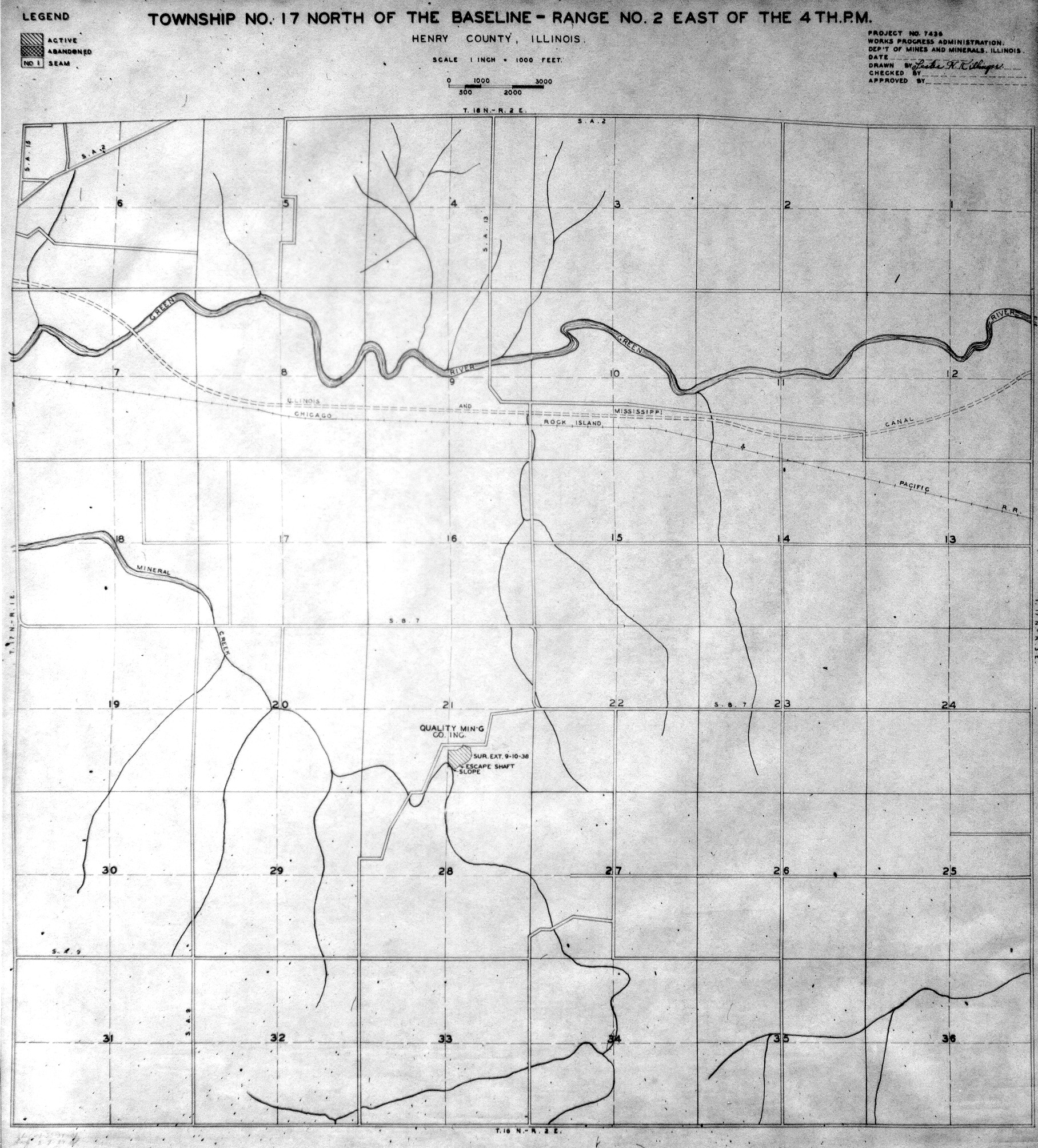
 WPA HENRY 17N2E.jpg 1,816 × 2,008; 1.29 MB
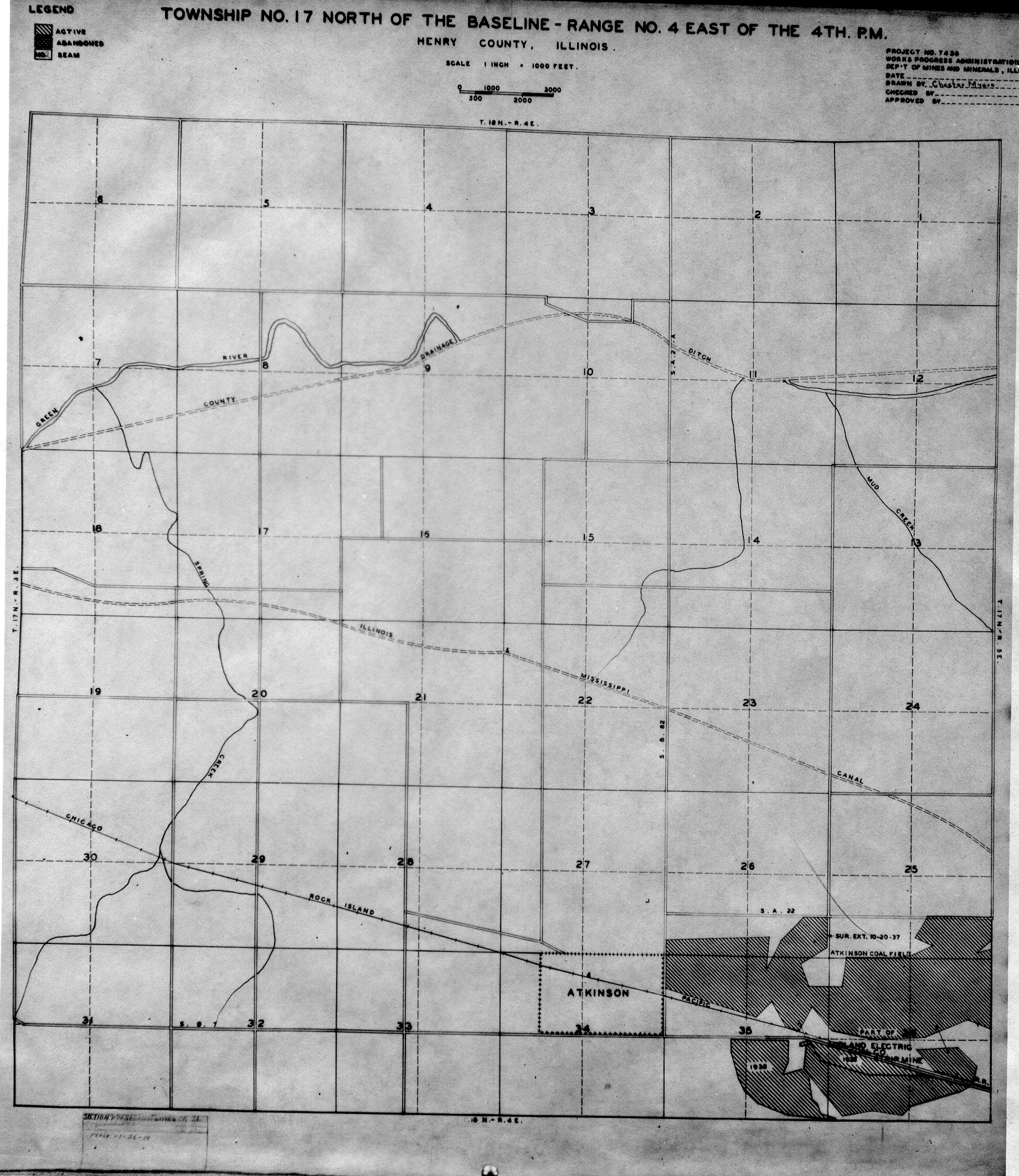
 WPA HENRY 17N4E.jpg 1,840 × 2,124; 1.5 MB
 WPA HENRY 17N5E.jpg 1,800 × 2,032; 1.42 MB