0066: Difference between revisions
No edit summary |
No edit summary |
||
| (2 intermediate revisions by 2 users not shown) | |||
| Line 4: | Line 4: | ||
|unlocated=No | |unlocated=No | ||
|shown_on_map=Yes | |shown_on_map=Yes | ||
|reason_nsm=The boundaries between this mine, Superior No. 1 (mine index | |reason_nsm=The boundaries between this mine, Superior No. 1 (mine index [[0413]]), No. 2 (mine index [[0503]]), and No. 4 (mine index [[0188]]) could not be distinguished. The acreage reported is the total for all four mines. | ||
|Mine-index=0066 | |Mine-index=0066 | ||
|Coal_co=Superior Coal Company | |Coal_co=Superior Coal Company | ||
|Mine Name Header=Superior No. 3 Mine | |Mine Name Header=Superior No. 3 Mine | ||
|mine_type=Underground | |mine_type=Underground | ||
|mined-out-area=19, | |mined-out-area=19,186 | ||
|indicated=No | |||
|indicated= | |||
|county1=Macoupin | |county1=Macoupin | ||
|quad1=Gillespie North | |quad1=Gillespie North | ||
| Line 18: | Line 17: | ||
|year-start=1905 | |year-start=1905 | ||
|year-end=October 1953 | |year-end=October 1953 | ||
|Latitude= | |Latitude=39.09991966 | ||
|Longitude= | |Longitude=-89.82841871 | ||
|Zoom= | |Zoom=12 | ||
}} | }} | ||
==Shaft, Slope, Drift or Tipple Location(s)== | ==Shaft, Slope, Drift or Tipple Location(s)== | ||
| Line 70: | Line 69: | ||
{{Source map header}} | {{Source map header}} | ||
{{Source Map | {{Source Map | ||
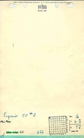
|Source Map= | |Source Map=State archive, IL_1124 | ||
|Map Date=10-29-1953 | |Map Date=10-29-1953 | ||
|Original Scale=1:4800 | |Original Scale=1:4800 | ||
|Digitized Scale=1: | |Digitized Scale=1:4800 | ||
|Map Type=Final | |Map Type=Final | ||
}} | }} | ||
{{Source Map | {{Source Map | ||
|Source Map= | |Source Map=State archive, IL_1102 | ||
|Map Date=8-7-1953 | |Map Date=8-7-1953 | ||
|Original Scale=1:4800 | |Original Scale=1:4800 | ||
|Digitized Scale=1: | |Digitized Scale=1:4800 | ||
|Map Type=Final | |Map Type=Final | ||
}} | }} | ||
{{Source Map | {{Source Map | ||
|Source Map= | |Source Map=State archive, IL_1126_03 | ||
|Map Date= | |Map Date=5-9-1951 | ||
|Original Scale=1:4800 | |Original Scale=1:4800 | ||
|Digitized Scale=1: | |Digitized Scale=1:4800 | ||
|Map Type= | |Map Type=Final | ||
}} | }} | ||
{{Source Map | {{Source Map | ||
|Source Map= | |Source Map=State archive, IL_1130 | ||
|Map Date= | |Map Date=5-25-1954 | ||
|Original Scale=1:4800 | |Original Scale=1:4800 | ||
|Digitized Scale=1: | |Digitized Scale=1:4800 | ||
|Map Type= | |Map Type=Final | ||
}} | }} | ||
{{Annotated bibliography header}} | {{Annotated bibliography header}} | ||
| Line 108: | Line 107: | ||
}} | }} | ||
{{Annotated bibliography | {{Annotated bibliography | ||
|bibliography= | |bibliography=State archive, IL_1124 - Shaft locations, mine outline (west, north), mining method. | ||
}} | }} | ||
{{Annotated bibliography | {{Annotated bibliography | ||
|bibliography= | |bibliography=State archive, IL_1102 map of Superior No. 2 (mine index [[0503]]) - Mine outline (southeast, south central). | ||
}} | }} | ||
{{Annotated bibliography | {{Annotated bibliography | ||
|bibliography= | |bibliography=State archive, IL_1126_03, map of Superior No. 1 (mine index [[0413]]) - Mine outline (east, northeast, north central). | ||
}} | }} | ||
{{Annotated bibliography | {{Annotated bibliography | ||
|bibliography= | |bibliography=State archive, IL_1130, map of Superior No. 4 (mine index [[0188]]) - Mine outline (west, southwest). | ||
}} | }} | ||
==Mine Notes== | ==Mine Notes== | ||
Latest revision as of 16:29, October 17, 2023
Mine Index Number: 0066
| Company Name: | Superior Coal Company | ||
|---|---|---|---|
| Mine Name: | Superior No. 3 Mine | ||
| Start Date: | 1905 | End Date: | October 1953 |
| Type of Mine: | Underground | ||
| Total acres shown: | 19,186 | ||
| Acres after map date: | General Area of mining acres shown: | ||
|
The boundaries between this mine, Superior No. 1 (mine index 0413), No. 2 (mine index 0503), and No. 4 (mine index 0188) could not be distinguished. The acreage reported is the total for all four mines. | |||
Shaft, Slope, Drift or Tipple Location(s)
| Type | County | Township-Range | Section | Part Section |
|---|
| Main shaft | Macoupin | 8N 7W | 36 | 50 FNL, 440 FWL |
| Air shaft | Macoupin | 8N 7W | 36 | NE NW NW |
Geology
| Thickness (ft) | |||||
|---|---|---|---|---|---|
| Seam | Depth (ft) | Min | Max | Ave | Mining Method |
| Herrin | 340-350 | 6.0 | 9.33 | 7.0-7.5 | RPP |
Geological Problems Reported
Concretions (some 5 feet long, 3 feet wide and 1.5 feet thick) surrounded by slips were present and fell without warning. Limestone protrusions extended down into the coal seam. Roof conditions in this mine were otherwise considered very good. The floor clay heaved, but was thin (1.5 to 2 feet).
Production
| Company | Mine Name | Date | Production (tons) |
| Superior Coal Company | Superior No. 3 | 1905-1953 | 36,857,601 |
| Total Production: 36,857,601 | |||
Production Notes
Coal Report production (if available)
Sources of Data
| Source Map | Map Date | Original Scale | Digitized Scale | Map Type |
| State archive, IL_1124 | 10-29-1953 | 1:4800 | 1:4800 | Final |
| State archive, IL_1102 | 8-7-1953 | 1:4800 | 1:4800 | Final |
| State archive, IL_1126_03 | 5-9-1951 | 1:4800 | 1:4800 | Final |
| State archive, IL_1130 | 5-25-1954 | 1:4800 | 1:4800 | Final |
Annotated Bibliography (Data source - brief description of information)
| Coal Reports - Production, ownership, years of operation. |
| Directory of Illinois Coal Mines (Macoupin County) - Mine names, mine index, ownership, years of operation. |
| Mine notes (Macoupin County) - Mine type, shaft location, seam, depth, thickness, geologic problems. |
| State archive, IL_1124 - Shaft locations, mine outline (west, north), mining method. |
| State archive, IL_1102 map of Superior No. 2 (mine index 0503) - Mine outline (southeast, south central). |
| State archive, IL_1126_03, map of Superior No. 1 (mine index 0413) - Mine outline (east, northeast, north central). |
| State archive, IL_1130, map of Superior No. 4 (mine index 0188) - Mine outline (west, southwest). |
Mine Notes
Mine Images
![[[:Superior No. 2|Superior No. 2]]](https://go.illinois.edu/ILMImages/macoupin/thumbnails/m0503_IL_1102_th.jpg)
![[[:Superior No. 1|Superior No. 1]]](https://go.illinois.edu/ILMImages/macoupin/thumbnails/m0413_IL_1126_th.jpg)
![[[:Superior No. 4|Superior No. 4]]](https://go.illinois.edu/ILMImages/macoupin/thumbnails/m0188_IL_1130_th.jpg)
![[[:Superior No. 3|Superior No. 3]]](https://go.illinois.edu/ILMImages/macoupin/thumbnails/m0066_IL_1124_th.jpg)
Photographs