3733: Difference between revisions
No edit summary |
No edit summary |
||
| Line 1: | Line 1: | ||
{{Sidebar Info Query}} | {{Sidebar Info Query}} | ||
{{Header | {{Header | ||
|checked= | |checked=Checked OK | ||
|unlocated=No | |unlocated=No | ||
|shown_on_map=Yes | |shown_on_map=Yes | ||
|reason_nsm=The eastern mine boundary is more like a general area of mining, but was extended to include the shaft location as indicated in the mine notes. Some of the area shown for the Bluebird Mine may have been mined by the Kellyville No. 1 Mine (mine index 3731). | |reason_nsm=The eastern mine boundary is more like a general area of mining, but was extended to include the shaft location as indicated in the mine notes. Some of the area shown for the Bluebird Mine may have been mined by the Kellyville No. 1 Mine (mine index [[3731]]). | ||
|Mine-index=3733 | |Mine-index=3733 | ||
|Coal_co=John OConnell | |Coal_co=John OConnell | ||
|Mine Name Header=Bluebird Mine | |Mine Name Header=Bluebird Mine | ||
|mine_type=Underground | |mine_type=Underground | ||
|mined-out-area=42 | |mined-out-area=42 | ||
|after_map=12 | |||
|indicated=Yes | |||
|county1=Vermilion | |county1=Vermilion | ||
|quad1=Danville SE | |quad1=Danville SE | ||
Revision as of 11:07, September 7, 2022
Mine Index Number: 3733
| Company Name: | John OConnell | ||
|---|---|---|---|
| Mine Name: | Bluebird Mine | ||
| Start Date: | 1892 | End Date: | 1907 |
| Type of Mine: | Underground | ||
| Total acres shown: | 42 | ||
| Production Indicated Acres: | 12 | General Area of mining acres shown: | |
|
The eastern mine boundary is more like a general area of mining, but was extended to include the shaft location as indicated in the mine notes. Some of the area shown for the Bluebird Mine may have been mined by the Kellyville No. 1 Mine (mine index 3731). | |||
Shaft, Slope, Drift or Tipple Location(s)
| Type | County | Township-Range | Section | Part Section |
|---|
| Main shaft | Vermilion | 19N 11W | 32 | SW NE SE |
Geology
| Thickness (ft) | |||||
|---|---|---|---|---|---|
| Seam | Depth (ft) | Min | Max | Ave | Mining Method |
| Herrin | 30-60 | 6.0-7.0 | RP |
Geological Problems Reported
Production
| Company | Mine Name | Date | Production (tons) |
| William Kelly | Kelly | 1892-1894 | 2,265 |
| OConnell and Hume | Bluebird | 1894-1896 | 43,204 |
| John OConnell | Bluebird | 1896-1907 | 354,025 |
| Total Production: 399,494 | |||
Production Notes
Coal Report production (if available)
Sources of Data
| Source Map | Map Date | Original Scale | Digitized Scale | Map Type |
| ISGS mine notes | undated | (text only) | 1:24000 Point plotted onto 1:24,000 USGS topographic map and digitized. | Undated |
| ISGS map library, 4103.V4 i5.1-107 | undated | 1:3400 | 1:3400 | Secondary source |
| State Archive, MSHA_1050_01 | 4-11-1909 | 1:2400 | 1:2400 | Secondary source |
Annotated Bibliography (Data source - brief description of information)
| Coal Reports - Production, ownership, years of operation, depth, thickness, mining method. |
| Directory of Illinois Coal Mines (Vermilion County) - Mine names, mine index, ownership, years of operation. |
| Mine notes (Vermilion County) - Mine type, shaft location, seam. |
| ISGS map library, 4103.V4 i5.1-107, map of Danville Belt Coal Company - Shaft location. |
| State Archive, MSHA_1050_01, map of Kelly No. 5 Mine (mine index 3740) - Mine outline (northwestern). |
Mine Notes
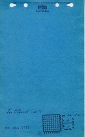
Mine Images


Photographs