Mine Index Number: 3740
| Company Name:
|
Bunsen Coal Company
|
| Mine Name:
|
Kelly No. 5 Mine
|
| Start Date:
|
1902
|
End Date:
|
1911
|
| Type of Mine:
|
Underground
|
| Total acres shown:
|
263
|
| Acres after map date:
|
|
General Area of mining acres shown:
|
|
|
|
Shaft, Slope, Drift or Tipple Location(s)
| Type
|
County
|
Township-Range
|
Section
|
Part Section
|
| Main shaft
|
Vermilion
|
19N 11W
|
32
|
NE SW NE
|
| Air shaft
|
Vermilion
|
19N 11W
|
32
|
SE NW NE
|
Geology
Geological Problems Reported
Production
| Company
|
Mine Name
|
Date
|
Production (tons)
|
| Kelly Coal Company
|
Kelly No. 45
|
1906-1909 Idle 1909. The title block for the 1909 source map indicates the mine was owned by Hammond Coal Company, and was known as the No. 45 Mine. A handwritten note on the map blueline print states the mine was operated by Brazil Block Coal Company. Production was not reported under either name.
|
308,135
|
|
|
Production Notes
Coal Report production (if available)
Sources of Data
| ISGS map library, 4103.V4 i5.1-135 The map is incomplete in the northwestern part of the mine.
|
7-1-1947
|
1:42240
|
1:42240
|
Secondary source
|
| State Archive, MSHA_1050_01
|
4-11-1909
|
1:2400
|
1:2400
|
Not final
|
Annotated Bibliography (Data source - brief description of information)
| Coal Reports - Production, ownership, years of operation, depth, thickness.
|
| Directory of Illinois Coal Mines (Vermilion County) - Mine names, mine index, ownership, years of operation.
|
| Mine notes (Vermilion County) - Mine type, shaft location, seam, thickness.
|
| ISGS map library, 4103.V4 i5.1-135, property map of U.S. Coal & Coke - Mine location, mine outline.
|
| ISGS map library, 4103.V4 i5.1-124, map of Kelly No. 4 (mine index 3660) - Mine outline, mine location, mining method.
|
| Company map, State Archive, MSHA_1050_01, courtesy Robert Gibson, DNR - Mine outline, shaft locations, mining method.
|
Mine Notes
Mine Images
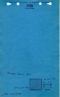
Company: MSHA_1050
Map Date: 4-11-1909
Coal Co.: Bunsen Coal Company
Mine Name: Kelly No. 5 Mine
Image Credit: Illinois Department of Natural Resources - Office of Mines and Minerals
Full Res Download
Photographs
Caption: Brick house near Danville abandoned on account of danger by room-and-pillar mining of a 6-foot coal at a depth of about 200 feet.
Credit: Illinois State Geological Survey
Date: Pre-1914
Publication: Fig. 42 Cooperative Bulletin 17 – Subsidence in Illinois
Library No.: M-1007
Caption: Brick house near Danville abandoned on account of danger by room-and-pillar mining of a 6-foot coal at a depth of about 200 feet.
Credit: Illinois State Geological Survey
Date: Pre-1914
Library No.: M-1008
Caption: Brick house near Danville abandoned on account of danger by room-and-pillar mining of a 6-foot coal at a depth of about 200 feet.
Credit: Illinois State Geological Survey
Date: Pre-1914
Library No.: M-1009
Caption: Brick house near Danville abandoned on account of danger by room-and-pillar mining of a 6-foot coal at a depth of about 200 feet.
Credit: Illinois State Geological Survey
Date: Pre-1914
Library No.: M-1010
Caption: Brick house near Danville abandoned on account of danger by room-and-pillar mining of a 6-foot coal at a depth of about 200 feet.
Credit: Illinois State Geological Survey
Date: Pre-1914
Library No.: M-1011
Caption: Subsidence Kelly No 5 Mine
(Mine Index:3740)
Credit: Illinois State Geological Survey
Date: Pre-1914
Library No.: M-929