Mine Index Number: 3731
| Company Name:
|
Kellyville Coal Company
|
| Mine Name:
|
Kellyville No. 1 Mine
|
| Start Date:
|
1878
|
End Date:
|
1898
|
| Type of Mine:
|
Underground
|
| Total acres shown:
|
253
|
| Acres after map date:
|
|
General Area of mining acres shown:
|
|
|
|
Shaft, Slope, Drift or Tipple Location(s)
| Type
|
County
|
Township-Range
|
Section
|
Part Section
|
| Main shaft
|
Vermilion
|
19N 11W
|
32
|
SE SW SE No air shafts were shown in this portion of the Kelly mines complex. Interconnection with other Kelly mines underground probably provided air and escapeways to satisfy regulations of the times.
|
Geology
Geological Problems Reported
Production
| Company
|
Mine Name
|
Date
|
Production (tons)
|
| Michael Kelly
|
Kelly No. 1
|
1878-1891 The mine reported in 1879 & the mine reported in 1882 may be different mines; 1882 was reputedly a surface mine. Production in 1881 and prior to 1878 is unknown.
|
568,220
|
|
|
|
|
|
|
|
| Total Production: 1,015,956
|
Production Notes
Coal Report production (if available)
Sources of Data
| State Archive, MSHA_1050_01
|
4-11-1909
|
1:2400
|
1:2400
|
Secondary source
|
| ISGS map library, 4103.V4 i5.1-135
|
7-1-1947
|
1:42240
|
1:42240
|
Secondary source
|
Annotated Bibliography (Data source - brief description of information)
| Coal Reports - Production, ownership, years of operation, depth, thickness, mining method.
|
| Directory of Illinois Coal Mines (Vermilion County) - Mine names, mine index, ownership, years of operation.
|
| Mine notes (Vermilion County) - Mine type, shaft location, seam.
|
| State Archive, MSHA_1050_01, map of Hammond No. 45 Mine (mine index 3740), courtesy Robert Gibson, DNR - Mine outline (northern).
|
| ISGS map library, 4103.V4 i5.1-135, property map of U.S. Coal & Coke Company - Shaft location, mine outline, mining method.
|
Mine Notes
Mine Images
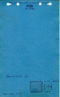
Company: MSHA_1050
Map Date: 4-11-1909
Coal Co.: Bunsen Coal Company
Mine Name: Kelly No. 5 Mine
Image Credit: Illinois Department of Natural Resources - Office of Mines and Minerals
Full Res Download
Photographs