Category:Galatia-Quadrangle: Difference between revisions
Alan.Myers (talk | contribs) (Created page with "{{County-Page}}") |
Alan.Myers (talk | contribs) No edit summary |
||
| Line 1: | Line 1: | ||
{{County- | __NOTOC__ | ||
==Mining in the Galatia Quadrangle== | |||
Mining began in the Galatia Quadrangle in 1902, when the [[0798|Galatia Coal]] Company opened a mine in the | |||
Herrin Coal, several miles north and west of Harrisburg. The following year, the [[0127|Diamond Coal Company]] | |||
began operation, mining the Springfield Coal northeast of Harrisburg. Mining continues today at American | |||
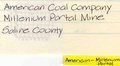
Coal Company’s Galatia Mine ([[1001|mine index 1001]]) and at Millennium Portal ([[1032|mine index 1032]]), both active | |||
underground mines. | |||
The [[ilstrat:2660Herrin Coal]] and the [[ilstrat:2790Springfield Coal]] are the major seams mined in the quadrangle. | |||
The [[ilstrat:2660Herrin Coal] is typically 4 to 6 feet thick and ranges from 60 to 80 feet deep in the southern part of the | |||
quadrangle to over 400 feet deep in the vicinity of Galatia. The Springfield Coal ranges from less than 200 | |||
feet deep in the Sahara No. 16 Mine ([[0801|mine index 801]]) to over 600 feet deep at the northern edge of the | |||
quadrangle. The seam averages 5 to 7.5 feet thick. | |||
Mining methods were sometimes varied within a mine due to the changing conditions presented by the | |||
seam. In the Sahara No. 20 Mine ([[0909|mine index 909]]), for instance, there were several areas where | |||
conventional mining was practiced, others where continuous miners were used, and still others where | |||
longwall methods were employed. The Springfield Coal is often interrupted by ‘rolls’, or channel fills, and | |||
by sheared fractured zones where the coal is crushed. In some locations, large plant fossils, including | |||
leaves, stems and bark, were seen in the roof. Occasionally fossil tree stumps, or ‘kettlebottoms’, were | |||
found in growth position. | |||
This quadrangle lies in an area of southern Illinois disturbed by the Cottage Grove Fault System. This | |||
system consists of one or more east-west trending master faults and numerous northwest-southeast | |||
trending subsidiary faults. Many large faults and igneous dikes have been encountered in the mines. The | |||
dikes are generally a few feet to 30 feet wide and up to several miles long. Nelson (1981 and 1983) and | |||
Nelson and Krausse (1981) provide detailed descriptions of the channels, faults, dikes and other | |||
disturbances found in these mines. | |||
==Map and Directory PDF Download== | |||
[https://wikiimage.isgs.illinois.edu/ilmines/webfiles/topo-mines/galatia.pdf Coal Mines In Illinois Galatia Quadrangle]</br> | |||
==Mines that Appear on the Galatia Quadrangle== | |||
{{#css: | |||
#mw-subcategories {display: none} | |||
#mw-pages {display: none} | |||
#mw-category-media {display: none} | |||
}} | |||
{{#ask:[[Category:Galatia-Quadrangle]] | |||
[[:+]] | |||
[[Unlocated::No]] | |||
|?combined = Coal Company, Mine Name | |||
|?County | |||
|format=datatable|limit=500|link=all|sort=Mine Index|order=asc|headers=plain|mainlabel=Mine Index|searchlabel=... further results|class=sortable wikitable smwtable|sep=<br>|Default='''Mines for this quadrangle have not been entered into Ilmines-Wiki see download above for more information'''}} | |||
==Unlocated Mines== | |||
===Saline County=== | |||
{{#ask:[[Category:Saline-County]] | |||
[[:+]] | |||
[[Unlocated::Yes]] | |||
|?combined = Coal Company, Mine Name | |||
|?City | |||
|format=datatable|limit=500|link=all|sort=Mine Index|order=asc|headers=plain|mainlabel=Mine Index|searchlabel=... further results|default=There are no known Unlocated mines in this county |class=sortable wikitable smwtable|sep=<br>}} | |||
{{DISPLAYTITLE:Galatia Quadrangle}} | |||
Latest revision as of 13:24, February 18, 2022
Mining in the Galatia Quadrangle
Mining began in the Galatia Quadrangle in 1902, when the Galatia Coal Company opened a mine in the Herrin Coal, several miles north and west of Harrisburg. The following year, the Diamond Coal Company began operation, mining the Springfield Coal northeast of Harrisburg. Mining continues today at American Coal Company’s Galatia Mine (mine index 1001) and at Millennium Portal (mine index 1032), both active underground mines.
The ilstrat:2660Herrin Coal and the ilstrat:2790Springfield Coal are the major seams mined in the quadrangle. The [[ilstrat:2660Herrin Coal] is typically 4 to 6 feet thick and ranges from 60 to 80 feet deep in the southern part of the quadrangle to over 400 feet deep in the vicinity of Galatia. The Springfield Coal ranges from less than 200 feet deep in the Sahara No. 16 Mine (mine index 801) to over 600 feet deep at the northern edge of the quadrangle. The seam averages 5 to 7.5 feet thick.
Mining methods were sometimes varied within a mine due to the changing conditions presented by the seam. In the Sahara No. 20 Mine (mine index 909), for instance, there were several areas where conventional mining was practiced, others where continuous miners were used, and still others where longwall methods were employed. The Springfield Coal is often interrupted by ‘rolls’, or channel fills, and by sheared fractured zones where the coal is crushed. In some locations, large plant fossils, including leaves, stems and bark, were seen in the roof. Occasionally fossil tree stumps, or ‘kettlebottoms’, were found in growth position.
This quadrangle lies in an area of southern Illinois disturbed by the Cottage Grove Fault System. This system consists of one or more east-west trending master faults and numerous northwest-southeast trending subsidiary faults. Many large faults and igneous dikes have been encountered in the mines. The dikes are generally a few feet to 30 feet wide and up to several miles long. Nelson (1981 and 1983) and Nelson and Krausse (1981) provide detailed descriptions of the channels, faults, dikes and other disturbances found in these mines.
Map and Directory PDF Download
Coal Mines In Illinois Galatia Quadrangle
Mines that Appear on the Galatia Quadrangle
Unlocated Mines
Saline County
Pages in category "Galatia-Quadrangle"
The following 29 pages are in this category, out of 29 total.
M
- FileList:M 0798 IL 2575 01
- FileList:M0044
- FileList:M0124 IL 2590 03
- FileList:M0798 IL 2576 01
- FileList:M0801 IL 356 06
- FileList:M0909
- FileList:M1001 6 374aa 2018
- FileList:M1001 6 374e springfield 2005.jpg
- FileList:M1001 6 374Y herrin 2017
- FileList:M1001 6-374m
- FileList:M1001 6-374n
- FileList:M1001 6-374o
- FileList:M1001 6-374p
- FileList:M1001 6-374s
- FileList:M1015.tif
Media in category "Galatia-Quadrangle"
The following 15 files are in this category, out of 15 total.
 M0044 minenotes.pdf 731 × 1,172, 27 pages; 5.61 MB
 M0045 minenotes.pdf 745 × 1,183, 23 pages; 4.93 MB
 M0124 fieldnotes.pdf 750 × 1,191, 3 pages; 610 KB
 M0124 minenotes.pdf 743 × 1,183, 27 pages; 5.96 MB
 M0125 minenotes.pdf 745 × 1,183, 52 pages; 11.13 MB
 M0127 minenotes.pdf 731 × 1,172, 31 pages; 6.94 MB
 M0535 minenotes.pdf 731 × 1,172, 13 pages; 2.81 MB
 M0608 minenotes.pdf 731 × 1,172, 3 pages; 415 KB
 M0798 fieldnotes.pdf 756 × 1,189; 257 KB
 M0798 minenotes.pdf 700 × 1,160, 18 pages; 4 MB
 M0801 minenotes.pdf 706 × 1,162, 35 pages; 7.9 MB
 M0909 minenotes.pdf 739 × 1,183, 80 pages; 7.89 MB
 M1001 minenotes.pdf 743 × 1,175, 150 pages; 40.92 MB
 M1015 minenotes.pdf 731 × 1,172, 25 pages; 6 MB
 M1032 minenotes.pdf 535 × 293, 6 pages; 1.01 MB