Mine Index Number: 3533
| Company Name:
|
Victoria Coal Company
|
| Mine Name:
|
Branch Mine (aka Victoria No. 1)
|
| Start Date:
|
1890
|
End Date:
|
May 1924
|
| Type of Mine:
|
Underground
|
| Total acres shown:
|
207
|
| Production Indicated Acres:
|
50 additional acres that are not accounted for by the acres added by the adjacent mine.
|
General Area of mining acres shown:
|
|
|
Connected underground to White Rose Mine (mine index 0783) in SE 29-T1N-R8W and NE 32-T1N-R8W.
|
Shaft, Slope, Drift or Tipple Location(s)
| Type
|
County
|
Township-Range
|
Section
|
Part Section
|
| Main shaft
|
St. Clair
|
1N 8W
|
28
|
NW NW SW
|
| Shaft
|
St. Clair
|
1N 8W
|
28
|
NW NW SW
|
Geology
Geological Problems Reported
Production
| Company
|
Mine Name
|
Date
|
Production (tons)
|
|
|
|
|
|
| Total Production: 1,483,788
|
Production Notes
Coal Report production (if available)
Sources of Data
| Microfilm, document 351039
|
1910
|
1:1200
|
1:2317
|
Not final
|
| ISGS map library, 4103.S31 i5.1-22
|
12-14-1942
|
1:2400
|
1:2400
|
Secondary source
|
Annotated Bibliography (Data source - brief description of information)
| Coal Reports - Production, ownership, years of operation.
|
| Directory of Illinois Coal Mines (St. Clair County) - Mine names, mine index, ownership, years of operation.
|
| Mine notes (St. Clair County) - Shaft location, mine type, seam, depth, thickness.
|
| Microfilm map, document 351039, reel 03134, frame 127 - Shaft locations, mine outline, mining method.
|
| ISGS map library, 4103.S31 i5.1-22, map of White Rose Mine (mine index 0783) - Mine outline (western, southern).
|
Mine Notes
Mine Images
Map library: 4103.S31 i5.1-22
Map Date: 12-14-1942
Coal Co.: White Rose Coal Company
Mine Name: White Rose Mine
Full Res Download
Microfilm: 351039
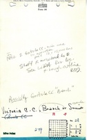
Map Date: 1910
Coal Co.: Victoria Coal Company
Mine Name: Branch Mine
Full Res Download
Photographs