Mine Index Number: 3748
| Company Name:
|
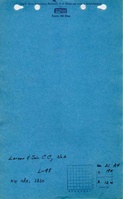
Larson Coal Company
|
| Mine Name:
|
Larson No. 2 Mine
|
| Start Date:
|
1934
|
End Date:
|
1938
|
| Type of Mine:
|
Underground
|
| Total acres shown:
|
Less than 1
|
| Acres after map date:
|
|
General Area of mining acres shown:
|
|
|
|
Shaft, Slope, Drift or Tipple Location(s)
| Type
|
County
|
Township-Range
|
Section
|
Part Section
|
| Slope
|
Vermilion
|
19N 12W
|
21
|
SE NW SE
|
| Air shaft
|
Vermilion
|
19N 12W
|
21
|
SE NW SENot shown on accompanying map due to later surface mining by Dixon Block No. 2 Mine (mine index 3850)
|
Geology
Geological Problems Reported
Production
| Company
|
Mine Name
|
Date
|
Production (tons)
|
Production Notes
Coal Report production (if available)
Sources of Data
| Company, Coal Section files The map is printed on microfilm paper, but has no document, reel or frame number. The map may be a print of an aperature card that was missed when the maps were microfilmed.
|
10-20-1937
|
1:1200
|
1:1241
|
Not final
|
| WPA, T19N-R12W
|
circa 1940 Survey extent 10-20-1937
|
1:12000
|
1:55384
|
Secondary source
|
Annotated Bibliography (Data source - brief description of information)
| Coal Reports - Production, ownership, years of operation, mining method.
|
| Directory of Illinois Coal Mines (Vermilion County) - Mine names, mine index, ownership, years of operation.
|
| Mine notes (Vermilion County) - Mine type, slope & shaft locations, seam.
|
| Company map, Coal Section files, 6-411 - Slope & shaft locations, mine outline, mining method.
|
| WPA map, T19N-R12W - Mine outline (aid in georegistration).
|
Mine Notes
Mine Images
Coal Section files: 6-411
Map Date: 10-20-1937
Coal Co.: Gibson Coal Company
Mine Name: Gibson Mine
Full Res Download
Photographs