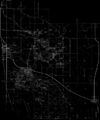
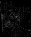
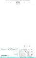
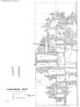
Mascoutah Quadrangle
Mining in the Mascoutah Quadrangle
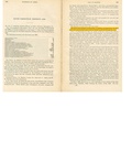
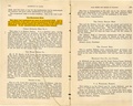
Mining in this quadrangle began prior to 1882, and continued until 1989. The most recent (and largest) mine in the Mascoutah quadrangle is the River King Underground Mine (mine index 940), just east of Freeburg. The oldest mine is the Enterprise Mine (mine index 3490), in the northwest corner of the quadrangle.
The Herrin Coal was the only coal mined here, ranging from 6.0 to 9.0 feet thick and 58 to 185 feet deep. The most prevalent geologic problem of this area were coal balls in the roof.
Map and Directory PDF Download
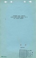
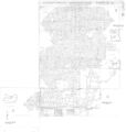
Coal Mines In Illinois Mascoutah Quadrangle
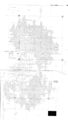
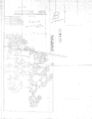
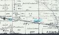
Mines that Appear on the Mascoutah Quadrangle
Unlocated Mines
St. Clair County
Pages in category "Mascoutah Quadrangle"
The following 16 pages are in this category, out of 16 total.
Media in category "Mascoutah Quadrangle"
The following 25 files are in this category, out of 25 total.
 M0340 coalreport1896 p145.pdf 1,585 × 1,218; 328 KB
 M0340 coalreport1897 p121.pdf 839 × 1,185; 120 KB
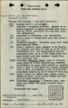
 M0340 minenotes.pdf 737 × 1,183, 7 pages; 12.21 MB
 M0340.jpg 1,925 × 3,390; 1.33 MB
 M0857 fieldnotes.pdf 750 × 1,187, 2 pages; 428 KB
 M0857 minenotes.pdf 737 × 1,183, 101 pages; 40.46 MB
 M0857.jpg 2,834 × 3,390; 1.12 MB
 M0857mas.jpg 2,860 × 3,390; 1.11 MB
 M0940 minenotes.pdf 745 × 1,162, 267 pages; 30.52 MB
 M3485 minenotes.pdf 737 × 1,183, 18 pages; 5.33 MB
 M3486 coalreport1884.pdf 1,587 × 1,272; 333 KB
 M3486mrg.jpg 3,218 × 3,390; 1.48 MB
 M3489 minenotes.pdf 733 × 1,183, 3 pages; 1.71 MB
 M3489.jpg 2,527 × 3,390; 929 KB
 M3490 coalreport1884.pdf 1,625 × 1,297; 331 KB
 M3490 coalreport1889.pdf 1,637 × 1,291; 898 KB
 M3490 coalreport1896.pdf 1,610 × 1,214; 357 KB
 M3490 minenotes.pdf 733 × 1,183, 8 pages; 13.15 MB
 M3490b.jpg 2,612 × 3,390; 871 KB
 M3491 coalreport1902.pdf 804 × 1,250; 97 KB
 M3491 coalreport1903.pdf 1,525 × 1,229; 254 KB
 M3491 minenotes.pdf 733 × 1,183, 8 pages; 2 MB
 M3491mrg.jpg 3,390 × 2,865; 1.25 MB
 M4373.jpg 1,862 × 1,112; 322 KB
 M4383 moa1950.jpg 3,490 × 3,297; 1.61 MB


