0147: Difference between revisions
No edit summary |
No edit summary |
||
| Line 11: | Line 11: | ||
|after_map=2 {{#info: Approximately 2 acres on the western and southwestern side of the mine were later surface mined by Burning Star No. 5 Mine (mine index 967).|note}} | |after_map=2 {{#info: Approximately 2 acres on the western and southwestern side of the mine were later surface mined by Burning Star No. 5 Mine (mine index 967).|note}} | ||
|county1=Franklin | |county1=Franklin | ||
|county2=Williamson | |||
|quad1=De Soto | |quad1=De Soto | ||
|quad2=Elkville | |quad2=Elkville | ||
| Line 111: | Line 112: | ||
{{Photo Query}} | {{Photo Query}} | ||
{{Editwithform}} | {{Editwithform}} | ||
{{Editwithform}} | {{Editwithform}} | ||
Revision as of 15:56, April 4, 2022
Mine Index Number: 0147
| Company Name: | Western Coal and Mining Company | ||
|---|---|---|---|
| Mine Name: | Western No. 2 Mine | ||
| Start Date: | 1916 | End Date: | March 1928 |
| Type of Mine: | Underground | ||
| Total acres shown: | 1,046 | ||
| Acres after map date: | 2 Approximately 2 acres on the western and southwestern side of the mine were later surface mined by Burning Star No. 5 Mine (mine index 967). | General Area of mining acres shown: | |
Shaft, Slope, Drift or Tipple Location(s)
| Type | County | Township-Range | Section | Part Section |
|---|
| Main shaft (10'x15') | Franklin | 7S 1E | 31 | SE NW SE |
| Air shaft (10'x15') | Franklin | 7S 1E | 31 | SW NW SE |
Geology
| Thickness (ft) | |||||
|---|---|---|---|---|---|
| Seam | Depth (ft) | Min | Max | Ave | Mining Method |
| Herrin | 152 | 6.5 | 12.0 | 7.0-10.5 | RPP |
Geological Problems Reported
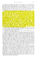
Water-bearing gravels in the glacial materials above the mine discharged water that had to be pumped out of the mine. A northwest-southeast trending fault with 6 to 8 feet upthrown on the northeastern side ran through this mine, crossing the main north just off the bottom, 200 feet from the shaft. The northeastern side was thrust over the opposite side, thickening the coal up to about 15 feet. Many northwest-southeast-trending faults that disrupted the mining pattern are shown on the source maps. Bad top was noted on a source map in the extreme northeastern part and the south part of the mine. These areas of bad top appear to have halted mining in those rooms. The roof varied from black fissile shale to gray shale; generally the gray shale was 18 feet thick. The most conspicuous impurity was the pyrite, especially common as facings running vertically through layers of the seam. Lenses of solid pyrite were not uncommon, especially in the upper part of the seam.
Production
| Company | Mine Name | Date | Production (tons) |
| Western Coal and Mining Company | Western No. 2 | 1916-1928 | 7,146,997 |
| Total Production: 7,146,997 | |||
Production Notes
Coal Report production (if available)
Sources of Data
| Source Map | Map Date | Original Scale | Digitized Scale | Map Type |
| ISGS map library, 4102 i5.1-64 | 11-14-1929 | 1:2400 | 1:2400 | Final |
| Microfilm, document 351420 | 11-14-1929 | 1:2400 | 1:4800 | Final |
Annotated Bibliography (Data source - brief description of information)
| Coal Reports - Production, ownership, years of operation, shaft sizes, depth, thickness. |
| Directory of Illinois Coal Mines (Franklin County) - Mine names, mine index, ownership, years of operation. |
| Mine notes (Franklin County) - Mine type, shaft location, seam, thickness, geologic problems. |
| ISGS map library, 4102 i5.1-64 - Mine outline (western part). |
| Microfilm map, document 351420, reel 03136, frames 63 & 64 - Mine outline (eastern part), shaft locations, geologic problems. |
Mine Notes
Mine Images
![[[:Western No. 2|Western No. 2]]](https://wikiimage.isgs.illinois.edu/ilmines/williamson/thumbnails/m0147b_th.jpg)
![[[:Western No. 2|Western No. 2]]](https://wikiimage.isgs.illinois.edu/ilmines/williamson/thumbnails/m0147c_th.jpg)
![[[:Western No. 2|Western No. 2]]](https://wikiimage.isgs.illinois.edu/ilmines/williamson/thumbnails/m0147a_th.jpg)
Photographs