West Frankfort Quadrangle
Mining in the West Frankfort Quadrangle
The coal in Franklin County contained a lot of gas and explosions killed many people. Zeigler No. 1 (mine index 0053) had one of the worst mine disasters in the state, an explosion that killed 48, with 3 more dying from asphyxiation during rescue attempts. Old Ben Mine No. 11 had a bad explosion, killing 17, in November of 1917. Ventilation was good at the working faces, but gas would accumulate behind stoppings. Factors that contributed to the mines’ problems were open flames in miners lamps and coal dust that would promulgate the explosion throughout the mine. The open flames in the miners lamps were a known hazard, but the introduction of closed lamps caused serious labor antagonism, since the lamps only provided about 2 candlepower of illumination. The gradual development of 100-candlepower lamps eased acceptance of the battery-powered lights. Rock dusting required development also, although the process was known in 1917. Lime dust was often too coarse to apply effectively, highway dust was tried, but it became wet in the mine. Old Ben Coal Company worked aggressively to develop a shale dust and this was used from 1918 until 1928, when lime rock dust became available in paper bags. (John E. Jones, 1954 Coal Report, pages 143-145). Gas explosions killed 375 miners in Franklin County. The worst explosion was in 1951 in the Orient No. 2 Mine, mine index 1951, killing 119. Natural hazards also took down mines, a 1912 tornado destroyed the top works of the Possum Ridge Mine (mine index 0421).
The Herrin Coal was very thick in Franklin County, over 12 feet in some locations. Orient No. 2 Mine (mine index 0366) established a world record of 15,174 tons in 8 hours in 1943.
Old Ben No. 14 (mine index 0665) and Old Ben No. 24 (mine index 0866) had several large faults passing through the workings. These faults are part of the Rend Lake Fault Zone, and had offsets up to 55 feet. For details on the Rend Lake Fault System, see ISGS Circular 513, noted in the Reference section on page 8 of this report.
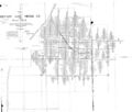
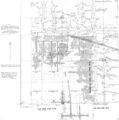
Map and Directory PDF Download
Coal Mines In Illinois West Frankfort Quadrangle
Mines that Appear on the West Frankfort Quadrangle
Unlocated Mines
Franklin County
Pages in category "West Frankfort Quadrangle"
The following 22 pages are in this category, out of 22 total.
Media in category "West Frankfort Quadrangle"
The following 75 files are in this category, out of 75 total.
- M-825 Coop 17 fig 26 broken sidewalk tilted pole Old Ben 8 - 8ft coal at 450ft.jpg 2,544 × 4,340; 1.07 MB
- M-992 Coop 17 Fig 40 trestle 1.5ft submine.jpg 2,500 × 1,460; 366 KB
- M-993 Old Ben 8 mine W Frankfort rt end 4ft lower.jpg 2,500 × 1,440; 509 KB
- M-994 Old Ben 8 mine W Frankfort Coop 17 Fig 47 rt end 4ft lower.jpg 2,500 × 1,397; 379 KB
- M0051 coalreport 1908.pdf 629 × 970; 86 KB
- M0051 minenotes.pdf 733 × 1,202, 15 pages; 3.55 MB
- M0051mrg.jpg 1,803 × 3,390; 2.91 MB
- M0052 coalreport 1908.pdf 629 × 970; 70 KB
- M0052 minenotes.pdf 727 × 1,200, 21 pages; 5.15 MB
- M0052.jpg 3,390 × 2,875; 2.04 MB
- M0139 coalreport 1914.pdf 825 × 1,264; 568 KB
- M0139 minenotes.pdf 739 × 1,193, 19 pages; 5.3 MB
- M0139.jpg 3,390 × 2,452; 1.76 MB
- M0143 coalreport 1910.pdf 583 × 943, 2 pages; 194 KB
- M0143 coalreport 1921.pdf 847 × 1,310; 1.65 MB
- M0143 coalreport 1924.pdf 635 × 997; 69 KB
- M0143 coalreport 1947.pdf 1,270 × 902, 2 pages; 415 KB
- M0143 coalreport1929 p190.pdf 639 × 1,000; 985 KB
- M0143 minenotes.pdf 733 × 1,202, 22 pages; 5.95 MB
- M0143.jpg 2,374 × 3,390; 4.45 MB
- M0143a.jpg 2,405 × 3,390; 4.25 MB
- M0256 coalreport 1907p329.pdf 587 × 966; 90 KB
- M0256 coalreport 1908p347.pdf 629 × 970; 85 KB
- M0256 coalreport 1909p374.pdf 1,606 × 1,241; 413 KB
- M0256 coalreport 1917p252.pdf 602 × 991; 81 KB
- M0256 coalreport 1928.pdf 656 × 979, 2 pages; 113 KB
- M0256 minenotes.pdf 733 × 1,202, 6 pages; 1.6 MB
- M0256mrg.jpg 3,390 × 2,141; 2.64 MB
- M0366 coalreport 1923p270.pdf 625 × 997; 56 KB
- M0366 coalreport 1926p205.pdf 639 × 1,016; 65 KB
- M0366 coalreport 1943p152.pdf 625 × 1,016; 72 KB
- M0366 coalreport 1947p175.pdf 902 × 1,270; 1.15 MB
- M0366 minenotes.pdf 733 × 1,202, 28 pages; 7.03 MB
- M0421 coalreport 1908p348.pdf 629 × 970; 70 KB
- M0421 coalreport 1909p370.pdf 1,591 × 1,229; 394 KB
- M0421 fieldnotes.pdf 752 × 1,200, 8 pages; 745 KB
- M0421 minenotes.pdf 733 × 1,202, 27 pages; 7.03 MB
- M0428 minenotes.pdf 733 × 1,202, 16 pages; 3.91 MB
- M0432 coalreport 1917.pdf 602 × 991; 79 KB
- M0432 minenotes.pdf 739 × 1,193, 14 pages; 3.81 MB
- M0433 coalreport 1910.pdf 583 × 943; 80 KB
- M0433 minenotes.pdf 733 × 1,202, 5 pages; 1.19 MB
- M0433a.jpg 3,356 × 3,390; 2.03 MB
- M0433mrg.jpg 3,390 × 2,533; 3.54 MB
- M0505 coalreport 1913p246.pdf 793 × 1,187; 1.46 MB
- M0505 minenotes.pdf 733 × 1,202, 18 pages; 4.67 MB
- M0505.jpg 2,207 × 3,390; 1.78 MB
- M0665 coalreport 1912.pdf 795 × 1,241, 4 pages; 13.25 MB
- M0665 minenotes.pdf 739 × 1,193, 15 pages; 4.12 MB
- M0665wrp.jpg 3,371 × 3,390; 4.25 MB
- M0847 minenotes.pdf 733 × 1,202, 46 pages; 12.6 MB
- M0847.jpg 3,390 × 2,889; 1.84 MB
- M0866 minenotes.pdf 739 × 1,193, 26 pages; 6.65 MB
- M0866.jpg 3,106 × 3,800; 4.87 MB
- M0962 minenotes.pdf 731 × 1,202, 39 pages; 10.26 MB
- M2070 coalreport 1917p249.pdf 602 × 991; 92 KB
- M2070 minenotes.pdf 739 × 1,193, 15 pages; 3.76 MB
- M2070mrg.jpg 2,483 × 3,390; 1.06 MB
- Orient No 2 0001.jpg 3,996 × 2,737; 1.34 MB
- Orient No 2 0002.jpg 3,980 × 2,782; 1.07 MB
- Orient No 2 0003.jpg 2,650 × 1,832; 662 KB
- Orient No 2 0004.jpg 2,619 × 1,867; 478 KB
- Orient No 2 0005.jpg 2,607 × 1,861; 513 KB
- Orient No 2 0006.jpg 2,613 × 1,843; 511 KB
- Orient No 2 0007.jpg 2,613 × 1,837; 484 KB
- Orient No 2 0008.jpg 2,631 × 1,819; 497 KB
- Orient No 2 0009.jpg 2,199 × 1,756; 554 KB
- Orient No 2 0010.jpg 2,400 × 1,977; 521 KB
- Orient No 2 0011.jpg 2,220 × 1,784; 515 KB
- Orient No 2 0012.jpg 2,231 × 1,802; 423 KB
- Orient No 2 0013.jpg 1,700 × 2,187; 448 KB
- Orient No 2 0014.jpg 2,152 × 1,591; 369 KB
- Orient No 2 0015.jpg 2,225 × 1,814; 419 KB
- Orient No 2 0016.jpg 2,213 × 1,831; 343 KB
- Orient No 2 0017.jpg 1,995 × 1,364; 257 KB


