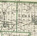
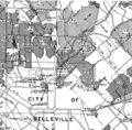
Category:St. Clair-County
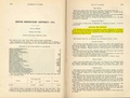
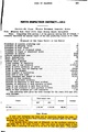
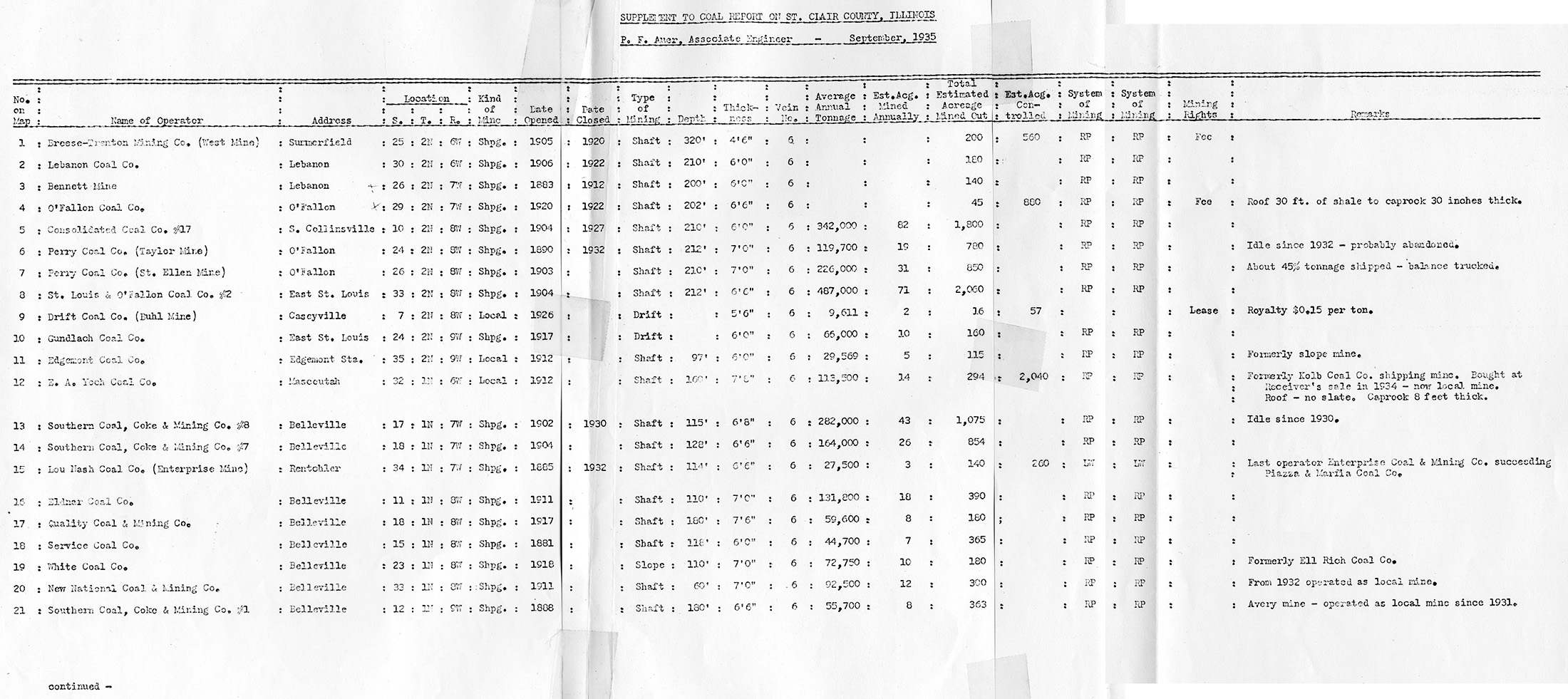
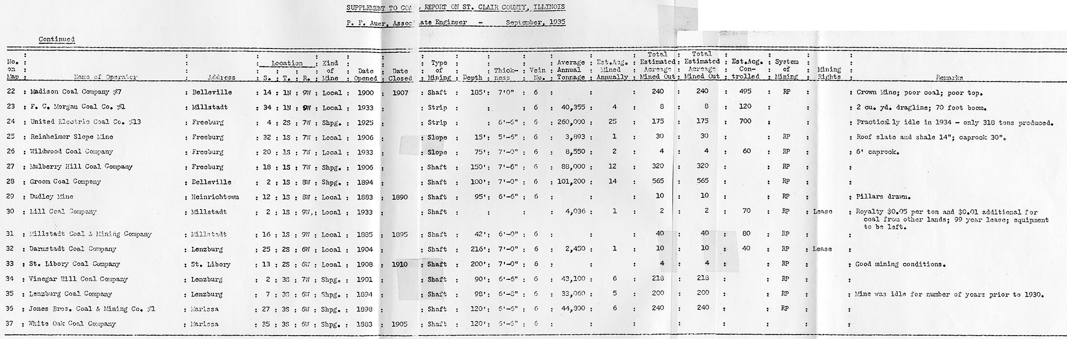
County Coal Data
Mines that Appear in St. Clair-County
- 9998 & 9999 = Unknown dates
Unlocated Mines in St. Clair-County
Mine that have known coal production but no known location
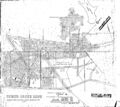
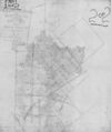
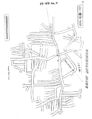
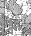
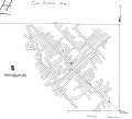
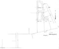
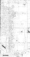
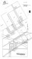
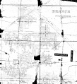
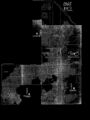
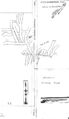
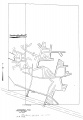
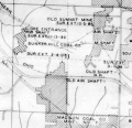
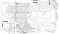
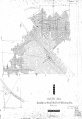
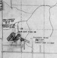
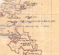
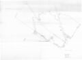
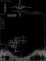
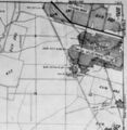
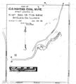
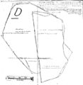
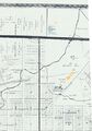
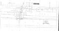
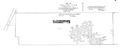
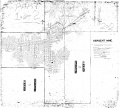
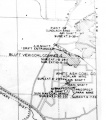
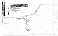
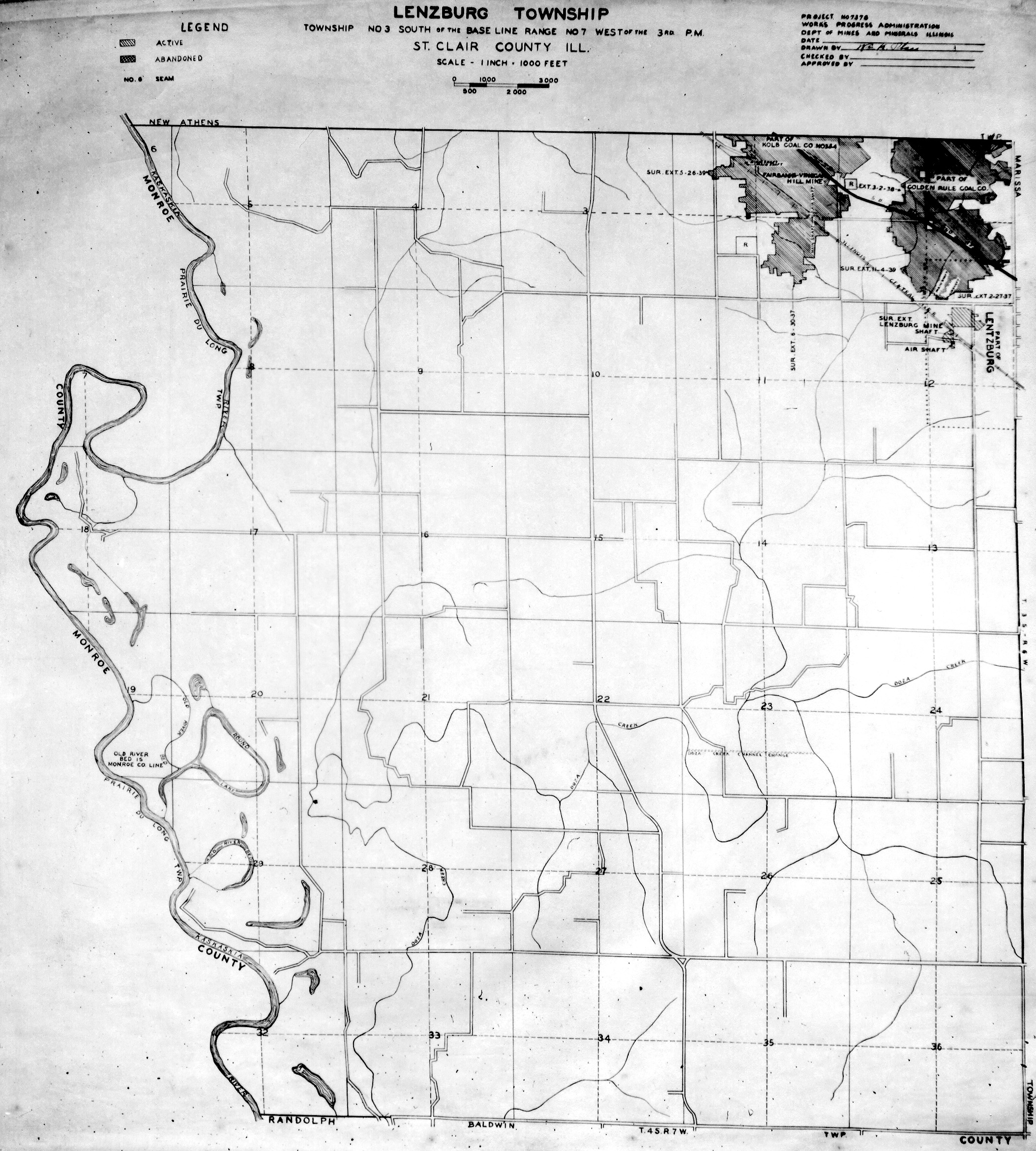
Historical Mined Out Area Maps
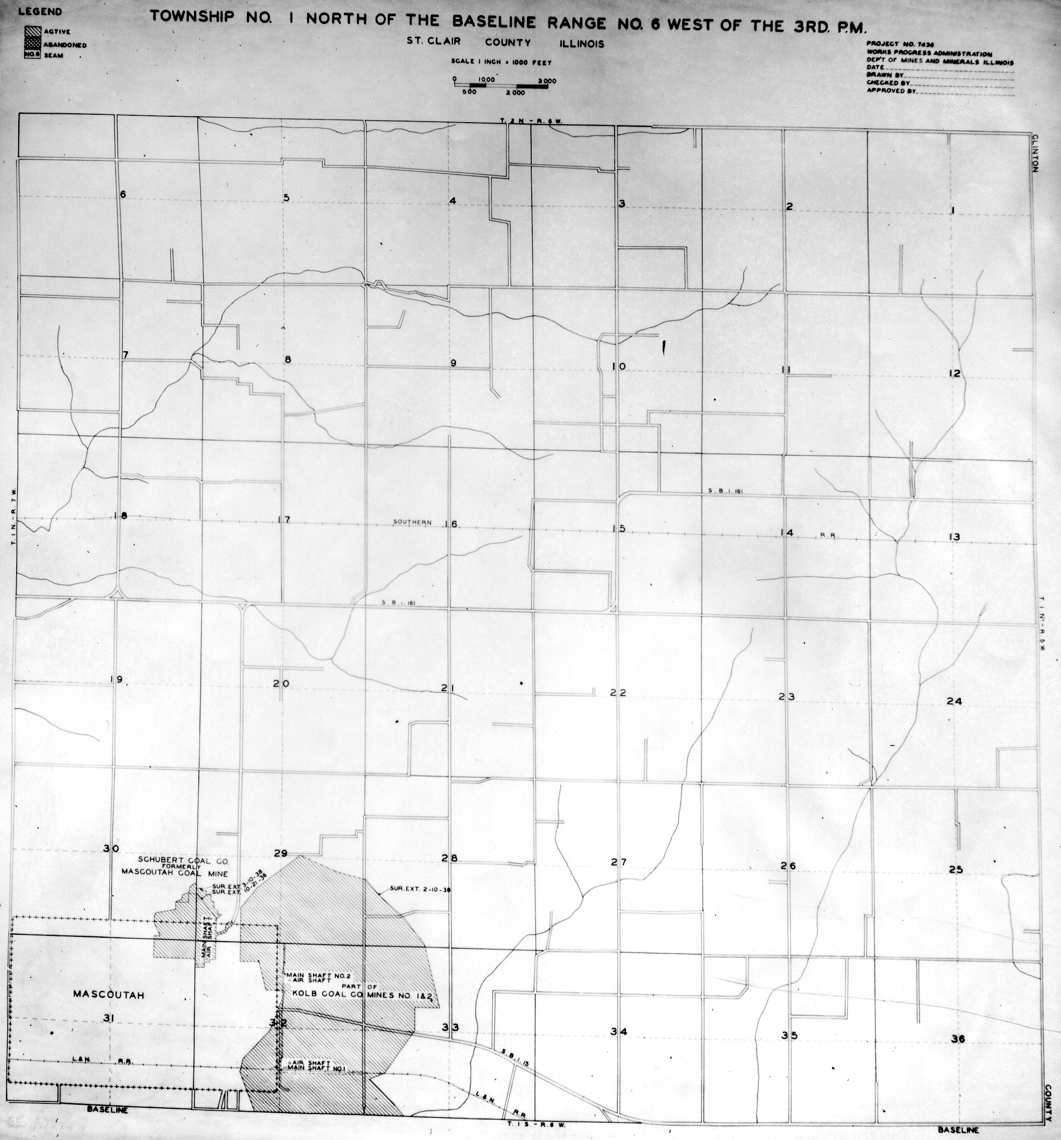
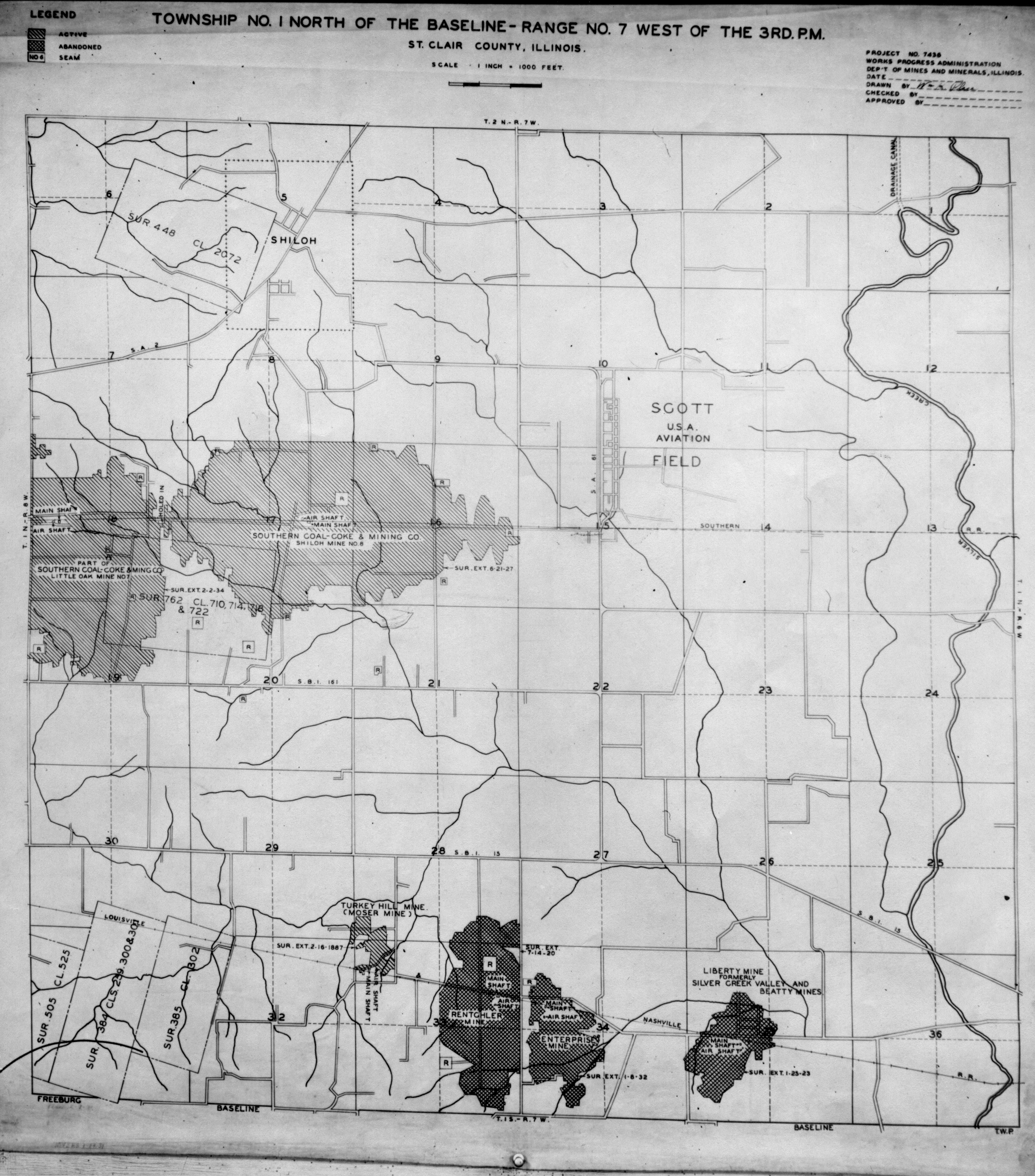
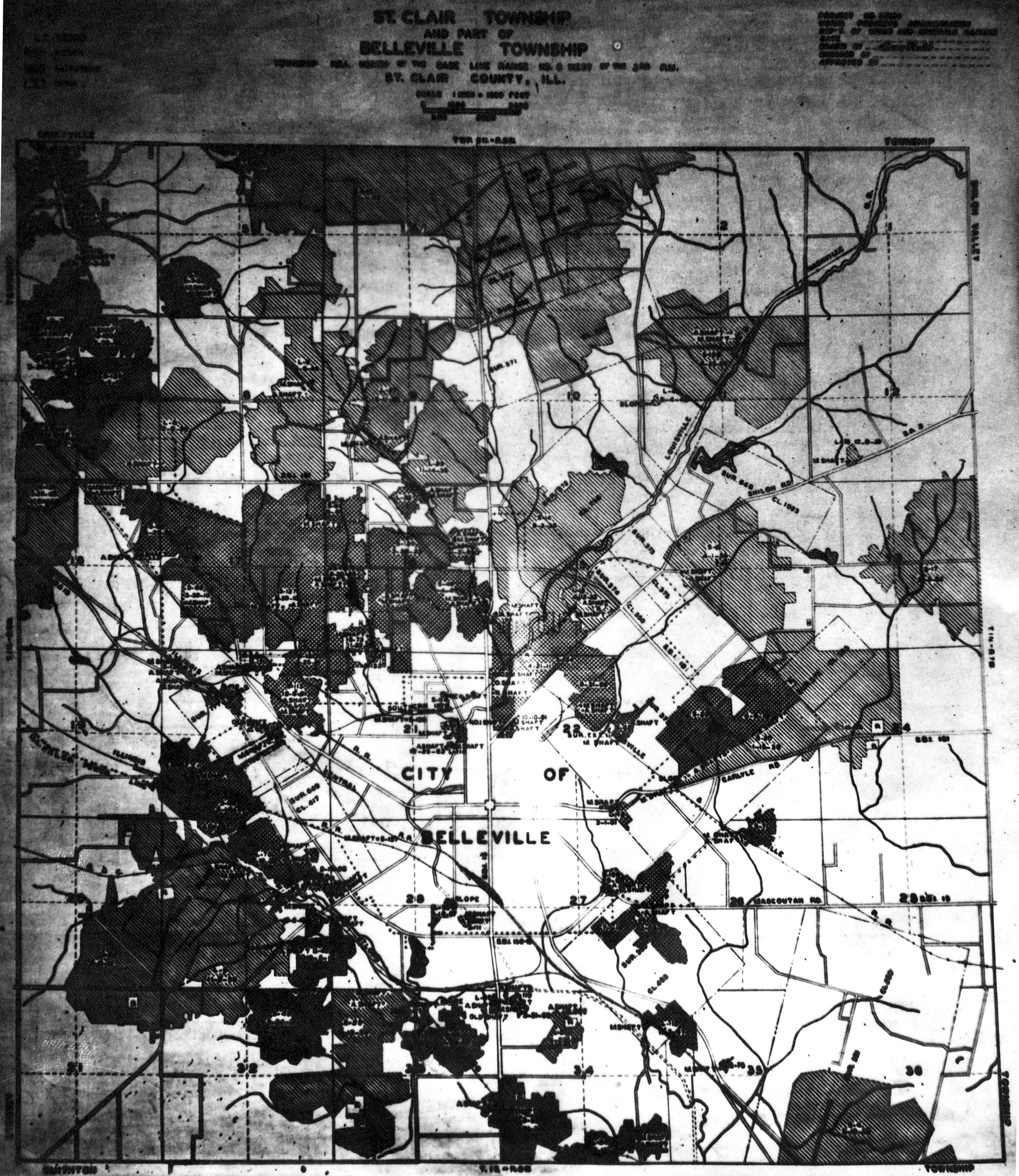
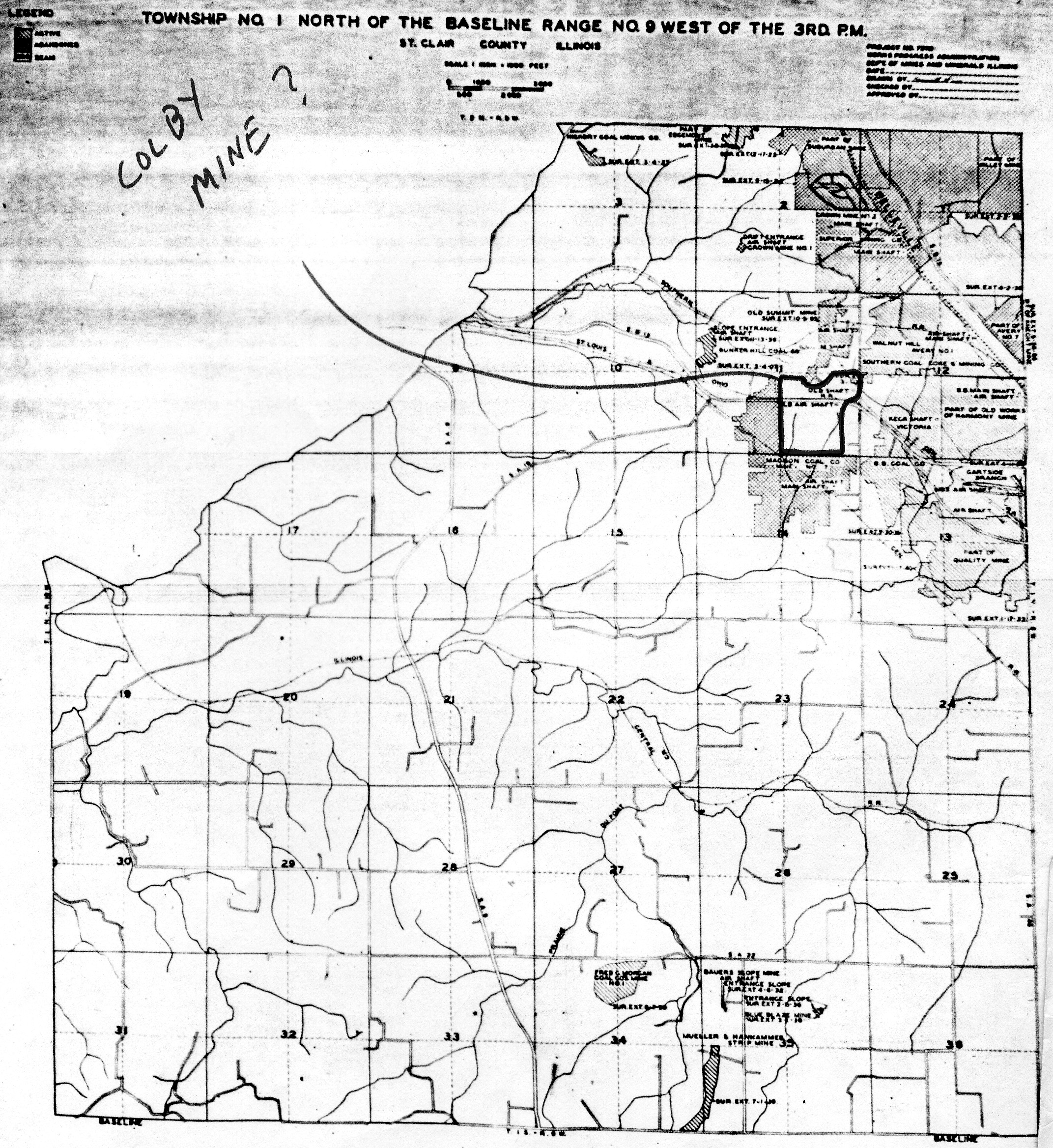
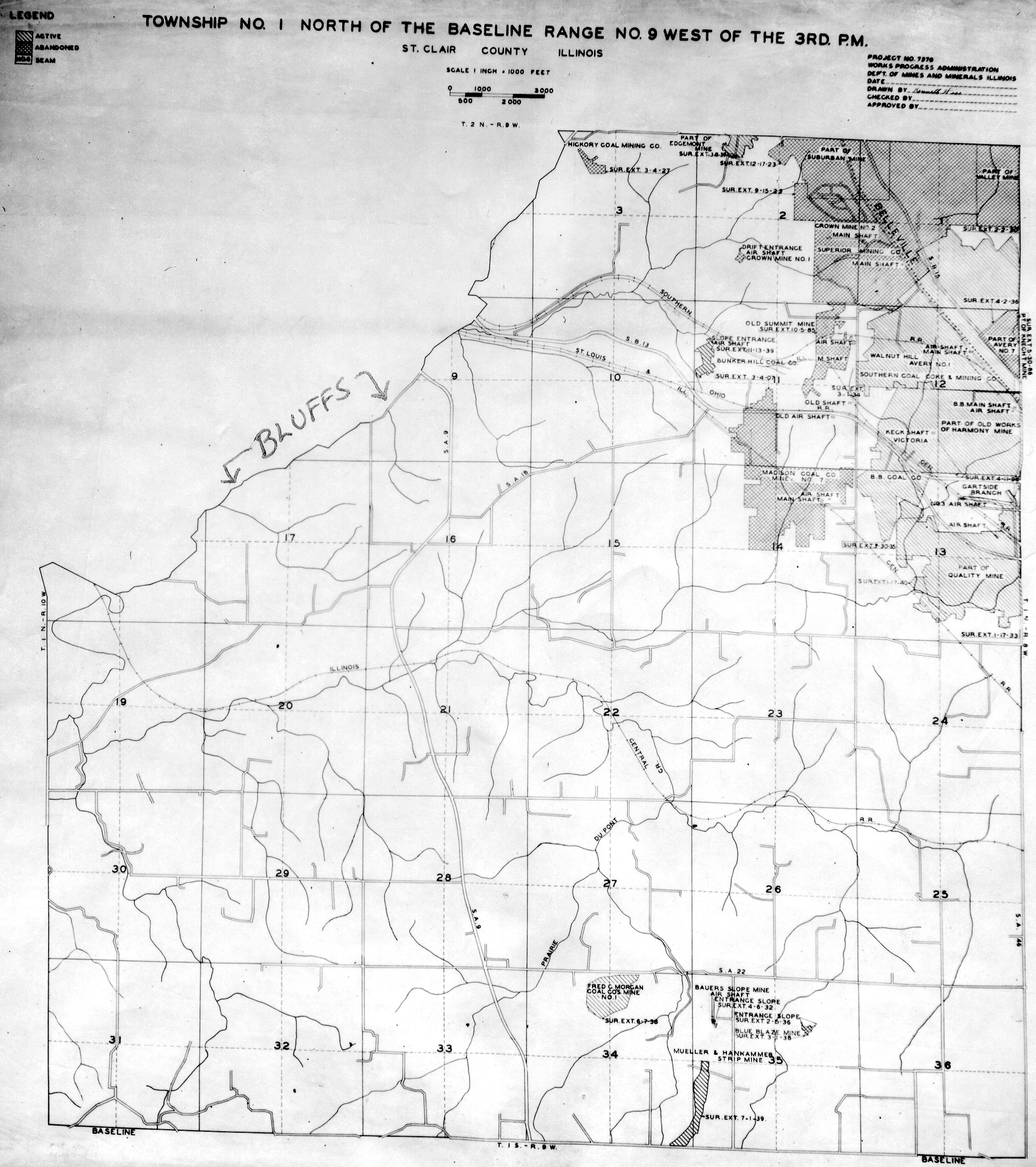
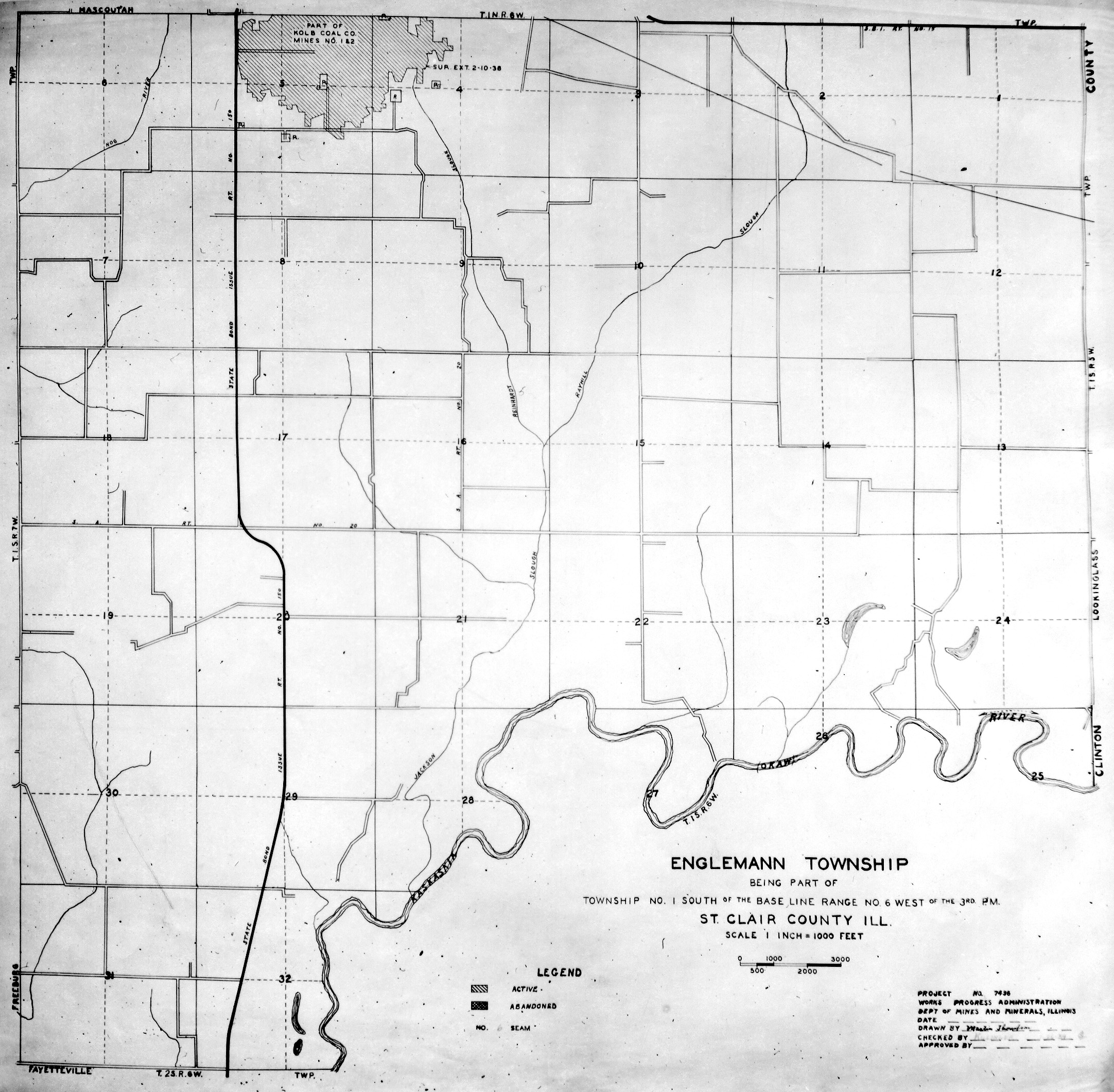
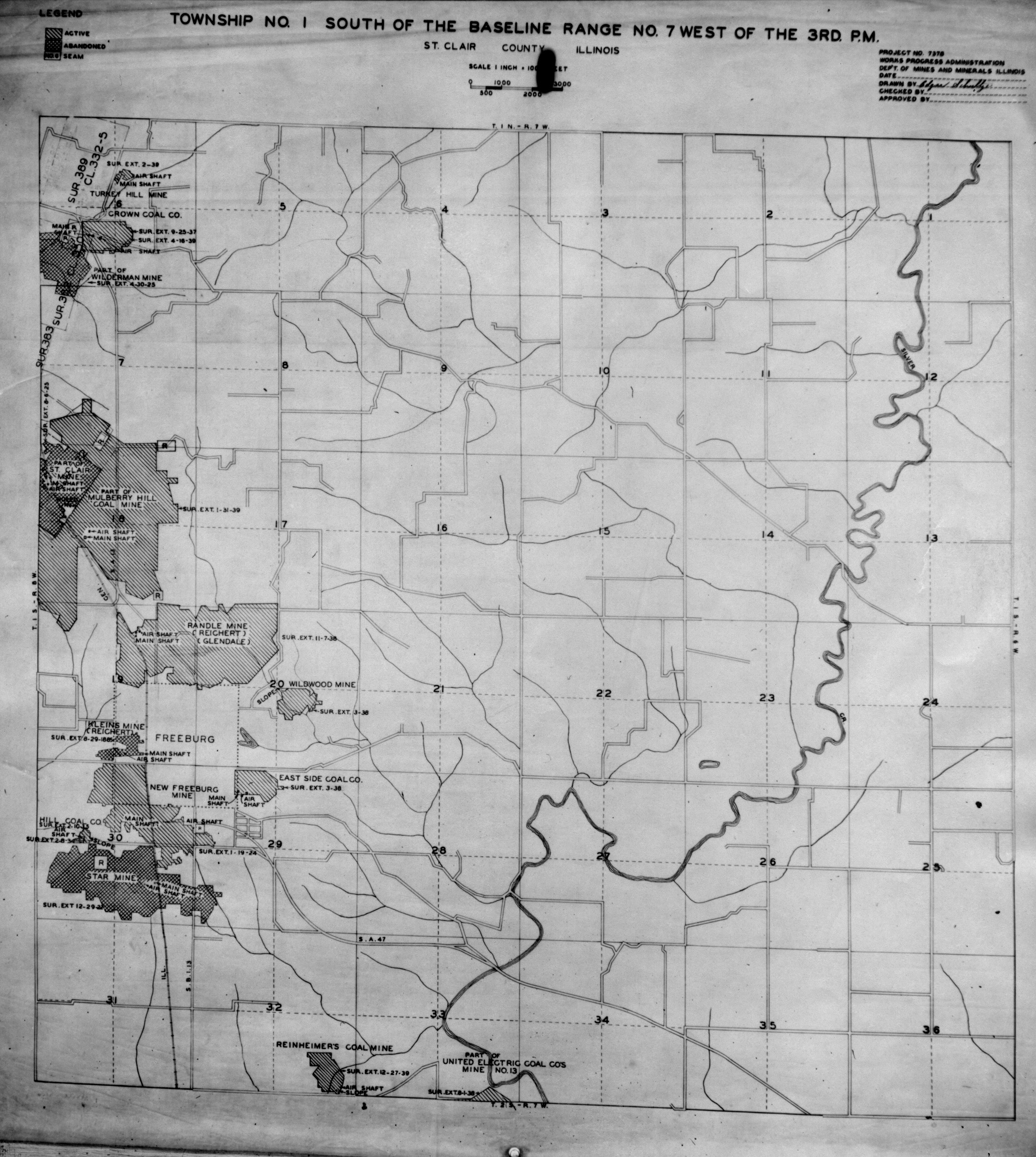
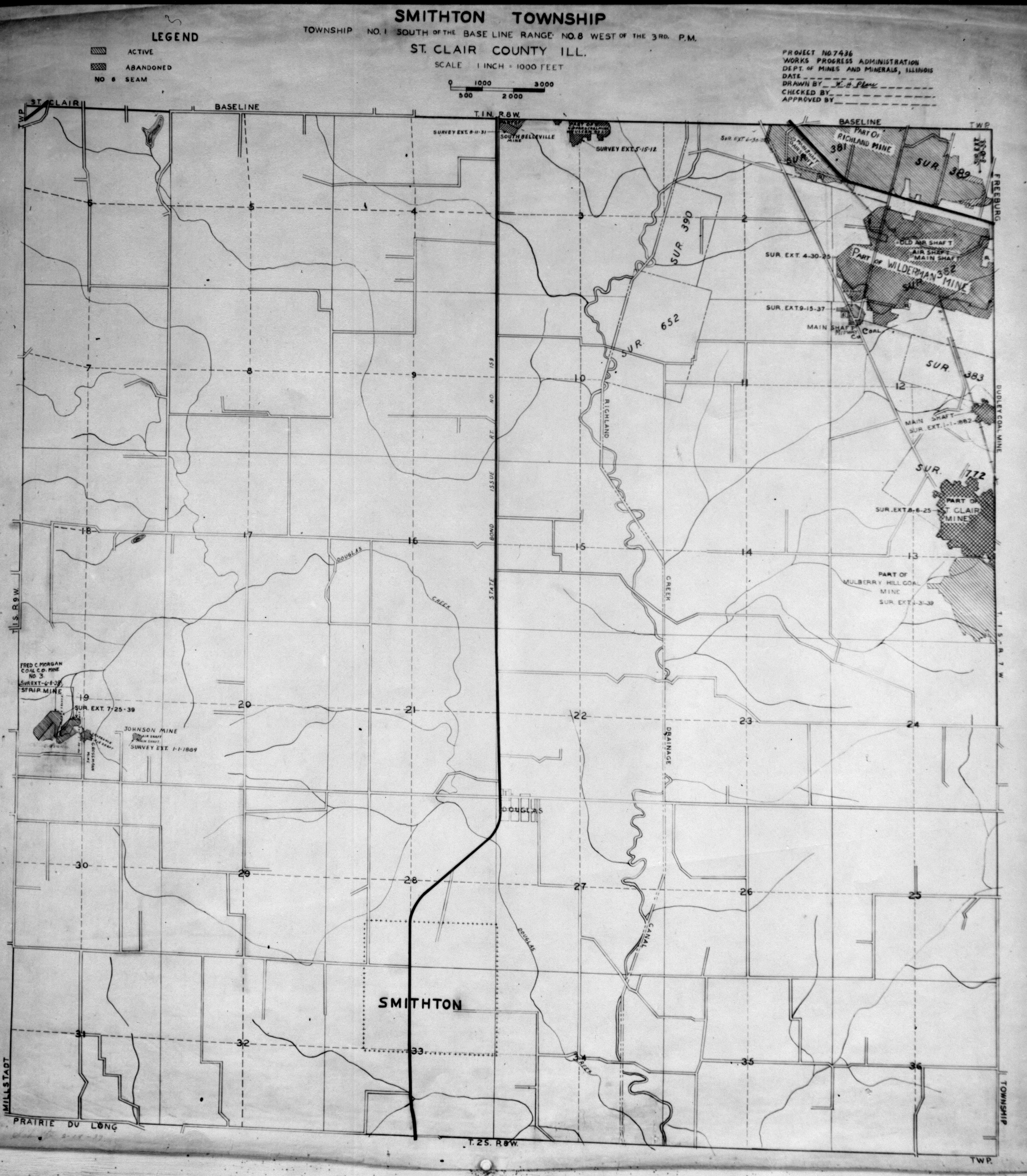
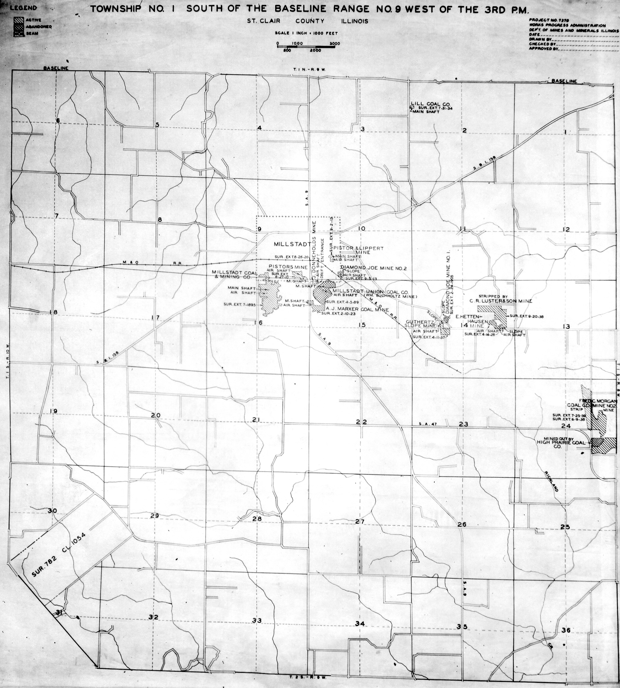
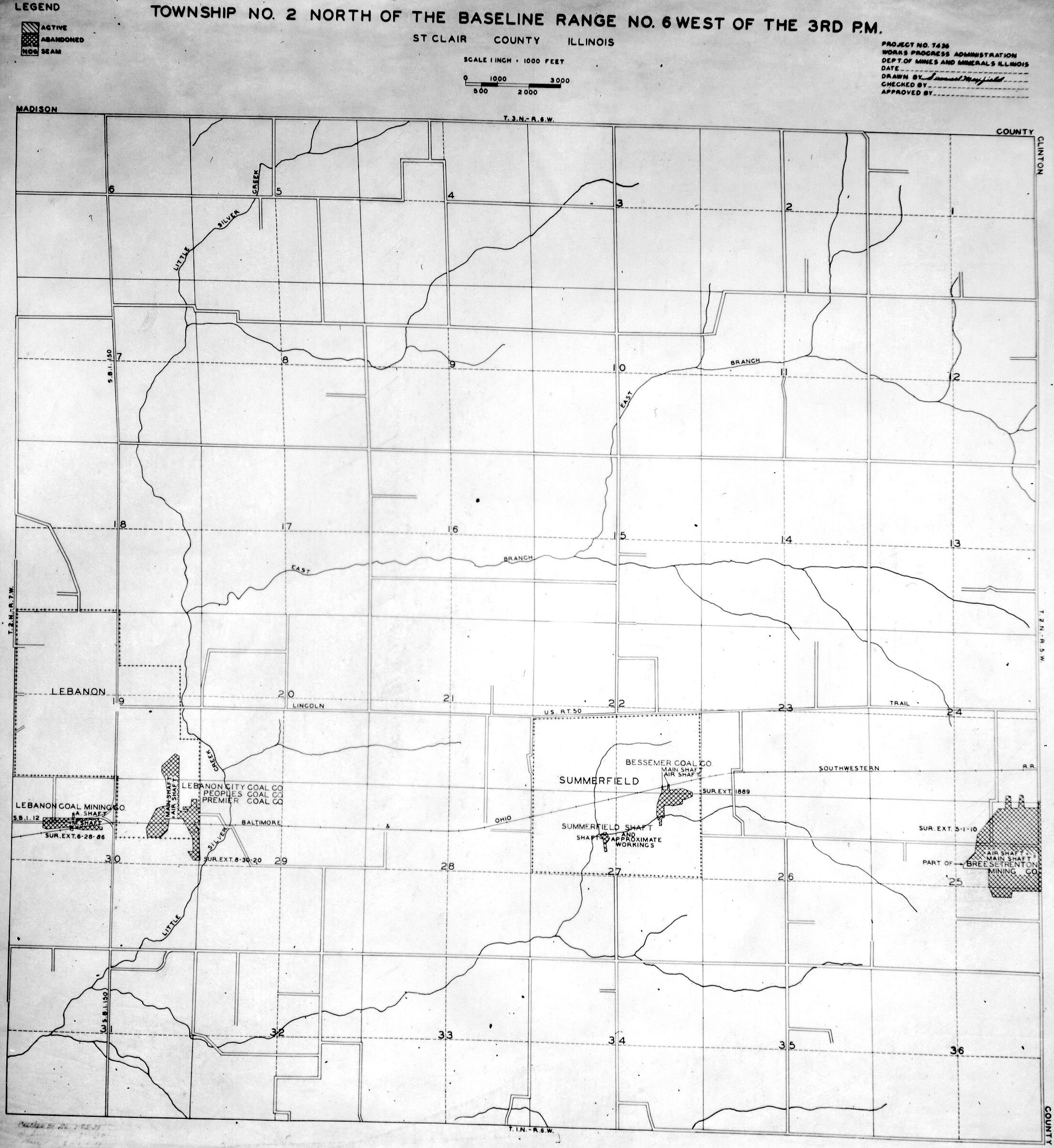
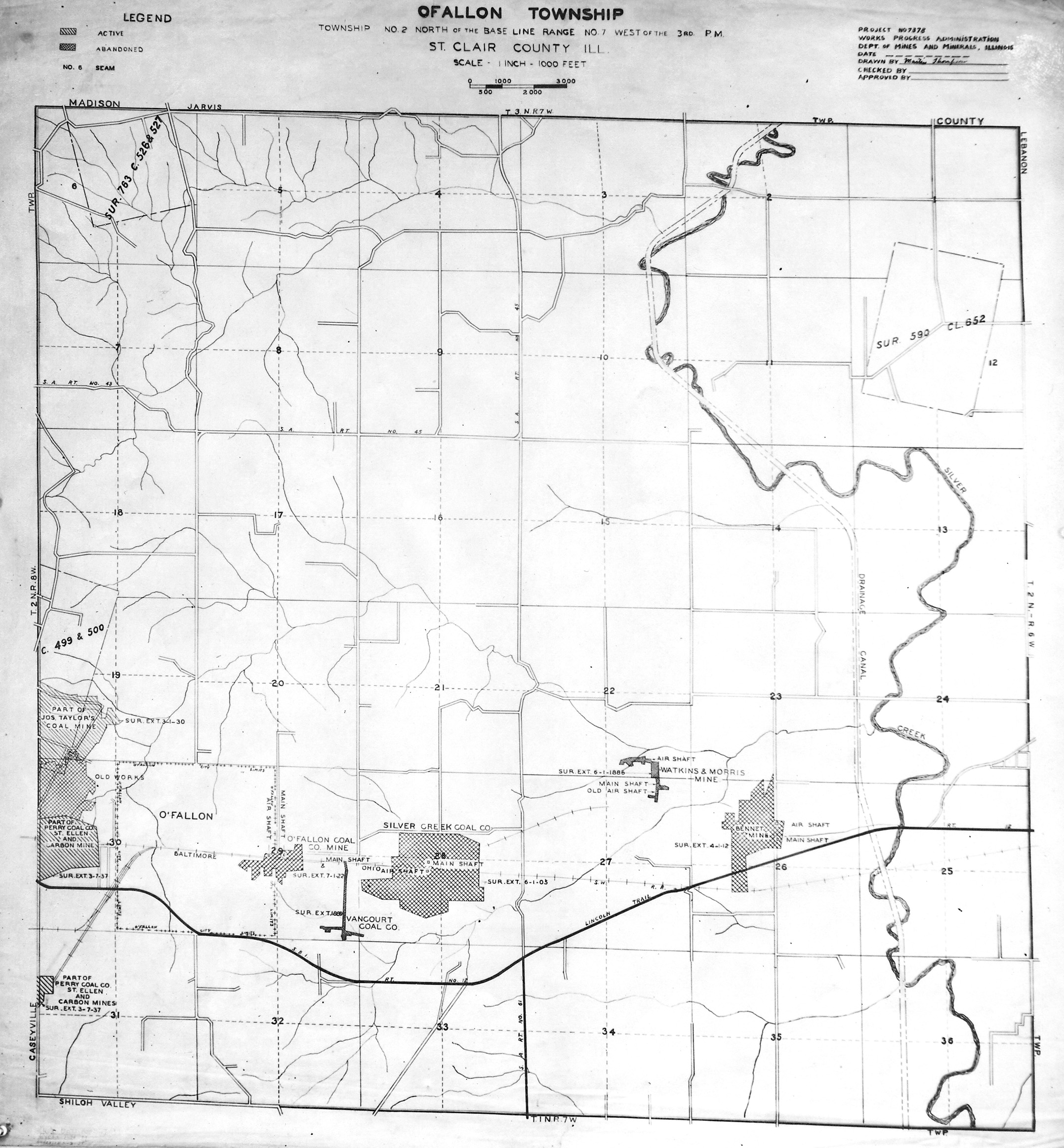
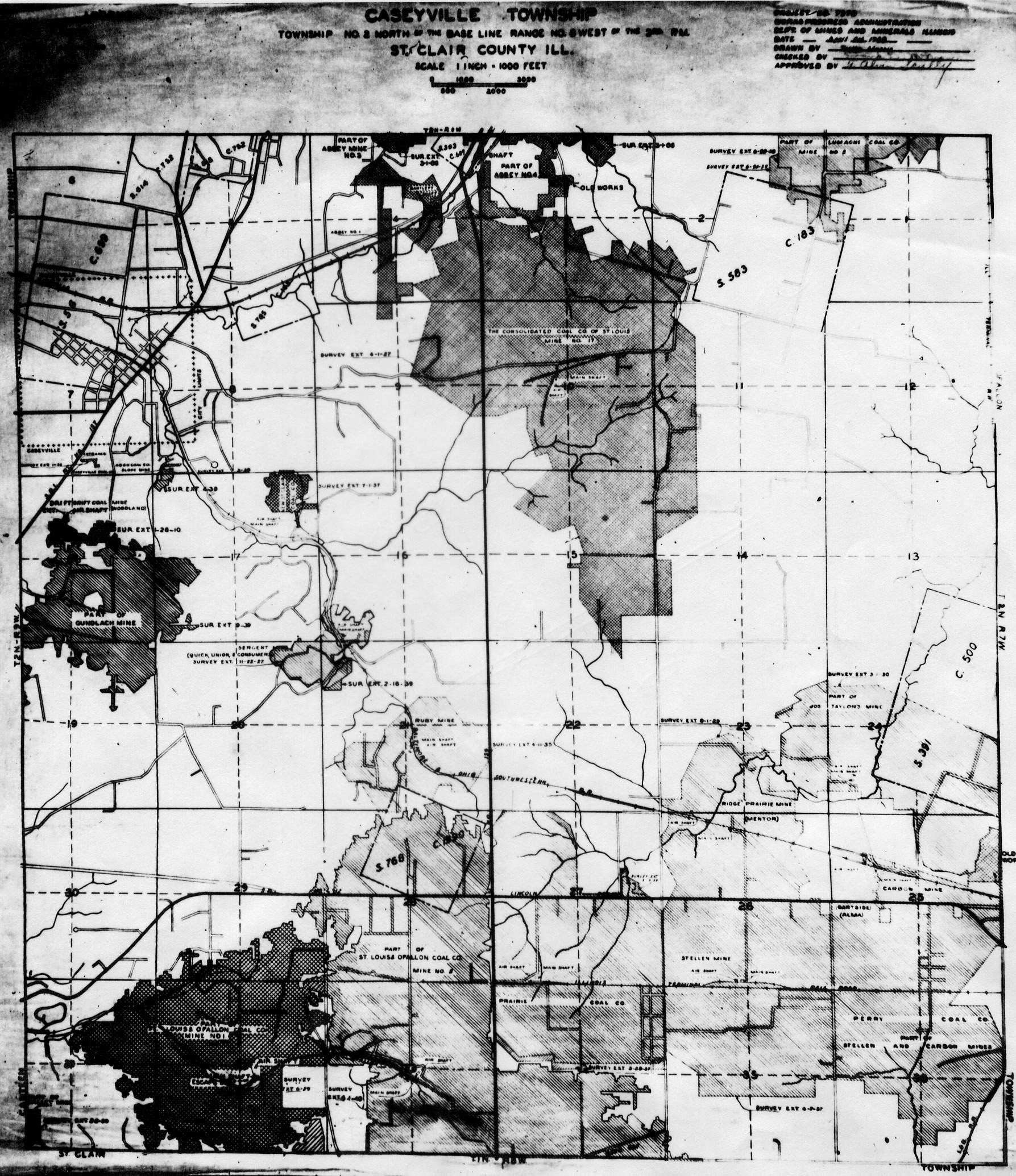
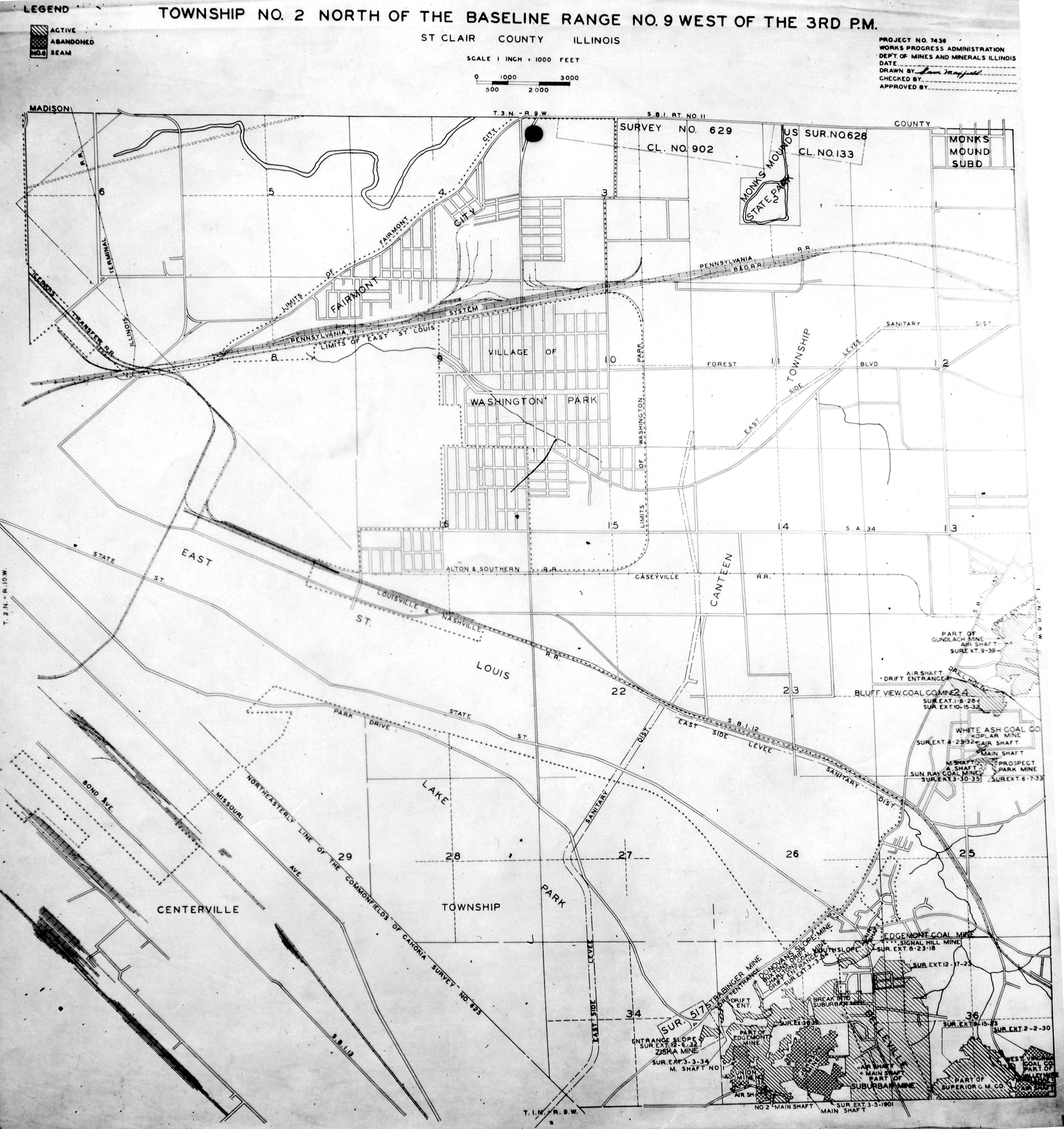
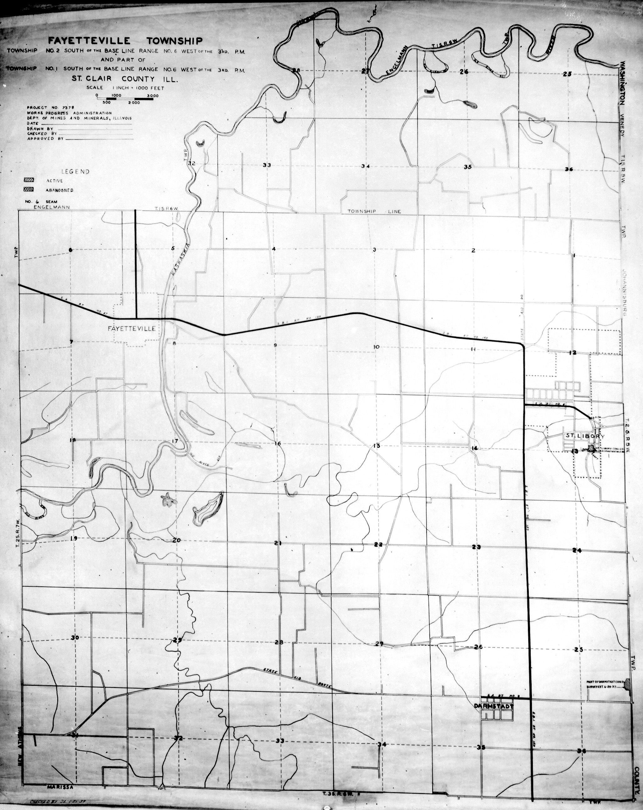
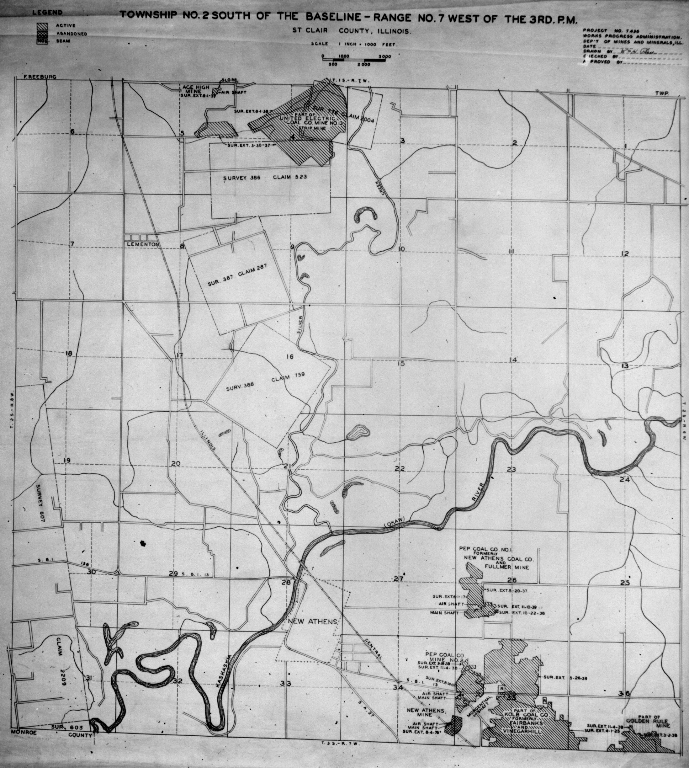
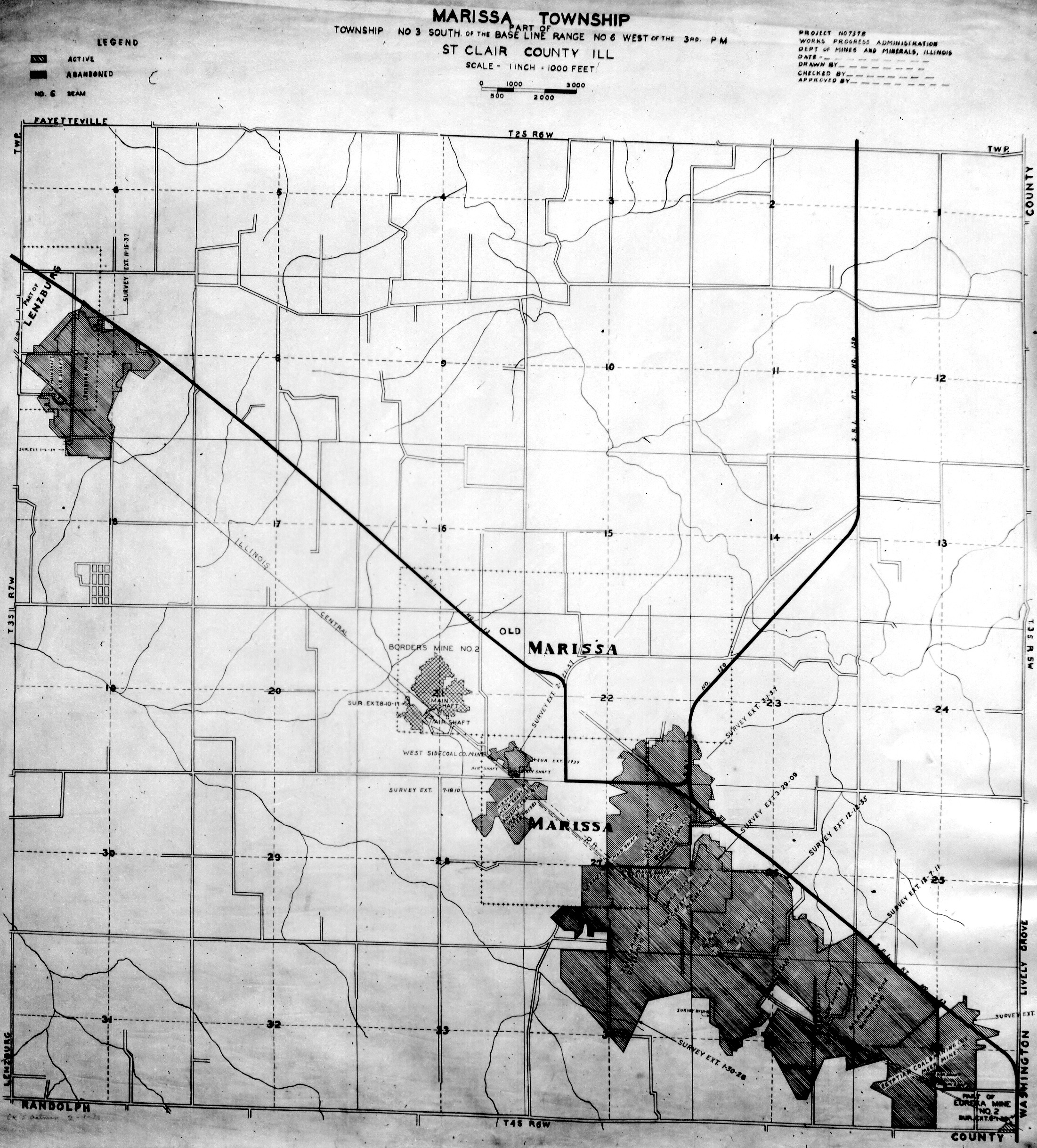
WPA
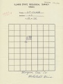
These maps were constructed as part of the nationwide Works Projects Administration (WPA), generally between 1934 and 1937 with some later updates or revisions,
Disclaimer
Maps for some locations might have multiple versions/seams, please inspected these areas closely for differences.
Notes and corrections were made by ISGS staff.
These maps are reproductions from microfilm, they may be of poor quality with text difficult to read.


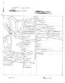
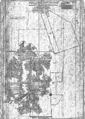
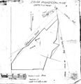
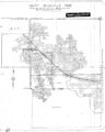
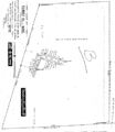
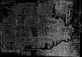
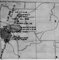
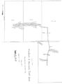
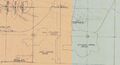
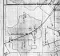
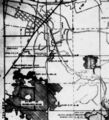
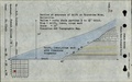
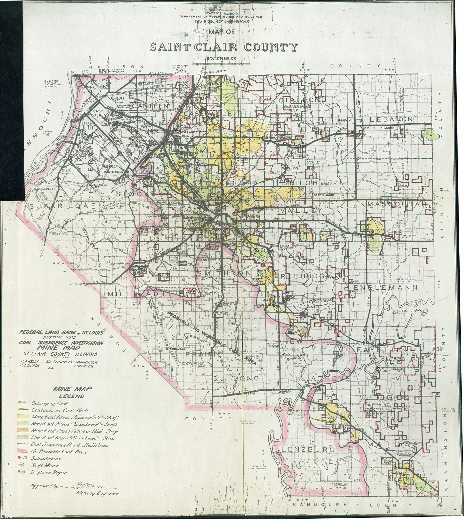
Federal Land Bank of St. Louis, Preliminary Reports on Subsidence Investigations
Federal Land Bank of St. Louis, Preliminary Reports on Subsidence Investigations (refered by Coal Section Staff as "Quade Maps")
Mining engineers working for the Federal Land Bank of St. Louis mapped areas of subsidence due to coal mining in the early 1930s. These reports often include county maps of mine properties with mined-out areas including shaft locations, as well as subsidence areas.
Disclaimer
Maps for some locations might have multiple versions/seams, please inspected these areas closely for differences.
These maps are accompanied by a report, please download and inspect this document.
Notes and corrections were made by ISGS staff.


Photographs

Pages in category "St. Clair-County"
The following 200 pages are in this category, out of 444 total.
(previous page) (next page)3
- 3516
- 3517
- 3518
- 3521
- 3522
- 3523
- 3524
- 3525
- 3526
- 3527
- 3528
- 3529
- 3530
- 3531
- 3532
- 3533
- 3534
- 3535
- 3536
- 3537
- 3538
- 3539
- 3541
- 3542
- 3543
- 3544
- 3545
- 3546
- 3547
- 3550
- 3551
- 3553
- 3555
- 3557
- 3558
- 3559
- 3560
- 3561
- 3562
- 3563
- 3565
- 3566
- 3567
- 3568
- 3569
- 3570
- 3571
- 3572
- 3573
- 3575
- 3577
- 3578
- 3579
- 3580
- 3581
- 3583
- 3584
- 3585
- 3586
- 3587
- 3588
- 3589
- 3592
- 3593
- 3594
- 3595
- 3596
- 3598
- 3599
- 3600
- 3601
- 3602
- 3603
- 3604
- 3605
- 3606
- 3608
- 3609
- 3610
- 3611
- 3612
- 3613
- 3614
- 3615
- 3616
- 3617
- 3618
- 3619
- 3620
- 3621
- 3622
- 3624
- 3625
- 3626
- 3627
- 3628
- 3816
4
- 4035
- 4231
- 4255
- 4258
- 4259
- 4260
- 4261
- 4263
- 4266
- 4268
- 4269
- 4270
- 4271
- 4272
- 4273
- 4274
- 4275
- 4279
- 4280
- 4282
- 4283
- 4284
- 4285
- 4286
- 4287
- 4288
- 4289
- 4290
- 4291
- 4292
- 4293
- 4294
- 4295
- 4296
- 4297
- 4298
- 4299
- 4301
- 4304
- 4305
- 4310
- 4311
- 4312
- 4313
- 4314
- 4316
- 4317
- 4319
- 4320
- 4321
- 4322
- 4323
- 4326
- 4327
- 4328
- 4329
- 4330
- 4331
- 4332
- 4335
- 4336
- 4337
- 4338
- 4339
- 4340
- 4373
- 4383
- 4500
- 4589
- 4707
- 4726
- 4731
- 4849
- 4862
- 4995
Media in category "St. Clair-County"
The following 200 files are in this category, out of 569 total.
(previous page) (next page) M3509 minenotes.pdf 733 × 1,183, 10 pages; 1.54 MB
 M3510 351052.jpg 3,390 × 3,027; 1.79 MB
 M3510 minenotes.pdf 737 × 1,187, 7 pages; 1.09 MB
 M3511 coalreport1905 p325.pdf 633 × 977; 105 KB
 M3511 coalreport1912.pdf 1,641 × 1,241; 307 KB
 M3511 coalreport1916 p219.pdf 654 × 1,016; 64 KB
 M3511 IL21.jpg 2,840 × 3,390; 1.71 MB
 M3511 minenotes.pdf 741 × 1,187, 7 pages; 1.47 MB
 M3512 coalreport1884 p575.pdf 1,587 × 1,268; 325 KB
 M3512.jpg 2,616 × 3,390; 670 KB
 M3513 350961.jpg 3,390 × 1,952; 2.07 MB
 M3513 atlas1874.jpg 1,895 × 1,578; 424 KB
 M3513 coalreport1884 p574.pdf 752 × 1,181; 332 KB
 M3513 minenotes.pdf 741 × 1,187, 3 pages; 3.45 MB
 M3514 coalreport1884.pdf 1,625 × 1,297; 325 KB
 M3514 minenotes.pdf 737 × 1,183, 6 pages; 1.32 MB
 M3514.jpg 2,665 × 3,390; 626 KB
 M3515 coalreport1884 p574.pdf 1,587 × 1,268; 322 KB
 M3516 351022.jpg 939 × 1,098; 597 KB
 M3516 coalreport1889 p70.pdf 700 × 1,143; 399 KB
 M3516 minenotes.pdf 741 × 1,187, 8 pages; 7.66 MB
 M3516.jpg 2,413 × 3,390; 4.04 MB
 M3517 coalreport1884 p574.pdf 1,587 × 1,268; 322 KB
 M3518 350961.jpg 3,390 × 1,952; 2.07 MB
 M3518 atlas1874.jpg 1,895 × 1,578; 424 KB
 M3518 coalreport1884 p575.pdf 1,587 × 1,268; 323 KB
 M3518 fieldnotes.pdf 747 × 1,193; 177 KB
 M3521 350965.jpg 2,942 × 3,390; 1.49 MB
 M3521 coalreport1884 p575.pdf 1,587 × 1,268; 327 KB
 M3521 minenotes.pdf 741 × 1,187, 9 pages; 9.77 MB
 M3522 350975.jpg 3,390 × 2,784; 1.2 MB
 M3522 coalreport1889 p70.pdf 700 × 1,143; 398 KB
 M3522 minenotes.pdf 737 × 1,183, 8 pages; 5.7 MB
 M3523 35100101.jpg 3,176 × 2,897; 737 KB
 M3523 coalreport1884 p574.pdf 1,587 × 1,268; 324 KB
 M3524 350995.jpg 3,390 × 1,648; 255 KB
 M3524 351026.jpg 3,390 × 2,435; 1.11 MB
 M3524 fieldnotes.pdf 747 × 1,193; 177 KB
 M3525 coalreport1884 p575.pdf 1,587 × 1,268; 322 KB
 M3525 IL543.jpg 3,194 × 3,390; 919 KB
 M3526 351097.jpg 3,390 × 2,133; 533 KB
 M3526 minenotes.pdf 741 × 1,187, 2 pages; 1.88 MB
 M3527 coalreport1884 p574.pdf 1,587 × 1,268; 320 KB
 M3527.jpg 3,390 × 2,838; 299 KB
 M3528 351108.jpg 1,794 × 3,390; 1.1 MB
 M3528 minenotes.pdf 741 × 1,187, 2 pages; 2.53 MB
 M3529 351043.jpg 2,928 × 3,032; 1.01 MB
 M3530 351144.jpg 3,390 × 3,175; 1.51 MB
 M3530 minenotes.pdf 741 × 1,187, 9 pages; 1.22 MB
 M3530.jpg 3,390 × 2,710; 1.4 MB
 M3531 35110101.jpg 3,390 × 3,168; 561 KB
 M3532 35098702.jpg 1,579 × 2,863; 464 KB
 M3532 coalreport1884 p578.pdf 1,570 × 1,277; 309 KB
 M3533 351039.jpg 2,824 × 3,094; 1.53 MB
 M3533 coalreport1912 p346.pdf 741 × 1,166; 383 KB
 M3533 minenotes.pdf 741 × 1,179, 2 pages; 1.94 MB
 M3535 351054.jpg 3,097 × 3,390; 938 KB
 M3535 minenotes.pdf 741 × 1,179, 6 pages; 7.46 MB
 M3538 350983.jpg 2,694 × 3,390; 831 KB
 M3538 coalreport1884.pdf 1,577 × 1,275; 305 KB
 M3538 coalreport1904.pdf 1,647 × 1,229; 415 KB
 M3539 minenotes.pdf 741 × 1,179, 5 pages; 4.33 MB
 M3539.jpg 2,541 × 3,390; 1.66 MB
 M3541 351005.jpg 1,958 × 3,390; 416 KB
 M3541 351033.jpg 2,704 × 3,390; 1.09 MB
 M3541 minenotes.pdf 741 × 1,179, 2 pages; 1.27 MB
 M3542 351003.jpg 2,341 × 3,390; 468 KB
 M3542 coalreport1900 p188.pdf 1,558 × 1,195; 353 KB
 M3543 minenotes.pdf 741 × 1,179, 3 pages; 2.65 MB
 M3544 minenotes.pdf 741 × 1,179, 6 pages; 6.2 MB
 M3545 351064.jpg 3,198 × 3,390; 695 KB
 M3545 minenotes.pdf 741 × 1,179, 2 pages; 1.52 MB
 M3546 1874atlas.jpg 1,827 × 1,021; 276 KB
 M3546 minenotes.pdf 741 × 1,179, 2 pages; 2.32 MB
 M3546 wpa.jpg 403 × 391; 58 KB
 M3550 350971v2.jpg 3,390 × 1,897; 1.09 MB
 M3550 350979.jpg 1,970 × 3,390; 643 KB
 M3550 350981.jpg 3,390 × 1,974; 1.6 MB
 M3550 coalreport1884 p573.pdf 1,587 × 1,272; 333 KB
 M3550 coalreport1897 p121.pdf 839 × 1,185; 1.23 MB
 M3550 coalreport1900 p187.pdf 1,558 × 1,193; 349 KB
 M3550 coalreport1904 p317.pdf 1,647 × 1,229; 411 KB
 M3550 coalreport1912 p345.pdf 1,643 × 1,241; 274 KB
 M3550 minenotes.pdf 741 × 1,179, 6 pages; 7.53 MB
 M3551 350963.jpg 2,331 × 3,390; 1.38 MB
 M3551 fieldnotes.pdf 747 × 1,193; 182 KB
 M3551 minenotes article.pdf 733 × 1,791; 1.66 MB
 M3551 minenotes.pdf 741 × 1,187, 14 pages; 17.27 MB
 M3553 fieldnotes.pdf 747 × 1,193; 153 KB
 M3553 minenotes.pdf 741 × 1,187, 2 pages; 1.49 MB
 M3555 minenotes.pdf 741 × 1,187, 4 pages; 3.54 MB
 M3557 wpa1s8w.jpg 405 × 416; 46 KB
 M3558 350989.jpg 2,948 × 3,072; 543 KB
 M3558 minenotes.pdf 733 × 1,187, 6 pages; 2.54 MB
 M3559 351069.jpg 2,813 × 3,390; 418 KB
 M3559 minenotes.pdf 733 × 1,187, 5 pages; 2.45 MB
 M3561 351047.jpg 2,928 × 3,390; 630 KB
 M3561 minenotes.pdf 737 × 1,183, 6 pages; 1.18 MB
 M3562 minenotes.pdf 737 × 1,183, 5 pages; 967 KB
 M3562 MOA1950 Area27.jpg 1,314 × 1,220; 282 KB
 M3563 350987.jpg 3,390 × 2,263; 1.34 MB
 M3563 minenotes.pdf 737 × 1,183, 5 pages; 903 KB
 M3563 pb408.jpg 3,390 × 2,478; 371 KB
 M3565 351087.jpg 3,390 × 2,433; 1.64 MB
 M3565 minenotes.pdf 737 × 1,183, 7 pages; 1.57 MB
 M3566 minenotes.pdf 737 × 1,183, 5 pages; 1.03 MB
 M3566.jpg 2,550 × 3,390; 962 KB
 M3567 minenotes.pdf 737 × 1,183, 5 pages; 1.22 MB
 M3567.jpg 3,390 × 2,387; 2.41 MB
 M3568 coalreport1909.pdf 1,666 × 1,229; 416 KB
 M3568 minenotes.pdf 737 × 1,183, 17 pages; 8.42 MB
 M3568.jpg 3,390 × 2,401; 556 KB
 M3569 35104501.jpg 2,389 × 3,390; 1,006 KB
 M3569 35104502.jpg 2,838 × 3,390; 1.57 MB
 M3569 minenotes.pdf 737 × 1,183, 4 pages; 812 KB
 M3570 coalreport1884.pdf 1,577 × 1,275; 309 KB
 M3570 IL178.jpg 3,188 × 2,273; 926 KB
 M3570 minenotes.pdf 737 × 1,183, 4 pages; 4.18 MB
 M3571 minenotes.pdf 737 × 1,183, 4 pages; 738 KB
 M3571 wpa1s7w.jpg 2,207 × 2,253; 607 KB
 M3571 wpa1s8w.jpg 738 × 755; 139 KB
 M3572 coalreport1913.pdf 793 × 1,187, 2 pages; 187 KB
 M3572 minenotes.pdf 737 × 1,183, 7 pages; 1.31 MB
 M3572 quade.jpg 450 × 250; 40 KB
 M3573 minenotes.pdf 737 × 1,183, 5 pages; 934 KB
 M3575 351023.jpg 2,568 × 2,852; 586 KB
 M3575 minenotes.pdf 737 × 1,183, 2 pages; 380 KB
 M3577 351015.jpg 2,382 × 3,390; 568 KB
 M3577 coalreport1884.pdf 1,587 × 1,272; 333 KB
 M3578 351156.jpg 2,834 × 3,390; 595 KB
 M3579 351155.jpg 3,390 × 2,153; 382 KB
 M3579 wpa1s9w.jpg 458 × 436; 60 KB
 M3580 351148.jpg 3,216 × 2,026; 443 KB
 M3580 minenotes.pdf 737 × 1,183, 3 pages; 577 KB
 M3581 351152.jpg 2,820 × 2,876; 746 KB
 M3583 minenotes.pdf 737 × 1,183, 4 pages; 798 KB
 M3583 wpa1s9w.jpg 435 × 434; 54 KB
 M3584 351056.jpg 3,390 × 2,793; 587 KB
 M3584 minenotes.pdf 737 × 1,183, 6 pages; 1.24 MB
 M3585 minenotes.pdf 737 × 1,183, 4 pages; 809 KB
 M3585.JPG 287 × 279; 49 KB
 M3586 35100401.jpg 3,058 × 1,938; 230 KB
 M3587.jpg 3,020 × 3,390; 943 KB
 M3588 351172.jpg 2,976 × 3,044; 695 KB
 M3588 minenotes.pdf 737 × 1,183, 5 pages; 975 KB
 M3589 1959 b.jpg 2,574 × 3,390; 930 KB
 M3589 a.jpg 2,641 × 3,390; 871 KB
 M3589 b.jpg 2,602 × 3,390; 928 KB
 M3589 c.jpg 2,565 × 3,390; 1,002 KB
 M3589 d.jpg 1,670 × 3,390; 638 KB
 M3589 e.jpg 2,592 × 2,896; 621 KB
 M3589 f.jpg 3,390 × 2,394; 569 KB
 M3589 fieldnotes.pdf 747 × 1,193, 2 pages; 319 KB
 M3589 g.jpg 3,390 × 2,852; 758 KB
 M3589 h.jpg 2,920 × 2,744; 809 KB
 M3589 i.jpg 3,040 × 2,960; 1.17 MB
 M3589 j.jpg 3,390 × 3,253; 1.63 MB
 M3589 minenotes.pdf 737 × 1,183, 40 pages; 13.76 MB
 M3592 351250.jpg 3,390 × 2,487; 494 KB
 M3593 atlas1874.jpg 3,501 × 4,726; 2.04 MB
 M3593 coalreport1884 p569.pdf 1,589 × 1,247; 371 KB
 M3593 minenotes.pdf 737 × 1,183, 3 pages; 618 KB
 M3594 351065.jpg 3,008 × 3,390; 829 KB
 M3594 coalreport1884 p569.pdf 1,589 × 1,247; 372 KB
 M3594 maswpa.jpg 686 × 701; 122 KB
 M3595 351012.jpg 2,524 × 3,390; 331 KB
 M3595 atlas1876.jpg 443 × 427; 115 KB
 M3595 coalreport1884.pdf 1,589 × 1,247; 373 KB
 M3596 atlas 1874.jpg 3,022 × 4,327; 1.49 MB
 M3596 coalreport1884 p572.pdf 1,587 × 1,272; 335 KB
 M3596.jpg 1,371 × 1,352; 736 KB
 M3598 351137.jpg 3,390 × 1,771; 609 KB
 M3598 minenotes.pdf 737 × 1,183, 5 pages; 1.05 MB
 M3598 PB 207.jpg 3,390 × 1,827; 707 KB
 M3598 wpa 2n7w.jpg 953 × 806; 156 KB
 M3599 350988.jpg 2,587 × 3,390; 445 KB
 M3599 coalreport1884 p570.pdf 1,625 × 1,297; 330 KB
 M3599 coalreport1889 p69.pdf 1,637 × 1,291; 962 KB
 M3599 minenotes.pdf 737 × 1,183, 7 pages; 1.49 MB
 M3601 coalreport1884 p568.pdf 1,589 × 1,247; 373 KB
 M3601alt.jpg 1,305 × 1,207; 411 KB
 M3602 minenotes.pdf 737 × 1,183, 2 pages; 370 KB
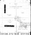
 M3603 351020.jpg 3,390 × 1,398; 272 KB
 M3603 minenotes.pdf 737 × 1,183, 5 pages; 1,015 KB
 M3603 wpa.jpg 593 × 651; 147 KB
 M3604 351072.jpg 3,390 × 3,042; 1.63 MB
 M3604 minenotes.pdf 737 × 1,183, 9 pages; 1.7 MB
 M3605 351019.jpg 1,828 × 3,390; 538 KB
 M3605 minenotes.pdf 737 × 1,183, 4 pages; 792 KB
 M3606 fieldnotes.pdf 747 × 1,193; 182 KB
 M3606 minenotes.pdf 737 × 1,183, 4 pages; 828 KB
 M3608 1950moa.jpg 697 × 612; 127 KB
 M3608 coalreport1907 p308.pdf 587 × 966; 84 KB
 M3609 minenotes.pdf 737 × 1,183, 6 pages; 1.06 MB
 M3609 wpa.jpg 461 × 521; 62 KB
 M3610 351080.jpg 3,390 × 2,532; 573 KB
 M3610 351257.jpg 3,390 × 2,105; 516 KB
 M3610 minenotes.pdf 737 × 1,183, 3 pages; 535 KB
 M3611 fieldnotes.pdf 1,193 × 745; 182 KB
 M3611 minenotes.pdf 737 × 1,183, 8 pages; 1.65 MB


