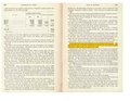
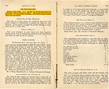
Category:St. Clair-County
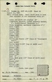
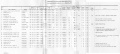
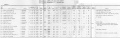
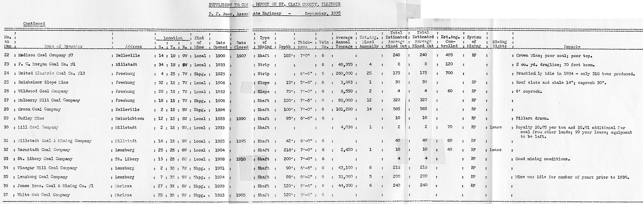
County Coal Data
Mines that Appear in St. Clair-County
- 9998 & 9999 = Unknown dates
Unlocated Mines in St. Clair-County
Mine that have known coal production but no known location
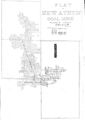
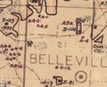
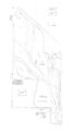
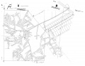
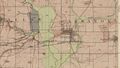
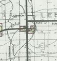
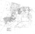
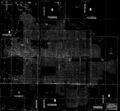
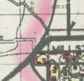
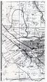
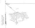
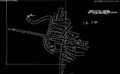
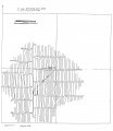
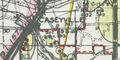
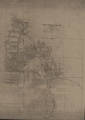
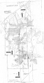
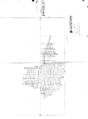
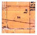
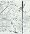
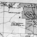
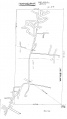
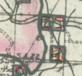
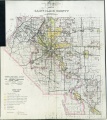
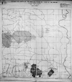
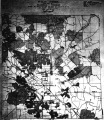
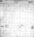
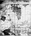
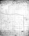
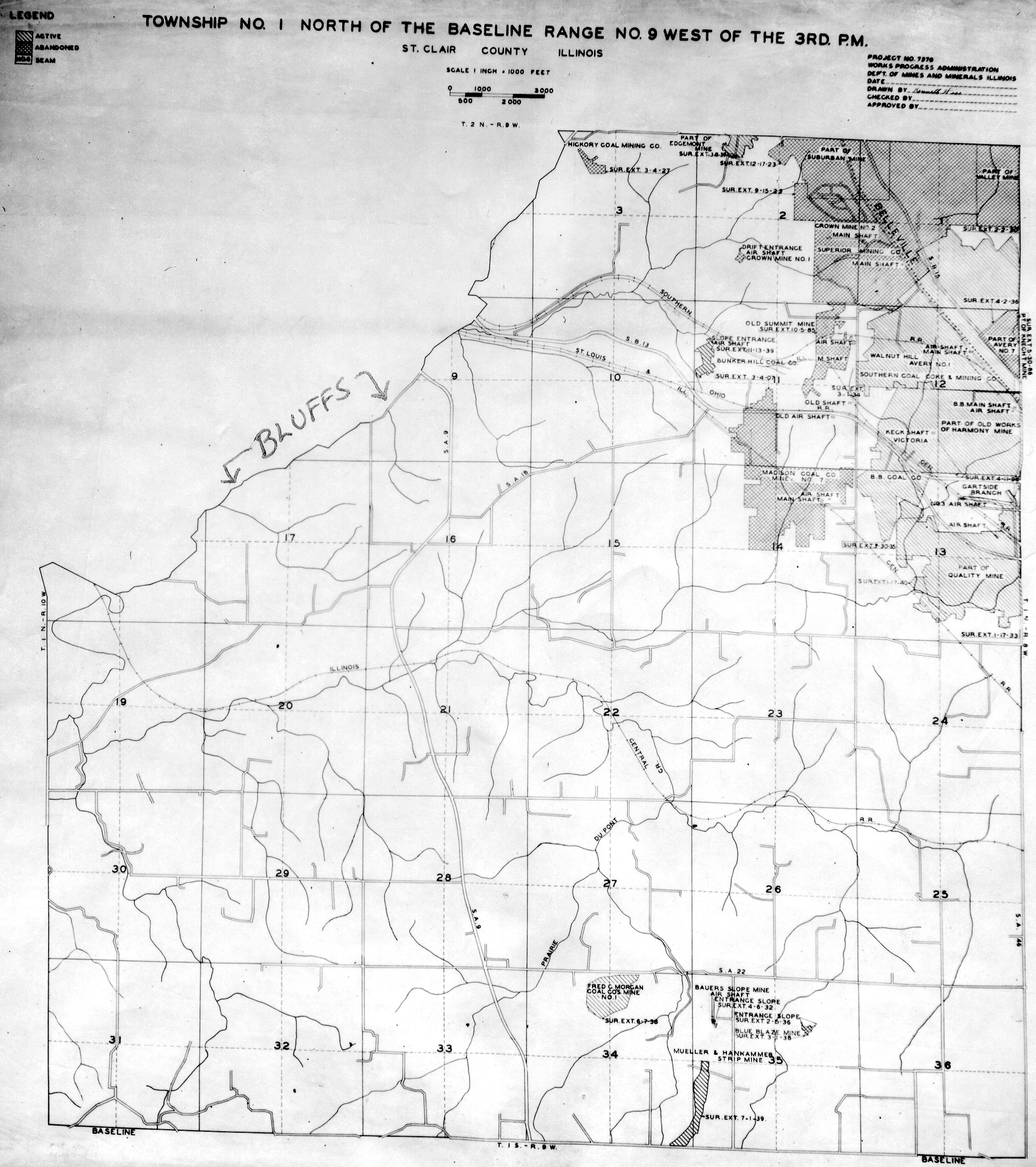
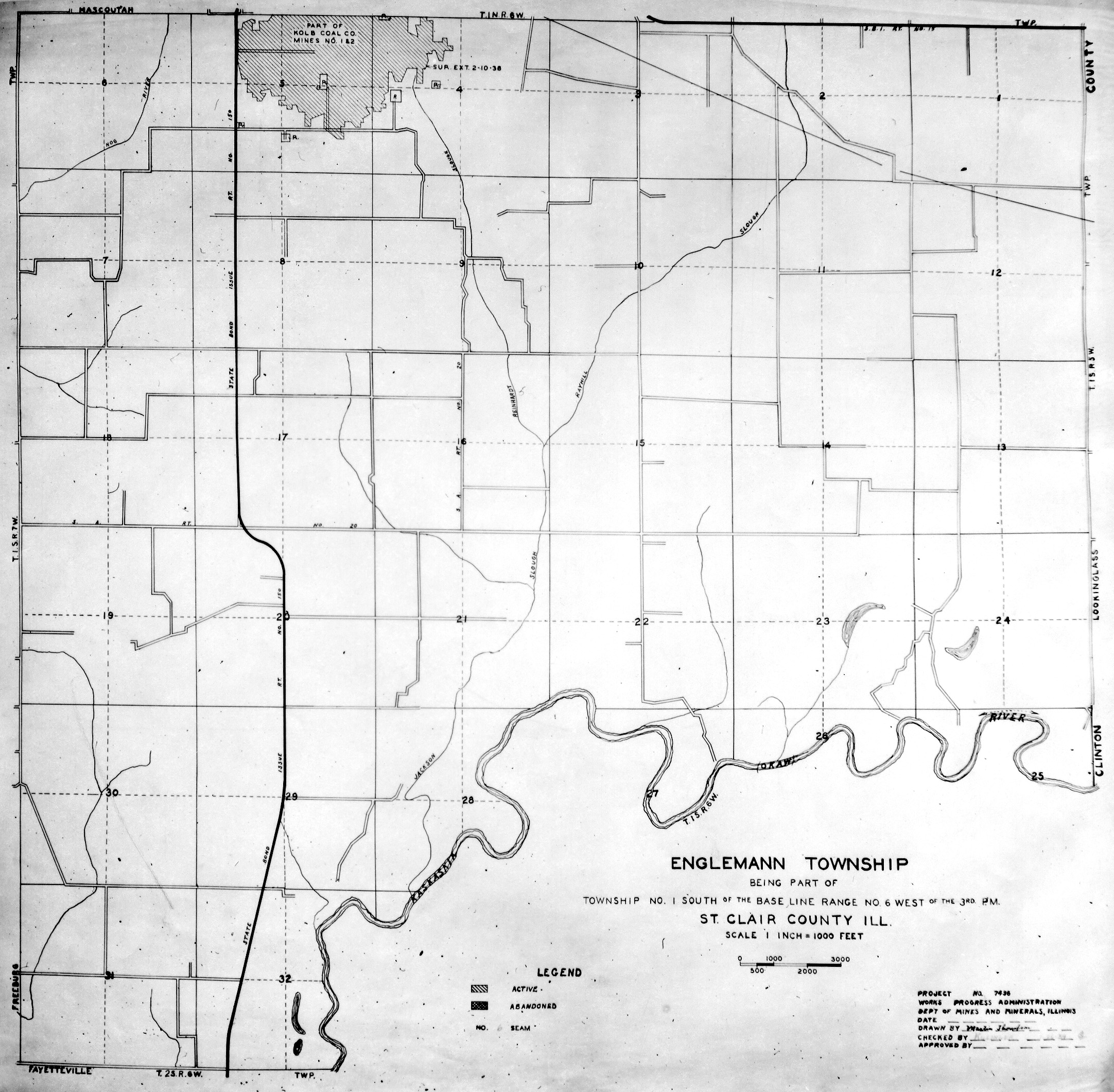
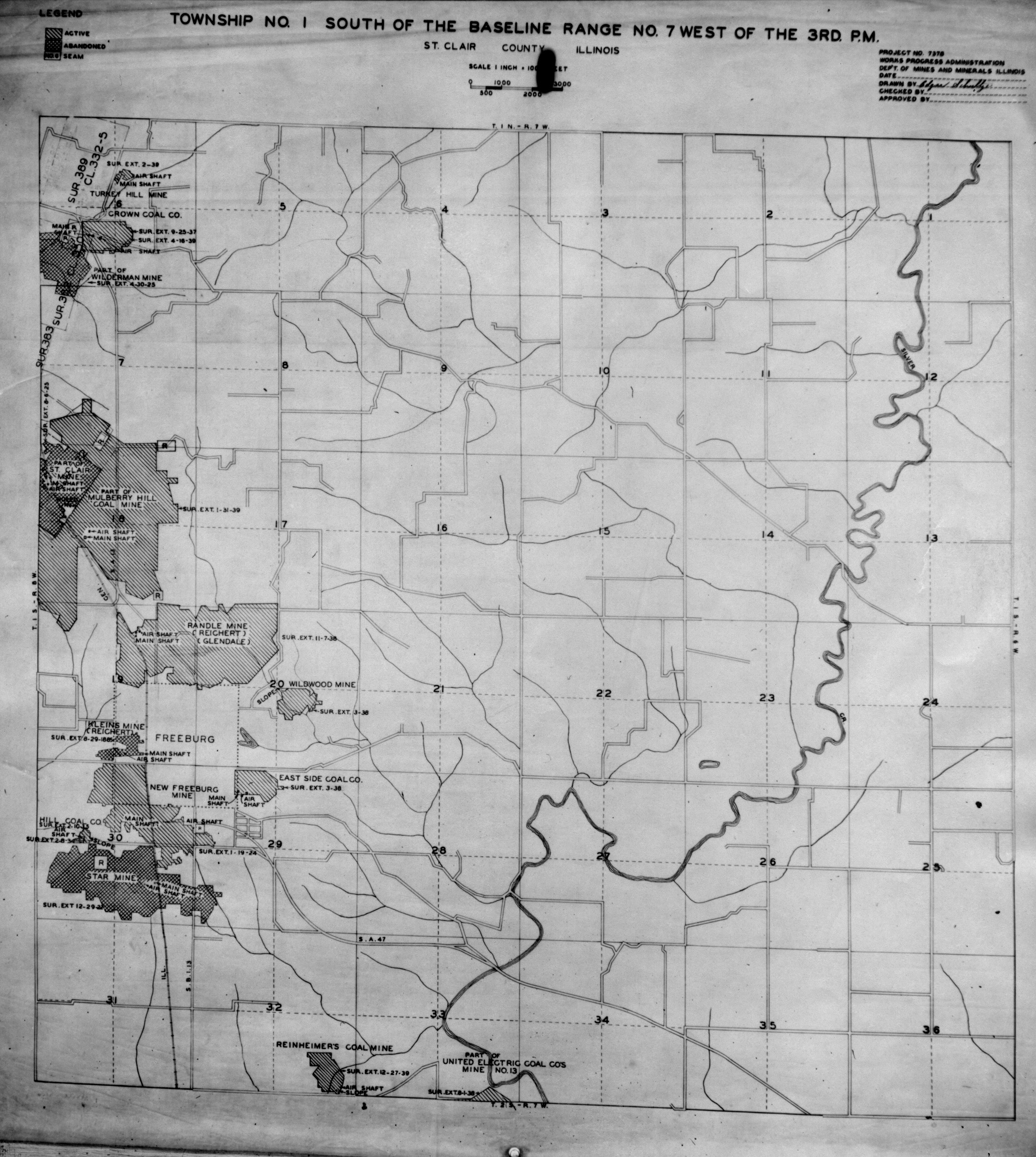
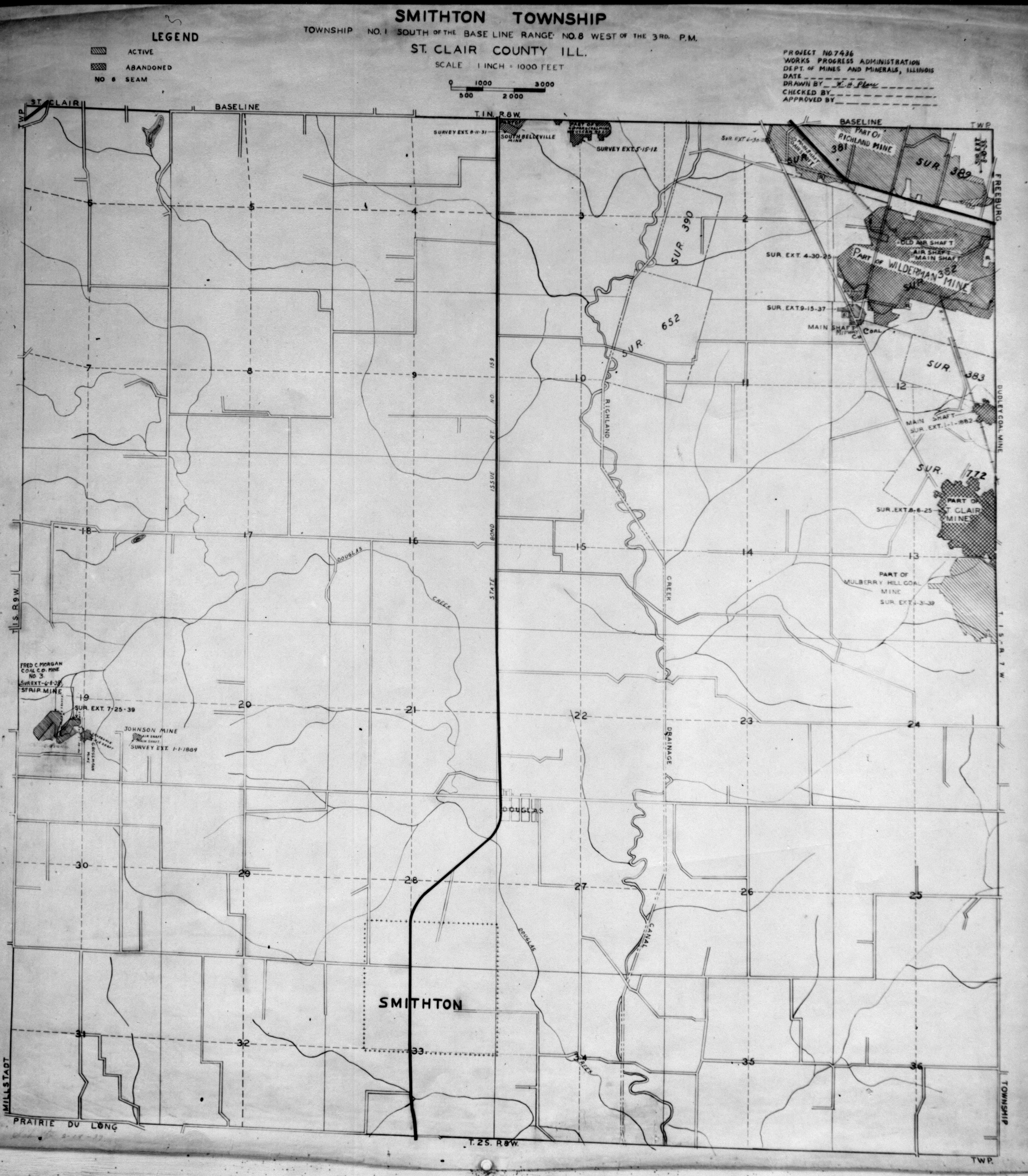
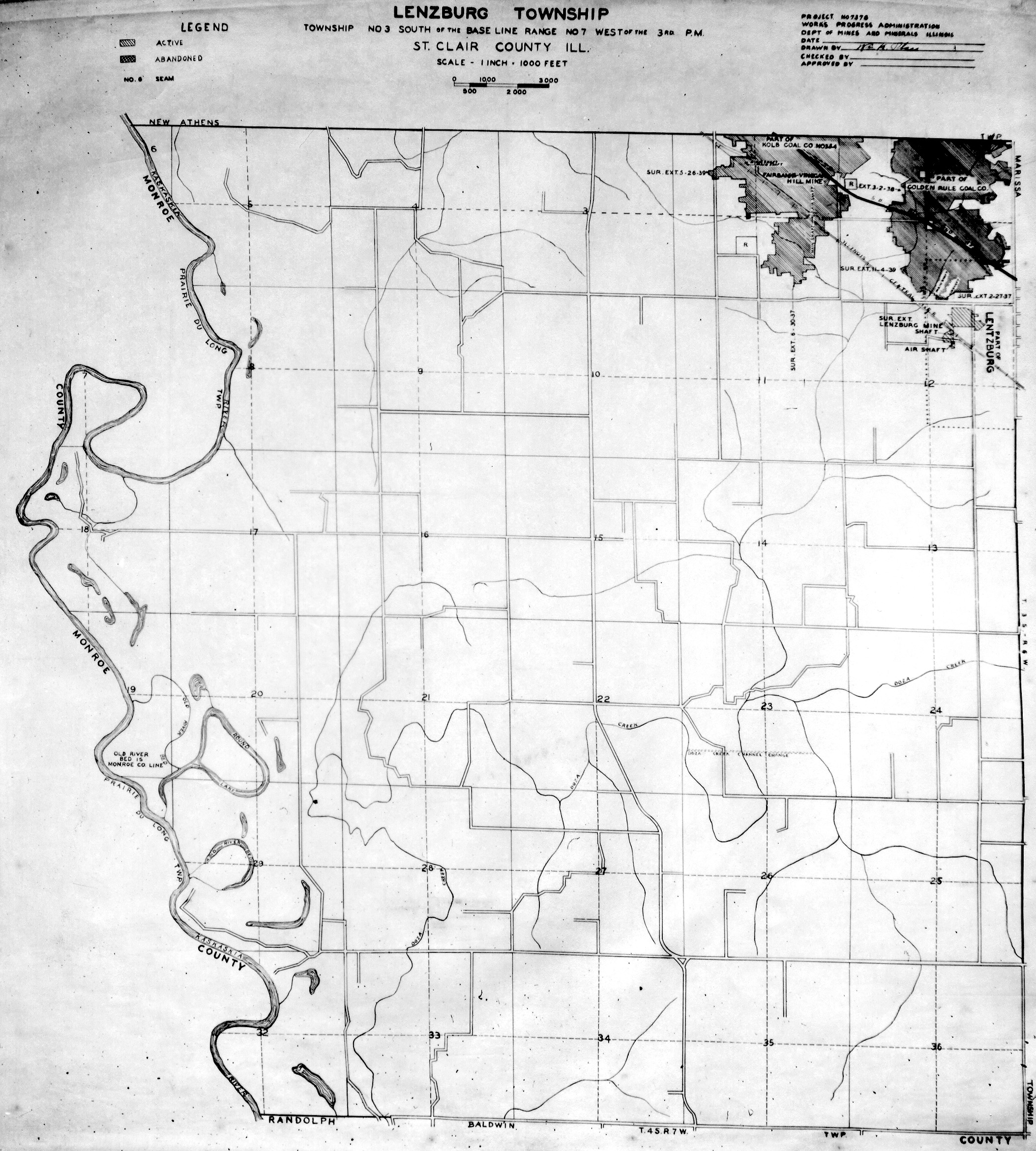
Historical Mined Out Area Maps
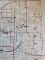
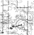
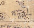
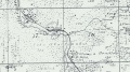
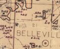
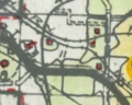
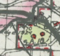
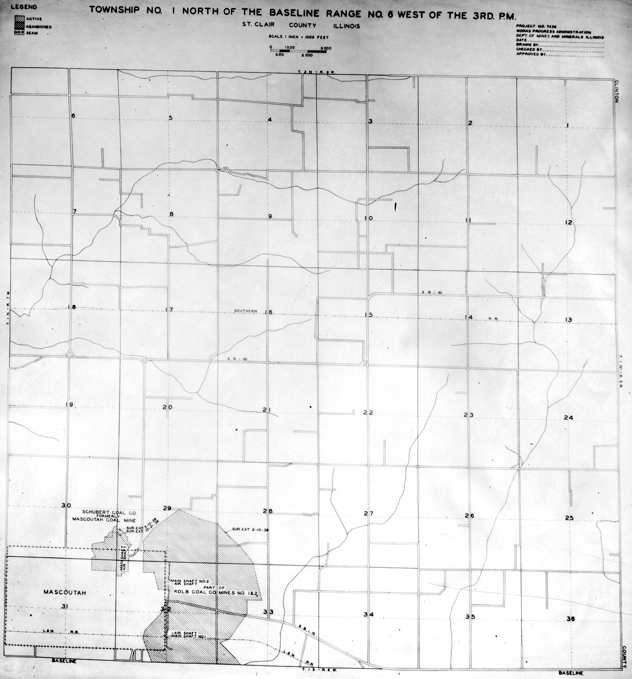
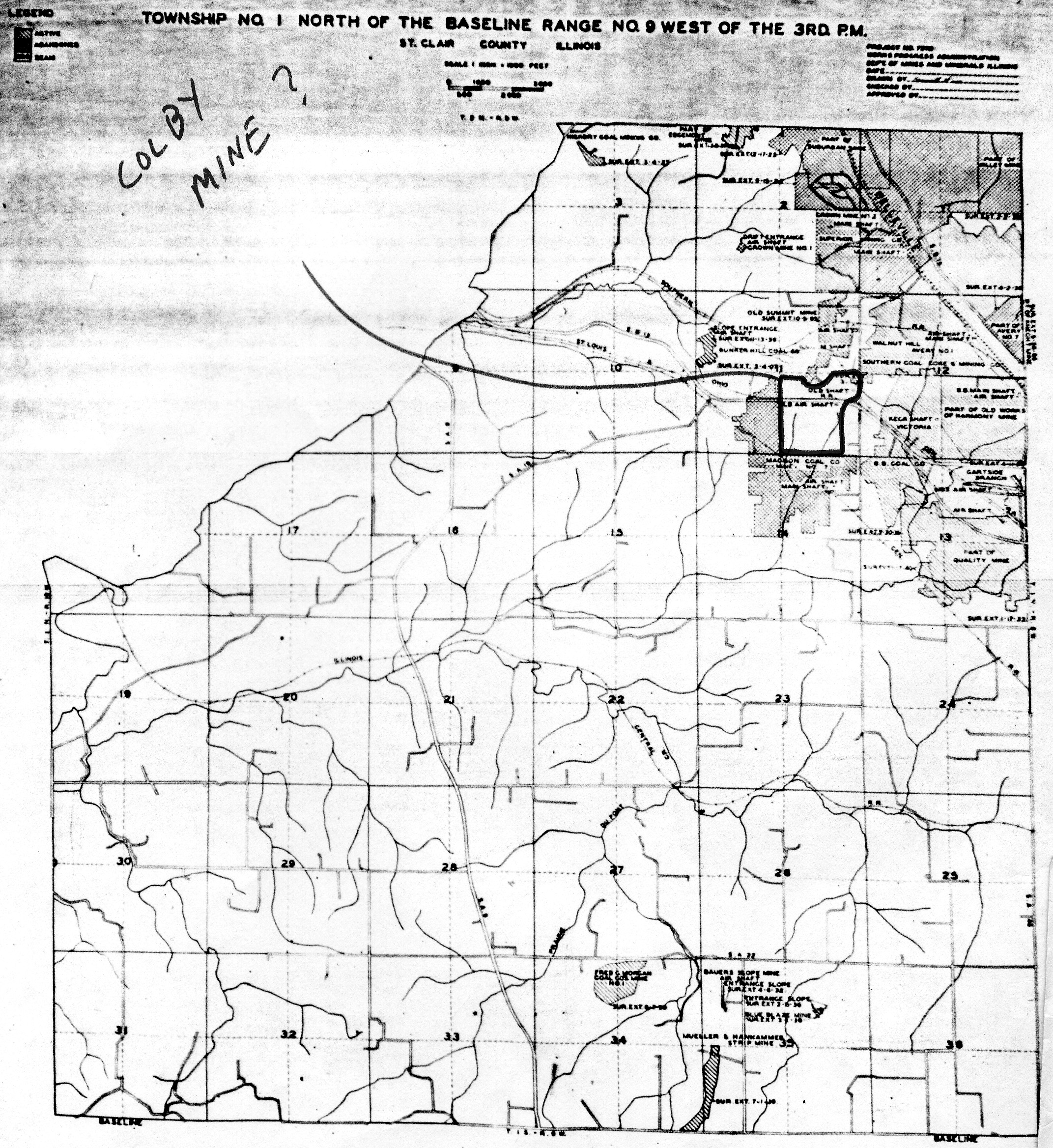
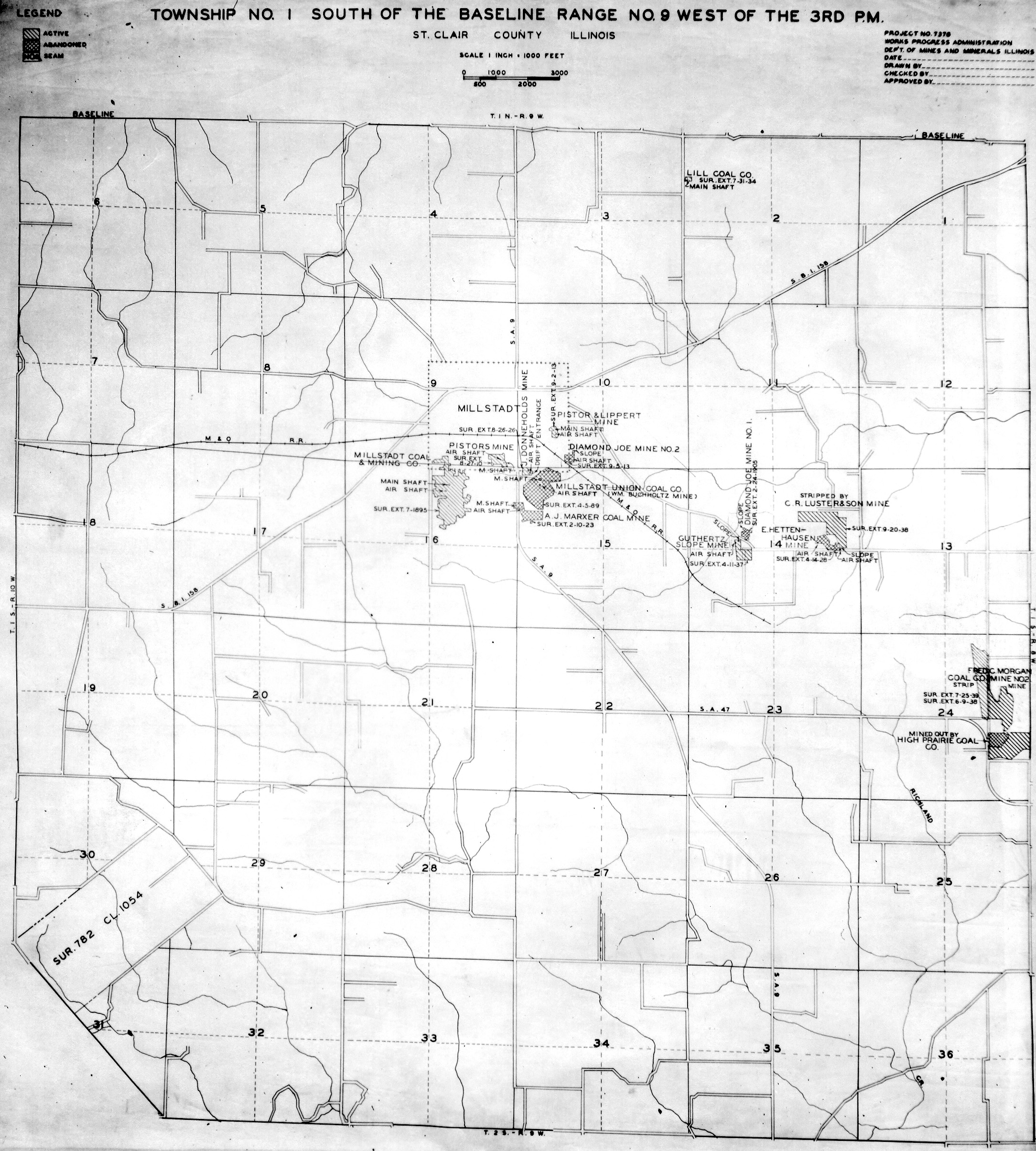
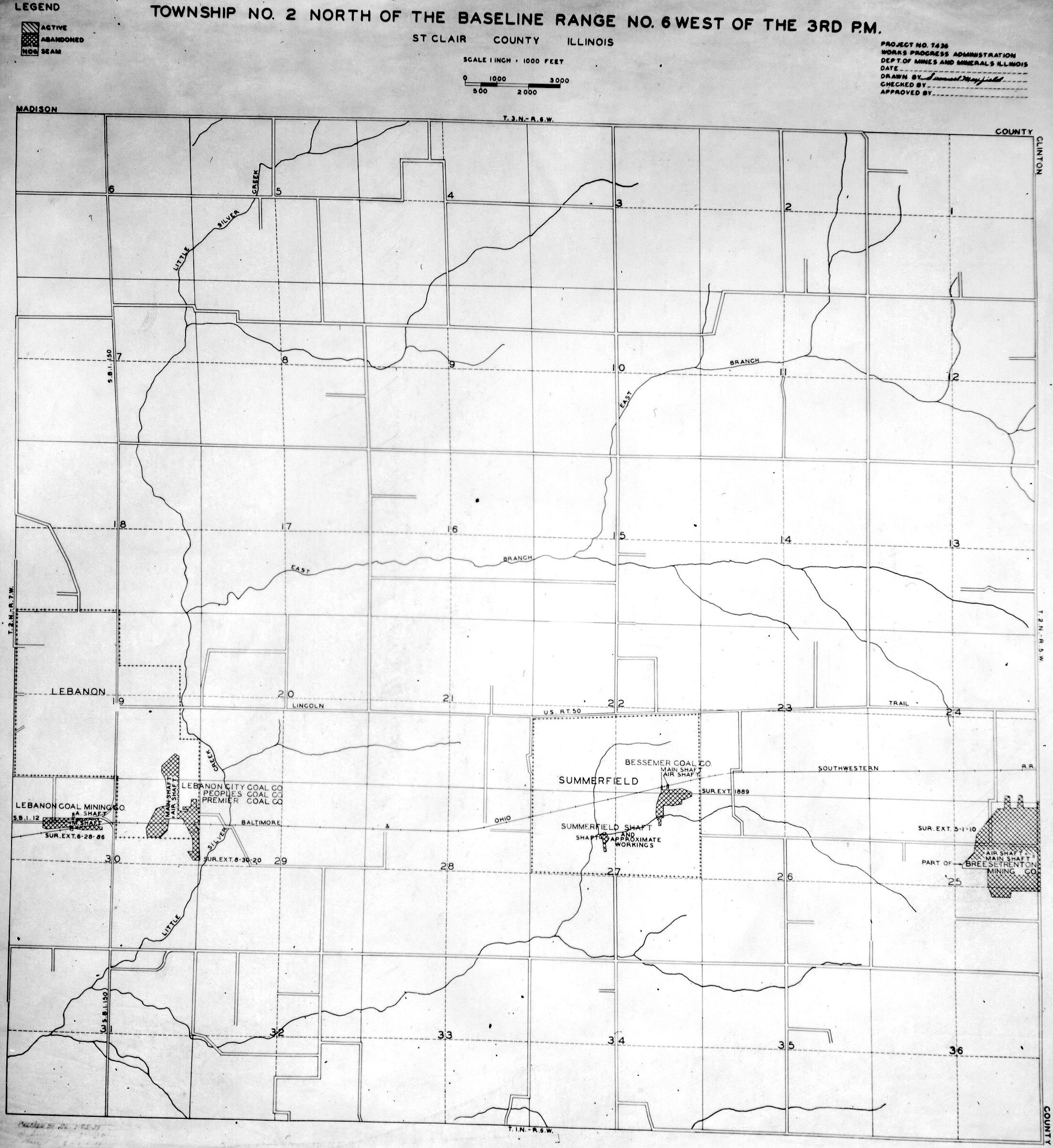
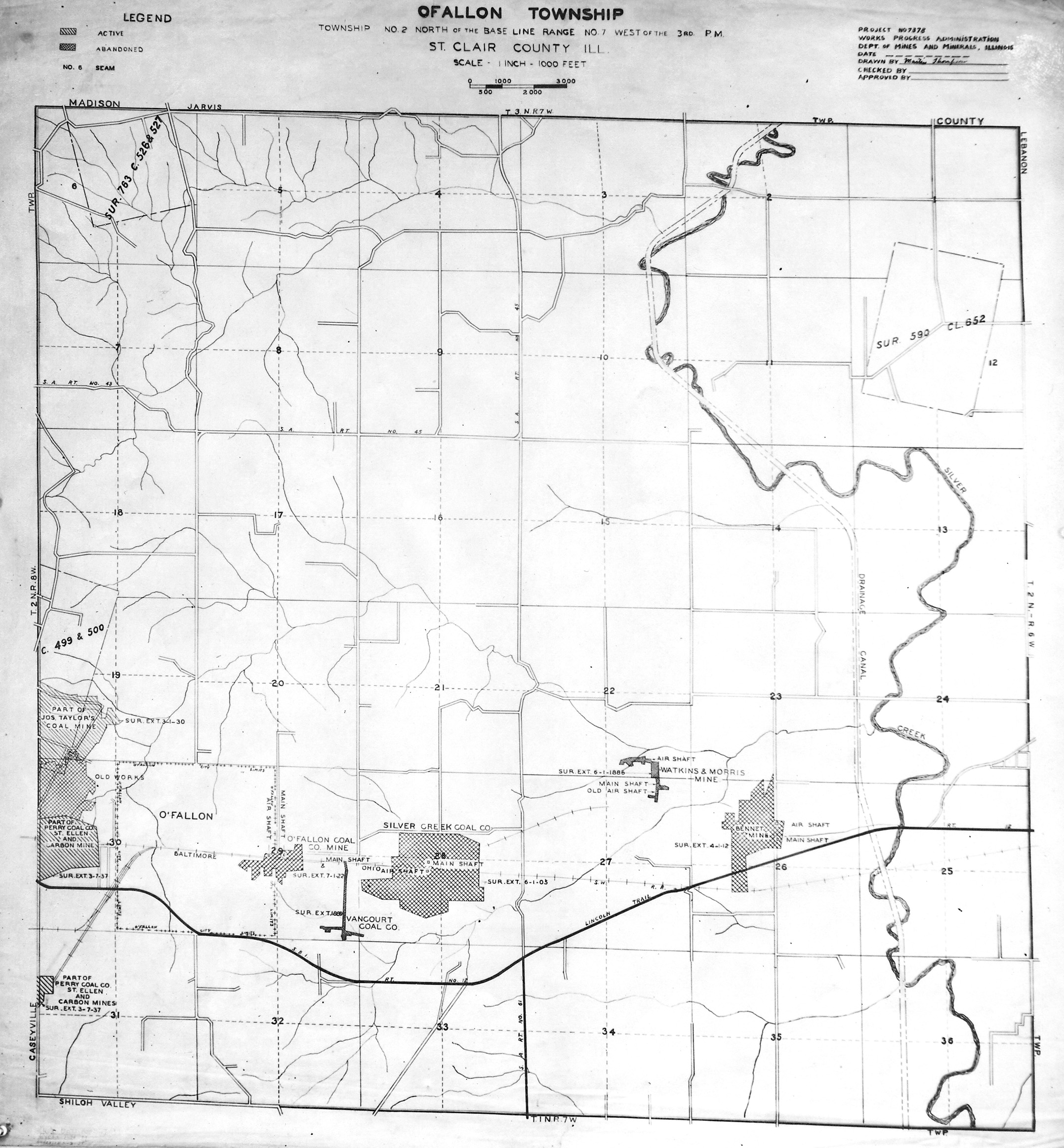
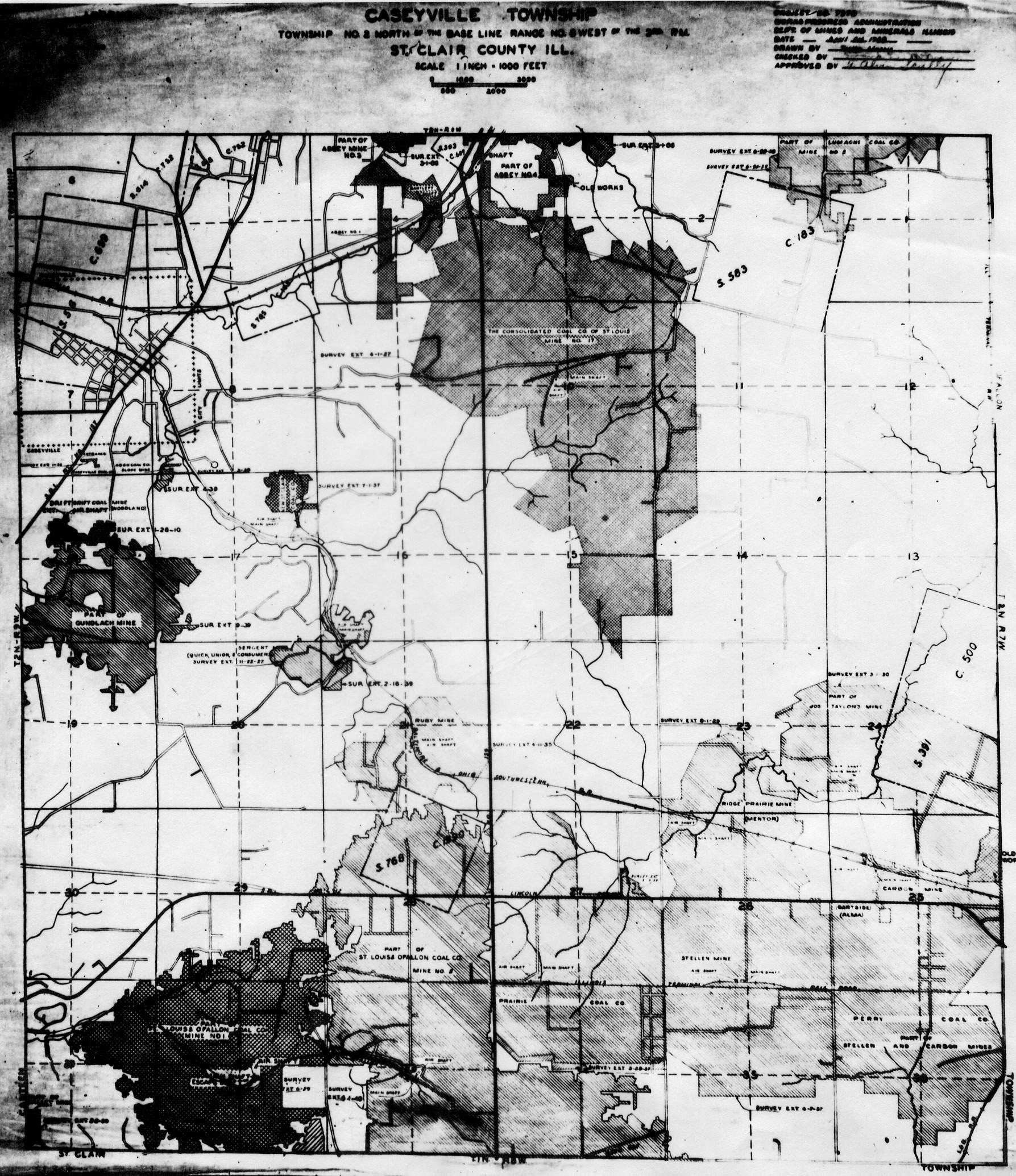
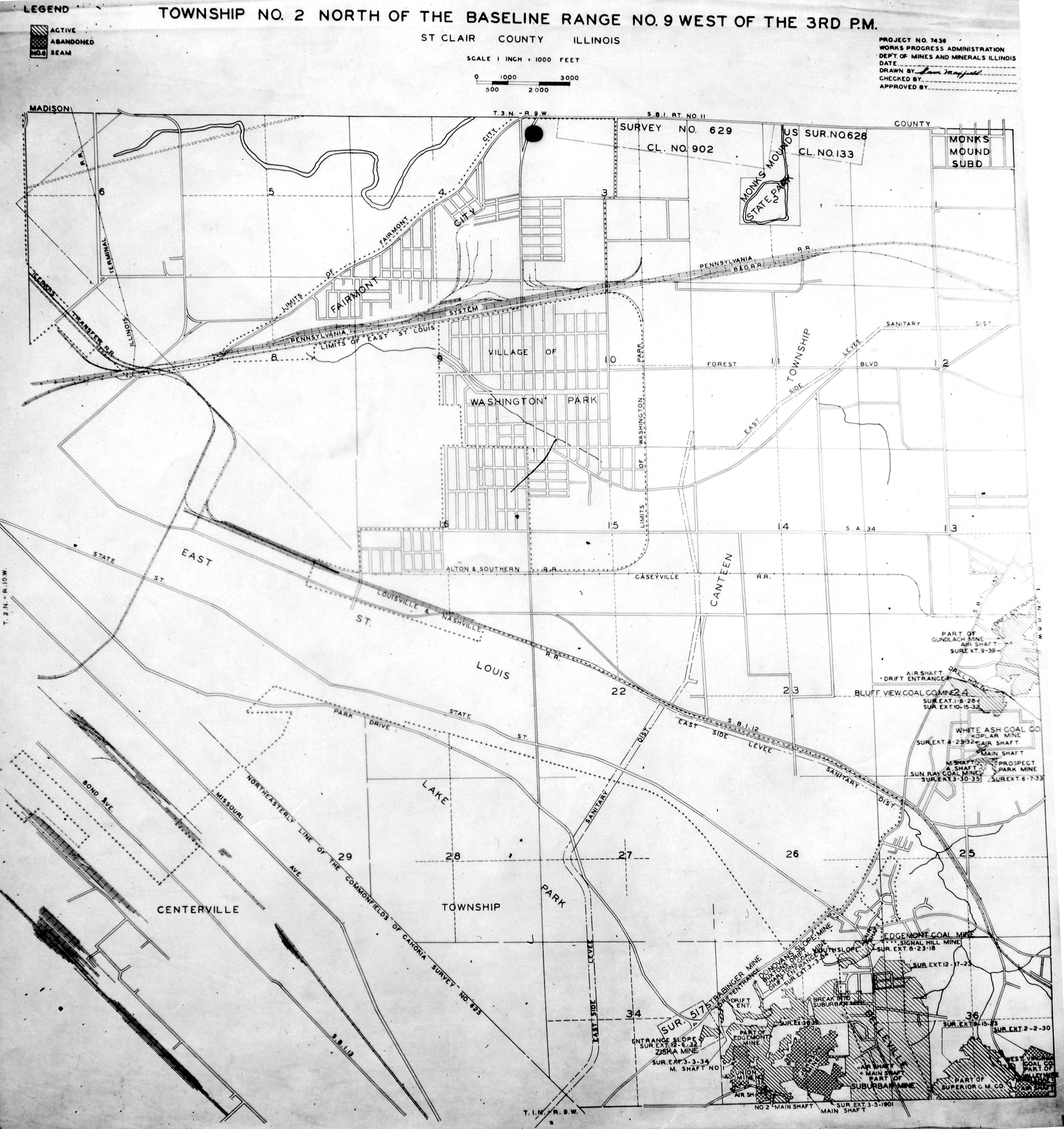
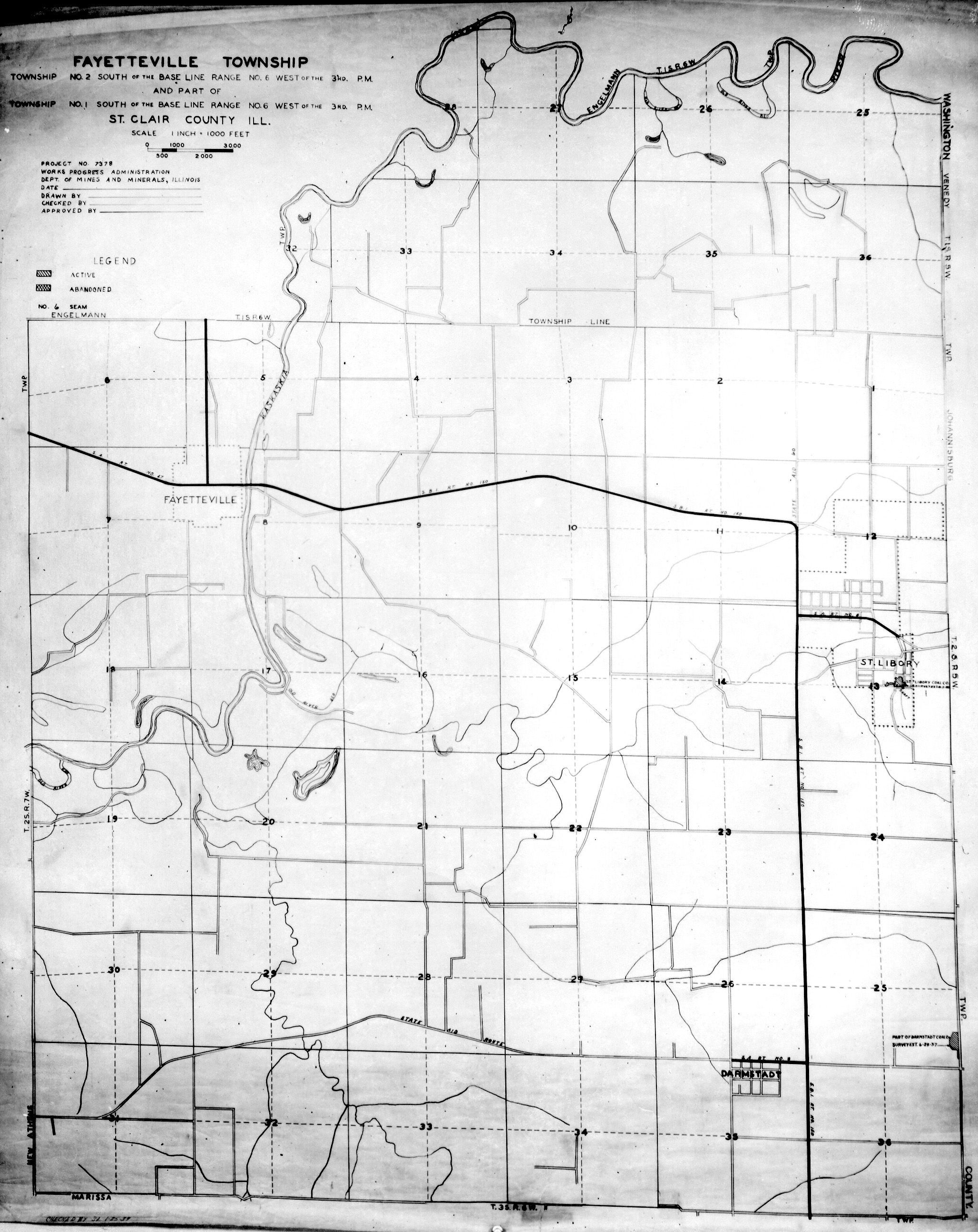
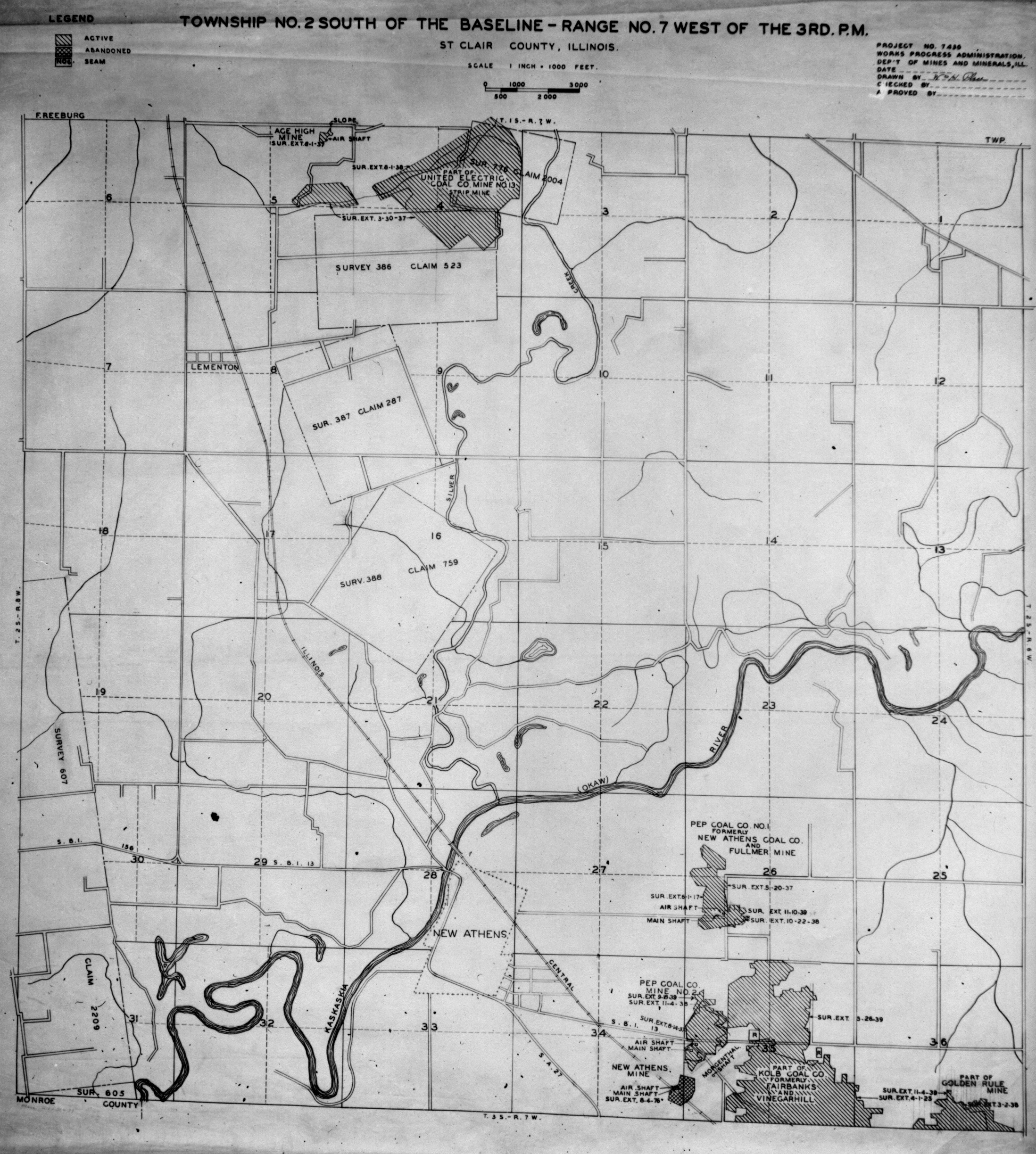
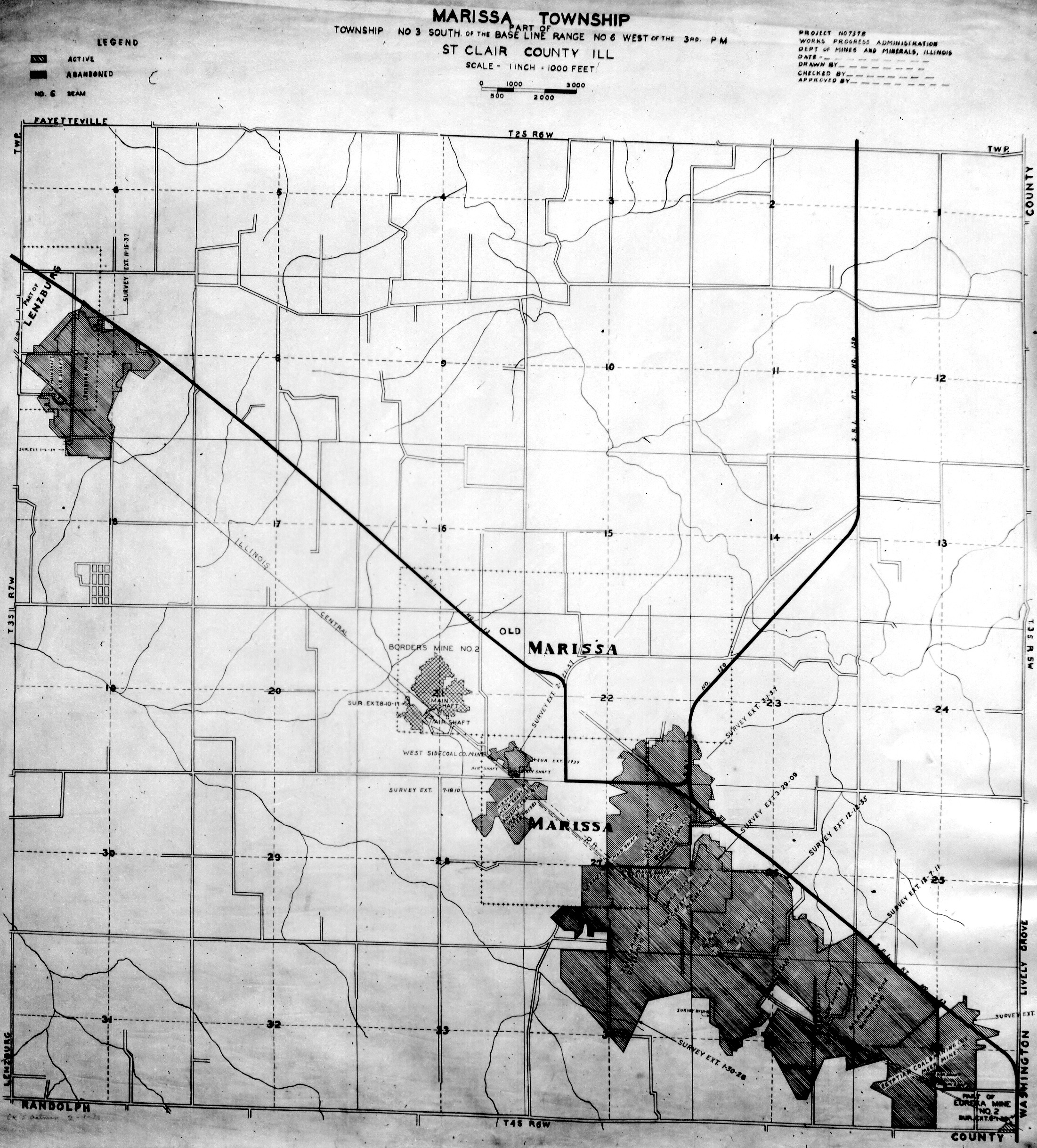
WPA
These maps were constructed as part of the nationwide Works Projects Administration (WPA), generally between 1934 and 1937 with some later updates or revisions,
Disclaimer
Maps for some locations might have multiple versions/seams, please inspected these areas closely for differences.
Notes and corrections were made by ISGS staff.
These maps are reproductions from microfilm, they may be of poor quality with text difficult to read.


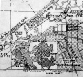
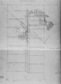
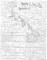
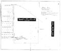
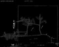
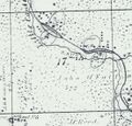
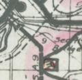
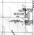
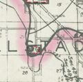
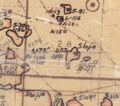
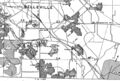
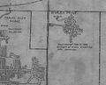
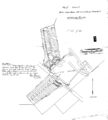
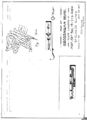
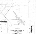
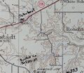
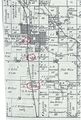
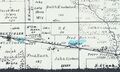
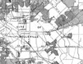
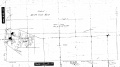
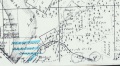
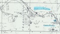
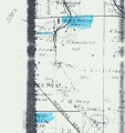
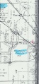
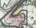
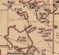
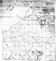
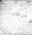
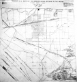
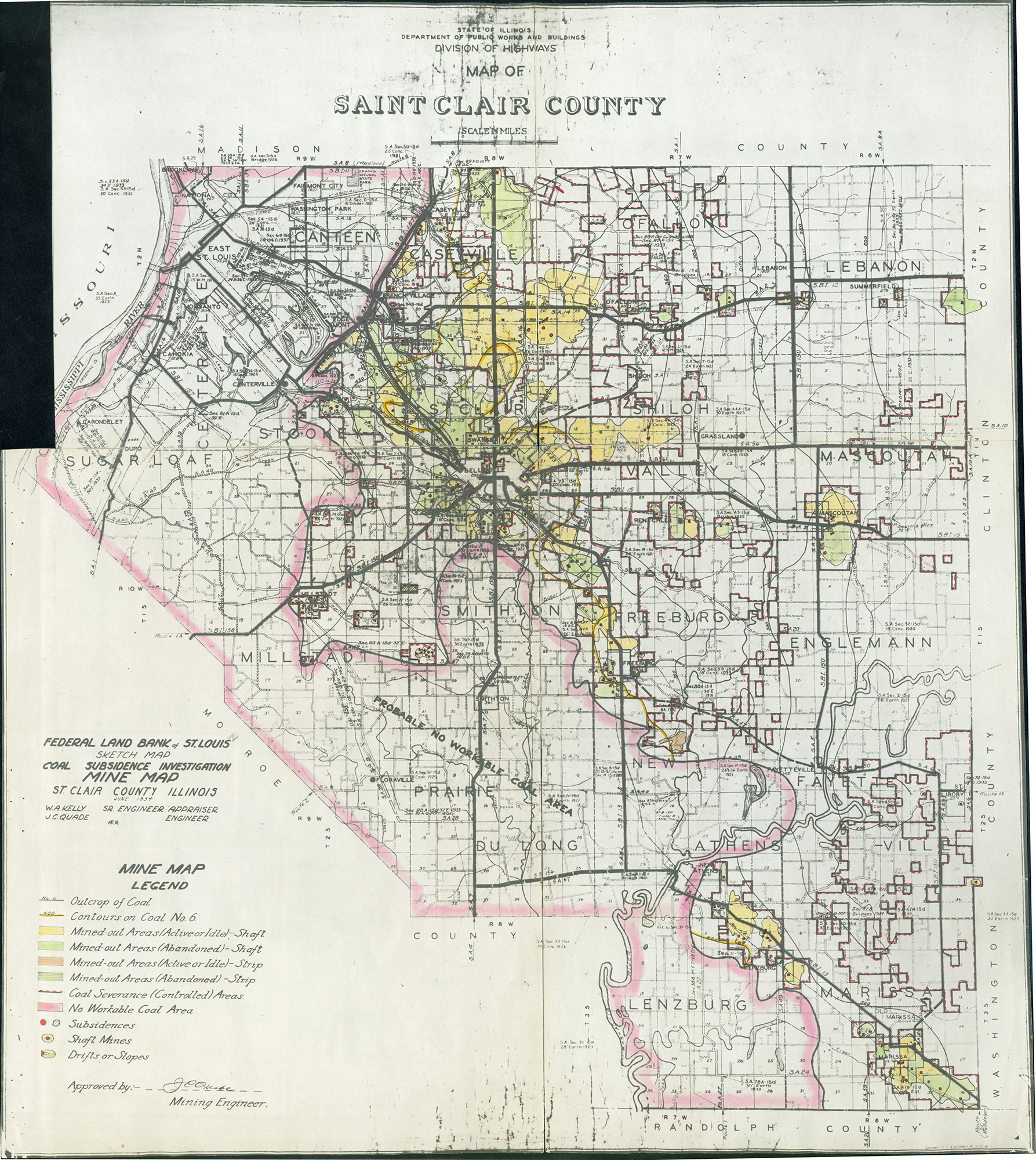
Federal Land Bank of St. Louis, Preliminary Reports on Subsidence Investigations
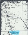
Federal Land Bank of St. Louis, Preliminary Reports on Subsidence Investigations (refered by Coal Section Staff as "Quade Maps")
Mining engineers working for the Federal Land Bank of St. Louis mapped areas of subsidence due to coal mining in the early 1930s. These reports often include county maps of mine properties with mined-out areas including shaft locations, as well as subsidence areas.
Disclaimer
Maps for some locations might have multiple versions/seams, please inspected these areas closely for differences.
These maps are accompanied by a report, please download and inspect this document.
Notes and corrections were made by ISGS staff.


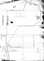
Photographs

Pages in category "St. Clair-County"
The following 200 pages are in this category, out of 444 total.
(previous page) (next page)0
1
- 10120320
- 1630000a
- 1630000b
- 1630000d
- 1630000e
- 1630001
- 1630002
- 1630003
- 1630004
- 1630005
- 1630006
- 1630007
- 1630008
- 1630009
- 1630010
- 1630011
- 1630012
- 1630015
- 1630020
- 1630021
- 1630023
- 1630024
- 1630026
- 1630027
- 1630028
- 1630029
- 1630030
- 1630031
- 1630033
- 1630034
- 1630035
- 1630036
- 1630047
- 1630051
- 1630053
- 1630055
- 1630061
- 1630063
- 1630064
- 1630065
- 1630066
- 1630068
- 1630069
- 1630070
- 1630071
- 1630074
- 1630075
- 1630076
- 1630077
- 1630078
- 1630079
- 1630081
- 1630082a
- 1630082b
- 1630083
- 1630086
- 1630090
- 1630093
- 1630094
- 1630095
- 1630096
- 1630097
- 1630099
- 1630100
- 1630104
- 1630106
- 1630107
- 1630108
- 1630109
- 1630110
- 1630113
- 1630114
- 1630115
- 1630117
- 1630118
- 1630120
- 1630121
- 1630122
- 1630123
- 1630125
- 1630126
- 1630127
- 1630129
- 1630130
- 1630136
- 1630137
- 1630138
- 1630139
- 1630145
- 1630146
- 1630147
- 1630148
- 1630149
- 1630151
- 1630154
- 1630156
- 1630157
- 1630159
- 1630162
- 1630163
- 1630165
- 1630168
- 1630170
- 1630172
- 1630174
- 1630175
- 1630176
- 1630178
- 1630179
- 1630180
- 1630183
- 1630184
- 1630187
- 1630188
- 1630195
- 1630198
- 1630200
- 1630201
Media in category "St. Clair-County"
The following 169 files are in this category, out of 569 total.
(previous page) (next page)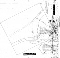 M3612 351128.jpg 3,290 × 3,146; 990 KB
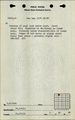
 M3612 minenotes.pdf 737 × 1,183, 4 pages; 814 KB
 M3613 minenotes.pdf 737 × 1,183, 6 pages; 1.24 MB
 M3614 wpa.jpg 472 × 438; 105 KB
 M3615 coalreport1901 p239.pdf 639 × 1,168; 307 KB
 M3615 coalreport1912 p346.pdf 741 × 1,166; 381 KB
 M3615 IL 221.jpg 2,408 × 3,390; 1.12 MB
 M3615 minenotes.pdf 737 × 1,183, 4 pages; 927 KB
 M3616 fieldnotes.pdf 747 × 1,191, 6 pages; 7.49 MB
 M3616 minenotes.pdf 737 × 1,183, 8 pages; 1.79 MB
 M3617 minenotes.pdf 737 × 1,183, 4 pages; 828 KB
 M3617.jpg 2,400 × 3,390; 504 KB
 M3618 pb83.jpg 2,485 × 3,390; 589 KB
 M3619 minenotes.pdf 737 × 1,183, 6 pages; 1.45 MB
 M3620 coalreport1904 p316.pdf 1,647 × 1,229; 411 KB
 M3620 minenotes.pdf 737 × 1,183, 8 pages; 1.61 MB
 M3621 minenotes.pdf 737 × 1,183, 15 pages; 7.04 MB
 M3622 coalreport1898 p201.pdf 1,591 × 1,170; 317 KB
 M3622 minenotes.pdf 737 × 1,183, 7 pages; 1.45 MB
 M3624 minenotes.pdf 737 × 1,183, 3 pages; 524 KB
 M3625 coalreport1884 p578.pdf 1,570 × 1,277; 309 KB
 M3625 coalreport1913 p228.pdf 793 × 1,187; 116 KB
 M3625 minenotes.pdf 737 × 1,183, 6 pages; 1.1 MB
 M3626 1950moa.jpg 603 × 491; 87 KB
 M3627 fieldnotes.pdf 747 × 1,193; 176 KB
 M3627 minenotes.pdf 737 × 1,183, 3 pages; 482 KB
 M3628 minenotes.pdf 737 × 1,183, 4 pages; 934 KB
 M3628.jpg 2,651 × 3,390; 1,015 KB
 M3628mrg.jpg 1,894 × 3,390; 340 KB
 M3816.JPG 478 × 640; 135 KB
 M4035.jpg 920 × 932; 276 KB
 M4231 351136.jpg 3,192 × 2,685; 586 KB
 M4255.jpg 2,922 × 2,304; 391 KB
 M4258 coalreport1889.pdf 1,637 × 1,291, 2 pages; 1.81 MB
 M4258 coalreport1911 p331.pdf 1,660 × 1,239; 304 KB
 M4260 350990.jpg 3,390 × 2,632; 959 KB
 M4260 coalreport1884.pdf 1,625 × 1,297, 2 pages; 621 KB
 M4261 atlas 1874.jpg 2,922 × 3,390; 1.05 MB
 M4261 coalreport1884 p576.pdf 1,577 × 1,275; 311 KB
 M4268 350992.jpg 3,204 × 3,152; 450 KB
 M4269 atlas1874.jpg 1,099 × 1,056; 242 KB
 M4269 fieldnotes.pdf 752 × 1,197, 3 pages; 526 KB
 M4270 GFolio195.jpg 764 × 432; 599 KB
 M4271 quade.jpg 612 × 660; 99 KB
 M4272 fieldnotes.pdf 747 × 1,191, 3 pages; 566 KB
 M4272 flb.jpg 208 × 202; 22 KB
 M4273 minenotes.pdf 741 × 1,179, 2 pages; 2.32 MB
 M4274.jpg 3,390 × 3,292; 1.68 MB
 M4275 minenotes.pdf 741 × 1,179, 4 pages; 2.77 MB
 M4280 minenotes.pdf 737 × 1,183, 2 pages; 414 KB
 M4280.jpg 3,390 × 3,126; 2.14 MB
 M4283 wpa1s9w.jpg 398 × 408; 53 KB
 M4284 351158.jpg 3,212 × 2,804; 809 KB
 M4285 351014.jpg 2,664 × 3,104; 614 KB
 M4285 coalreport1884.pdf 1,587 × 1,272; 333 KB
 M4286 flb.jpg 351 × 346; 40 KB
 M4288 flb.jpg 241 × 233; 25 KB
 M4289.jpg 2,438 × 3,390; 1.03 MB
 M4290 atlas1874.jpg 1,143 × 1,977; 624 KB
 M4290 MOA1950 Area27.jpg 588 × 518; 85 KB
 M4292 351160.jpg 3,234 × 3,390; 659 KB
 M4292 coalreport1897 p120.pdf 839 × 1,185; 1.27 MB
 M4292 fieldnotes.pdf 752 × 1,195; 187 KB
 M4293 351000.jpg 2,946 × 3,390; 258 KB
 M4294 35099901.jpg 2,582 × 2,275; 358 KB
 M4294 35099902.jpg 2,916 × 2,996; 813 KB
 M4296 coalreport1897 p120.pdf 839 × 1,185, 2 pages; 257 KB
 M4296.jpg 2,780 × 2,232; 345 KB
 M4297 351022 wpa.jpg 1,735 × 1,173; 585 KB
 M4298 pb168.jpg 392 × 316; 46 KB
 M4298.jpg 3,281 × 2,012; 392 KB
 M4299 atlas1874 1n8w.jpg 1,582 × 1,623; 365 KB
 M4299.jpg 1,706 × 2,853; 303 KB
 M4301.pdf 4,033 × 5,400; 10.4 MB
 M4304 MOA1950.jpg 648 × 536; 86 KB
 M4305 atlas 1874 1n-8w a.jpg 1,911 × 1,452; 612 KB
 M4305.jpg 3,056 × 3,390; 702 KB
 M4310 minenotes.pdf 737 × 1,183; 166 KB
 M4310.pdf 4,033 × 5,400; 10.4 MB
 M4311 351067.jpg 2,464 × 3,390; 542 KB
 M4311 minenotes.pdf 737 × 1,183, 4 pages; 833 KB
 M4312 351077.jpg 3,288 × 3,176; 1.46 MB
 M4312 minenotes.pdf 737 × 1,183, 4 pages; 807 KB
 M4313 coalreport1888 p430.pdf 1,581 × 1,289; 924 KB
 M4316 351133.jpg 2,994 × 2,799; 640 KB
 M4316 fieldnotes.pdf 745 × 1,183, 4 pages; 764 KB
 M4319 350980.jpg 3,166 × 3,664; 799 KB
 M4319 minenotes.pdf 733 × 1,183, 3 pages; 2.94 MB
 M4320 minenotes.pdf 737 × 1,183, 2 pages; 371 KB
 M4321 minenotes.pdf 737 × 1,183, 2 pages; 363 KB
 M4321.jpg 842 × 1,059; 400 KB
 M4322 fieldnotes.pdf 745 × 1,183, 2 pages; 473 KB
 M4322 minenotes.pdf 737 × 1,183, 2 pages; 358 KB
 M4323.jpg 622 × 537; 125 KB
 M4326 flb.jpg 459 × 231; 46 KB
 M4327 atlas 1874.jpg 1,980 × 1,110; 356 KB
 M4327 fieldnotes.pdf 752 × 1,197, 2 pages; 404 KB
 M4329 1874atlas.jpg 984 × 1,212; 275 KB
 M4329 minenotes.pdf 733 × 1,183, 6 pages; 5.11 MB
 M4330 coalreport1884 p572.pdf 1,587 × 1,272; 328 KB
 M4331 coalreport1884 p572.pdf 1,587 × 1,272; 328 KB
 M4331 IL 221.jpg 2,408 × 3,390; 1.12 MB
 M4332 351083.jpg 1,824 × 3,390; 982 KB
 M4335 atlas1874.jpg 1,810 × 2,683; 836 KB
 M4336 351256.jpg 2,498 × 3,390; 519 KB
 M4339 fieldnotes.pdf 754 × 1,197, 3 pages; 454 KB
 M4340 fieldnotes.pdf 747 × 1,191, 3 pages; 553 KB
 M4373.jpg 1,862 × 1,112; 322 KB
 M4383 moa1950.jpg 3,490 × 3,297; 1.61 MB
 M4500 fieldnotes.pdf 745 × 1,181, 2 pages; 390 KB
 M4707 351022.jpg 1,780 × 1,376; 947 KB
 M4707 atlas 1874.jpg 3,040 × 3,390; 1.7 MB
 M4707 coalreport1884 p575.pdf 1,587 × 1,268; 321 KB
 M4726 351055.jpg 3,496 × 2,848; 662 KB
 M4731.jpg 3,390 × 2,335; 678 KB
 M4849 atlas 1874.jpg 2,683 × 3,390; 1.38 MB
 M4862 fedlndbnk.jpg 191 × 184; 20 KB
 M4862 MOA1950 area27.jpg 511 × 538; 91 KB
 M4862 wpa.jpg 400 × 405; 65 KB
 M5022 351124.jpg 3,390 × 1,889; 547 KB
 M5022 fieldnotes.pdf 747 × 1,193; 182 KB
 M5277.jpg 3,306 × 3,390; 835 KB
 M6639 351017.jpg 1,908 × 3,390; 340 KB
 M6639 coalreport1884 p575.pdf 1,587 × 1,268; 324 KB
 M6639 fieldnotes.pdf 747 × 1,193; 155 KB
 M6639 minenotes.pdf 741 × 1,179, 4 pages; 4.27 MB
 M6641 351098.jpg 2,492 × 3,390; 322 KB
 M6641 minenotes.pdf 741 × 1,179, 3 pages; 3.24 MB
 M6642 atlas1874.jpg 3,390 × 3,110; 1.48 MB
 M6663 atlas 1874.jpg 1,842 × 1,154; 324 KB
 M6877 1950moa.jpg 603 × 491; 87 KB
 M6877 atlas1874.jpg 1,143 × 1,977; 624 KB
 M6880 atlas 1874.jpg 1,796 × 989; 303 KB
 M6882 atlas 1874.jpg 1,796 × 989; 303 KB
 M6885 1874atlas.jpg 1,827 × 1,021; 276 KB
 M6887 flb.jpg 232 × 185; 24 KB
 M6889 1874atlas.jpg 1,388 × 1,479; 298 KB
 M6890 atlas 1874.jpg 1,032 × 2,238; 378 KB
 M6893 fieldnotes.pdf 747 × 1,193; 188 KB
 M6894 fieldnotes.pdf 747 × 1,193; 182 KB
 M6895 fieldnotes.pdf 747 × 1,195, 2 pages; 270 KB
 M6895 flb.jpg 299 × 237; 32 KB
 M6896 flb.jpg 192 × 181; 21 KB
 M6897 atlas 1874 1n-8w a.jpg 1,764 × 1,613; 496 KB
 M6898 flb.jpg 242 × 223; 25 KB
 M6900 fieldnotes.pdf 747 × 1,193; 165 KB
 M6901 fieldnotes.pdf 750 × 1,193; 182 KB
 M6902 fieldnotes.pdf 754 × 1,197; 196 KB
 QUADE ST CLAIR TABLE1.jpg 2,200 × 981; 582 KB
 QUADE ST CLAIR TABLE2.jpg 2,200 × 699; 461 KB
 QUADE ST CLAIR.jpg 1,787 × 2,000; 1.45 MB
 Sec20 MOA1950 Area27.jpg 575 × 535; 96 KB
 WPA ST CLAIR 1N6W.jpg 2,173 × 2,334; 1.17 MB
 WPA ST CLAIR 1N7W.jpg 2,169 × 2,464; 1.48 MB
 WPA ST CLAIR 1N8W.jpg 1,824 × 2,104; 1.49 MB
 WPA ST CLAIR 1N9W COLBY MINE.jpg 2,143 × 2,336; 1.83 MB
 WPA ST CLAIR 1N9W.jpg 2,086 × 2,350; 1.37 MB
 WPA ST CLAIR 1S6W.jpg 2,164 × 2,121; 1.16 MB
 WPA ST CLAIR 1S7W.jpg 2,145 × 2,396; 1.38 MB
 WPA ST CLAIR 1S8W.jpg 2,105 × 2,410; 1.3 MB
 WPA ST CLAIR 1S9W.jpg 2,168 × 2,408; 1.33 MB
 WPA ST CLAIR 2N6W.jpg 2,202 × 2,400; 1.27 MB
 WPA ST CLAIR 2N7W.jpg 2,154 × 2,325; 1.02 MB
 WPA ST CLAIR 2N8W.jpg 1,787 × 2,069; 1.44 MB
 WPA ST CLAIR 2N9W.jpg 2,172 × 2,304; 1.19 MB
 WPA ST CLAIR 2S6W-1S6W.jpg 2,056 × 2,590; 1.33 MB
 WPA ST CLAIR 2S7W.jpg 2,197 × 2,448; 1.5 MB
 WPA ST CLAIR 3S6W.jpg 2,202 × 2,437; 1.63 MB
 WPA ST CLAIR 3S7W.jpg 2,107 × 2,341; 1.37 MB


